

Texas is crisscrossed by more than 190,000 miles of rivers and streams, ranging from the mighty Rio Grande forming the international border with Mexico to small spring-fed creeks in the Hill Country. These waterways have shaped the state's geography, ecology, and human settlement patterns for millennia.
Introduction
The major rivers of Texas generally flow from the higher elevations in the northwest and west toward the Gulf of Mexico in the southeast, carving through diverse landscapes from desert canyons to coastal prairies. Each river system supports distinct ecosystems and has played a unique role in the state's development.
Understanding Texas rivers means understanding the state itself — its vast scale, its geographic diversity, and the critical importance of water resources in a region where rainfall varies from 150 cm per year in the east to less than 20 cm in the west.
Major Geographic Features
Rio Grande
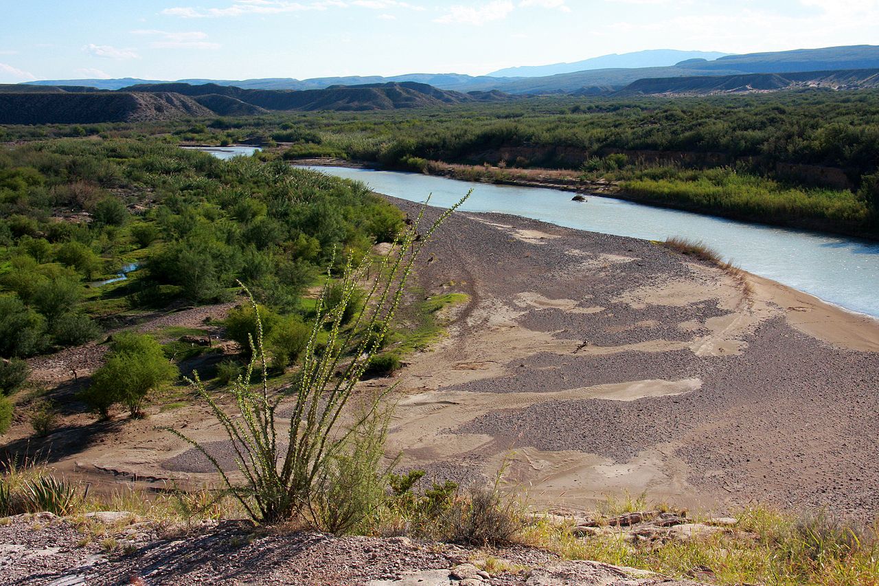
The Rio Grande stretches 3,051 km from its headwaters in the San Juan Mountains of Colorado to the Gulf of Mexico, forming the entire southern border of Texas (approximately 1,900 km). In Texas, the river carves through dramatic canyons in Big Bend National Park — including Santa Elena Canyon with 460-meter walls — before widening as it crosses the coastal plains. Despite its name meaning "Great River," heavy water extraction has reduced its flow dramatically, and it sometimes fails to reach the Gulf.
Brazos River
The Brazos River is the longest river in Texas at approximately 1,352 km, flowing from its headwaters near the New Mexico border to the Gulf of Mexico south of Freeport. The name comes from "Los Brazos de Dios" (The Arms of God), given by Spanish explorers grateful to find water. The river drains roughly 118,000 square km — the largest watershed entirely within Texas — and passes through diverse landscapes from the arid Llano Estacado to the humid Gulf Coast.
Colorado River of Texas
Not to be confused with the more famous Colorado River of the American West, the Colorado River of Texas flows 1,387 km from Dawson County to Matagorda Bay on the Gulf. The river passes through Austin, where a series of dams has created the Highland Lakes chain, including Lake Travis and Lake Buchanan. These reservoirs provide critical water supply for central Texas and created the popular recreational areas of the Highland Lakes.
Guadalupe River
The Guadalupe River flows 370 km from its headwaters in Kerr County through the Texas Hill Country to San Antonio Bay on the Gulf Coast. The upper Guadalupe is a crystal-clear, spring-fed river that cuts through limestone canyons and is one of the premier recreational rivers in the state. Canyon Lake, a reservoir on the river, is one of the clearest bodies of water in Texas.
Pecos River
The Pecos River flows 1,490 km from its origin in the Sangre de Cristo Mountains of New Mexico through far West Texas to its confluence with the Rio Grande near Langtry. Historically, the Pecos marked the boundary of the "Wild West" — the phrase "west of the Pecos" became synonymous with lawless frontier territory. The river cuts through dramatic limestone canyons and is the largest tributary of the Rio Grande in Texas.
Trinity River
The Trinity River flows approximately 885 km from its headwaters north of Dallas-Fort Worth to Trinity Bay on the Gulf Coast. It is the longest river with its entire watershed within Texas (unlike the Brazos, which originates in New Mexico). The river drains a 46,100 square km watershed and is fed by four major forks that converge in the Dallas-Fort Worth metropolitan area.
San Antonio River
The San Antonio River flows 386 km from its headwaters at the San Antonio Springs in downtown San Antonio to its confluence with the Guadalupe River. The San Antonio River Walk, a network of pedestrian walkways along the banks of the river through downtown, is one of the most-visited tourist attractions in Texas. The river is fed by the Edwards Aquifer, one of the most productive artesian aquifer systems in the world.
Red River
The Red River forms the entire northern border of Texas with Oklahoma, stretching approximately 2,190 km from its headwaters in the Texas Panhandle to its confluence with the Mississippi River in Louisiana. The river gets its name from the red-colored sediment it carries, eroded from Permian-age red beds in its upper basin. Its course and jurisdiction have been the subject of border disputes between Texas and Oklahoma for over a century.
Key Geographic Facts
- Texas has over 190,000 miles of rivers and streams
- The Rio Grande is 3,051 km long, forming 1,900 km of the Texas-Mexico border
- The Brazos River at 1,352 km is the longest river in Texas
- The Red River at 2,190 km forms the entire Texas-Oklahoma border
- Major Texas rivers generally flow from the northwest toward the Gulf of Mexico
- The Edwards Aquifer is one of the most productive artesian systems in the world
Fun Facts
- The Rio Grande sometimes fails to reach the Gulf of Mexico due to heavy water extraction upstream
- The phrase "west of the Pecos" became an American idiom meaning lawless or wild frontier territory
- The Colorado River of Texas is completely different from the famous Colorado River that carved the Grand Canyon
- The San Antonio River Walk began as a flood control project in the 1930s and is now one of Texas's top tourist attractions
- Spanish explorers named the Brazos River "The Arms of God" because they were so grateful to find water in the arid landscape
Final Thoughts
Texas's rivers are lifelines that sustain one of America's largest and most diverse states. From the border-defining Rio Grande to the spring-fed Guadalupe and the historic Red River, these waterways have shaped the land, supported ecosystems, and driven human settlement for thousands of years. As Texas faces growing water challenges, understanding these rivers has never been more important.
Test Your Knowledge!
Think you know your US state geography? Try our interactive quiz!
Play Country Quiz →