

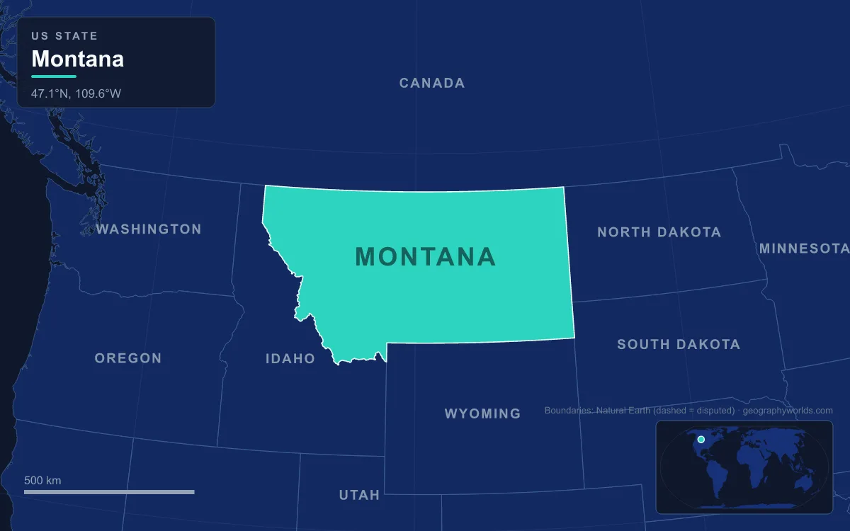
Montana has a hundred or more named mountain ranges, most of them in the western half of the state, where the northern Rocky Mountains cover the ground from the Idaho border to the edge of the Great Plains. The highest ground is in the Beartooth Mountains, which hold Granite Peak, at 3,904 m (12,807 ft) the state's highest point. Other major ranges include the Bitterroots along the Idaho line, the Lewis Range of Glacier National Park, the Absaroka, the Gallatin and Madison ranges, and isolated "island ranges" such as the Crazy Mountains, which rise out of the prairie farther east. About 60 percent of Montana's 380,800 km² (147,040 square miles) is plains, so the mountains are concentrated in the west and southwest. The best way to see how they fit together is to drive Interstate 90, which runs 889 km (552 miles) through the state, the longest stretch of that highway in any single state. Heading east from Idaho, it crosses or passes many of the major ranges.
Lookout Pass, 1,436 m, on the Bitterroot crest
The interstate enters Montana at Lookout Pass, 1,436 m (4,710 ft), in the Coeur d'Alene Mountains of the Bitterroot Range. The state line follows the ridge crest, and the pass is also a time-zone boundary between Pacific and Mountain time. The Bitterroots are one of the longest continuous ranges in the Rockies, running along the Idaho border and blending into the Continental Divide in their southern third. Heading east, no point on the road is higher than Lookout Pass until beyond Deer Lodge, more than 200 km away.
From the pass the highway drops through forest beside the St. Regis River to the town of St. Regis. There it meets the Clark Fork, the largest river by volume in Montana, and follows it upstream nearly all the way to Butte. All of this water drains west of the Divide to the Columbia and the Pacific.
The Clark Fork and the shorelines of Glacial Lake Missoula
At Missoula the valley widens, and the mountainside above the city holds a clear geological record. Between about 15,000 and 13,000 years ago, a lobe of the Cordilleran ice sheet pushed south into the Idaho Panhandle and blocked the Clark Fork near present-day Clark Fork, Idaho. The ice dam was often close to 600 m (2,000 ft) high, and behind it Glacial Lake Missoula filled the valleys of western Montana for about 320 km (200 miles) to the east. At its largest the lake covered about 7,770 km² (3,000 square miles) and held some 2,100 km³ (500 cubic miles) of water, about half the volume of Lake Michigan.
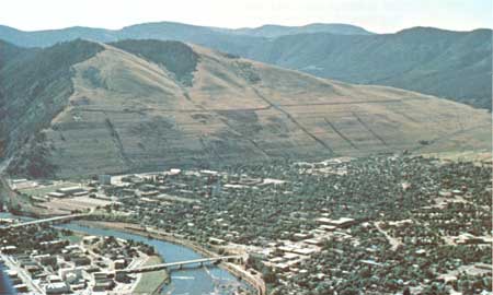
The lake's old shorelines show as faint horizontal lines across Mount Sentinel, the 1,572 m (5,158 ft) peak that rises directly behind the University of Montana. Each time the ice dam gave way, the lake drained west across Idaho and Washington in a catastrophic flood. Giant current ripples 8 to 15 m high near Camas Prairie, about 110 km (68 miles) northwest of the city, helped J Harlen Bretz show that Washington's Channeled Scablands were cut by repeated floods over about 2,000 years, not by millions of years of slow erosion.
The Garnet Range and Flint Creek Range above Drummond
East of Missoula the road climbs the Clark Fork past Clinton and Bearmouth into Granite County. On the north side rises the Garnet Range, reached from the interstate by the Garnet Back Country Byway. To the south, between Drummond and Garrison, eastbound drivers look up at the Flint Creek Range. Its high point is Mount Powell, 3,099 m (10,168 ft), northeast of Philipsburg.
From Deer Lodge the ridge between Mount Powell and Deer Lodge Mountain looks level and bare, but from the interstate between Drummond and Garrison it turns out to be a sheer wall of granite ribs known as The Crater. About 24,000 hectares (60,000 acres) of the Flints are roadless, with dozens of alpine lakes and a few mountain goats. At Garrison, US 12 turns north toward Helena, while I-90 bends south up the broad Deer Lodge Valley toward Butte.
Butte and the Boulder Batholith
The hills around Butte are carved from one great body of once-molten rock. The Boulder Batholith is a mass of granite, mostly quartz monzonite, that lies between Butte and Helena. It is made of at least seven and possibly as many as fourteen separate bodies of magma, called plutons, which intruded between about 73 and 78 million years ago in the Late Cretaceous. At that time the west coast of North America lay near today's Montana–Idaho border, and subduction along it fed the rising magma. Uplift and erosion later brought the granite to the surface. The Butte Granite makes up about 70 percent of the batholith, and the Elkhorn Mountains are a large mass of forested lava associated with the batholith.
The batholith's mineral veins made Butte. Hundreds of millions of dollars' worth of copper, silver, gold, zinc and lead has been mined from it, in shafts and open pits. The Clark Fork also begins here, rising within Butte's city limits under the name Silver Bow Creek.
Homestake Pass: I-90's summit on the Continental Divide
Just east of Butte, I-90 separates from I-15 and climbs the batholith's granite to Homestake Pass. The pass sits on the Continental Divide about 10 km (6 miles) south-southeast of the city, at roughly 1,929 m (6,329 ft), and it is the highest point on the whole 4,860 km (3,020 mile) interstate from Seattle to Boston. Water on its western side reaches the Pacific by way of the Clark Fork and the Columbia. Water on its eastern side drains to the Missouri and on to the Gulf of Mexico.
The Northern Pacific Railway built a line over the pass in 1889 on a route surveyed by the engineer Edwin Harrison McHenry, and the North Coast Limited passenger train used it. The line has been out of service since 1983 because its grades and curves are too awkward for freight. Beyond the pass the highway descends past Pipestone and Cardwell and crosses the Missouri at the Broadwater–Gallatin county line.
Bozeman Pass between the Bridger and Gallatin ranges
After Belgrade and Bozeman the interstate climbs once more, to Bozeman Pass at 1,738 m (5,702 ft), about 21 km (13 miles) east of Bozeman. The pass is a gap between the Bridger Range to the north and the Gallatin Range to the south. It takes its name from John Bozeman, who opened the Bozeman Trail from Fort Laramie to Virginia City through it in 1863. Earlier, on 15 July 1806, Sacagawea guided William Clark and ten men of the Lewis and Clark Expedition through the same gap on their way to the Yellowstone River. The Northern Pacific tunneled under the pass in 1884 with a 1,113 m bore and added a shorter tunnel just to the north in 1945.
Livingston, the Absaroka Range and Emigrant Peak
East of the pass the road drops to Livingston and the Yellowstone River, which runs about 1,080 km (671 miles) from the Yellowstone country to the Missouri in North Dakota. The northern tip of the Absaroka Range rests on the interstate here. The range stretches about 240 km (150 miles) across the Montana–Wyoming border and forms the eastern wall of Paradise Valley and Yellowstone National Park. Its highest summit, Francs Peak, 4,009 m (13,153 ft), is in Wyoming, and 46 other peaks top 3,700 m (12,000 ft), while on the Montana side Mount Cowen reaches 3,419 m (11,217 ft) and still holds small glacierets on its northern slopes.

A short detour south on US 89 leads up Paradise Valley toward Gardiner and Yellowstone's north entrance. Emigrant Peak, 3,330 m (10,926 ft), stands on the western edge of the Absarokas above the valley floor. The river's full course is described in our Yellowstone River guide.
The Crazy Mountains and the Beartooth skyline toward Billings
Past Livingston the interstate follows the Yellowstone to Big Timber. To the north stand the Crazy Mountains, a 64 km (40 mile) island range between the Musselshell and Yellowstone rivers, clearly visible from the highway. Their bedrock is the Big Timber Stock, a Tertiary intrusion of diorite and gabbro. Crazy Peak, at 3,418 m (11,214 ft), rises more than 2,100 m (7,000 ft) above the Yellowstone valley. It is the most topographically prominent peak in the state, and it still has a small glacier on its northeast slope. The Crazies are one of more than a dozen island ranges east of the Divide, alongside the Little Belts, the Big Snowies and the Bears Paw. Many of these formed between about 120 and 66 million years ago, when rising magma cracked and bowed the crust.
South of Columbus and Laurel lie the Beartooth Mountains. Granite Peak lies about 72 km (45 miles) southwest of Columbus and only 16 km (10 miles) from the Wyoming border, inside the Absaroka-Beartooth Wilderness. It was the last state high point in the country to be climbed, first reached on 29 August 1923 by Elers Koch, James C. Whitham and R.T. Ferguson, and climbers still usually spend two or three days on it. From Red Lodge, south of Billings, US 212 crosses the range over Beartooth Pass, just inside Wyoming at 3,337 m (10,947 ft), more than 1,400 m higher than anything on I-90. East of Billings the interstate turns toward Hardin and the plains, and the mountains are behind you. For the chain as a whole, read our Rocky Mountains guide; for the northern ranges that I-90 never reaches, see the Glacier National Park guide.