

Alabama’s landforms fall from 735 m (2,413 ft) on Cheaha Mountain, its highest point, to sea level on the Gulf of Mexico, across a state of 135,760 km² (52,419 sq mi). The north holds the last ridges of the Appalachians: the Talladega Mountains around Cheaha, the Ridge and Valley country of the Coosa Valley, and the flat-topped sandstone plateaus of Lookout and Sand mountains on the Cumberland Plateau, cut by Little River Canyon and threaded by the Tennessee River. A small corner of Piedmont upland lies in the east. Below the Fall Line, about three-fifths of the state is Gulf Coastal Plain: the black-soil prairie of the Black Belt, pine-covered hills, and finally the Mobile–Tensaw Delta, Mobile Bay and the barrier beaches of Dauphin Island and the Fort Morgan Peninsula.
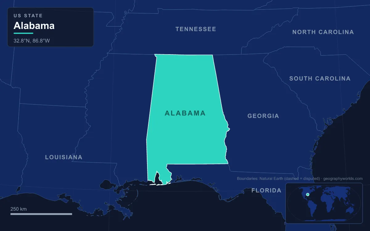
The simplest way to read that sequence is to walk it downhill, starting on the summit and ending with your feet in the Gulf.
Cheaha Mountain, 735 m: the Talladega Ridges and the Piedmont Below
Cheaha Mountain rises a few miles northwest of the town of Delta, inside Cheaha State Park, which opened in 1933 and is Alabama’s oldest continuously operating state park. The summit is marked by a US Geological Survey benchmark in front of Bunker Tower, a stone observation tower built by the Civilian Conservation Corps, which worked in the park from 1933 to 1939. The nearest higher ground is Brushy Top in Gilmer County, Georgia, about 172 km (107 mi) away, and Cheaha is the highest point in the eastern Sun Belt, the area east of the Mississippi, south of Interstate 20 and north of the Gulf.
It feels taller than it is. The summit stands about 526 m above the city of Oxford at its western foot, because the land to the west is low. The mountain is built of the Cheaha quartzite, weakly metamorphosed sandstones and conglomerates of Silurian to Devonian age that resist erosion better than the rocks around them. It belongs to the Talladega Mountains, a small section of the Ridge and Valley province, which makes it geologically different from the plateau mountains farther north. Around it, the Talladega National Forest covers about 1,589 km² (613 sq mi) at the southern edge of the Appalachians, including the 30 km² Cheaha Wilderness and the Dugger Mountain Wilderness, which protects the area around Alabama’s second-highest peak.

Southeast of the ridges, the Piedmont Plateau crosses into Alabama from Georgia as a small triangle made up mainly of Randolph and Clay counties with northern Tallapoosa and Chambers. Its gently rolling surface sits at about 300 m (1,000 ft), a lowland worn down on hard crystalline rock and later lifted up again. The Tallapoosa River drains it. Northwest of Cheaha, the Coosa Valley, the local name for the Appalachian Valley, covers about 21,000 km² (8,000 sq mi) of limestone lowland broken by parallel ridges of harder rock, all trending northeast to southwest. The Coosa River runs down it.
Lookout Mountain, Sand Mountain and Little River Canyon
North of the Coosa Valley the landscape changes from ridges to tablelands. Lookout Mountain and Raccoon Mountain, which continues into Alabama as Sand Mountain, are long flat-topped plateaus of sandstone that belong to the Cumberland Plateau. Near the Georgia line they top out at a little over 550 m (1,800 ft) and lose height toward the southwest. Sand Mountain averages about 460 m (1,500 ft), compared with about 200 m in the surrounding land, and is the largest plateau in the Appalachian chain. That elevation gives it the coolest climate in Alabama; its largest town, Albertville, had 22,386 people in 2020.
The most dramatic landform on these plateaus is Little River Canyon. The Little River is formed by an East Fork of 27 km and a West Fork of 40 km, then runs a further 37 km almost entirely along the middle of Lookout Mountain before it leaves the plateau and empties into Weiss Lake on the Coosa near Leesburg. Over that course it has cut one of the deepest canyons in the Southeast, known historically as May’s Gulf; “gulf” is the Cumberland Plateau word for this kind of gorge. The 6,187-hectare Little River Canyon National Preserve, created by Congress in 1992, protects what is sometimes called the nation’s longest mountaintop river.

The Tennessee Valley: Karst Caves, Waterfalls and Two Great Lakes
Across the Cumberland Plateau, rivers have dissected the tableland into separate blocks. West of Jackson County lie about 2,600 km² of level highland at 210 to 240 m (700 to 800 ft), and on each side of the Tennessee River runs a strip of gentle rolling lowland at 150 to 240 m. In the south of the region, Little Mountain runs about 129 km (80 mi) east to west, rising steeply 150 m above the valleys on its north side.
The Tennessee River, 1,049 km long overall, enters Alabama from Chattanooga, having missed Georgia by only about 76 m, and swings in a great arc past Guntersville, Huntsville and Decatur to Muscle Shoals, then forms a short piece of the Mississippi border before turning back north into Tennessee. Muscle Shoals takes its name from a former shallow stretch of the river where mussels were gathered. Dams have turned the river into a chain of reservoirs: Guntersville Lake, 121 km long and 280 km², is Alabama’s largest lake, and Wheeler Lake below it, at 276 km², is its second largest. The Tennessee is the only part of Alabama that drains north and west; every other region drains southwest to the Gulf.
The limestone under the valley is riddled with karst. Russell Cave, near Bridgeport, has a mapped length of 11.6 km, the third-longest mapped cave in Alabama, and its huge entrance sheltered people from around 6500 BCE; it became a national monument in 1961. Cathedral Caverns, in Kennamer Cove near Grant, holds a stalagmite forest covering about 1.2 hectares, with some 3,400 m of passage surveyed; it was named a National Natural Landmark in 1972. On the western end of the plateau, the Sipsey Wilderness in Bankhead National Forest, designated in 1975 as the first wilderness area east of the Mississippi, is nicknamed the “Land of 1000 Waterfalls” because its creeks tumble over alternating layers of limestone and sandstone on Brindlee Mountain.
The Fall Line, the Wetumpka Crater and the Black Belt Prairie
South of Birmingham and the ridges, rivers leaving the hard upland rocks drop onto the softer sediments of the Coastal Plain. This boundary is the Fall Line, marked by shoals and rapids where rivers cross it. On the Coosa at Wetumpka, the rapids of the Devil’s Staircase gave the town its Muscogee name, “rumbling waters”, and could reportedly be heard for miles before the Walter Bouldin and Jordan dams were built. Just downstream the Coosa and Tallapoosa unite to form the Alabama River.
Just east of downtown Wetumpka lies a landform most visitors never notice: the Wetumpka crater, the only confirmed impact crater in Alabama. It is 7.6 km (4.7 mi) across and about 85 million years old, from the Late Cretaceous, when a meteorite estimated at about 335 m in diameter struck a shallow sea roughly 90 to 120 m deep. Thornton Neathery identified it during mapping in 1969–70, and Auburn University researchers published evidence in 2002 that established it as an internationally recognised impact site. Its eroded rim shows as a ring of hills east of town.
Beyond the Fall Line, the inner lowland of the Coastal Plain forms the Black Belt, a band across central Alabama named for its dark, clay-rich soil, much of it Vertisols formed on the Cretaceous chalk of the Selma Group. This flat to gently rolling prairie became the heart of Alabama’s cotton economy, and Montgomery, the state capital since 1846, is its largest city. The central Coastal Plain averages about 180 m (600 ft), lower and more level toward the southwest. South of the Black Belt lie foothills and the sandy, pine-covered outer belt of the Coastal Plain, extending about 240 km (150 mi) north from the Gulf. The Conecuh National Forest protects 340 km² of it, with longleaf pine stands, along the Florida line.
Mobile–Tensaw Delta, Mobile Bay and Dauphin Island: Alabama at Sea Level
In the southwest the Tombigbee, fed by the Black Warrior, meets the Alabama River, and together they spread into the Mobile–Tensaw River Delta, the largest river delta and wetland in the state and the second-largest delta in the contiguous United States. It covers about 1,050 km² in an area roughly 64 by 16 km, with about 28,000 hectares of swamp and more than 34,000 hectares of bottomland forest, and it drains about 114,000 km², including 64 per cent of Alabama. Its 126 fish species and at least 300 bird species led the naturalist E. O. Wilson to call it an “American Amazon”.
The Mobile and Tensaw rivers empty into Mobile Bay, the fourth-largest estuary in the United States. The bay covers 1,070 km² (413 sq mi), is 50 km long and up to 39 km wide, and has an average depth of only 3 m, though its shipping channel exceeds 23 m. Geologically it is a drowned river valley: the lower valley of the Alabama and Tombigbee rivers flooded as the land here subsided. Several times most summers the bay has a “jubilee”, when fish and crabs crowd into the shallows along its shore.
The bay’s mouth is pinched between two strips of sand. On the east is the Fort Morgan Peninsula, running west from Gulf Shores to Mobile Point, where the Bon Secour National Wildlife Refuge, set up in 1980, protects about 29 km² of undeveloped dune and marsh. On the west is Dauphin Island, one of the Mississippi–Alabama barrier islands, with pine and saw palmetto on its wider eastern end and low scrub on its narrow western tail. The Gulf coast receives about 1,574 mm of rain a year, compared with about 1,320 mm in the rest of the state.

From the quartzite of Cheaha to the sands of Dauphin Island, Alabama compresses the southern end of the Appalachians and a full slice of Gulf Coastal Plain into one state. The ridges are traced northward in our guide to the Appalachian Mountains, the northern river in Tennessee River geography, and the waters beyond the barrier islands in our article on the Gulf of Mexico, while Alabama geography sets these landforms beside the state’s cities and climate.