

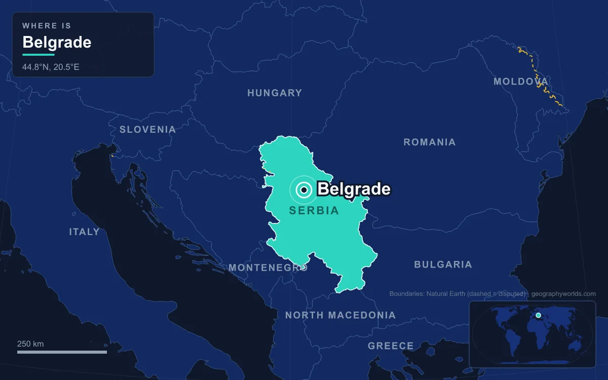
The capital of Serbia is Belgrade, a city of 1,197,114 people in its urban core at the 2022 census and 1,682,720 across its wider administrative area. It stands where the Sava flows into the Danube, at the meeting point of the Pannonian Plain and the Balkan Peninsula, and that position has made it one of the most fought-over places in Europe: by one count it has been contested in 115 wars and razed 44 times. Its name, Beograd, means "White City". Because so much was destroyed, the city's history survives less in old buildings than in places, and the clearest way to read it is on foot, from the fortress on the confluence ridge to the Habsburg town of Zemun on the far bank.
Kalemegdan: The Ridge Above the Sava–Danube Confluence
Start where Belgrade started, on the 125.5 m ridge at the end of the Šumadija plateau. Below it the Sava enters the Danube beside Great War Island, and the ridge's position commanding both rivers explains nearly everything that followed. A Thraco-Dacian tribe lived here before Celtic Scordisci took the site after 279 BC and called it Singidūn; Rome made it Singidunum and granted it city rights in the 2nd century. The Slavic name first appears as Belograd in a papal letter of 16 April 878.
The walls around you today are the Belgrade Fortress, whose parkland is called Kalemegdan. Despot Stefan Lazarević, who made Belgrade the capital of the Serbian Despotate in the early 15th century, built a castle here, of which the Despot's Tower and the west wall survive. In 1456 a Hungarian army under John Hunyadi held the fortress against a siege by over 100,000 Ottoman soldiers, a victory Pope Callixtus III marked with the noon bell still rung in churches across Europe. The Ottomans finally took the city in 1521, and it changed hands with the Habsburgs repeatedly afterwards. The Habsburgs held it from 1688 to 1690, 1717 to 1739 and 1789 to 1791, and each Ottoman recapture left it largely razed. On 18 April 1867 the last Ottoman garrison was ordered out of Kalemegdan, the moment from which Serbia's de facto independence is dated.
At the western point of the Upper Town stands the Victor, or Pobednik, a 14 m bronze by Ivan Meštrović cast in 1913 and raised in 1928 to mark Serbia's victories in the Balkan Wars and the First World War. It looks across the confluence toward the plain and Fruška Gora, Austro-Hungarian territory until 1918. The fortress draws over 2 million visitors a year, more than anywhere else in the city. For the river's full 2,850 km course, see our complete guide to the Danube.

Knez Mihailova, Along a Roman Road
Leave the fortress by its south-east gate and you are on Knez Mihailova, the city's main pedestrian and shopping street. It runs about a kilometre and follows the line of one of the main access roads of Roman Singidunum; the oldest Roman graves in the city were found along this stretch. The buildings you see, though, are mostly from the late 1870s. After 1867 the planner Emilijan Josimović drew up a regulation plan that replaced the Ottoman town's crooked lanes with a grid and borrowed the idea of grand boulevards from Vienna's Ringstrasse. Belgrade had moved fast. Prince Mihailo Obrenović, after whom the street is named, had brought the capital of the Principality of Serbia here from Kragujevac in 1841, when the town still looked largely Ottoman. Of that Ottoman Belgrade, little remains beyond the citadel, a fountain with Arabic inscriptions and a mosque or two, depending on the count. The street became Belgrade's first protected urban ensemble in 1964.
Republic Square and Skadarlija
At the far end of Knez Mihailova the street opens into Republic Square, framed by the National Museum and the National Theatre, with a statue of Prince Mihailo at its centre. The square has been the city's stage for protest. On 9 March 1991 somewhere between 100,000 and 150,000 people gathered here, led by Vuk Drašković, against Slobodan Milošević; two people were killed and tanks were sent onto the streets that evening.
A few minutes north-east, below the square, Skadarska Street drops through Skadarlija, the old bohemian quarter often compared to Montmartre. The street is under 400 m long, cobbled and lined with taverns, and has been protected by law since 1967. After Kalemegdan it is Belgrade's most visited attraction.
Terazije to Vračar and the Church of Saint Sava
Walk back south to Terazije, less a square than a widened street, which is Belgrade's official centre: house numbers on the city's streets start from the end nearest to it. From here King Milan Street, the main street of the city, runs to Slavija square, and beyond it lies the Vračar plateau.
Vračar carries one of the heaviest memories in Serbian history. After a Serb uprising in 1594, whose rebels carried banners bearing Saint Sava's icon, the Ottoman grand vizier Sinan Pasha had the relics of Saint Sava, the first Serbian archbishop, brought from Mileševa Monastery and burned on a pyre, by tradition on this plateau, in April 1595. The Church of Saint Sava was built on the traditional site of the pyre. Work began in 1935 and was halted by war and politics for decades; the exterior was finished only in 2004 and the interior in 2020. Modelled on Istanbul's Hagia Sophia, it is the fourth-largest Eastern Orthodox church in the world. For the place of the Orthodox Church in Serbian life today, see our guide to religion in Serbia.

Savamala and the Belgrade Waterfront
Head west, downhill to the Sava, and you reach Savamala, the riverside district that grew up around the port in the 19th century. When steamers and, after 1884, the railway brought visitors to Belgrade, hotels such as the Bosna and the Bristol opened here. The riverbank beside it, about 177 hectares between Branko's Bridge and the Belgrade Fair, is now one vast building site. Belgrade Waterfront, launched in 2014 by the Serbian government with the Emirati developer Eagle Hills, had absorbed more than 4 billion euros by May 2025 and put up about 6,000 apartments, with thousands more under construction or planned, alongside hotels, offices, a shopping mall and a planned Belgrade Tower. The project remains the most visible, and most argued-over, change to the skyline in a generation.
Much of what is missing along this walk is missing because of bombs. Austro-Hungarian monitors shelled Belgrade on 29 July 1914, the day after the First World War began. The Luftwaffe raid of 6 April 1941 killed up to 2,274 people, Allied bombing on Orthodox Easter, 16 April 1944, killed at least 1,100, and the city ended the war with 11,500 homes destroyed.
Across Branko's Bridge to New Belgrade
From Savamala, Branko's Bridge carries you over the Sava. It was built in 1956 on the foundations of the King Alexander Bridge of 1934, which was destroyed in the Second World War, and for a time it was the only motorway bridge linking the old city to the left bank. Construction of New Belgrade on that bank began in 1948. Tito's Yugoslavia, with Belgrade as its capital, wanted a showcase of modernism inspired by Le Corbusier, and the result was a plain of numbered residential blocks, wide boulevards and prestige buildings such as the Ušće Tower of 1964, which housed the Central Committee of the League of Communists, and the Hotel Jugoslavija. The city passed one million people in 1969.
Some of those buildings were struck again in 1999, when NATO's bombing campaign during the Kosovo War hit the Central Committee tower, the Hotel Jugoslavija, the state broadcaster RTS and the Chinese embassy, among other targets; according to the Humanitarian Law Center, 27 civilians and 16 soldiers were killed in Belgrade. Today New Belgrade is Serbia's main business district, home to the Sava Centar congress hall, the Belgrade Stock Exchange and most of the new office towers of the IT boom. Block 70 has been known as the city's Chinese quarter since the mid-1990s.
Zemun and Gardoš, the Old Habsburg Frontier
Keep walking north-west along the Danube and the blocks give way to a small town of low houses around a fortress hill. This is Zemun, the Celtic and Roman Taurunum, which for centuries faced Belgrade across the water from another empire. Until 1918 northern Belgrade was the southernmost post of the Habsburg Monarchy, and Zemun passed to the new Kingdom of Serbs, Croats and Slovenes with the rest of the former Austro-Hungarian south in 1918. It stayed a separate town until 1 April 1934, when it was absorbed into the municipality of Belgrade. Belgrade became that kingdom's capital, and stayed capital of Yugoslavia in all its forms until the federation dissolved.
The walk ends at the Gardoš Tower on the loess hill above the old town. It was opened on 20 August 1896 to mark a thousand years of Hungarian settlement in the Pannonian Plain, the southernmost of seven millennium monuments built across the Hungarian half of Austria-Hungary. From its gallery you can look back along the whole route: the Danube, New Belgrade's towers, and on the far ridge the fortress where you began.

Walked end to end, the route covers about two thousand years of Belgrade and crosses the line where two empires met. It also explains why the capital sits here rather than in Kragujevac, the capital it replaced: the ridge over two navigable rivers was too valuable to leave to anyone else. Belgrade is also the seat of Serbia's government, parliament and nearly all its largest companies, media and research institutions, which makes it a primate city in the full sense. For the rest of the country beyond the capital, from the Vojvodina plain to the mountains of the south, continue with our Serbia country guide.
Quick Facts About Belgrade
- Country: Serbia
- Continent: Europe (Southern Europe)
- Country population: approximately 6.6 million
- Capital city status: Belgrade is the capital of Serbia, the seat of national government, and the location of foreign embassies, parliament, and the head of state's official residence.
Frequently Asked Questions
What is the capital of Serbia?
The capital of Serbia is Belgrade. Belgrade is the seat of national government, hosts most foreign embassies and consulates, and is typically where the head of state and parliament are located.
What continent is Belgrade in?
Belgrade, the capital of Serbia, is located in Europe, in the Southern Europe region. As Serbia's capital, Belgrade serves as the country's primary connection to the broader Europen political, economic, and cultural sphere.
Why is Belgrade the capital of Serbia?
Belgrade was chosen as the capital of Serbia for reasons that typically combine geography, history, and politics. Capital city selections often reflect a desire for centrality (being accessible from across the country), historical importance (being a longstanding seat of government or culture), or neutrality (being acceptable to multiple regions or ethnic groups within the country). The specific reasons for Belgrade's designation are detailed in the city's history above.
What is Belgrade known for?
As the capital of Serbia, Belgrade is best known for housing the country's central government institutions — parliament, presidential or royal residences, supreme court, and key ministries. It is also typically a major cultural and economic center within Serbia, hosting national museums, embassies, and signature monuments. The introduction and history sections above provide detailed coverage of the city's specific notable institutions and landmarks.
Related Pages
- Serbia Country Guide — full geography, climate, economy, and culture overview
- Flag of Serbia — meaning, history, and design of Serbia's national flag