
Georgia is the largest state east of the Mississippi River at 153,910 square km, and its geography spans five distinct physiographic provinces from the Blue Ridge Mountains in the north to the Atlantic barrier islands in the southeast. This enormous range of terrain makes Georgia one of the most geographically diverse states in the eastern United States.
Introduction
The state's landscape was shaped by Appalachian mountain-building events, the slow erosion of the Piedmont Plateau, and the rise and fall of sea levels that created the Coastal Plain. Georgia's rivers flow from the mountains through the Piedmont and across the Coastal Plain to the Atlantic, creating waterfalls at the Fall Line where hard rock meets soft sediments.
From the misty summits of the Blue Ridge to the blackwater swamps of the Okefenokee, Georgia offers a complete transect of the southeastern United States landscape.
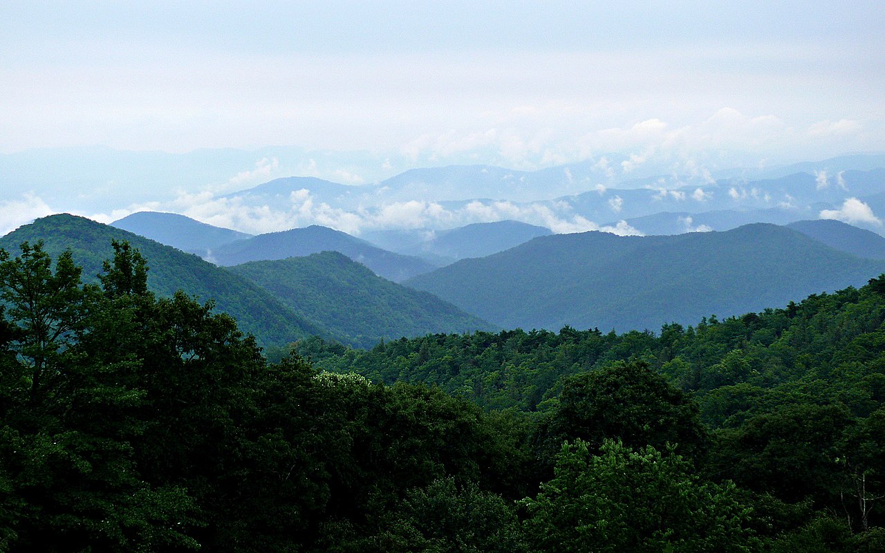
Major Geographic Features
Brasstown Bald & the Blue Ridge
Brasstown Bald at 1,458 meters (4,784 feet) is Georgia's highest point, located in the Blue Ridge Mountains of the state's northeastern corner. The Georgia Blue Ridge features deeply forested ridges, hundreds of waterfalls, and the southern terminus of the Appalachian Trail at Springer Mountain (1,153 m). The region receives over 200 cm of rainfall annually, making it one of the wettest areas in the eastern US.
Tallulah Gorge
Tallulah Gorge is one of the deepest canyons in the eastern United States, plunging nearly 300 meters over a 3.2-km stretch of the Tallulah River. The gorge cuts through quartzite bedrock of the Blue Ridge and features six waterfalls along its floor. The gorge walls support rare plant species found nowhere else, including persistent trillium and several cliff-dwelling ferns.
Stone Mountain
Stone Mountain is the world's largest exposed granite monadnock, rising 251 meters above the surrounding Piedmont Plateau near Atlanta. The dome of exposed granite covers 2.4 square km and is composed of a 300-million-year-old igneous intrusion. The mountain's bare granite face was the site of the rebirth of the Ku Klux Klan in 1915 and now features a large Confederate memorial carving.
Piedmont Plateau
Georgia's Piedmont covers roughly one-third of the state, a rolling landscape of weathered metamorphic and igneous rock between the Blue Ridge and the Coastal Plain. The Piedmont surface sits at 150-500 meters elevation and is deeply weathered, with red clay soils often extending 15-30 meters before reaching solid bedrock. The Chattahoochee River has carved a scenic corridor through the Piedmont from Atlanta to the Fall Line at Columbus.
Okefenokee Swamp
The Okefenokee Swamp in southeastern Georgia covers 1,770 square km, making it one of the largest freshwater wetlands in North America. The swamp occupies a shallow basin on the Coastal Plain, with peat deposits reaching 4.6 meters deep. The blackwater swamp is the headwaters of both the Suwannee and St. Marys Rivers and supports a population of over 10,000 American alligators.
Golden Isles & Barrier Islands
Georgia's 160-km coastline features a chain of barrier islands including Cumberland, Jekyll, St. Simons, and Sapelo Islands. These islands protect the mainland from Atlantic storms and shelter vast salt marshes that are among the most productive ecosystems in the world. Cumberland Island, the largest at 145 square km, features maritime forests, undeveloped beaches, and a herd of wild horses.
Fall Line & Providence Canyon
Georgia's Fall Line runs through Macon, Columbus, and Augusta, marking where rivers drop from the hard Piedmont rock onto the soft Coastal Plain. South of the Fall Line, erosion has carved Providence Canyon, sometimes called Georgia's "Little Grand Canyon," where gullies up to 50 meters deep expose layers of colorful pink, orange, red, and purple sands and clays.
Key Geographic Facts
- Georgia is the largest state east of the Mississippi at 153,910 sq km
- Brasstown Bald at 1,458 m (4,784 ft) is the highest point
- The Okefenokee Swamp at 1,770 sq km is one of the largest freshwater wetlands in North America
- The Appalachian Trail's southern terminus is at Springer Mountain in Georgia
- Georgia spans five physiographic provinces from mountains to coast
Fun Facts
- Stone Mountain is the world's largest exposed granite monadnock at 2.4 square km of bare rock
- Providence Canyon was not formed by natural erosion alone — poor farming practices in the 1800s accelerated the gullying dramatically
- The Okefenokee Swamp is the headwaters of both the Suwannee River (flowing to the Gulf) and the St. Marys River (flowing to the Atlantic)
- Georgia's Blue Ridge receives over 200 cm of rainfall per year, rivaling the Pacific Northwest
Final Thoughts
Georgia's vast size and position spanning from the Appalachians to the Atlantic give it a geographic diversity unmatched in the eastern United States. Mountains, gorges, granite monadnocks, a rolling Piedmont, one of the continent's great swamps, and a pristine chain of barrier islands all lie within this single state. Georgia is a complete cross-section of the southeastern landscape.
Test Your Knowledge!
Think you know your US state geography? Try our interactive quiz!
Play Country Quiz →