
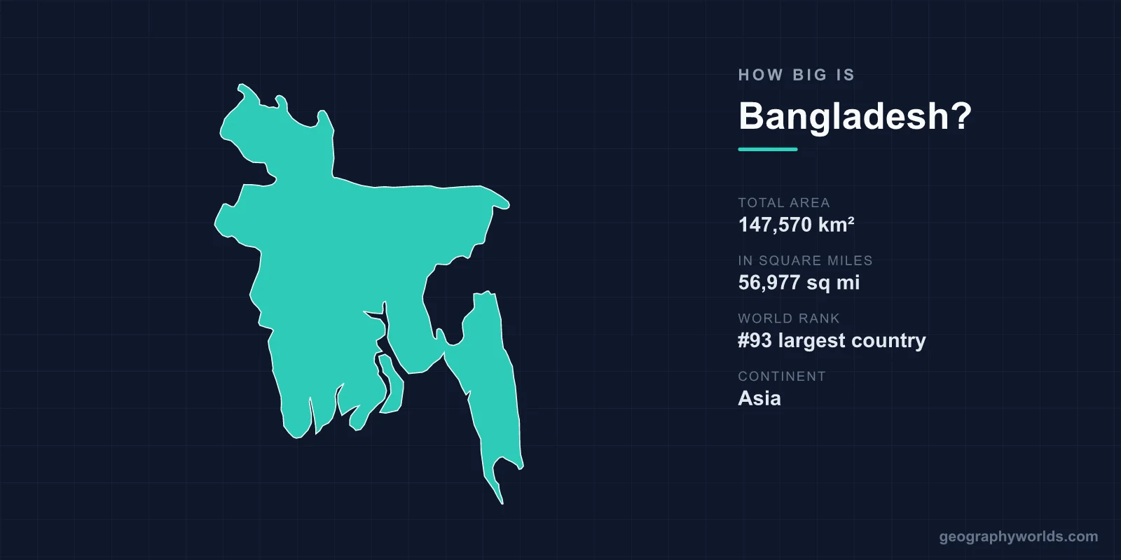
Bangladesh covers 147,570 km², or 56,977 square miles, which makes it the 93rd largest country in the world. That is roughly the size of the American state of Iowa, slightly larger than England and Wales together, and about a third the size of Sweden. Into that area it fits around 175 million people — more than Russia, in a country a fifteenth of one per cent of Russia's size.
The Most Crowded Large Country on Earth
Bangladesh's population density is roughly 1,200 people per square kilometre. Among countries with populations over ten million, nothing else comes close: South Korea is around 520, India around 480, the Netherlands around 520.
The only places denser are city-states and microstates — Singapore, Monaco, Bahrain — which are essentially single urban areas. Bangladesh is a nation of 175 million at a density normally found inside a city.
The comparison people reach for is that if the whole world lived at Bangladeshi density, humanity would fit into an area about the size of Argentina and Chile combined.
Why the Land Can Carry It
The density is possible because of what the land is. Bangladesh is essentially one enormous delta, built by the Ganges, the Brahmaputra and the Meghna where they meet and empty into the Bay of Bengal — the largest river delta in the world, covering most of the country.
The silt those rivers carry down from the Himalaya is exceptionally fertile and is renewed by flooding every year. Most of the country is flat alluvial plain under two or three rice crops annually, and almost none of it is wasted: around 70 per cent of the land area is agricultural, one of the highest proportions anywhere.
A country of the same area in the Sahara or the Canadian Shield could not feed a fraction as many people. Bangladesh's size only makes sense alongside its soil.
The Same Size as Iowa
Iowa covers 145,746 km², which is within two per cent of Bangladesh. Iowa has about 3.2 million residents; Bangladesh has around 175 million. Holding the area constant and varying only the population by a factor of fifty is the clearest way to feel what the density figure means.
Other useful equivalents: Greece is 131,957 km², England 130,279, and New York State 141,297 — all a little smaller. The most pointed comparison is Nepal, immediately to the north at 147,181 km², effectively the same size as Bangladesh with roughly a sixth of the people, because almost all of Nepal is mountain and almost all of Bangladesh is delta.
A Country That Is Still Being Built
Most countries have a fixed area. Bangladesh does not, in any strict sense, because the delta is actively accreting: the rivers deposit sediment faster than the sea removes it in some places, and new land emerges.
These are the chars — sandbars and silt islands that appear, consolidate, are settled and farmed, and sometimes vanish again in a flood. Char land is legally complicated and often violently contested, and the people who live on it are among the country's most precarious.
Bangladesh has run deliberate land-accretion programmes, building cross-dams to encourage deposition, and estimates of net gain have at times run to a few square kilometres a year. In the other direction, riverbank erosion destroys settlements annually and displaces tens of thousands.
The Land That May Not Stay
Because the delta is flat and low, small changes in sea level translate into large changes in area. Much of the country sits under ten metres of elevation, and a substantial part under five.
Frequently cited projections suggest that a sea-level rise of around a metre could inundate something on the order of a tenth of the country's land area and displace many millions. The interaction is complex — sediment deposition can raise land as the sea rises — but the vulnerability is not seriously disputed.
Salinity intrusion is already measurable in the coastal districts, pushing rice cultivation out and shrimp farming in, and cyclones driving storm surges up the funnel-shaped Bay of Bengal have repeatedly killed on a catastrophic scale.
The Forest at the Bottom
The south-western coast holds the Sundarbans, the largest mangrove forest in the world, covering around 10,000 km² across Bangladesh and the Indian state of West Bengal, with the larger share in Bangladesh.
It is a UNESCO World Heritage site and the only mangrove forest inhabited by tigers. It also functions as a physical buffer, absorbing cyclone energy before it reaches the densely settled interior, which means a substantial part of Bangladesh's land area exists to protect the rest.
Water Is a Large Share of the Total
Roughly 7 per cent of Bangladesh's surface area is inland water in the standard figures, but that understates the seasonal reality. During the monsoon, something between a fifth and a third of the country is typically under water in a normal year, and in a severe flood year — 1988, 1998, 2004 — the figure has approached two-thirds.
The country has about 700 rivers and a total river length in the tens of thousands of kilometres. Roads and rail have to bridge them, which is why the Padma Bridge, opened in 2022 at over six kilometres long, was treated as a national achievement: it connected the south-west of the country to the capital without a ferry for the first time.
The Hills in the East
Not all of Bangladesh is flat. The Chittagong Hill Tracts in the south-east cover around 13,000 km², roughly a tenth of the country, and rise to Saka Haphong near the Myanmar border at a little over 1,000 metres — the highest ground in Bangladesh.
The region is ethnically and religiously distinct from the delta, home to Chakma, Marma and other peoples who are mostly Buddhist, and it was the site of an insurgency from the 1970s until a 1997 peace accord. The Kaptai dam, built in the 1960s, flooded a large area of the Hill Tracts and displaced around 100,000 people, many of whom were never adequately resettled.
A Country Carved Out Twice
Bangladesh's area is the product of two partitions within twenty-five years. In 1947 Bengal was divided, with the Muslim-majority eastern districts becoming East Pakistan — a territory separated from West Pakistan by more than 1,500 kilometres of India.
In 1971, after the suppression of an election result and a nine-month war of independence in which very large numbers were killed, East Pakistan became Bangladesh. The area did not change; the sovereignty did.
A residue of the 1947 partition persisted until 2015 in the form of enclaves — around 160 fragments of Indian territory inside Bangladesh and Bangladeshi territory inside India, including the world's only third-order enclave, a patch of India inside Bangladesh inside India inside Bangladesh. A land boundary agreement exchanged them, finally fixing the borders of both countries.
What the Size Means in Practice
Bangladesh is small enough to cross by road in a day in most directions, and dense enough that there is rarely a stretch without settlement. Dhaka, the capital, is among the most densely populated cities in the world, with parts of the old city exceeding 100,000 people per square kilometre.
The economic implication is that Bangladesh has very little margin. There is almost no unused land to expand into, so growth in output has had to come from yield per hectare and from manufacturing — which is what happened: the ready-made garment sector became the second largest in the world after China, built on labour rather than land.
Crossing a Country Made of Rivers
Bangladesh is compact enough to drive across in a day in principle, and for decades it was not, because the rivers had to be ferried. The Jamuna, the Padma and the Meghna are each several kilometres wide in the dry season and far wider in flood.
The Jamuna Bridge, opened in 1998 at 4.8 kilometres, was the first fixed link between the north-west and the capital. The Padma Bridge, opened in 2022 at 6.15 kilometres, connected the entire south-west — a region of some 30 million people — to Dhaka without a ferry for the first time, cutting journeys that had taken most of a day to a couple of hours.
Inland waterways remain central: Bangladesh has something on the order of 24,000 kilometres of river channel, of which several thousand are navigable year-round, and passenger launches carry very large numbers of people. Ferry disasters have been a recurring feature, because the same geography that makes the country fertile makes it hard to build across.
Area Is the Wrong Measure Here
147,570 km², 93rd in the world by area, eighth by population. The combination is the point: Bangladesh is proof that land area is a poor predictor of national significance, and that what a country's territory is made of matters more than how much of it there is.
The delta that makes it crowded is the same delta that makes it fertile, and the same delta that makes it vulnerable. Bangladesh beyond its dimensions is our Bangladesh country guide, while our Ganges river guide follows the system that built the land it sits on.
