

Peru has no states: it is a unitary republic divided into 24 departments (departamentos, usually called regions), plus two provinces with a special status, the Constitutional Province of Callao and Lima Province, which makes 26 first-level units in all. The 24 departments and Callao each elect a regional government, while Lima Province, home to the capital, is run by the Metropolitan Municipality of Lima with equal standing. Loreto, in the Amazon, is by far the largest department at 368,852 km², nearly 29% of Peru’s 1,285,216 km². The most populous is Lima, where the 2017 national census counted 9,485,405 people across the department and its capital province, almost a third of the national total.
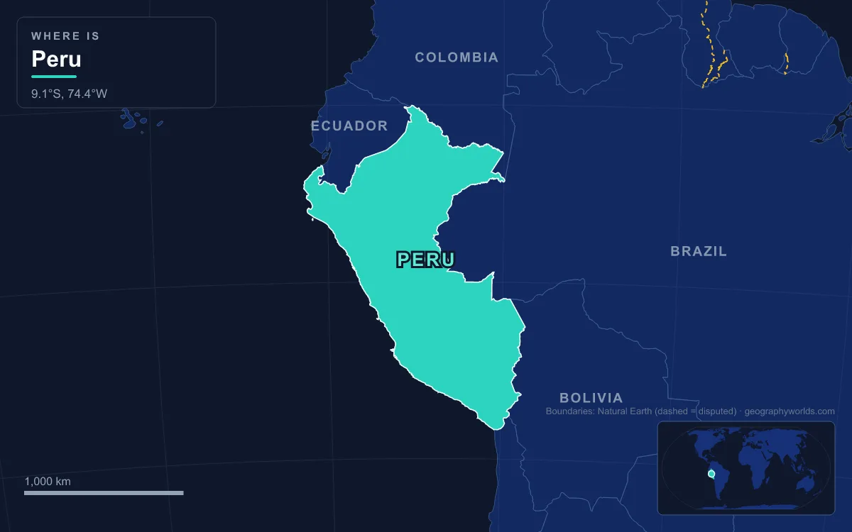
Departments, regions and two special provinces: how Peru reaches 26
English speakers ask about Peru’s “states” by analogy with Mexico or Brazil, but Peru has never been a federation. Its first-level units are formally departments, the name used since independence, and since the decentralisation laws of 2002 each one has had a regional government, which is why “region” has become the everyday word. Each regional government is led by a governor elected for a four-year term, with an elected regional council that approves budgets and can remove the governor.
Two units sit outside that pattern. Callao, the port next to Lima, has not belonged to any department since 1836 and was declared a Constitutional Province in 1857; it has its own regional government, so official lists count 25 regional governments. Lima Province, by contrast, was left out of the 2002 regional system altogether: it belongs geographically to the Department of Lima, but it is governed by the Metropolitan Municipality of Lima, and the surrounding department’s regional government sits in Huacho, about 150 km up the coast. Below this top tier Peru has 196 provinces and 1,838 districts. Áncash has the most provinces, with 20, and Lima Province has the most districts, with 43.
Peruvian geographers divide the country into three natural zones: the arid costa (coast), the Andean sierra (highlands) and the Amazonian selva (jungle). The selva covers almost 60% of the land, yet the coast holds about 58.8% of the people. The departments below are grouped along those lines, with areas from the National Institute of Statistics and Informatics (INEI) and populations from the 2017 census count.
Tumbes, Piura, Lambayeque and La Libertad on the northern coast
Tumbes, on the border with Ecuador, is the smallest department at 4,046 km², with 224,863 people counted in 2017. It began as a province in 1901 and only became a department in 1942. Its neighbour Piura (35,892 km², capital Piura) is the second most populous department, with 1,856,809 people, a rise of 10.8% on the 2007 count.
Lambayeque, with its capital at Chiclayo, is compact (14,231 km²) but crowded: its 1,197,260 residents give it one of the highest population densities of any department. Further south, La Libertad (25,500 km²) counted 1,778,080 people in 2017, the third highest figure in the country. Its capital, Trujillo, was settled by the Spaniards under Diego de Almagro in 1534 and given its first town council by Francisco Pizarro in 1535, five kilometres from Chan Chan, the adobe capital of the Chimor kingdom that the Inca conquered around 1470. La Libertad itself began life in 1821 as the Department of Trujillo and took its present name in 1825.
Lima, Callao and Ica, the central coast
The Department of Lima covers 34,802 km² of coast and western Andean slopes. Nearly all its weight sits in Lima Province, which dates its history as a province to 1821. That province produced about half of Peru’s GDP in 2012 and holds almost a third of the national population, yet it covers only about 2,672 km², under a tenth of the department. The remaining provinces, governed from Huacho, hold most of the land but only a small share of the people. Callao is the smallest first-level unit of all, at 147 km², yet 994,494 people were counted there in 2017. It is Peru’s chief seaport and the site of Jorge Chávez International Airport, and its centre lies about 15 km west of historic Lima.
Ica (21,328 km², capital Ica) is a desert department whose counted population grew 19.5% between the 2007 and 2017 counts, to 850,765. It contains the Nazca Lines, geoglyphs scraped into the Pampas de Jumana about 400 km south of Lima, whose combined lines run for more than 1,300 km. UNESCO listed them as a World Heritage Site in 1994.
Arequipa, Moquegua and Tacna in the far south
Arequipa is the largest coastal department, at 63,345 km², and the fourth most populous, with 1,382,730 people in 2017, a rise of almost 20% in ten years. The Colca Canyon, about 160 km northwest of Arequipa city, is roughly 3,270 m deep, making it one of the deepest canyons in the world.
Moquegua (15,734 km²) is one of the least populous departments, with 174,863 people counted in 2017. Its status has changed more than most: created in 1857, it was reduced to a province in 1875 and only regained department status in 1936. Tacna (16,076 km², 329,332 people), on the Chilean border, was established as a department in 1875 and is Peru’s southernmost.
The Andean departments from Cajamarca to Ayacucho
Ten departments lie mostly in the sierra. In the north, Cajamarca (33,318 km²) counted 1,341,012 people in 2017, about 47,000 fewer than in 2007. Áncash (35,914 km², capital Huaraz, 1,083,519 people) holds the Cordillera Blanca and Huascarán, whose south summit reaches 6,768 m (22,205 ft), the highest point in Peru and in the Earth’s tropics. Áncash was created in 1835 under the name Huaylas.

The central highlands come next. Huánuco (36,849 km², 721,047 people) dates from 1869. Pasco, carved out in 1944, covers 25,320 km², and its capital Cerro de Pasco stands at 4,330 m, one of the highest cities on Earth, built around silver, copper, zinc and lead mines. Junín (37,667 km²) is governed from Huancayo and counted 1,246,038 people in 2017. Huancavelica (22,131 km²) recorded the steepest fall of any department, losing 23.6% of its counted population between 2007 and 2017, down to 347,639. Ayacucho (43,815 km², 616,176 people) was founded in 1822 as Huamanga and renamed in 1825.
Cusco, Apurímac and Puno in the southern highlands
Cusco is the largest Andean department, at 71,986 km², with 1,205,527 people counted in 2017. Its capital was the seat of the Inca state, and Machu Picchu stands in its Urubamba Province, about 80 km northwest of the city, on a ridge at 2,430 m. Neighbouring Apurímac (20,896 km², capital Abancay, 405,759 people) was split off in 1873.
Puno (66,997 km²), on the Bolivian border, is the fifth largest department. Its capital sits on the shore of Lake Titicaca, whose western part lies within the department, and the Uros people live on artificial islands of totora reed out on the lake. Andean terrain covers about 70% of Puno and Amazon rainforest the rest. Its counted population fell 7.6% between 2007 and 2017, to 1,172,697.
Loreto, Ucayali, Madre de Dios, San Martín and Amazonas in the selva
East of the Andes, five departments share the Amazon basin. Loreto is larger than the next three departments combined. It began in 1853 as the Province of Maynas, was renamed Loreto in 1861 and became a department in 1866. Its 883,510 counted residents are spread at under three people per km², and its capital, Iquitos, is the largest city in the world that cannot be reached by road and is not on an island: it is served only by river and air.

Ucayali (101,831 km², capital Pucallpa) is the newest department, created in 1980; its counted population rose almost 15% between 2007 and 2017, to 496,459. Madre de Dios, established in 1912, covers 85,301 km² but had only 141,070 people counted in 2017, the fewest of any unit, although it was also the fastest growing, up 28.8% on 2007. It shares Manu National Park with Cusco, a reserve of about 17,163 km² listed by UNESCO in 1987.
The two northern selva departments climb into cloud forest. San Martín (51,253 km², capital Moyobamba, 813,381 people) was created in 1906. Amazonas (39,249 km², capital Chachapoyas, 379,384 people) holds Kuélap, a walled settlement built by the Chachapoyas culture from the 6th century AD on a ridge at about 3,000 m above the Utcubamba Valley.
From four departments in 1821 to the 2005 merger referendum
After independence in 1821 Peru was divided into four departments, which grew to eleven in 1822 and reached the present 24 only with Ucayali in 1980. The 1979 constitution promised autonomous regions, and on 20 January 1989 the government of Alan García created twelve, larger than the departments. They were starved of revenue, and on 29 December 1992 Alberto Fujimori replaced them with appointed transitional councils.
The present system came under Alejandro Toledo. The Decentralisation Bases Law of 17 July 2002 and the Organic Law of Regional Governments of November 2002 gave each department, and Callao, an elected government, with the first regional elections held that November. Because the departments were thought too small, the law allowed them to merge into true regions by referendum. On 30 October 2005 voters were offered five groupings, such as Arequipa with Puno and Tacna, or Lambayeque with Piura and Tumbes. Every department except Arequipa voted no, so no merger took place, and the 24-plus-two map has stood since. To see how the main towns of these departments compare in size, read our guide to the largest cities in Peru, or our profile of Lima, the capital that sits outside the regional system.