
Indiana's geography is defined by two major forces: glaciation in the north and water dissolution of limestone in the south. The boundary between these zones creates one of the most distinct landscape transitions in the Midwest, running roughly along an east-west line through Indianapolis.
Introduction
Northern Indiana is flat to gently rolling glacial terrain, shaped by the Wisconsinan ice sheet that retreated roughly 12,000 years ago. Southern Indiana, which was not covered by the last glaciation, features a rugged karst landscape of sinkholes, caves, underground rivers, and forested hills that look more like Appalachia than the stereotypical Midwest.
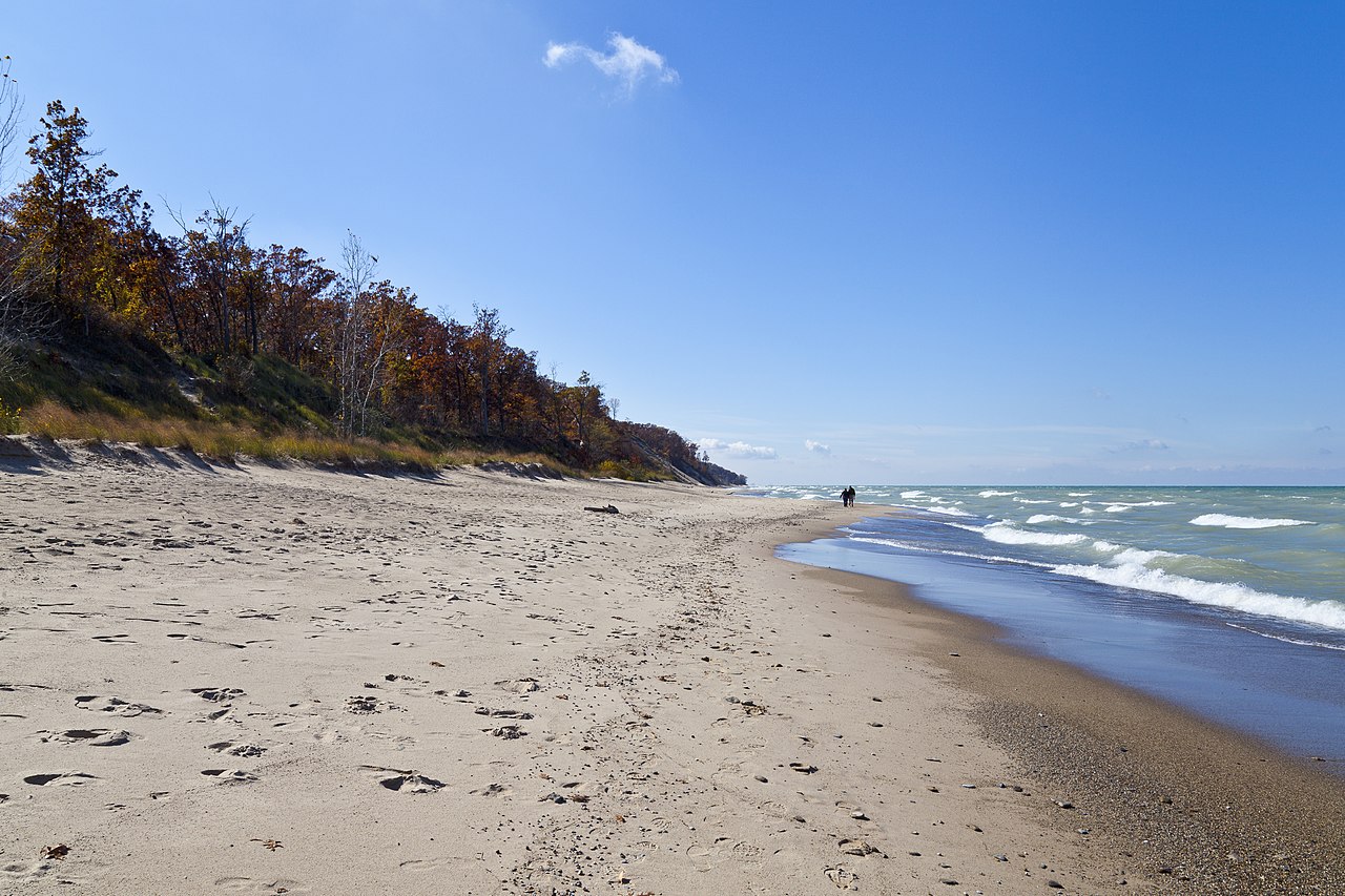
The state's most dramatic landform may be its least expected: the massive sand dunes along Lake Michigan's southern shore, where dunes rise 60 meters above the lake in one of the most biodiverse landscapes in the Great Lakes region.
Major Geographic Features
Indiana Dunes
Indiana Dunes National Park protects 6,100 hectares along 24 km of Lake Michigan shoreline. Mount Baldy, the tallest dune, rises 37 meters above the lake and is a "living dune" that migrates inland about 1.2 meters per year. The dunes ecosystem supports over 1,100 native plant species and 350 bird species, making it one of the most biodiverse landscapes in the Great Lakes basin. The park contains bogs, fens, prairies, and oak savannas within a few km of each other.
Wyandotte Cave & Indiana Karst
Southern Indiana sits on thick Mississippian limestone that has been dissolved into one of the most extensive karst landscapes in the eastern US. Wyandotte Cave is one of the largest caves in the state, with over 13 km of mapped passages and a 32-meter-tall underground mountain called Monument Mountain. The entire karst region features thousands of sinkholes, disappearing streams, springs, and over 2,400 documented caves.
Knobs Region
The Knobs are a series of conical, isolated hills forming an escarpment along the edge of the unglaciated uplands of southern Indiana. These hills rise 60-90 meters above the surrounding terrain and are erosional remnants of a once-continuous plateau. The Knobs stretch roughly 240 km from Floyd County to Brown County and mark the boundary between the glaciated central lowland and the dissected southern hills.
Brown County Hills
Brown County in south-central Indiana contains the most rugged terrain in the state, with deeply dissected hills and narrow valleys carved into unglaciated sandstone and shale. The area is so hilly that early settlers bypassed it for flatter land, preserving extensive forests that today make up Brown County State Park (6,500 hectares, Indiana's largest). Elevations range from 180 to 320 meters within short distances.
Wabash River Valley
The Wabash River flows 764 km from Ohio through Indiana to the Ohio River, draining about two-thirds of the state. The river created broad alluvial plains and terraces, particularly in the lower reaches where the floodplain exceeds 8 km in width. The Wabash is the longest free-flowing river east of the Mississippi (no dams on the main stem in Indiana) and supports significant riparian wetlands.
Glacial Moraines & Till Plains
Central and northern Indiana feature extensive glacial moraines and till plains from the Wisconsinan glaciation. The Mississinewa Moraine and other terminal moraines form low rolling ridges 15-30 meters above the surrounding till plain. The Tipton Till Plain in central Indiana is extraordinarily flat, one of the levelest landscapes in the nation, with some areas having less than 3 meters of relief over 30 km.
Falls of the Ohio
The Falls of the Ohio at Clarksville expose a 390-million-year-old Devonian fossil bed spanning 56 hectares, one of the largest naturally exposed fossil beds in the world. The fossil reef contains remains of corals, brachiopods, and other marine organisms from when Indiana was covered by a warm, shallow sea. The falls themselves are a series of rapids where the Ohio River drops 7.5 meters over 3 km of exposed bedrock.
Key Geographic Facts
- Hoosier Hill at 383 m (1,257 ft) is Indiana's highest point
- Southern Indiana has over 2,400 documented caves in its karst landscape
- Indiana Dunes National Park protects 24 km of Lake Michigan shoreline
- The Wabash River at 764 km is the longest free-flowing river east of the Mississippi
- The Falls of the Ohio fossil bed is 390 million years old and spans 56 hectares
Fun Facts
- Mount Baldy dune at Indiana Dunes moves inland about 1.2 meters per year, burying trees as it goes
- Indiana Dunes supports over 1,100 native plant species, more per unit area than almost any other national park
- The Falls of the Ohio fossil bed preserves a 390-million-year-old coral reef from when Indiana was a tropical sea
- The Tipton Till Plain is so flat that early surveyors reported areas with less than 3 meters of relief over 30 km
Final Thoughts
Indiana's geography offers a study in contrasts: the glacially flattened north versus the cave-riddled, hilly south, connected by broad river valleys and punctuated by the unexpected drama of Lake Michigan's towering sand dunes. The state's landscapes tell a story of ice sheets, ancient seas, and the slow dissolving of limestone that continues today beneath the surface of southern Indiana.
Test Your Knowledge!
Think you know your US state geography? Try our interactive quiz!
Play Country Quiz →