

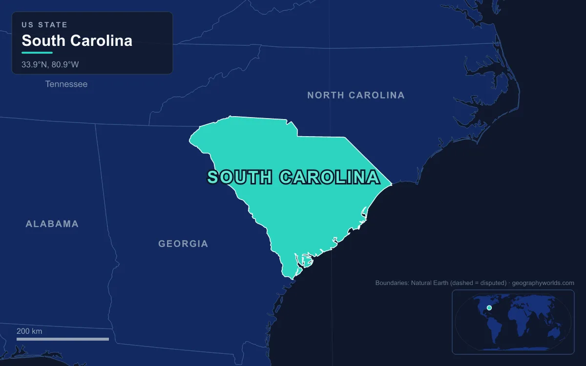
South Carolina’s landforms descend in three steps from northwest to southeast: the Blue Ridge Mountains in the far northwestern corner, the rolling Piedmont across the Upstate, and the Atlantic Coastal Plain, which covers most of the state and ends in salt marsh and barrier islands. The highest point is Sassafras Mountain at 1,085 m (3,560 ft) on the North Carolina line in Pickens County, and the lowest is the Atlantic Ocean at sea level. Between them, in a state of about 82,930 km² (32,020 sq mi), lie a granite escarpment, a string of deep mountain reservoirs, the Fall Line at Columbia, a belt of ancient sand dunes, the largest old-growth bottomland forest left in the United States, and more than 100 km of beach. Following the water downhill is the simplest way to see them in order.
Sassafras Mountain and the Blue Ridge Escarpment
The descent starts on the state line. Sassafras Mountain sits where Pickens County, South Carolina, meets Transylvania County, North Carolina, and its summit is a short walk from a parking lot; an observation tower opened on top in 2019. In 2010 the North Carolina side of the mountain was sold to The Conservation Fund, which passed most of it to the North Carolina Forest Service as Headwaters State Forest and gave the summit acreage to South Carolina.
Sassafras is part of the Blue Ridge, the Appalachian province that runs 885 km from southern Pennsylvania to Georgia, but in South Carolina the Blue Ridge is little more than its steep southern edge. That edge, the Blue Ridge Escarpment, is where the mountains break off abruptly onto the lower Piedmont, and it is responsible for most of the dramatic landforms in the Upstate. Streams draining off the mountains fall hundreds of metres in a few kilometres, carving gorges and plunging over cliffs.
Table Rock, Caesars Head and Lake Jocassee
A few kilometres east of Sassafras, the escarpment is at its most theatrical. Caesars Head, in northern Greenville County, is a granitic gneiss outcrop at 978 m (3,208 ft) that hangs roughly 600 m above the Piedmont below. The state engineer and architect Robert Mills described it in 1825 as a mass of granite whose ledges seemed to totter toward a fall. It now anchors the Mountain Bridge Wilderness together with Jones Gap State Park. Inside the same park, Matthews Creek drops over Raven Cliff Falls, the tallest waterfall in South Carolina; it is often billed at 400 ft, though topographic maps suggest 98 to 107 m (320 to 350 ft).
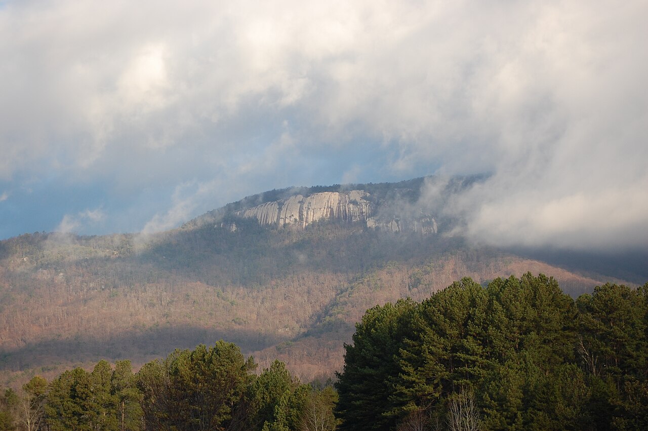
Table Rock, just to the west in Pickens County, is the escarpment’s signature profile: a flat-topped dome with a bare rock face, its summit at 952 m (3,124 ft). The summit trail climbs about 610 m in 5.6 km. The Cherokee, who held this land until the Treaty of Hopewell of 1785, called the area Sah-ka-na-ga, the Great Blue Hills of God, and a local legend holds that the Great Spirit used the mountain as a dining table. Table Rock State Park is also the eastern trailhead of the Foothills Trail, which runs about 130 km along the escarpment.
West of Table Rock the escarpment’s rivers have been drowned. Lake Jocassee, filled in 1973 by Duke Power and the state, covers about 30 km² (7,500 acres) and reaches 91 m (300 ft) deep behind a dam 117 m high. Four mountain rivers, the Whitewater, Thompson, Horsepasture and Toxaway, feed it, and several waterfalls pour straight into the lake. The flooding drowned a valley that had been lived in: the Mount Carmel Baptist Church cemetery, used as a location for the 1972 film Deliverance, now lies under about 40 m of water. Immediately below, Lake Keowee, built from 1971 with the Keowee and Little River dams, lies about 240 m above sea level, runs 42 km long and cools the three reactors of the Oconee Nuclear Station. Its outflows form the Seneca River, which joins the Savannah, the river that divides South Carolina from Georgia.
Paris Mountain and the Upstate Piedmont
Below the escarpment the land relaxes into the Piedmont, a belt of hard metamorphic rock worn down into rolling hills and long ridges between the mountains and the coastal plain. It is the most densely settled part of the Upstate, home to Greenville and Spartanburg. Here and there a knob of harder rock stands above the general level; the best known is Paris Mountain, 8 km north of downtown Greenville, protected as a state park whose name comes from Richard Pearis, the first European settler in Greenville County in 1765.
The Piedmont’s rivers set the pattern for everything farther downstream. The Saluda and the Broad drain its western and central parts, the Catawba–Wateree its eastern side, and all three run southeast toward the coastal plain. More on how this upland works across the whole Southeast is in this guide to the Piedmont region.
The Fall Line at Columbia and the Carolina Sandhills
The Piedmont ends at the Atlantic Seaboard Fall Line, a 1,400 km boundary running up the East Coast where hard metamorphic rock gives way to the soft, flat sediments of the coastal plain. Rivers crossing it tumble over rapids, and before locks and canals those rapids were the head of navigation, which is why cities grew on them. Columbia, the state capital, sits on it at about 84 m (276 ft) above sea level, where the Saluda and Broad join to form the Congaree River.
Just below the Fall Line lies a band of sand 16 to 56 km wide, the Carolina Sandhills. The sand, mapped as the Pinehurst Formation, was blown into sheets and dunes between roughly 75,000 and 6,000 years ago, mostly during the last glaciation when winds were stronger and vegetation thinner. It was derived from Cretaceous river deposits about 100 million years old, the Middendorf Formation, which still crops out in places such as Sugarloaf Mountain in the Sand Hills State Forest in Chesterfield County. Longleaf pine, kept open by frequent low fires, is the natural cover.
Congaree Swamp and the Santee Lakes
From Columbia the Congaree runs about 85 km across the upper coastal plain. Its floodplain holds Congaree National Park, about 108 km² (26,693 acres) beginning 29 km southeast of the capital. It preserves the largest tract of old-growth bottomland hardwood forest left in the United States, with a canopy among the tallest of any temperate deciduous forest in the world. Cypress logging began here in 1898, a preservation campaign started in 1969, and the area became a national park in 2003. About 60.7 km² (15,000 acres) of it is designated wilderness, yet with 145,929 visitors in 2018 the park ranked as the tenth-least visited national park in the country.

Just past the park the Congaree meets the Wateree, and together they form the Santee River, 230 km long, whose farthest headwaters lie 708 km away on the Catawba in North Carolina. By drainage area and flow it is the second-largest river on the eastern coast of the United States, after the Susquehanna. Much of its upper course is now Lake Marion, created when the 13 km Santee Dam was closed in November 1941. At about 450 km² (110,000 acres) with 507 km of shoreline, it is known as South Carolina’s inland sea. A 12 km diversion canal links it to Lake Moultrie, held back by the Pinopolis Dam. Scattered across the surrounding plain are Carolina bays, oval depressions of uncertain origin that were first described scientifically in 1895 near Darlington.
The Lowcountry, Sea Islands and Grand Strand at Sea Level
The last step is the coast, and it has two distinct halves. North of the Santee mouth, which reaches the Atlantic near McClellanville, the Grand Strand is a smooth arc of beach more than 97 km long from Little River to Winyah Bay, where Spanish ships under Pedro de Quexós and Francisco Gordillo arrived in June 1521. Just south, Cape Romain National Wildlife Refuge protects about 268 km² of salt marsh, creeks and barrier islands, most of it reachable only by boat; about 117 km² of it is designated wilderness, and in 1976 its Bulls Island was used for the first trial releases of red wolves.
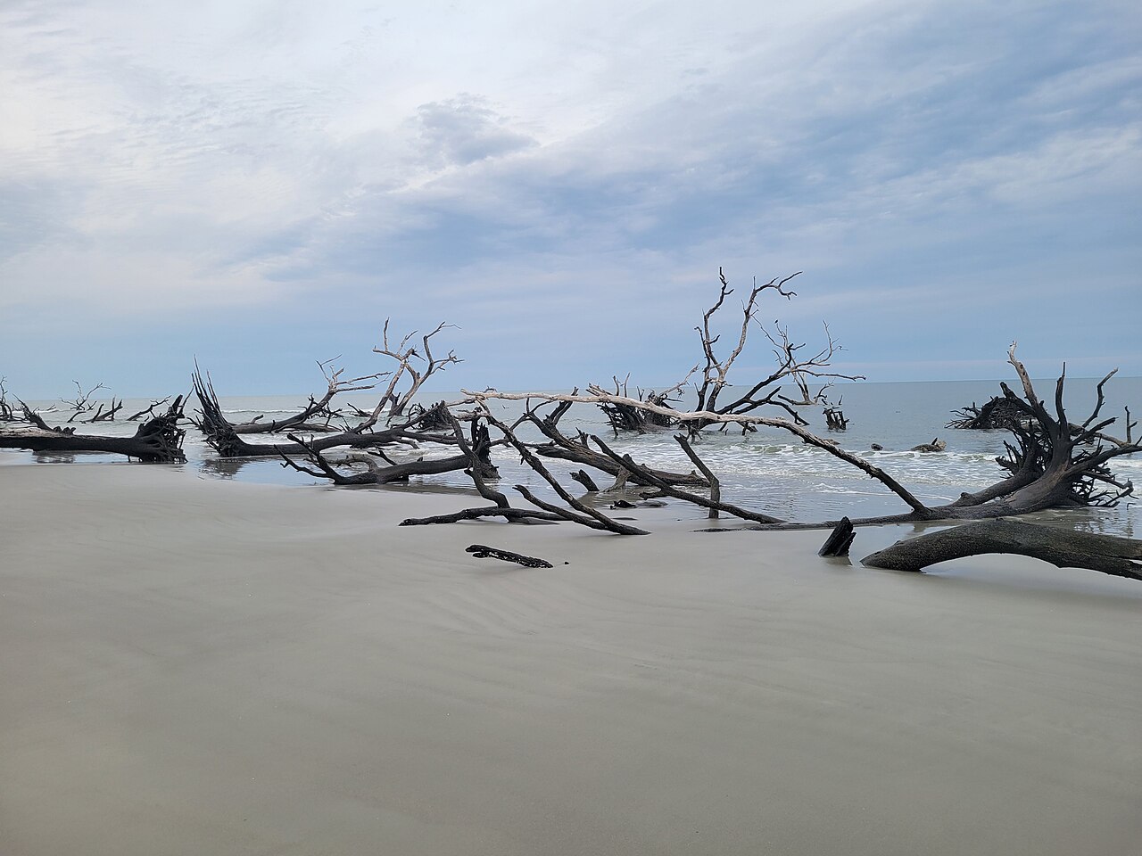
South of Charleston the shoreline breaks into the Lowcountry proper. The Ashepoo, Combahee and Edisto rivers meet in St. Helena Sound to form the ACE Basin, about 1,400 km² (350,000 acres) and one of the largest undeveloped estuaries on the Atlantic coast. Since the ACE Basin Task Force formed in 1988, federal, state and private partners have protected about 1,000 km² (250,000 acres) of it. Beyond it lie the Sea Islands, a chain of more than 100 tidal and barrier islands reaching into Georgia and Florida and the homeland of the Gullah Geechee people. Hunting Island, a 20 km² barrier island 24 km east of Beaufort and a state park since 1935, is one of the few still undeveloped; Hilton Head, named for Captain William Hilton, who sighted its headland in 1663, has 19 km of Atlantic beach. How these islands form and migrate is explained in this guide to barrier islands.
From the observation tower on Sassafras to that shoreline is a fall of 1,085 m, and the rivers do the work of linking each stage, from the drowned gorges under Lake Jocassee to the tidal creeks of St. Helena Sound. The marsh country at the end of that journey has its own culture and history, told in this guide to South Carolina’s Lowcountry.