

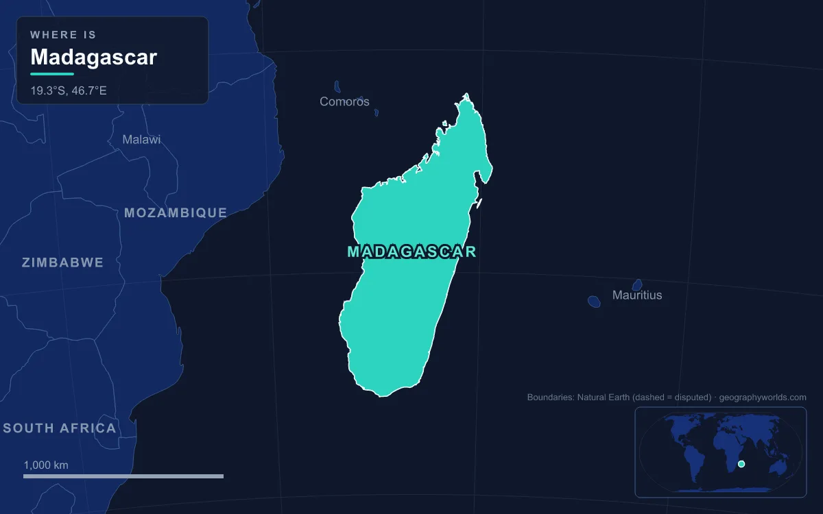
Madagascar is an island nation in the Indian Ocean, about 400 km off the south-east coast of Africa across the Mozambique Channel. It covers roughly 587,000 km² (some sources give up to 592,800 km²), making it the fourth-largest island in the world. Its physical regions run in long north–south bands: a narrow eastern coastal plain backed by a steep escarpment, the Central Highlands at about 800 to 1,800 m, the Tsaratanana Massif in the north, the sedimentary plains and deep bays of the west coast, and the dry south-west. The highest point is Maromokotro, 2,876 m, in the Tsaratanana Massif, followed by Imarivolanitra (Pic Boby), 2,658 m, in the Andringitra Massif. Because the highest ground lies close to the east coast, the long rivers flow west, among them the Mangoky (564 km) and the Betsiboka (525 km), with the Onilahy draining the far south-west. Almost all of these landscapes can be seen from one road, Route Nationale 7, which runs from the capital Antananarivo to Toliara on the south-west coast.
The RN7 is one of the country’s most important roads and is relatively well maintained. Its official length is given as 980 km, though the kilometre markers put Toliara at about 923 km. It passes through six regions, Analamanga, Vakinankaratra, Amoron’i Mania, Haute Matsiatra, Ihorombe and Atsimo-Andrefana, and descends from the cool rice country of the highlands to a coast lined with spiny forest.
Antananarivo to Antsirabe: Rice Valleys and the Ankaratra Volcanoes
The journey starts on the Central Highlands, the traditional homeland of the Merina people and the most densely populated part of Madagascar. Antananarivo sits at 1,276 m on a ridge of hills; the royal compound was built on Analamanga hill, and King Andriamasinavalona later renamed the town “City of the Thousand”. The highland landscape is one of rounded, eroded hills, granite outcrops and extinct volcanoes, with the valley floors between them converted to terraced, irrigated rice fields. Most of the forest that once covered the plateau is gone. North-east of the capital, a north–south rift valley holds Lake Alaotra, the island’s largest body of water, at 761 m; the ground there is still subsiding and tremors are frequent. The city itself is described in our guide to Antananarivo, the capital of Madagascar.
The capital also sits near a watershed. The Betsiboka rises east of Antananarivo and flows north-west for 525 km to Bombetoka Bay near Mahajanga, where it builds a large delta. Its water runs red with silt: after half a century of forest clearance for fields and pasture, soil losses in parts of its basin approach 250 tonnes per hectare a year, and much of that sediment settles in the bay. Further north, beyond the reach of this road, the highlands climb to the Tsaratanana Massif and Maromokotro, while the volcanic Montagne d’Ambre overlooks the deep natural harbour of Antsiranana near the island’s northern tip.
Heading south, the RN7 passes Ambatolampy at about 69 km and skirts the Ankaratra, a range of cinder cones about 50 km south-west of the capital. Its highest summit, Tsiafajavona, reaches about 2,643 m, and its name means “never out of the fog”. The range last erupted in the geologically recent Quaternary, and the heat that remains in its southern end feeds the hot springs around Antsirabe, at 170 km.
Antsirabe, the third-largest city in Madagascar with 265,018 people in 2014, owes its name, “the place of much salt”, and its French nickname, ville d’eau, to those mineral springs. Fifteen kilometres away along the RN34, Lake Tritriva fills the crater of an oval volcanic cone enclosed by vertical gneiss cliffs. The rim stands at about 2,000 m and the water lies roughly 50 m below it, but the lake is up to 160 m deep, the deepest in Madagascar. A local fady, or taboo, forbids swimming in it.

Ambositra to Fianarantsoa: Betsileo Highlands and the Eastern Escarpment
South of Antsirabe the road winds through Ambositra and into the Betsileo country of Amoron’i Mania and Haute Matsiatra. At Ambohimahasoa the RN25 branches east towards Mananjary on the Indian Ocean. That side road is the easiest way to see how abruptly Madagascar ends in the east: the highlands drop down an escarpment of about 500 m to a band of alluvial lowland only about 50 km wide, where the straight coast is fringed by the Canal des Pangalanes, a chain of natural and man-made lagoons running for about 800 km behind the beach.
On the escarpment itself lies Ranomafana National Park, created in 1991 after the primatologist Patricia Wright rediscovered the greater bamboo lemur and discovered the golden bamboo lemur there. It protects more than 41,600 ha of rainforest between 800 and 1,200 m, and its name, “hot water”, comes from the hot springs in the town below. It forms part of the Rainforests of the Atsinanana World Heritage Site. The park’s wildlife is covered in our guide to Madagascar’s lemurs.
Back on the RN7, Fianarantsoa, at about 412 km, stands at an average altitude of 1,200 m. The Merina founded it early in the 19th century as the administrative centre for the Betsileo kingdoms they had conquered. The region takes its name from the Matsiatra River, which joins the Mananantanana to form the Mangoky; the Mangoky rises just east of the city and flows west for 564 km to the Mozambique Channel north of Morombe, carrying so much eroded soil that sandbars choke its channel.
Ambalavao and the Granite Walls of Andringitra
Ambalavao, about 50 km beyond Fianarantsoa, is known for Antemoro paper and silk woven from silkworms that feed on tapia trees. Thirteen kilometres south, the Anja Community Reserve protects a small patch of forest managed by local villagers.
The road now runs beneath the Andringitra Massif, a granite range about 64 km long and almost 10 km wide at its centre, whose name means “desert of rocks”. Andringitra National Park, 47 km south of Ambalavao, was established in 1999 and covers 31,160 ha, rising from 700 m to the summit of Imarivolanitra, formerly Pic Boby, at 2,658 m, Madagascar’s second-highest peak. The eastern face is barren and cut by cliffs and storm-scoured channels, while the western slopes descend more gently and are partly forested. Above about 2,000 m the forest gives way to a belt of hardy shrubs and then to grassland. The park became part of the Rainforests of the Atsinanana World Heritage Site in 2007.

Ihosy and the Isalo Sandstone Massif
After Zazafotsy at about 586 km the landscape opens into the grass plateaus of the Ihorombe region. Ihosy, at 604 km, is a crossroads: the RN27 leads east to Farafangana and the RN13 south to Tolanaro. This is Bara country, where herding zebu cattle has long been the main way of life, on open, rolling grassland.
At Ranohira, 697 km from the capital, the road reaches Isalo National Park, created in 1962. The Isalo massif lies between the Central Highlands and the west coast, and it is built of sandstone that wind and water have dissected into a “ruiniform” landscape of towers, ridges, plateaus and canyons up to 200 m deep, with elevations ranging from 510 to 1,268 m. Permanent streams run through the canyons alongside many seasonal watercourses. The park contains Bara burial sites and older Sakalava burial sites, and most of it belongs to the dry deciduous forest ecoregion, which has lost almost 40% of its original extent.
Twenty-six kilometres further on, Ilakaka shows what the rocks beneath this region can hold. In the early 1990s it had about 40 residents. Then, in 1998, one of the largest known alluvial sapphire deposits on Earth was found in the valley of the Ilakaka River, and by 2005 the town had nearly 60,000 people.
Zombitse, Toliara and the Spiny Forest of the Mozambique Channel
Beyond Sakaraha, at 793 km, the RN7 crosses Zombitse-Vohibasia National Park, 147 km north-east of Toliara. Its 36,308 ha, in three separate blocks, protect succulent woodland, a forest type transitional between the dry deciduous forests to the north and the spiny thicket of the far south. The Zombitse forest was first protected in 1962 and the full park established in 2002. This whole side of the island lies in the rain shadow of the highlands, which is why the south-west is covered in dry forest, spiny thicket and semi-desert rather than rainforest.
At Andranovory the RN10 branches south towards Ampanihy and Ambovombe, and the RN7 drops to the coast at Toliara, formerly Tuléar, a port of 168,758 people in 2018. French buccaneers landed in the Bay of Saint-Augustin near the Tropic of Capricorn in the 17th century, and the Onilahy River, which rises in the hills near Betroka, reaches the sea there, 35 km south of the city. Inland lie the Madagascar spiny forests, where 95% of plant species and 48% of plant genera are found nowhere else, including the spiny plants of the endemic subfamily Didiereoideae.
That extraordinary level of endemism is the product of isolation: Madagascar separated from Africa as part of East Gondwana around 185 million years ago and from the Indian landmass about 84 to 92 million years ago. The change from mist-bound highlands to arid coast along the RN7 is mostly a story of rainfall, which our article on the climate of Madagascar follows from season to season.