
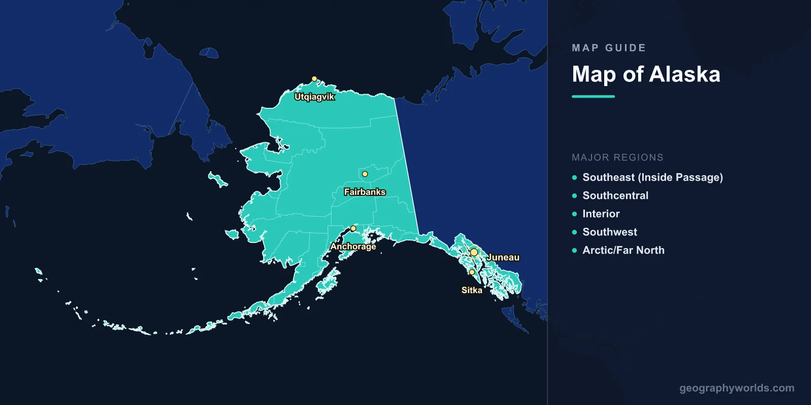
A map of Alaska shows the largest US state by far, spanning 1,723,337 km2 (665,384 sq mi)—more than twice the size of Texas. Located in the far northwest of North America, Alaska's map reveals Denali (6,190 m, the highest peak in North America), over 100,000 glaciers, 54,563 km of coastline (more than all other US states combined), three million lakes, and a landscape ranging from Arctic tundra to temperate rainforest. Alaska shares borders with Canada's Yukon Territory and British Columbia to the east, and is separated from Russia by just 85 km across the Bering Strait.
Geography of Alaska
Alaska occupies the northwestern extremity of the North American continent, extending from 51°N to 71°N latitude. The state spans four time zones and includes the westernmost (Attu Island) and northernmost (Point Barrow/Utqiagvik) points in the United States.
The landscape is dominated by mountain ranges. The Alaska Range, running in a 650 km arc through south-central Alaska, contains Denali (formerly Mount McKinley) at 6,190 m—the highest peak in North America. The Brooks Range extends 1,100 km across northern Alaska, dividing the Arctic slope from the interior. The Wrangell-St. Elias region in the southeast contains the largest collection of peaks above 4,900 m in North America.
Alaska contains over 100,000 glaciers covering approximately 75,000 km2—about 5% of the state's area. The Malaspina Glacier alone is larger than Rhode Island at 3,900 km2. Alaska's rivers include the Yukon (3,185 km total, 2,300 km in Alaska), the third-longest river in North America.
The state's 54,563 km of tidal shoreline exceeds the combined coastline of all other US states. This coast includes fjords, volcanic islands (the Aleutian chain extends 1,900 km into the Pacific), barrier islands along the Arctic coast, and the sheltered waterways of the Inside Passage in the southeast.

Major Regions
- Southeast (Inside Passage): A narrow panhandle of temperate rainforest, fjords, and islands. Includes Juneau (the capital), Sitka, and Ketchikan. Accessible mainly by air and ferry. Home to the Tongass National Forest, the largest in the US (68,000 km2).
- Southcentral: Alaska's population center, including Anchorage (population 290,000, the largest city). Kenai Peninsula, Prince William Sound, and the Chugach Mountains. Relatively mild climate influenced by the Pacific.
- Interior: Vast subarctic region centered on Fairbanks (32,000). Extreme temperature ranges: -51°C in winter to 37°C in summer. Flat to rolling terrain along the Yukon and Tanana rivers. Denali National Park is here.
- Southwest: The Aleutian Islands chain, Bristol Bay (world's largest sockeye salmon fishery), and the Alaska Peninsula. Volcanic landscape with over 40 active volcanoes. Katmai National Park is famous for brown bears and the Valley of Ten Thousand Smokes.
- Arctic/Far North: North of the Brooks Range. Flat coastal plain (North Slope) underlain by permafrost. Home to Prudhoe Bay oil fields and the Arctic National Wildlife Refuge. Utqiagvik (Barrow) is the northernmost US city. Experiences 24-hour darkness in winter and midnight sun in summer.
Major Cities
- Anchorage: 290,000; southcentral Alaska on Cook Inlet. Contains nearly 40% of the state's population. Surrounded by the Chugach Mountains and accessible by road, rail, and air.
- Fairbanks: 32,000; interior Alaska on the Chena River. Gateway to Denali and the Arctic. University of Alaska campus. Extreme subarctic climate.
- Juneau: 32,000; the state capital in the southeastern panhandle. Accessible only by air and sea—no roads connect it to the rest of Alaska. Surrounded by the Juneau Icefield.
- Sitka: 8,500; former Russian colonial capital on Baranof Island. Rich Tlingit and Russian heritage.
- Utqiagvik (Barrow): 4,400; northernmost city in the US at 71°N. Inupiat community; experiences 65 days of continuous darkness in winter.
Climate
- Arctic (North Slope): Average temperatures -29°C in January, 4°C in July. Less than 150 mm precipitation annually—technically an Arctic desert. Permafrost everywhere.
- Subarctic (Interior): Extreme continental climate. Fairbanks ranges from -41°C to 23°C average extremes. Low precipitation but significant snowfall.
- Maritime (Southeast/Aleutians): Mild, wet climate. Juneau receives 1,400 mm of rain/snow annually. Temperatures rarely drop below -10°C or rise above 20°C.
- Transitional (Southcentral): Moderate temperatures (Anchorage averages -11°C in January, 15°C in July) with moderate precipitation.
Key Facts About the Map of Alaska
- Alaska is 2.5 times the size of Texas, the second-largest US state.
- Denali (6,190 m) has the greatest base-to-summit rise of any mountain on Earth—5,500 m from the surrounding plain.
- Alaska has more than 100,000 glaciers, containing 75% of all US freshwater.
- The state's coastline (54,563 km) exceeds all other US states combined.
- Alaska has over 3 million lakes and 12,000 rivers.
- The Aleutian Islands extend across the 180th meridian, making Alaska technically the westernmost AND easternmost US state.
- Only about 740,000 people live in Alaska—the least densely populated US state at 0.5 people per km2.
Final Thoughts
The map of Alaska reveals a state of staggering scale and geographic extremes—from North America's highest peak to Arctic coastal plains, from temperate rainforests to volcanic island chains. Its five distinct regions each offer unique landscapes, climates, and ecosystems. Understanding Alaska's geography is essential for studying Arctic environments, glaciology, tectonics, and the ways human communities adapt to some of the most challenging conditions on the planet.
Test Your Geography Knowledge!
Think you know your maps? Try our interactive geography games!
Play Geography Games →