
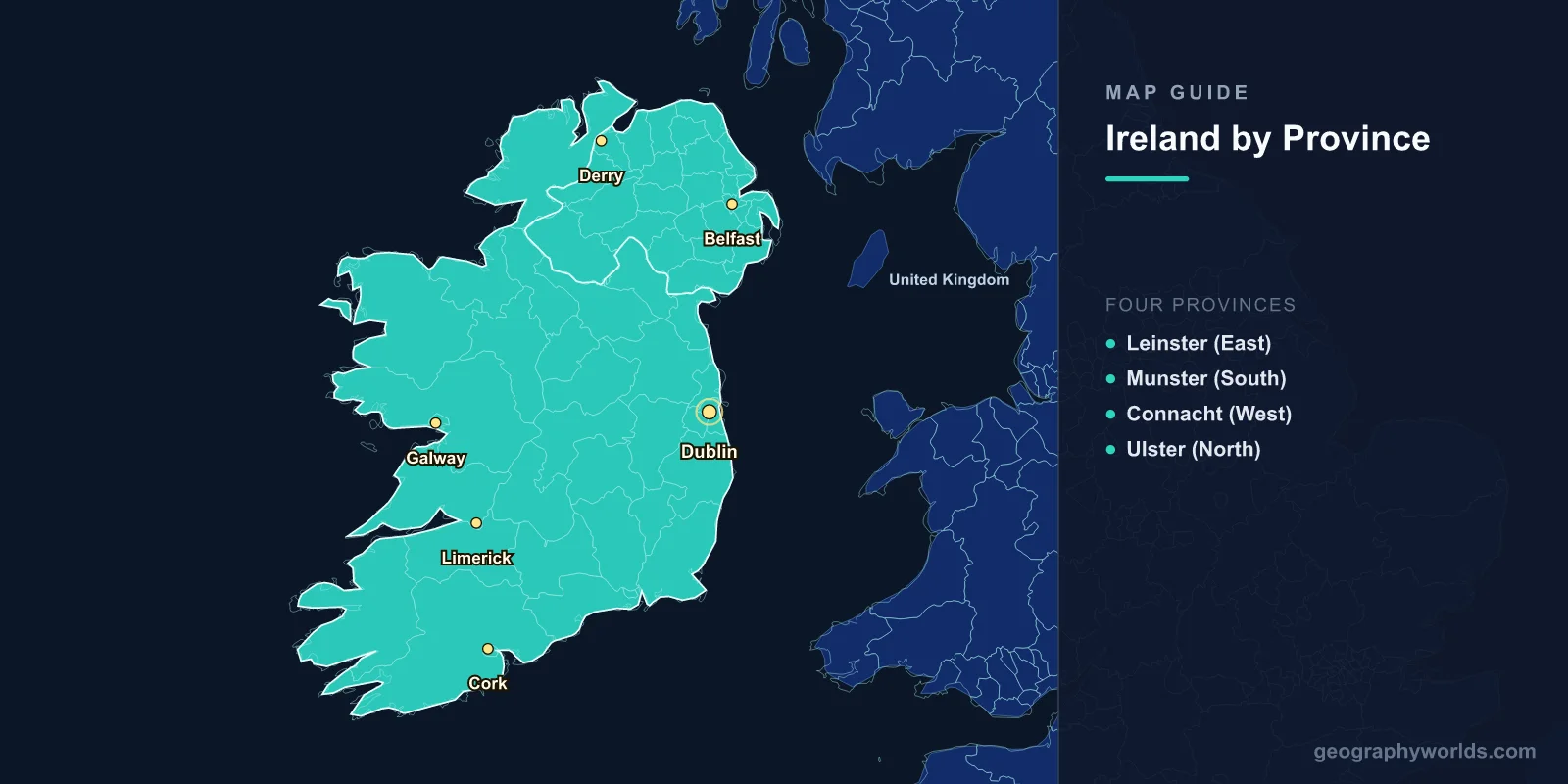
A map of Ireland shows the third-largest island in Europe, covering 84,421 km2 in the North Atlantic. The island is divided between two jurisdictions: the Republic of Ireland (70,273 km2, 26 counties, population 5.1 million) and Northern Ireland (13,843 km2, 6 counties, part of the United Kingdom, population 1.9 million). The map reveals 32 traditional counties grouped into four historic provinces—Leinster, Munster, Connacht, and Ulster—a central limestone plain ringed by coastal mountains, and one of Europe's most dramatic western coastlines.
Geography of Ireland
Ireland lies in the northeastern Atlantic Ocean, separated from Great Britain by the Irish Sea (20 km at the narrowest point between Northern Ireland and Scotland). The island's geography is often described as a saucer—a low-lying central plain surrounded by a rim of coastal highlands.
The central lowlands consist primarily of Carboniferous limestone, covered by glacial deposits, peat bogs, and rich agricultural land. This plain rarely exceeds 120 m in elevation and contains numerous lakes (loughs) and Ireland's great rivers. The Shannon, at 360 km, is the longest river in the British Isles and drains roughly one-fifth of Ireland's land area.
Mountain ranges ring the coast: the Macgillycuddy's Reeks in Kerry (Carrauntoohil at 1,038 m is Ireland's highest peak), the Wicklow Mountains south of Dublin, the Twelve Bens of Connemara, the Mourne Mountains in Northern Ireland, and Donegal's Blue Stack Mountains. None of Ireland's mountains exceed 1,100 m, giving the landscape a softer, more rolling character than neighboring Scotland or Wales.
Ireland's coastline stretches approximately 7,500 km and is deeply indented on the west, creating dramatic bays, peninsulas, sea cliffs, and offshore islands. The Cliffs of Moher (214 m), Slieve League cliffs in Donegal (601 m—among the highest sea cliffs in Europe), and the Skellig Islands are among the most spectacular coastal features.

Four Provinces & 32 Counties
Ireland's 32 counties, dating from the Norman and Tudor periods, remain the primary unit of local identity. They are grouped into four historic provinces:
- Leinster (East): 12 counties including Dublin, Wicklow, Wexford, Kilkenny, Meath, and Westmeath. Ireland's most urbanized and densely populated province, centered on the Dublin metropolitan area (1.4 million metro). Relatively flat terrain with the Wicklow Mountains as a notable exception.
- Munster (South): 6 counties—Cork, Kerry, Limerick, Tipperary, Waterford, Clare. Ireland's largest province by area. Home to the highest mountains (Macgillycuddy's Reeks), the Dingle Peninsula, the Ring of Kerry, and the Cliffs of Moher.
- Connacht (West): 5 counties—Galway, Mayo, Sligo, Roscommon, Leitrim. The most rugged and sparsely populated province. Atlantic-facing coastline with the Connemara bog lands, Aran Islands, and Croagh Patrick.
- Ulster (North): 9 counties—6 in Northern Ireland (Antrim, Down, Armagh, Tyrone, Fermanagh, Derry/Londonderry) and 3 in the Republic (Donegal, Cavan, Monaghan). Features the Giant's Causeway, Lough Neagh (392 km2, largest lake in the British Isles), and the Mourne Mountains.
Major Cities
- Dublin: 1.4 million (metro); capital of the Republic; east coast at the mouth of the Liffey River. Ireland's political, economic, and cultural center. European headquarters for many tech companies.
- Belfast: 340,000; capital of Northern Ireland; on Belfast Lough. Major shipbuilding heritage (Titanic was built here). Transformed since the 1998 Good Friday Agreement.
- Cork: 210,000; Republic's second city; natural harbor on the River Lee. Often called the "real capital" by locals.
- Galway: 85,000; western coast; gateway to the Aran Islands and Connemara. Ireland's fastest-growing city and cultural capital.
- Limerick: 100,000; on the Shannon estuary; third-largest city in the Republic.
- Derry/Londonderry: 85,000; Northern Ireland's second city; the only remaining completely walled city in Ireland.
The Wild Atlantic Way & Key Natural Features
The Wild Atlantic Way is a 2,500 km signed coastal driving route along Ireland's western seaboard—one of the world's longest defined coastal touring routes. It passes through nine counties from Donegal to Cork, taking in:
- Cliffs of Moher: 214 m vertical sea cliffs in County Clare; Ireland's most visited natural attraction.
- Ring of Kerry: 179 km scenic route around the Iveragh Peninsula; Macgillycuddy's Reeks.
- Connemara: Wild bog and mountain landscape in western Galway; Gaeltacht (Irish-speaking) region.
- Giant's Causeway: 40,000 interlocking basalt columns in County Antrim; UNESCO World Heritage Site.
- The Burren: 360 km2 karst limestone landscape in Clare; unique flora combining Arctic, Alpine, and Mediterranean species.
- Skellig Michael: Remote rock island off Kerry; 6th-century monastery; UNESCO World Heritage Site.
Climate
- Type: Temperate oceanic, heavily influenced by the North Atlantic Current (extension of the Gulf Stream).
- Temperatures: Mild year-round; average 4–7°C in January, 14–17°C in July. Frost and snow are relatively rare at low elevations.
- Rainfall: 800–1,400 mm annually in the east, 1,200–2,500 mm in the west. Rain falls on 150–225 days per year.
- Sunshine: 1,100–1,600 hours per year; the southeast (Wexford) is the sunniest region.
Key Facts About the Map of Ireland
- Ireland is the third-largest island in Europe and the twentieth-largest in the world at 84,421 km2.
- The island is divided between two jurisdictions: the Republic of Ireland (26 counties) and Northern Ireland (6 counties, UK).
- Carrauntoohil in Kerry (1,038 m) is the highest point on the island.
- Lough Neagh (392 km2) is the largest lake in the British Isles.
- The Shannon (360 km) is the longest river in the British Isles.
- Ireland's coastline stretches approximately 7,500 km with some of Europe's highest sea cliffs.
- About 20% of Ireland's land area is covered by peat bogs—important carbon stores and unique ecosystems.
Final Thoughts
The map of Ireland reveals an island of remarkable beauty and geographic interest, from the limestone karst of the Burren to the dramatic sea cliffs of the Atlantic coast. Its 32 counties, four historic provinces, and the political division between the Republic and Northern Ireland create a complex cultural and administrative landscape. Whether you are studying European geography, tracing the Wild Atlantic Way, or exploring how glaciation shaped the Irish midlands, the map of Ireland offers endless discoveries.
Test Your Geography Knowledge!
Think you know your maps? Try our interactive geography games!
Play Geography Games →