
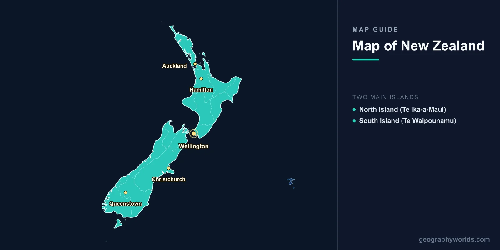
New Zealand is an island nation in the southwestern Pacific Ocean, located approximately 2,000 km southeast of Australia. It consists of two main islands — the North Island (Te Ika-a-Maui) and the South Island (Te Waipounamu) — plus over 600 smaller islands. Covering 268,021 square kilometers, New Zealand stretches roughly 1,600 km from north to south between 34°S and 47°S latitude, featuring some of the most dramatic and diverse geography on Earth.
Introduction
New Zealand sits on the boundary of the Pacific and Australian tectonic plates, which gives it an extraordinary range of landscapes within a relatively small area. Active volcanoes, boiling geothermal fields, glaciers, fjords, rainforests, and vast alpine ranges all exist within a country smaller than Italy. This guide covers everything from the subtropical north to the sub-Antarctic south.

North Island (Te Ika-a-Maui)
The North Island covers 113,729 km² and is home to approximately 77% of New Zealand's 5.1 million people. Its geography is shaped primarily by volcanic activity:
- Taupo Volcanic Zone: A highly active volcanic belt running from Mount Ruapehu to White Island (Whakaari). Includes Lake Taupo, which fills a massive volcanic caldera, and the Rotorua geothermal area with boiling mud pools and geysers.
- Tongariro National Park: A UNESCO World Heritage Site containing three active volcanoes — Ruapehu (2,797 m, North Island's highest peak), Ngauruhoe, and Tongariro. The Tongariro Alpine Crossing is considered one of the world's great day hikes.
- Waikato & Bay of Plenty: Fertile agricultural regions. The Waikato River is New Zealand's longest at 425 km.
- Northland: The subtropical far north, featuring the Bay of Islands and Cape Reinga, the northernmost tip of the mainland.
South Island (Te Waipounamu)
The South Island covers 150,437 km² and is less populated but more geographically dramatic:
- Southern Alps (Ka Tiritiri o te Moana): The mountain spine of the South Island, running nearly its entire length. Aoraki/Mount Cook at 3,724 m is New Zealand's highest peak. Over 3,000 glaciers exist in the Southern Alps, including the Franz Josef and Fox Glaciers.
- Fiordland: The remote southwestern corner, containing 14 fjords carved by glaciers. Milford Sound and Doubtful Sound are the most famous. Fiordland National Park is New Zealand's largest at 12,607 km².
- Canterbury Plains: The largest flat area in New Zealand, east of the Southern Alps. Christchurch, the South Island's largest city, sits on its eastern edge.
- Otago: Southern region featuring Queenstown (adventure tourism capital), Lake Wanaka, and the historic gold-rush town of Dunedin.
- Marlborough Sounds: A network of sea-drowned river valleys at the northern tip of the South Island, famous for Sauvignon Blanc wine production.
Major Cities
- Auckland: North Island, 36.8°S, 174.8°E. Population ~1.7 million (metro). New Zealand's largest city, built on an isthmus between two harbours and atop ~50 volcanic cones.
- Wellington: North Island, 41.3°S, 174.8°E. Population ~215,000. The capital, located at the southern tip of the North Island on Cook Strait. Known for fierce winds and vibrant arts culture.
- Christchurch: South Island, 43.5°S, 172.6°E. Population ~390,000. The South Island's largest city, rebuilt after devastating earthquakes in 2010-2011.
- Hamilton: North Island, 37.8°S, 175.3°E. Population ~180,000. Agricultural heartland of the Waikato region.
- Queenstown: South Island, 45.0°S, 168.7°E. Population ~50,000. The adventure capital of New Zealand, on the shores of Lake Wakatipu.
Fjords, Volcanoes & Key Landforms
- Milford Sound: The most famous fjord, 15 km long with sheer cliffs rising 1,200 m from the water. Receives about 7 meters of rainfall annually.
- Mount Taranaki: A symmetrical stratovolcano (2,518 m) on the North Island's west coast, last erupted around 1854.
- Lake Taupo: The largest lake in New Zealand and Australasia at 616 km², filling a supervolcanic caldera. Its last major eruption around 186 AD was one of the most violent in the past 5,000 years.
- Cook Strait: The 22 km wide strait separating the North and South Islands, connecting the Tasman Sea to the Pacific Ocean.
Position & Borders
New Zealand is one of the most isolated populated countries on Earth. Its nearest neighbour, Australia, is 2,000 km to the northwest across the Tasman Sea. The nearest Pacific Islands — New Caledonia, Tonga, and Fiji — lie roughly 1,500-2,000 km to the north. New Zealand also administers the Cook Islands and Niue in free association, and claims the Ross Dependency in Antarctica.
The country lies entirely within the Southern Hemisphere, between 34°S and 47°S latitude, giving it a temperate maritime climate. The International Date Line lies to the east, making New Zealand one of the first countries to see each new day.
Key Facts
- New Zealand consists of two main islands totaling 268,021 km².
- Aoraki/Mount Cook at 3,724 m is the highest peak, located in the Southern Alps.
- Auckland is the largest city with 1.7 million people; Wellington is the capital.
- Fiordland contains 14 glacially carved fjords in the remote southwest.
- The country sits on the Pacific-Australian plate boundary, driving volcanic and seismic activity.
Fun Facts
- New Zealand was the last major landmass settled by humans, around 1250-1300 AD by Polynesian navigators who became the Maori.
- The country has more sheep than people — roughly 26 million sheep versus 5.1 million humans.
- Milford Sound receives about 7 metres of rain per year, making it one of the wettest inhabited places in the world.
- Auckland is built on approximately 50 dormant volcanic cones, and a new eruption could theoretically occur anywhere in the city.
Final Thoughts
New Zealand's map reveals an astonishing concentration of geographic diversity within a compact island nation. From the volcanic plateau and geothermal wonders of the North Island to the alpine glaciers, fjords, and rainforests of the South Island, few countries on Earth pack so many landscapes into such a small area. Its isolation in the southwestern Pacific has produced unique ecosystems and a culture deeply connected to the land.
Test Your Knowledge!
Think you know where things are on the map? Test your skills!
Play Geography Games →