

Wellington is the capital of New Zealand, a harbour city of about 209,800 people (433,900 in the wider metropolitan area, June 2025) at the south-western tip of the North Island, facing Cook Strait. It has been the capital since 1865, when Parliament left Auckland for a more central site, and at 41°17′ south it is the southernmost capital of any sovereign state. Its status rests on constitutional convention rather than any statute: no law names Wellington as the capital, yet Parliament, the Supreme Court, the Governor-General and most of the public service are based there.
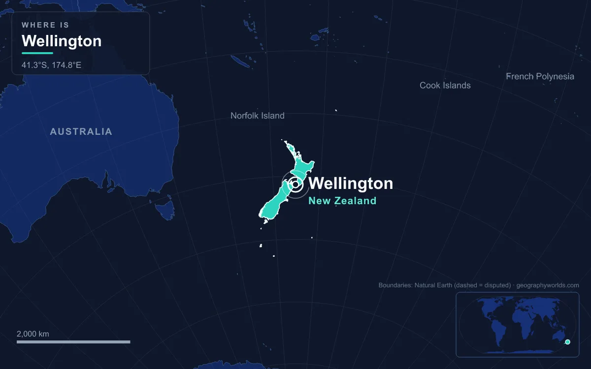
That arrangement was the result of a decade-long quarrel in which geography mattered more than size. Wellington was a town of fewer than 5,000 people when it won, and Auckland is far larger today. It became the capital because of where it sits on the map.
Okiato to Auckland: New Zealand's First Two Capitals, 1840–1865
New Zealand's first seat of government was not Wellington or Auckland but Okiato, a small site in the Bay of Islands about 7 km south of the modern town of Russell. After the Treaty of Waitangi was signed on 6 February 1840, Lieutenant-Governor William Hobson bought land there from the merchant James Reddy Clendon, renamed it Russell after the Colonial Secretary Lord John Russell, and moved in with his officials in May 1840. Only one of the town's planned roads was ever built.
Hobson always regarded Okiato as temporary. His surveyor general, Felton Mathew, explored harbours to the south, and in September 1840 about 3,000 acres on the Waitematā Harbour were bought from Ngāti Whātua. The new settlement was named after the Earl of Auckland, officials and records moved there in January 1841, and Hobson took up residence on 14 March 1841. Auckland would stay the capital for 24 years.
Wellington, meanwhile, was growing as a private venture. The New Zealand Company's advance ship Tory arrived on 20 September 1839, and the Aurora landed about 150 settlers on 22 January 1840, before the treaty was signed. They first built at Petone, at the mouth of the Hutt River, but the flats flooded, and within months most moved across the harbour to Thorndon. Surveyor William Mein Smith laid out a set of grid plans along the valleys that largely ignored the slopes. The settlement was named in November 1840 after the Duke of Wellington; in Māori the harbour is Te Whanganui-a-Tara, the great harbour of Tara.
The harbour was already contested ground. Around 1820 it was held by Ngāti Ira and other groups descended from the explorer Whatonga, including Rangitāne and Muaūpoko, but migrations from the north by Ngāti Toa, Te Ātiawa, Ngāti Tama, Ngāti Mutunga, Taranaki and Ngāti Ruanui displaced them. The Waitangi Tribunal has found that in 1840 Te Ātiawa, Taranaki, Ngāti Ruanui, Ngāti Tama and Ngāti Toa held mana whenua interests in the area. The city's other common Māori name, Pōneke, is usually explained as a transliteration of "Port Nick", short for Port Nicholson.
The "Shedifice" and a Decade of Arguments
The New Zealand Constitution Act 1852 gave the colony an elected House of Representatives, and the first Parliament opened in Auckland on 27 May 1854. Within a week, on 3 June, Edward Gibbon Wakefield argued that the seat of government should move to Wellington. His case was practical. Members from the far south had taken two months to reach Auckland, and the General Assembly House they arrived at was a hurried shell nicknamed the "Shedifice", which leaked, let the wind through and lacked basic amenities such as toilets.
Motions came and went. James FitzGerald's proposal to meet "in a more central position" was lost 13 to 11 while many southern members were absent. In 1856 a plan to hold the next session in Nelson was narrowly defeated, and Governor Thomas Gore Browne floated alternating sessions between Wellington and Auckland. In 1862 Parliament did sit in Wellington, from July to September, in the Wellington Provincial Council building of 1858, whose comfort was a deliberate contrast to the Shedifice. A motion to make the move permanent failed by a single vote.
Behind the procedural fights lay a larger fear. Gold had been found in the South Island, which then had the larger population, and there were concerns that southern settlers might press to split away as a separate colony if government stayed in the far north. A capital on Cook Strait, the waterway between the two main islands, would be reachable from both.
Three Australian Commissioners on Cook Strait
In November 1863 Premier Alfred Domett put a resolution to Parliament that the seat of government "should be transferred to some suitable locality in Cook Strait". Because members could not agree on which town, the choice was handed to outsiders. The governors of New South Wales, Victoria and Tasmania each nominated one commissioner: Joseph Docker of the New South Wales Legislative Council, Francis Murphy, Speaker of the Victorian Legislative Assembly, and Ronald Campbell Gunn, a former Tasmanian legislator.
Governor Sir George Grey instructed them to find a central site on the shores of Cook Strait. They inspected Wellington, Picton, Queen Charlotte Sound, the Tory Channel, Blenheim, Pelorus Sound, Havelock and Nelson, judging each on central position, access by water, available land, surrounding resources, defence and natural drawbacks. Their report was a two-page letter whose key finding fit into one sentence: they were unanimous that Wellington, in Port Nicholson, offered the greatest advantages. The harbour was a large part of the case; it was believed that the entire Royal Navy fleet could anchor inside it.

26 July 1865: Parliament Opens in a Town of 4,900
The fifth session of the third Parliament opened in Wellington on 26 July 1865, the date now treated as the transfer of the capital. The town it moved into was small: about 4,900 people and some 1,200 buildings, most of them in Te Aro, with Newtown largely undeveloped. The capital later grew by absorbing its neighbours, annexing Melrose in 1903, Onslow in 1919, Karori and Miramar in 1920 and Johnsonville in 1953. Auckland kept a small consolation: it is still home to the Governor-General's secondary official residence, Government House, Auckland, although the present building there was put up in the 1920s as a private house.
A Seat of Government on the 1855 Wairarapa Uplift
Wellington was also a risky place to build a seat of government. Earthquakes in 1848 did serious damage, and the 1855 Wairarapa earthquake, estimated at magnitude 8.2 or greater and probably the strongest in New Zealand's recorded history, lifted parts of the harbour floor by two to three metres. The raised land was later reclaimed and now forms much of the central business district, which is why Lambton Quay, once the waterfront, lies 100 to 200 metres from the harbour, with plaques in the footpath marking the 1840 shoreline.
That seismic record shaped the capital's first great public building. The Government Buildings, completed on Lambton Quay in 1876 to house the colony's departments, were built of timber, and after restoration in 1996 they are described as the largest wooden building in the Southern Hemisphere. The public service outgrew them almost at once; the last department, Education, had left by 1990.

Molesworth Street, the Beehive and What Capital Status Means Now
The core of the state sits where Lambton Quay meets Molesworth Street, a short walk from Thorndon, the first area the 1840 settlers occupied. Parliament House on Lambton Quay was built between 1914 and 1922 to replace a building destroyed by fire in 1907, and Parliament began using it in 1918. Faced in Tākaka marble on a base of Coromandel granite, it was earthquake-strengthened between 1991 and 1995. Beside it stands the Beehive, the Executive Wing, designed in concept by the Scottish architect Basil Spence in 1964 and built from 1969 to 1981. Ministers have worked there since 1979; Cabinet meets on the top floor, with the Prime Minister's offices directly beneath it on the ninth floor. Since 1992 the building has appeared on the twenty-dollar note.
The Prime Minister's official residence, Premier House, built in 1843 for Wellington's first mayor George Hunter, is on Tinakori Road in Thorndon. Government House, the Governor-General's residence, completed in 1910, is in Newtown opposite the Basin Reserve. The country's highest court, the Supreme Court, also sits in Wellington; it first sat on 1 July 2004, after the Supreme Court Act 2003 replaced appeals to the Privy Council in London.
Capital status has shaped Wellington's economy. It is mainly service-based, weighted towards government, finance and business services, alongside a film and special-effects industry. The national museum, Te Papa Tongarewa, which opened in 1998, traces its origins to the Colonial Museum founded in the same year the capital arrived, 1865. The 1939–40 Centennial Exhibition at Rongotai drew more than 2.5 million visits at a time when the country had 1.6 million people.
The fault lines that worried the 1860s builders have not gone away. After the magnitude 7.8 Kaikōura earthquake on 14 November 2016, centred in the South Island, the Wellington Region accounted for 65% of the total losses, and buildings including Statistics House on the waterfront were demolished rather than repaired. Auckland is now far larger (see our guide to Auckland's geography), and New Zealand's system of government explains how the institutions in Thorndon work; the climate of New Zealand covers the Cook Strait winds that have made Wellington the world's windiest city, with an average wind speed of 27 km/h.
Quick Facts About Wellington
- Country: New Zealand
- Continent: Oceania
- Country population: approximately 5.3 million
- Capital city status: Wellington is the capital of New Zealand, the seat of national government, and the location of foreign embassies, parliament, and the head of state's official residence.
Frequently Asked Questions
What is the capital of New Zealand?
The capital of New Zealand is Wellington. Wellington is the seat of national government, hosts most foreign embassies and consulates, and is typically where the head of state and parliament are located.
What continent is Wellington in?
Wellington, the capital of New Zealand, is located in Oceania. As New Zealand's capital, Wellington serves as the country's primary connection to the broader Oceanian political, economic, and cultural sphere.
Why is Wellington the capital of New Zealand?
Wellington was chosen as the capital of New Zealand for reasons that typically combine geography, history, and politics. Capital city selections often reflect a desire for centrality (being accessible from across the country), historical importance (being a longstanding seat of government or culture), or neutrality (being acceptable to multiple regions or ethnic groups within the country). The specific reasons for Wellington's designation are detailed in the city's history above.
What is Wellington known for?
As the capital of New Zealand, Wellington is best known for housing the country's central government institutions — parliament, presidential or royal residences, supreme court, and key ministries. It is also typically a major cultural and economic center within New Zealand, hosting national museums, embassies, and signature monuments. The introduction and history sections above provide detailed coverage of the city's specific notable institutions and landmarks.
Related Pages
- New Zealand Country Guide — full geography, climate, economy, and culture overview
- Flag of New Zealand — meaning, history, and design of New Zealand's national flag