
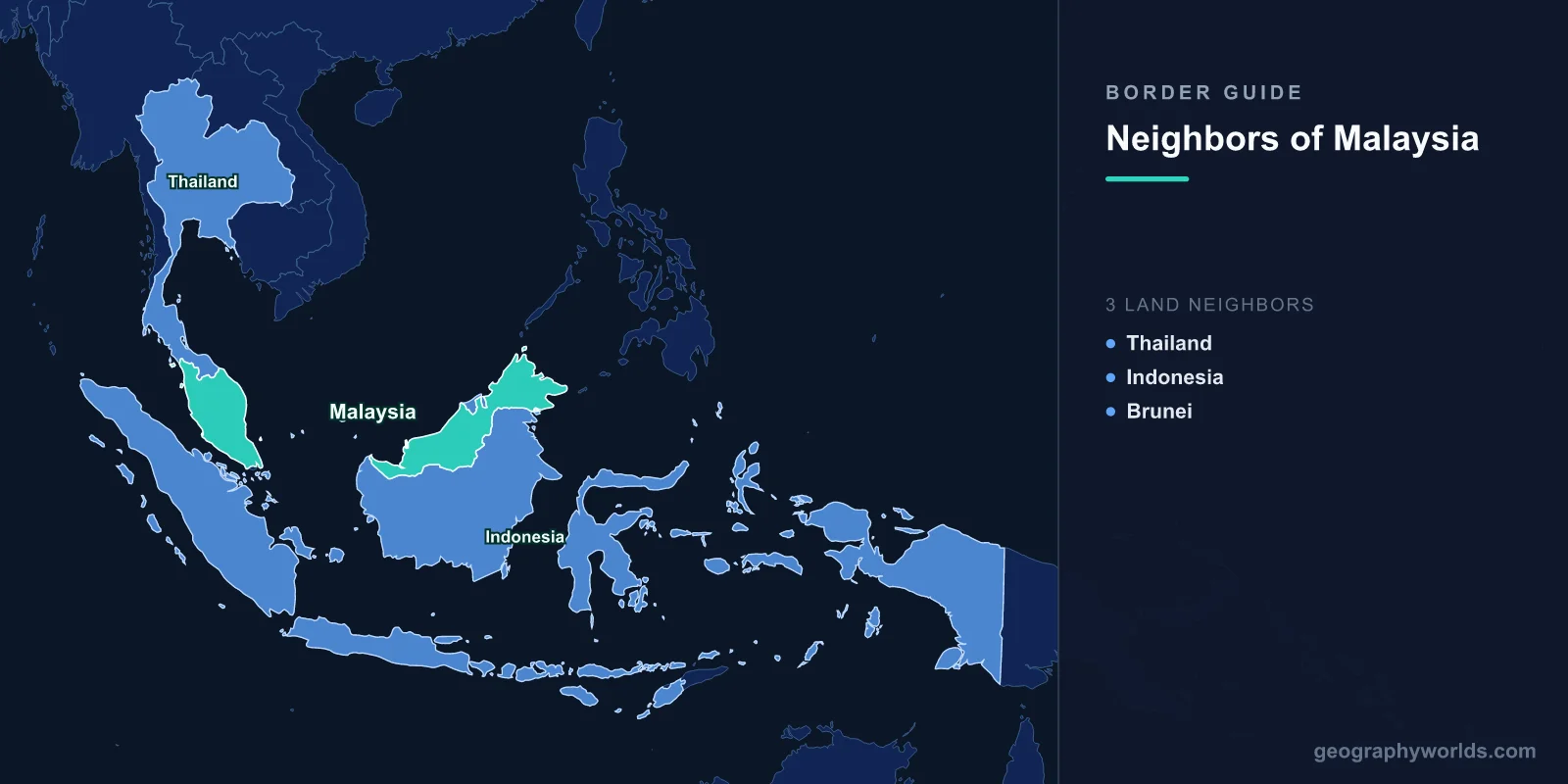
Malaysia shares land borders with three neighboring countries: Thailand, Indonesia, and Brunei, spanning a total land boundary of roughly 2,669 km. What makes Malaysia unusual is that these borders sit on two entirely separate landmasses, divided by the South China Sea. Peninsular (West) Malaysia occupies the southern tip of the Malay Peninsula, while East Malaysia (the states of Sabah and Sarawak) sits on the island of Borneo. As a result, only one neighbor touches the peninsula, and two more lie on Borneo.
Thailand: the only peninsular neighbor
Thailand is Malaysia's sole land neighbor on the Malay Peninsula, sharing a border of about 595 km to the north. The boundary stretches coast to coast, from the Strait of Malacca in the west to the Gulf of Thailand in the east, cutting across the mountainous backbone of the peninsula. On the Malaysian side it touches the northern states of Perlis, Kedah, Perak, and Kelantan; on the Thai side it borders provinces including Satun, Songkhla, Yala, and Narathiwat.
The border zone is culturally blended. Southern Thailand has large Malay-Muslim communities, while northern Malaysia hosts Thai-Buddhist populations and dozens of Buddhist temples. The busiest crossing is Bukit Kayu Hitam-Sadao, a key artery for road freight, while Padang Besar offers a rail link and Rantau Panjang-Sungai Kolok handles eastern traffic. Tourism runs in both directions, with Malaysians heading to Hat Yai and Thais visiting Penang and Langkawi.
Indonesia: the longest border, deep in Borneo
Indonesia shares Malaysia's longest land boundary, around 1,881 km, running entirely across the island of Borneo. It separates the Malaysian states of Sarawak and Sabah from the Indonesian provinces of West, North, and East Kalimantan. Much of the line follows the central watershed of Borneo's mountain ranges, threading through some of the oldest tropical rainforest on Earth, remote river valleys, and rugged highlands that remain sparsely populated.
Indigenous Dayak peoples live on both sides of this frontier, and their ancestral territories long predate the modern border. The main official crossing is Tebedu-Entikong in Sarawak, supplemented by smaller posts such as Serikin. Conservation cooperation is significant here: the trilateral Heart of Borneo initiative, involving Malaysia, Indonesia, and Brunei, aims to protect a vast block of contiguous rainforest spanning the border.
Brunei: a neighbor almost wrapped by Malaysia
Brunei shares a 266 km border with Malaysia, lying entirely within the state of Sarawak on Borneo. Geographically, Malaysia nearly envelops Brunei on its landward sides, leaving the sultanate with only a coastline on the South China Sea. Brunei is also split into two parts: its eastern Temburong district is cut off from the main territory by Sarawak's Limbang district, a historical source of friction between the two nations.
Relations today are warm, anchored by shared Malay language, culture, and Islamic heritage. The countries settled long-running disputes over offshore oil and gas areas in 2009. Daily cross-border movement is routine, with Bruneians shopping in the Sarawak towns of Limbang and Miri and Malaysians working in Brunei. The Sultan Haji Omar Ali Saifuddien Bridge, opened in 2020 across Brunei Bay, now links Brunei's two halves directly, easing reliance on transit through Malaysian land.
Maritime neighbors across the seas
Beyond its land borders, Malaysia has close maritime neighbors. Singapore sits just across the narrow Strait of Johor, connected by the Johor-Singapore Causeway and the Second Link, among the busiest border crossings in the world with hundreds of thousands of commuters daily. The Philippines lies across the Sulu and Celebes Seas from Sabah, while Vietnam faces Peninsular Malaysia across the South China Sea. Malaysia's maritime claims in the South China Sea overlap with those of several of these states, making negotiated boundaries and joint resource arrangements an ongoing diplomatic priority.
Why Malaysia's borders are unusual
Few countries have their land frontiers split across two separate islands or landmasses. Malaysia does, because the federation formed in 1963 united the peninsula with the formerly British-administered territories of Sabah and Sarawak on Borneo. This geographic division shapes the country's politics, infrastructure, and identity. For travelers and learners, it means Malaysia effectively borders Thailand to the north and both Indonesia and Brunei to the south and east, each across a very different terrain. To explore more about the country's geography, history, and culture, see our malaysia country guide.
Frequently Asked Questions
How many countries border Malaysia?
Malaysia borders three countries by land: Thailand, Indonesia, and Brunei. Thailand borders Peninsular Malaysia, while Indonesia and Brunei border East Malaysia on the island of Borneo.
Which country has the longest border with Malaysia?
Indonesia has the longest border with Malaysia, at roughly 1,881 km, running across Borneo between the Malaysian states of Sabah and Sarawak and the Indonesian provinces of Kalimantan.
Does Malaysia border Singapore?
Malaysia does not share a land border with Singapore. The two are separated by the Strait of Johor and connected only by the Johor-Singapore Causeway and the Second Link, so the boundary is maritime rather than terrestrial.
Is Brunei surrounded by Malaysia?
On its land sides, yes. Malaysia's state of Sarawak almost completely encloses Brunei, which retains only a South China Sea coastline. Sarawak's Limbang district even divides Brunei into two separate parts.
