
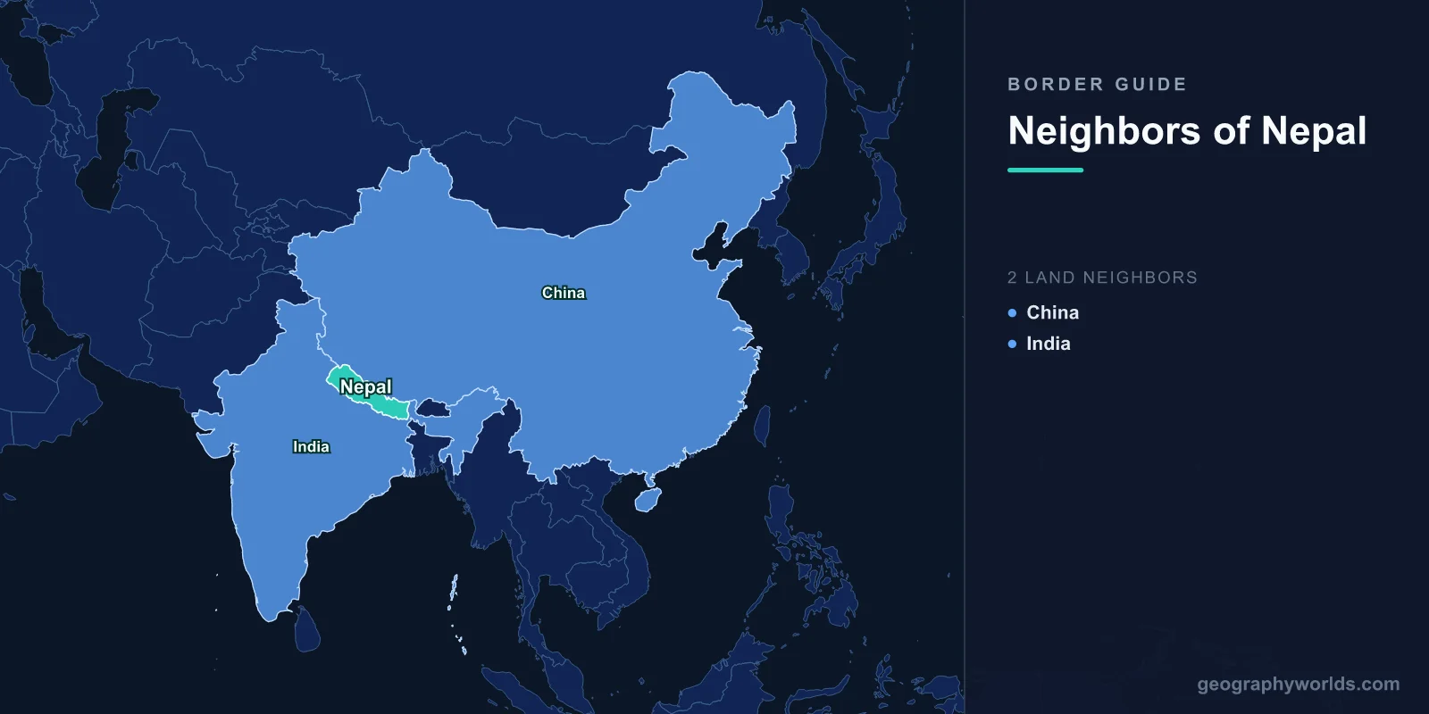
Nepal has exactly two neighboring countries: China to the north and India to the south, east, and west. Wedged into the central Himalayas between the two most populous nations on Earth, this landlocked country shares roughly 3,159 km of land border in total, and no other country touches its territory. With no coastline and no third neighbor, every overland route into or out of Nepal must pass through either Chinese or Indian soil.
That single geographic fact has shaped Nepal's economy, foreign policy, trade routes, and culture for centuries. Understanding Nepal's two borders means understanding two completely different worlds: an open, bustling lowland frontier in the south and a wall of high-altitude ice and rock in the north. This guide walks through each neighbor, what makes the borders distinct, and why Nepal's position remains one of the most strategically delicate on the map.
India: The Southern Neighbor
India is Nepal's dominant neighbor, sharing a border of approximately 1,770 km that wraps around Nepal's southern, eastern, and western flanks. This boundary touches five Indian states: Uttarakhand and Uttar Pradesh to the west and south, Bihar across the central Terai, and West Bengal and Sikkim to the east. Most of the border runs through the flat, fertile Terai plains and the low Siwalik hills rather than over mountains, making it easy to cross and densely populated on both sides.
What makes this border remarkable is how open it is. Under the 1950 Treaty of Peace and Friendship, citizens of both nations can cross without passports or visas, and they may live, work, and own property on either side. The result is one of the world's most porous international boundaries, with millions of Nepalis working in India and deep cross-border family, linguistic, and religious ties. Major crossing points include Birgunj-Raxaul, the busiest trade gateway, along with Sunauli-Bhairahawa in the central west and Kakarbhitta-Panitanki in the far east. India is Nepal's largest trading partner and supplies most of its fuel, medicine, and everyday consumer goods. You can learn more about the southern neighbor in our India country guide.
China: The Northern Neighbor
China shares about 1,389 km of border with Nepal along its entire northern edge, almost all of it within the Tibet Autonomous Region. Unlike the open southern frontier, this boundary follows the crest of the Himalayas, making it one of the highest international borders on the planet. It passes over or near eight of the world's fourteen peaks above 8,000 meters, and the summit of Mount Everest itself sits squarely on the line dividing the two countries.
Because the mountains are so formidable, cross-border movement has always concentrated at a handful of high passes. The Kerung (Gyirong) crossing is now the primary overland route, taking over after the historic Kodari crossing on the China-Nepal Friendship Highway was badly damaged in the 2015 earthquake. The two countries demarcated their border through a 1961 treaty, and China has since invested heavily in roads and rail approaching the frontier as part of wider regional connectivity plans. Nepal maintains a firm "One China" policy in its dealings with Beijing.
A Country Between Two Giants
Nepal is one of the very few states sandwiched between two nuclear-armed powers, and both neighbors together account for more than a third of humanity. This positioning forces Nepal into a careful balancing act, and Nepali leaders often describe the country as "a yam between two boulders," an image popularly attributed to the 18th-century unifier Prithvi Narayan Shah.
The dependence cuts deep. When supply routes from India were disrupted during the 2015 border blockade, Nepal faced severe shortages of fuel, medicine, and cooking gas, a stark reminder of how landlocked geography limits its options. In response, Nepal has steadily worked to expand trade and transit links with China to reduce reliance on any single partner, negotiating access to Chinese seaports and pushing for cross-border road and rail upgrades. You can read more about the country itself in our Nepal country guide.
Borders Defined by Extreme Terrain
Few countries pack such dramatic variation into their borders. In the south, the land sits as low as about 60 meters above sea level on the Indian plains; in the north, it climbs to 8,849 meters at the top of Everest. That entire vertical range is compressed into roughly 150 km of horizontal distance, giving Nepal some of the steepest border terrain anywhere on Earth.
This contrast also defines the character of each frontier. The Indian border is continuous with the Gangetic plain, sharing climate, crops, language, and Hindu and Buddhist heritage with adjoining regions. Trade, marriage, and daily commuting flow across it constantly. The Chinese border, by contrast, is a barrier of ice and rock crossed only by trekkers, traders, and the occasional highway through a narrow gorge. The two borders could hardly be more different in feel, yet both are essential lifelines for a nation with no sea access of its own.
Border Disputes and Cooperation
While Nepal's borders are largely settled, one area remains contested. The Kalapani-Lipulekh-Limpiyadhura region in the far northwest, near the trijunction with China and India, is claimed by both Nepal and India, and the dispute has periodically strained relations and even prompted Nepal to update its official map. Despite this friction, day-to-day cooperation continues on trade, hydropower, water sharing, and tourism. Cross-border collaboration is also vital for protecting shared Himalayan ecosystems and managing the major rivers, such as the Koshi, Gandaki, and Karnali, that rise in Nepal and flow down into the Indian plains.
Why Nepal's Borders Matter
For a country of roughly 30 million people, Nepal's borders are far more than lines on a map. They determine where fuel comes from, how exports reach global markets, where migrant workers find jobs, and how the nation manages relations with two rising superpowers. Tourism, one of Nepal's biggest earners, depends almost entirely on visitors arriving through Indian transit points or by air, because the Himalayan wall to the north admits only a trickle of overland travelers. In a very real sense, Nepal's geography is its destiny, and its two neighbors hold many of the keys to its future.
Key Facts
- Number of neighbors: 2 (India and China)
- Total land border: Approximately 3,159 km
- Longest border: India, about 1,770 km
- Shortest border: China, about 1,389 km
- Coastline: None (Nepal is landlocked)
- Highest point on a border: Mount Everest, 8,849 m, on the Nepal-China line
- Lowest point near a border: About 60 m in the southern Terai plains
Frequently Asked Questions
How many countries border Nepal?
Nepal borders exactly two countries: India and China. There are no other neighbors, and Nepal has no coastline, which makes it a landlocked nation entirely surrounded by these two states.
Which country shares the longer border with Nepal?
India shares the longer border at roughly 1,770 km, compared with about 1,389 km for China. The total length of Nepal's land borders is approximately 3,159 km.
Is the Nepal-India border open?
Yes. Under the 1950 Treaty of Peace and Friendship, citizens of Nepal and India can cross the border freely without passports or visas, and they may live and work in either country.
Does Mount Everest sit on a border?
Yes. The summit of Mount Everest lies directly on the border between Nepal and China, making it the highest point of any international boundary in the world.
