

Beijing is the capital of the People’s Republic of China, set at the northern tip of the North China Plain where the land stops being flat and mountains close in on the west and north. It is a municipality governed directly by the central government, with 21.83 million people in 2024, which makes it the most populous national capital in the world. It has been China’s political centre for most of the past eight centuries, and nearly every chapter of that history, from its first walls to its drinking water, was shaped by the ground it stands on.
A Plain Walled by the Western Hills and the Jundu Mountains
Look at Beijing on a relief map and its logic is immediate. The roughly triangular North China Plain opens to the south and east, flat and fertile. To the west rise the Xishan, or Western Hills; to the north-west and north run the Jundu Mountains, which dominate the municipality’s Yanqing and Huairou districts. The highest point, Mount Dongling on the border with Hebei, reaches 2,303 metres, while the urban core sits on the plain at just 40 to 60 metres above sea level. Mountains on three sides gave the city natural protection and screened both it and the farmland to the south from the dry steppe beyond.
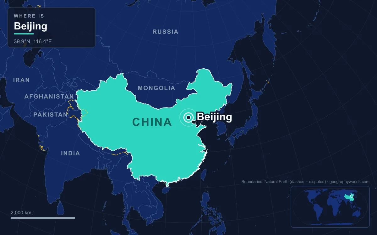
That position made the site a hinge. Whoever held it controlled traffic between the farming heartland of China and the grasslands of Mongolia and Manchuria. Chinese dynasties treated it as a frontier garrison, while conquering dynasties from the north treated it as the natural foothold for ruling the plain. Beijing today is the core of the Jing-Jin-Ji cluster, surrounded mostly by Hebei Province, with Tianjin Municipality to the south-east between the capital and the Bohai Sea.

Lotus Pond and the First City of Ji
People lived in this corner of the plain long before any city. At Zhoukoudian in Fangshan District, the caves of Dragon Bone Hill yielded the Homo erectus fossils known as Peking Man, dated to 230,000 to 250,000 years ago. The first walled town was Ji, capital of the state of the same name, which stood around today’s Guang’anmen area in the south of Xicheng District. The state of Yan conquered it in the early Zhou period and moved its capital there from a site 45 km to the south-west.
Ji was placed beside water. The lake now inside Lotus Pond Park, next to Beijing West railway station, is believed to have been the city’s main water source from the Zhou dynasty until the Yuan, according to the classical geography Commentary on the Water Classic. Under the Qin and Han, Ji served as a commandery seat and, under the Han, as capital of You Province. After the Sui reunified China in 581, it became the northern terminus of the Grand Canal, and under the Tang, as Youzhou, it was a military command facing the frontier. The rebel general An Lushan briefly called it Yanjing, “the Yan capital”, during his rebellion in the 750s.
Juyong Pass and the Road From the Steppe
North-west of the city, over 50 km from the centre, the 18 km Guangou Valley cuts through the mountains. Juyong Pass guards it, with a southern gate and a northern one at Badaling, and under the Ming it was one of the “Three Inner Passes” between Mongolia and Beijing. The Great Wall follows the ridges on either side, and in the middle of the valley stands the Cloud Platform, a white marble gateway 9.5 metres high built in 1342.
It was through gaps like this that the city’s northern rulers came. In 938 the frontier region passed to the Khitan Liao dynasty, which made the city Nanjing, its “Southern Capital”, one of four secondary capitals; the Tianning Pagoda survives from that era. The Jurchen Jin dynasty took it in 1125 and in 1153 made it their Central Capital, Zhongdu. Genghis Khan’s army besieged Zhongdu in 1213 and razed it two years later. Kublai Khan then ordered a new capital for his Yuan dynasty, Dadu, commonly known as Khanbaliq, built between 1264 and 1293 to the north-east of the Jin ruins. The project greatly raised the standing of a city on the northern fringe of China proper.
Guo Shoujing’s Water: Kunming Lake and the Canal’s End
Moving the city north-east meant leaving the Lotus Pond behind, and Dadu needed a new water supply for its people and for the grain barges that fed them. The engineer and astronomer Guo Shoujing solved it. He built a channel of about 30 km to bring water from the Baifu spring in the hills to the city, crossing between river basins with sluices to hold the level, and in 1291 he turned an old pond in the north-western suburbs into a reservoir for the capital. That reservoir is Kunming Lake, now the centrepiece of the Summer Palace. In 1292 and 1293 the Grand Canal was repaired and extended into Dadu itself.

The canal’s last stretch ended in the lakes of Shichahai, just north-west of the later Forbidden City. From the Yuan onwards this 147-hectare chain of three lakes, Qianhai, Houhai and Xihai, was the northernmost point of a waterway running all the way from Hangzhou, and its shores became the capital’s most important commercial district. Dadu was centred on the Drum Tower, slightly north of the modern centre, and fragments of its rammed-earth wall still stand as the Tucheng.
The Ming Axis of 1420 and the Walls That Became Ring Roads
The Ming founder captured Dadu in 1368, razed its palaces and renamed it Beiping, “Northern Peace”. His son Zhu Di, who held the city as Prince of Yan, seized the throne as the Yongle Emperor and renamed it Beijing, “Northern Capital”, in 1403. The Forbidden City was built from 1406 to 1420, along with the Temple of Heaven and Tian’anmen, and on 28 October 1420 Beijing officially became the capital, with Nanjing demoted to co-capital. A 1425 order by the next emperor to move back to Nanjing was never carried out, because he died the following month. By the fifteenth century Beijing had essentially its present shape, and it is generally thought to have been the largest city in the world for most of the fifteenth to eighteenth centuries.
The Qing kept the Ming layout after 1644, adding large palatial gardens to the north-west, including the Old Summer Palace and the Summer Palace. The Republic moved the capital to Nanjing in 1928 and Beijing became Beiping again, until Mao Zedong proclaimed the People’s Republic from atop Tian’anmen on 1 October 1949 and restored both name and status. The Ming walls survived until the 1960s, when they were pulled down to make way for the Beijing Subway and the 2nd Ring Road, which traces their line. The city has since spread across the plain in concentric rings out to the 6th Ring Road, a pattern planners call “spreading like a pancake”. Chang’an Avenue forms the east–west axis past Tian’anmen, while the Forbidden City still sits directly north of it at the heart of the old city, with Zhongnanhai, the compound of China’s current leaders, just to the west.
Dust From the Gobi, Rain in July
The mountains that protect Beijing also shape its weather. The climate is humid continental, bordering on semi-arid. In winter the Siberian anticyclone brings brief, cold, dry spells, and the January daily mean is −2.7 °C. In summer the East Asian monsoon arrives and July averages 27.2 °C. Of the roughly 528 mm of precipitation a year, close to three-quarters falls between June and August. Spring is dry and windy, and sandstorms sometimes blow in from the Gobi Desert across the Mongolian steppe. Recorded extremes since 1951 run from −27.4 °C on 22 February 1966 to 41.9 °C on 24 July 1999.
The same bowl of mountains that blocks the steppe also traps polluted air. Research in 2006 found that 35 to 60 per cent of the city’s ozone came from outside Beijing, carried in on southerly summer winds and held against the ranges to the north and north-west. After severe smog in 2013 the city cut coal’s share from 24 per cent in 2012 to 10 per cent in 2017, and the city recorded a 35 per cent reduction in fine particulates in 2017.
Miyun, the Yongding and the South–North Water Transfer
Water remains the geographic limit on the capital. The largest river crossing the municipality, the Yongding, was once called the Wuding, the “unfixed river”, for its floods and shifting course; the Kangxi Emperor’s engineering works earned it the new name, meaning “ever-fixed”. It runs 650 km from Shanxi, feeds the Guanting Reservoir and enters Beijing through the Western Hills, but its Beijing stretch has in recent years run dry, and the city has spent 16 billion yuan turning parts of the bed into parkland and ponds.
To the north-east, the Miyun Reservoir on the Chao and Bai rivers, completed in September 1960, covers 180 km² and holds up to 4 billion cubic metres. It was not enough for a city of more than 20 million. Since late 2014 the Central Route of the South–North Water Transfer Project has carried water from the Danjiangkou Reservoir on the Han River, a tributary of the Yangtze, north to Beijing and Tianjin, the modern answer to the problem Guo Shoujing faced seven centuries earlier.
The hills themselves have changed too. Forest covered just 1.3 per cent of the municipality in 1949 and 44.8 per cent by 2022. A 2020 to 2024 survey recorded 515 species of wild birds in the municipality, nearly 100 more than a decade earlier, and leopard cats, wolves and roe deer still live in the ranges west and north of the city that the first builders of Ji saw on their horizon.
Quick Facts About Beijing
- Country: China
- Continent: Asia (East Asia)
- Country population: approximately 1412.9 million
- Capital city status: Beijing is the capital of China, the seat of national government, and the location of foreign embassies, parliament, and the head of state's official residence.
Frequently Asked Questions
What is the capital of China?
The capital of China is Beijing. Beijing is the seat of national government, hosts most foreign embassies and consulates, and is typically where the head of state and parliament are located.
What continent is Beijing in?
Beijing, the capital of China, is located in Asia, in the East Asia region. As China's capital, Beijing serves as the country's primary connection to the broader Asian political, economic, and cultural sphere.
Why is Beijing the capital of China?
Beijing was chosen as the capital of China for reasons that typically combine geography, history, and politics. Capital city selections often reflect a desire for centrality (being accessible from across the country), historical importance (being a longstanding seat of government or culture), or neutrality (being acceptable to multiple regions or ethnic groups within the country). The specific reasons for Beijing's designation are detailed in the city's history above.
What is Beijing known for?
As the capital of China, Beijing is best known for housing the country's central government institutions — parliament, presidential or royal residences, supreme court, and key ministries. It is also typically a major cultural and economic center within China, hosting national museums, embassies, and signature monuments. The introduction and history sections above provide detailed coverage of the city's specific notable institutions and landmarks.
Related Pages
- China Country Guide — full geography, climate, economy, and culture overview
- Flag of China — meaning, history, and design of China's national flag