
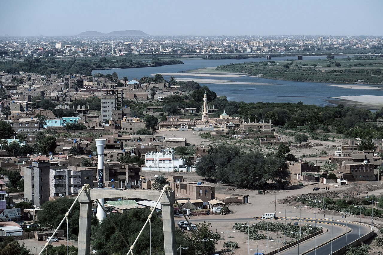
Khartoum is the capital of Sudan, built on the flat point of land where the Blue Nile and the White Nile meet to form the main Nile, about 385 metres above sea level in the east-centre of the country. Together with Omdurman and Khartoum North across the rivers, it makes up Greater Khartoum, an urban area with an estimated 7.1 million people, the largest in Sudan. The city was founded as an Egyptian army camp in 1821 and has been the capital of independent Sudan since 1956, and almost everything about it, from its name to its street plan to the damage it suffered in the fighting of 2023 to 2025, follows from that meeting of two rivers.
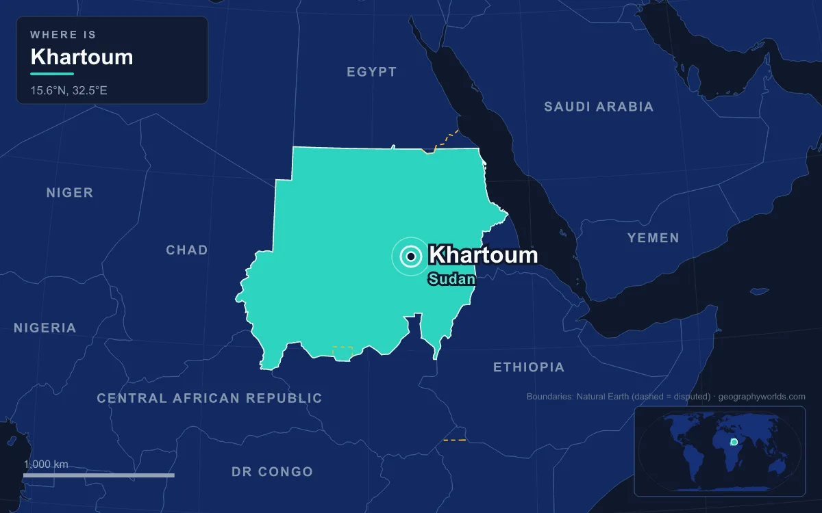
Al-Mogran: Where the Blue and White Niles Meet
The confluence has a name of its own: al-Mogran, or al-Muqran, "the confluence". Stand on the tip of the Khartoum peninsula and you can see two rivers of very different character arriving side by side. The White Nile comes in from the south after a long, slow journey from Lake Victoria through the swamps of South Sudan, and it is the longer of the two. The Blue Nile comes from the south-east. It rises at Lake Tana in Ethiopia and travels about 1,450 kilometres through Ethiopia and Sudan, about 650 of them in Sudan, dropping off the Ethiopian Highlands through a canyon that has discouraged every attempt to trace it since Frédéric Cailliaud's in 1821.

The Blue Nile is the river that matters for volume. In the rainy season from June to September it supplies between 80 and 86 per cent of the water in the Nile proper, and overall about 59 per cent of the water that reaches Egypt comes from the Ethiopian Highlands by this route. During the summer floods it carries so much soil eroded from the highlands that its water turns dark brown or almost black. Upstream in Sudan, the Roseires and Sennar dams on the Blue Nile irrigate the Gezira Scheme, a farming region known for its high-quality cotton. Our guides to the Blue Nile and the White Nile follow each river back to its source.
The site gives Khartoum water in one of the driest settings of any capital. The city has a hot desert climate. Average annual rainfall is just 121.3 millimetres, most of it in a brief rainy season peaking in August at about 48 millimetres, and about eight months of the year get less than 5 millimetres each. Annual mean temperatures hover around 30 °C, average highs exceed 40 °C from April to June, and in no month does the average high drop below 30 °C, which sets Khartoum apart even from Riyadh, Baghdad and Phoenix.
A Trunk of Land: Where the Name Khartoum Comes From
The most common explanation of the name is geographical. The Arabic khurṭūm means "trunk" or "hose", and it is usually taken to describe the narrow strip of land that extends like an elephant's trunk between the two Niles. Other theories exist. Captain James Grant, who reached Khartoum with John Speke's expedition in 1863, thought it came from qurṭum, the safflower plant grown for its oil. Some scholars have proposed Nubian or Beja origins, including a Beja word meaning "meeting", which would suit the confluence just as well.
1821: An Egyptian Army Camp on the Point
Khartoum was founded in 1821, 24 kilometres north of the ancient city of Soba, by Isma'il Kamil Pasha, son of Egypt's ruler Muhammad Ali, who had just brought Sudan into his realm. At first it was simply an outpost for the Egyptian army, chosen because it controlled the junction of both river routes. In 1823 the colonial administration moved its seat from Wad Madani to Khartoum, and the camp became a town. It served as a rest stop on the caravan route from Ethiopia to Egypt, and it also became a centre of the slave trade that drew captives from the Blue Nile region, the Nuba Mountains and the upper White Nile.
The rivers that made the site also threatened it. In 1854 heavy rains and floods destroyed most of the city, which was rebuilt in mud and stone instead of thatch and straw. The same year, under European pressure, the public slave market was closed, although the trade itself continued on a large scale.
Gordon, the Mahdi and Omdurman Across the White Nile
The confluence made Khartoum easy to supply and hard to escape. On 13 March 1884 the forces of the Mahdi, Muhammad Ahmad, laid siege to the city, defended by an Egyptian garrison under the British general Charles Gordon. The defenders dug trenches and built a wall connecting the Blue Nile to the White Nile, so that the rivers and the wall together enclosed the city. It held for more than ten months. On 26 January 1885 the Mahdists broke in and killed the entire garrison. Survivors among the population were deported across the White Nile to the newly established Omdurman, and Khartoum was left largely in ruins.
Omdurman, on the west bank, grew rapidly around the Mahdi's tomb. In September 1898 Herbert Kitchener's Anglo-Egyptian army defeated the Mahdist forces at the Battle of Omdurman, fought at nearby Kerreri, in about five hours. Omdurman today is the second most populous city in Sudan, and the largest cities in Sudan are dominated by the three towns of the confluence.
Kitchener's Union Jack Street Plan
After 1898 Khartoum was rebuilt as the capital of Anglo-Egyptian Sudan, and its geography was redrawn on paper. Kitchener, who became Governor-General in September 1898, laid out the new city on a street plan shaped like the Union Jack, with diagonal avenues crossing a grid. The three towns were given separate roles: Khartoum was the seat of government, Khartoum North across the Blue Nile became a garrison with a dockyard and the railhead from Egypt, and Omdurman remained the most populous and kept its older form. Kitchener also ordered the city's mosques rebuilt and guaranteed freedom of religion to its residents.
Under Governor-General Reginald Wingate, who served from 1899 to 1916, the Governor-General's Palace was rebuilt in red brick with sandstone corners. Gordon Memorial College, now the University of Khartoum, opened in 1903, and a railway to Port Sudan on the Red Sea was completed in 1919. Migrants arrived from the countryside, and by 1930 the city had more than 50,000 people.
Khartoum became the capital of the independent Republic of Sudan in 1956, and growth accelerated. The population reached 185,000 by 1964 and 334,000 at the 1973 census. The National Museum of Sudan, founded in 1971, displays the temples of Buhen and Semna, moved here from the Nile valley in the north when the waters of Lake Nasser rose behind the Aswan High Dam. From the 1970s onward, refugees from Chad, Eritrea, Ethiopia and Uganda, and later from South Sudan and Darfur, settled on the city's edges, spreading Greater Khartoum far out into the desert.
Tuti Island and the Bridges of the Three Towns
Right at the confluence sits Tuti Island, just 3.99 square kilometres of citrus orchards and vegetable farms with a single village founded in the late 15th century. Tuti has long supplied much of Khartoum's fruit and vegetables, and until 2008 it could only be reached by ferry. That year the Tuti Bridge, a suspension bridge, linked it to Khartoum.
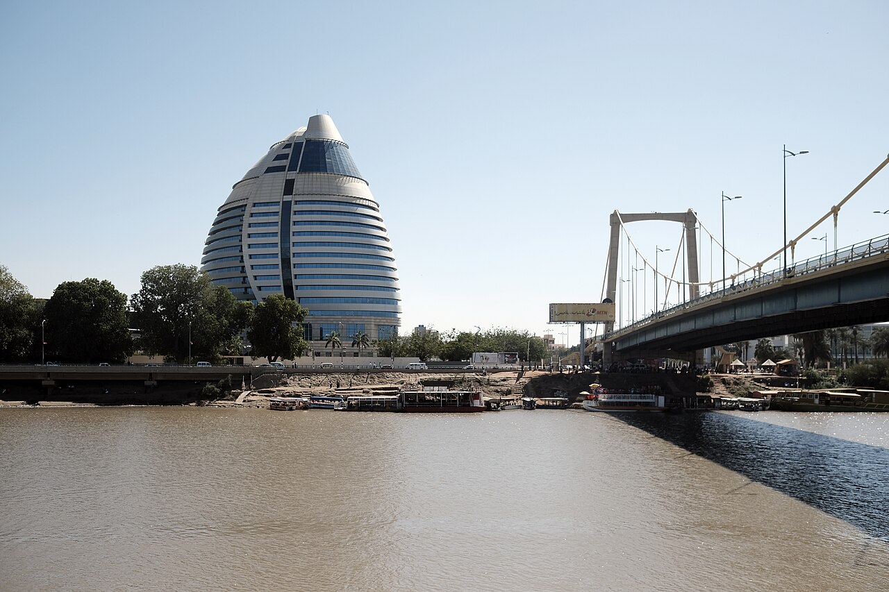
Bridges are what hold the three towns together. The Mac Nimir Bridge, the Blue Nile Road and Railway Bridge, the Cooper Bridge and the Elmansheya Bridge cross the Blue Nile between Khartoum and Khartoum North. The Omdurman Bridge, the Victory Bridge and the Al-Dabbasin Bridge cross the White Nile to Omdurman. Khartoum also has rail links to Wadi Halfa, Port Sudan and El Obeid. After the 2005 peace agreement with the south, the government launched large projects such as the Al-Mogran Development Project and the Corinthia Hotel tower, which partly opened in 2011.
2023 to 2026: War Along the Riverbanks
The capital had already seen upheaval: on 3 June 2019, during the Sudanese Revolution, Rapid Support Forces soldiers broke up a protest sit-in and killed more than 100 people, and after a military coup the city was locked down on 26 October 2021. The same rivers that made Khartoum defensible in 1884 divided it into front lines after 15 April 2023, when fighting broke out between the Sudanese Armed Forces and the Rapid Support Forces. Battles hit the presidential palace and Khartoum International Airport, and the RSF held much of the city. The RSF turned Tuti Island into what was effectively an open-air prison; by October 2024 nearly all of its 30,000 inhabitants had fled, leaving about 50 people. The government relocated to Port Sudan on the Red Sea, which was described as a de facto capital.
The army regained full control of Khartoum on 26 March 2025, and after nearly three years in Port Sudan, the government returned to the capital on 11 January 2026. The city remains badly damaged by displacement, looting and the near collapse of basic services. Its geography has not changed, though: the two Niles still meet at al-Mogran, and that is why a capital stands there at all. For more on the country governed from that point, see our Sudan country guide.
Quick Facts About Khartoum
- Country: Sudan
- Continent: Africa (North Africa)
- Country population: approximately 53.3 million
- Capital city status: Khartoum is the capital of Sudan, the seat of national government, and the location of foreign embassies, parliament, and the head of state's official residence.
Frequently Asked Questions
What is the capital of Sudan?
The capital of Sudan is Khartoum. Khartoum is the seat of national government, hosts most foreign embassies and consulates, and is typically where the head of state and parliament are located.
What continent is Khartoum in?
Khartoum, the capital of Sudan, is located in Africa, in the North Africa region. As Sudan's capital, Khartoum serves as the country's primary connection to the broader African political, economic, and cultural sphere.
Why is Khartoum the capital of Sudan?
Khartoum was chosen as the capital of Sudan for reasons that typically combine geography, history, and politics. Capital city selections often reflect a desire for centrality (being accessible from across the country), historical importance (being a longstanding seat of government or culture), or neutrality (being acceptable to multiple regions or ethnic groups within the country). The specific reasons for Khartoum's designation are detailed in the city's history above.
What is Khartoum known for?
As the capital of Sudan, Khartoum is best known for housing the country's central government institutions — parliament, presidential or royal residences, supreme court, and key ministries. It is also typically a major cultural and economic center within Sudan, hosting national museums, embassies, and signature monuments. The introduction and history sections above provide detailed coverage of the city's specific notable institutions and landmarks.
Related Pages
- Sudan Country Guide — full geography, climate, economy, and culture overview
- Flag of Sudan — meaning, history, and design of Sudan's national flag