

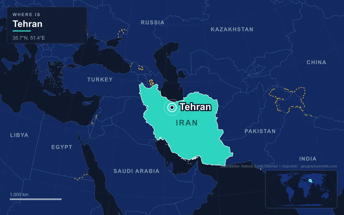
Tehran has been the capital of Iran since 1786, when the Qajar ruler Agha Mohammad Khan chose a modest walled town at the foot of the Alborz Mountains over the old royal cities of Isfahan and Shiraz. Today it is Iran's largest city, with 8,693,706 people at the 2016 census and roughly 16.8 million in the wider metropolitan area, spread across slopes that climb from about 1,100 metres in the south to more than 1,800 metres in the north. It was chosen precisely because it was unimportant, and the question of whether it should stay the capital has never quite gone away.
Agha Mohammad Khan's Choice of 1786
Before the Qajars, Tehran was a satellite of a far older place. The Median and later Parthian city of Rhages, today's Rey on the southern edge of the metropolis, was the regional centre for centuries; a medieval writer put its population at about 500,000 before the Mongols ruined it in the 13th century, and many survivors fled to the village of Tehran. The Castilian ambassador Ruy González de Clavijo passed through in July 1404 and described an unwalled settlement. The English traveller Thomas Herbert, in 1627, counted about 3,000 houses.
Karim Khan of the Zand dynasty ordered a palace and government office built in Tehran in the 18th century, apparently considering it as a capital, but he governed from Shiraz instead. The Qajar chief Agha Mohammad Khan, who had spent sixteen years as a hostage at Karim Khan's court, besieged Tehran in 1783, took control of northern Iran and in 1786 made the town his capital. He was enthroned in 1789 and crowned shah only in 1796.
His reasons were strategic and political. The two previous capitals were loyal to rival houses: Isfahan to the Safavids and Shiraz to the Zands, and each had powerful local notables who might resist a new dynasty. Tehran, with little urban structure, had no such families. It also sat within reach of Azerbaijan and the Caucasian khanates north of the Aras River, which Iran still claimed and which were contested with the Russian Empire. Those lands were lost in the 19th century, confirmed by the Treaty of Gulistan in 1813 and the Treaty of Turkmenchay after the war of 1826 to 1828, but by then Tehran was established. The town was small at first: about 15,000 people in 1797, and still barely more than 80,000 after fifty years of Qajar rule.
Naser al-Din Shah's Octagon and the Golestan Palace
Being the capital turned the village into a royal city over the following century. Until the 1870s Tehran consisted of a walled citadel, a roofed bazaar and three main neighbourhoods, Udlajan, Chale-Meydan and Sangelaj. During the long reign of Naser al-Din Shah, from 1848 to 1896, the city gained Iran's first institute of higher learning, first bank, first railway line and first museum. The Golestan Palace, the Qajar royal complex, was substantially rebuilt and enlarged in 1865 by Haji Ab ol Hasan Mimar Navai, adding the Brilliant Hall, the Mirror Hall and the Edifice of the Sun. It is now a UNESCO World Heritage Site.

Growth was planned in stages. A first development plan in 1855 kept the traditional layout. A second, drawn up in 1878 under the supervision of the Dar al-Fonun college, enclosed the city in new walls shaped as a regular octagon covering about 19 square kilometres, modelled on Renaissance cities in Europe. The walled area had grown more than fourfold. By 1867 the population had reached about 147,000.
The capital also became the stage for national politics. The Constitutional Revolution produced Iran's first constitution in 1906, and on 2 June 1907 the new parliament passed a municipal law for local government. Since 2016 the city has marked 6 October as Tehran Day, commemorating the date in 1907 when it officially became the capital. The gains were fragile: on 23 June 1908 Mohammad Ali Shah had the parliament bombarded with the help of the Russian-led Cossack Brigade, and revolutionary forces recaptured the city on 13 July 1909. During the First World War, as Russian troops approached from Qazvin, government functions moved to Qom and then Isfahan while the monarchy stayed in Tehran, the nearest the city came to losing its role.
Reza Shah's Street-Widening and the Walls That Came Down in 1937
The Pahlavi dynasty, founded by Reza Shah in the 1920s, remade the capital as the showcase of a centralised state. He suspended the 1907 municipal law, replacing elected city councils with central planning. Parts of the Golestan Palace, the Takyeh Dowlat theatre and Toopkhaneh Square were replaced by new buildings in a style influenced by classical Iranian architecture, including the National Bank, the police headquarters, the telegraph office and the military academy.
A street-widening act in 1933 became the template for every other Iranian city. The Grand Bazaar was cut in half, cruciform avenues were driven through the old fabric, and large roundabouts were created at major public spaces. In 1937 the citadel and the octagonal walls were demolished and replaced with wide streets. Tehran's population, around 250,000 in 1930, passed 540,000 by 1940.
The capital's status also drew foreign armies. After the Anglo-Soviet invasion of Iran in 1941, the city was occupied, and in 1943 it hosted the Tehran Conference of Franklin D. Roosevelt, Joseph Stalin and Winston Churchill. Under Mohammad Reza Shah, rural migration, accelerated by the land reforms of the 1962 White Revolution, drove explosive growth: 1.56 million people in 1956, 2.72 million in 1966 and 4.53 million in 1976. A comprehensive plan by Abd-ol-Aziz Farmanfarmaian and Victor Gruen Associates was approved in 1968 to tackle crowded suburbs, pollution and weak infrastructure, but it was overtaken by the revolution and the Iran–Iraq War.
From Shahyad to Azadi: Tehran After 1979
The monument that best tells the story of the capital's politics was built in 1971 to mark the 2,500th anniversary of the Persian monarchy. Designed by the architect Hossein Amanat after a competition, it blends Sasanian and later Iranian forms and was named the Shahyad Tower. After the 1979 revolution the new authorities renamed it the Azadi, or Freedom, Tower, and renamed Shahyad Square around it, part of a wider renaming of streets and public places across the city. Several million Tehranis turned out to greet Ayatollah Ruhollah Khomeini on his return, and Tehran became the capital of the Islamic Republic.

Being the capital also made the city a target. During the Iran–Iraq War of 1980 to 1988 Tehran was repeatedly hit by airstrikes and Scud missiles in the so-called War of the Cities, which caused substantial damage to its infrastructure. It was struck again by Israeli airstrikes during the Twelve-Day War of June 2025 and during the 2026 conflict.
Today the city is divided into 22 municipal districts. The ministries and government headquarters are concentrated in the centre, while the wealthiest districts, such as Niavaran, Farmanieh and Zafaraniyeh, climb the Alborz slopes in the north. The 435-metre Milad Tower, completed in 2007, and the Tabiat Bridge, a 270-metre pedestrian bridge by Leila Araghian opened in 2014, have joined the skyline. The Tehrani variety of Persian is the city's dominant language, and Tehran is home to more Azerbaijanis than any other city in the world; Iranian Azeris make up about 10 to 15 percent of residents.
Faults, Falling Reservoirs and the Makran Relocation Debate
The features that made Tehran a good capital in 1786 now weigh against it. The city is squeezed between the Alborz range, which rises to Tochal Peak at 3,963 metres on its northern edge, and the dry Iranian Central Plateau. It lies near two major fault lines, although no major earthquake has struck it since 1830. Annual rainfall in central Tehran averages only about 230 to 300 millimetres, and its summers, from June to September, are extremely dry. About 80 percent of its severe air pollution comes from cars.
Water has become the sharpest problem. In the summer of 2025, during a fifth consecutive year of below-average rainfall, storage at the Karaj Dam was reported down by 58 percent against normal, and authorities declared temporary public holidays and closed government offices and banks to save water and electricity. In November 2025 President Masoud Pezeshkian warned that rationing would be needed without rain, that some parts of Tehran were sinking by up to 30 centimetres a year, and that the city might ultimately have to be evacuated. Former mayor Gholamhossein Karbaschi called the idea of evacuating Tehran a joke.
Moving the capital has been proposed many times. In 2010 the government announced that a plan to move it had been finalised for security and administrative reasons, and there have been plans to relocate 163 state firms and several universities to reduce earthquake risk. Since January 2025 the government has reportedly considered the Makran region on Iran's southern coast as a possible site. Critics argue that the region is underdeveloped and exposed to security risks, and that inflation and sanctions make such a move impossible. So far, none of these plans has been approved. For more on the country around the capital, see our guide to the geography of Iran, compare Tehran with the older royal seats in the cities of the Persian Empire, or look up the regional centres in our list of Iran's province capitals.
Quick Facts About Tehran
- Country: Iran
- Continent: Asia (Middle East)
- Country population: approximately 93.2 million
- Capital city status: Tehran is the capital of Iran, the seat of national government, and the location of foreign embassies, parliament, and the head of state's official residence.
Frequently Asked Questions
What is the capital of Iran?
The capital of Iran is Tehran. Tehran is the seat of national government, hosts most foreign embassies and consulates, and is typically where the head of state and parliament are located.
What continent is Tehran in?
Tehran, the capital of Iran, is located in Asia, in the Middle East region. As Iran's capital, Tehran serves as the country's primary connection to the broader Asian political, economic, and cultural sphere.
Why is Tehran the capital of Iran?
Tehran was chosen as the capital of Iran for reasons that typically combine geography, history, and politics. Capital city selections often reflect a desire for centrality (being accessible from across the country), historical importance (being a longstanding seat of government or culture), or neutrality (being acceptable to multiple regions or ethnic groups within the country). The specific reasons for Tehran's designation are detailed in the city's history above.
What is Tehran known for?
As the capital of Iran, Tehran is best known for housing the country's central government institutions — parliament, presidential or royal residences, supreme court, and key ministries. It is also typically a major cultural and economic center within Iran, hosting national museums, embassies, and signature monuments. The introduction and history sections above provide detailed coverage of the city's specific notable institutions and landmarks.
Related Pages
- Iran Country Guide — full geography, climate, economy, and culture overview
- Flag of Iran — meaning, history, and design of Iran's national flag