

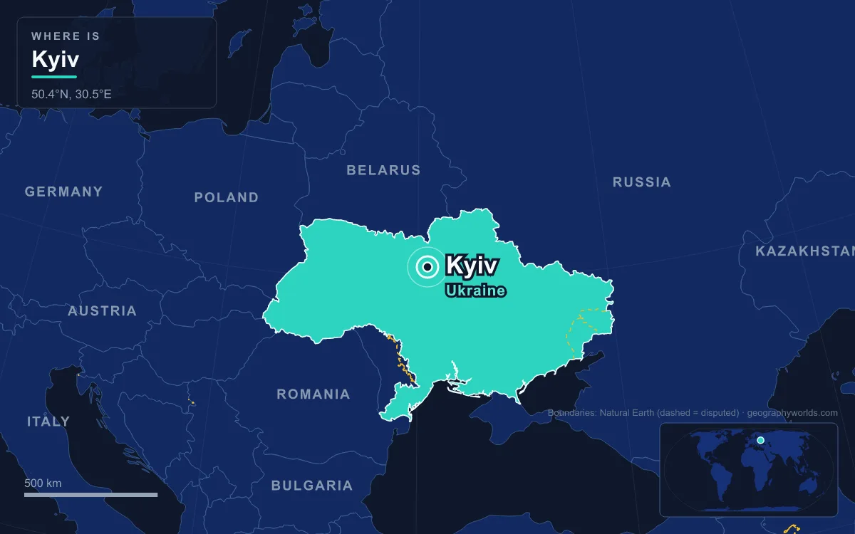
Kyiv is the capital and largest city of Ukraine, set in the north-centre of the country on both banks of the Dnieper River (the Dnipro in Ukrainian). The official estimate for January 2022 put its population at 2,952,301, which made it the seventh-most populous city in Europe. It is one of the oldest cities in Eastern Europe: a thousand years ago it was the capital of Kievan Rus’, the first East Slavic state, and several of the buildings from that age still stand on the high right bank. Six of its landmarks tell its history.
Saint Sophia Cathedral: Yaroslav the Wise’s Metropolitan Church
Yaroslav the Wise built Saint Sophia in the early 11th century as the seat of the metropolitan, the head of the church in Kievan Rus’. Nobody agrees on exactly when. The Primary Chronicle, the most trusted source, gives 1037; the First Novgorod Chronicle places the founding in 1017; and the Ukrainian historian Nadiia Nikitenko has argued for 4 November 1011, under Yaroslav’s father Volodymyr the Great. UNESCO and the Ukrainian government accepted 1011, and the country marked the cathedral’s 1,000th anniversary in 2011.
The interior is what makes the building exceptional. The walls carry 11th-century mosaics set on a shining gold background, each labelled with an inscription in medieval Greek, the work of a team that specialists put at eight craftsmen. The central apse is dominated by a 6-metre Virgin Orans with raised hands, and the summit of the main dome holds a medallion of Christ Pantocrator. Only one of the four mosaic archangels around him survived intact; the painter Mikhail Vrubel filled in the other three in oils in 1884. Outside, it looks younger: by 1695 raised galleries, an outer gallery and extra domes had given it the Ukrainian Baroque silhouette it keeps today.

The cathedral came close to disappearing in the 1920s, when the Soviet anti-religious campaign called for it to be demolished and the ground turned into a park honouring the heroes of Perekop. In 1921 the All-Ukrainian Academy of Sciences set up a Sophia Commission that argued the building’s case and saved it. Services were banned in 1934, the museum reserve opened to visitors in 1935, and in 1990 it became the first site in Ukraine inscribed on the UNESCO World Heritage List, jointly with the Kyiv Pechersk Lavra.
The Golden Gate and Yaroslav’s 3.5-Kilometre Walls
Not far from Saint Sophia, on the corner of Volodymyrska Street and Yaroslaviv Val Street, stands the Golden Gate. It was the main entrance to the Upper City that Yaroslav fortified between about 1017 and 1024. His stone walls ran for only 3.5 kilometres, and the gate was one of three, alongside the Polish (Ladski) and Jewish gates, neither of which survives. It took its name from the gilded domes of the Church of the Annunciation beside it, and probably echoed the Golden Gate of Constantinople. The passage was roughly 12 metres high and 6 metres wide, and for close to five centuries it worked as the city’s triumphal arch.
That Kyiv did not last. Historians estimate that 36,000 to 50,000 people lived in the city at the end of the 12th century, which put it among the larger cities of its day. Then in 1240 the Mongol army of Batu Khan stormed and ruined it, damaging the gate along with most of the town. For four centuries it was ruled from elsewhere. After the Battle of Blue Waters in 1362 it was absorbed into the Grand Duchy of Lithuania. The Union of Lublin of 1569 moved it to the Polish Crown as the capital of Kyiv Voivodeship. After the Treaty of Pereyaslav in 1654 and the Truce of Andrusovo in 1667, it passed to the Tsardom of Russia, keeping a measure of self-government within the Cossack Hetmanate.
What you see today is not medieval. The ruins were excavated in 1832, and in 1982 Soviet authorities rebuilt the whole gate for Kyiv’s official 1,500th anniversary, which was counted from a traditional founding date of 482. No image of the original survives, so the reconstruction remains controversial. The metro station beside it is called Zoloti Vorota, Ukrainian for Golden Gate.
Kyiv Pechersk Lavra and the Caves of Berestov Hill
South of the centre, on the high bank above the river, is the monastery that gave the Pechersk district its name, from pechera, “cave”. The Primary Chronicle dates its founding to either 1051 or 1074. A monk named Anthony, a native of Liubech who had lived on Mount Athos, came back to Rus’ and settled in a cave on Berestov Hill overlooking the river. Prince Iziaslav I later gave his followers the whole hill, and the monastery became the leading religious and literary centre of Rus’, where monks wrote the Primary Chronicle itself.

Its wealth made it a target. Cumans plundered the monastery in 1096, Prince Andrey Bogolyubsky sacked it in 1169, Batu Khan’s army took it in 1240, and the Golden Horde ruler Edigey burned it in 1416. Its best-known feature was added much later: the Great Lavra Belltower, built between 1731 and 1745 to a design by Johann Gottfried Schädel. At 96.5 metres it was the tallest free-standing bell tower anywhere when it was finished, and it remains one of the most prominent features of the Kyiv skyline.
The 20th century hit the Lavra hardest. On 3 November 1941, weeks after German troops occupied Kyiv, an explosion destroyed the main Dormition Cathedral. Soviet newspapers blamed the Germans, but the blast has since been attributed to the Soviet NKVD. Independent Ukraine rebuilt the cathedral, which reopened on 24 August 2000. The Lavra has also been caught up in a church dispute: in January 2023 the government ended the Moscow-linked Ukrainian Orthodox Church’s lease on the Dormition Cathedral and the Refectory Church. On 14 June 2026 a Russian drone attack tore away much of the Dormition Cathedral’s roof and damaged its main dome.
St Andrew’s Church Above the Podil Descent
Kyiv is a two-level city, and the local place names say so. Podil means “lower”, and a steep street linking the upper town to it is an uzviz, a “descent”. The most famous of these is Andriivskyi Descent, a 720-metre cobbled street that winds down around Zamkova Hill from the end of Volodymyrska Street to Kontraktova Square in Podil, the old merchants’ quarter by the river.
At the top is St Andrew’s Church, built between 1747 and 1754 to a design by the Italian architect Bartolomeo Rastrelli, and a rare example of Ukrainian Baroque. The site comes from a legend in the Primary Chronicle. Andrew the Apostle is said to have climbed these slopes above the Dnieper, set up a cross and foretold that a great city would rise there. Vsevolod I of Kyiv built a church in a monastery dedicated to St Andrew here in 1086. The present building was commissioned by Empress Elizabeth of Russia, who laid the first foundation stones herself on 9 September 1744. It became a museum in 1968, and its unstable foundation needed a major renovation at the end of the 2010s. Since October 2018 the Ukrainian state has allowed the Ecumenical Patriarchate of Constantinople to use it.
Khreshchatyk and Maidan Nezalezhnosti: the Rebuilt Centre
Kyiv’s main street, Khreshchatyk, runs 1.2 kilometres from European Square through Maidan Nezalezhnosti to Bessarabska Square. It was planned as the city’s principal street in 1837. Then, on 24 September 1941, five days after German troops entered the city, retreating Soviet forces set off explosives they had planted along the street, triggered by radio from more than 400 kilometres away. It was the first time long-distance radio-controlled demolition was used in war. The City Duma, the Stock Exchange, the National Hotel and the Ginsburg Skyscraper all fell. The street you walk today was rebuilt after the war in Stalinist neoclassical style.
The square halfway along has been renamed seven times since it was first named in 1869, passing through Duma Square, Kalinin Square and the Square of the October Revolution. It became Maidan Nezalezhnosti, Independence Square, on 26 August 1991, two days after Ukraine declared independence. Maidan, a word borrowed from Persian through Turkic languages, is used officially for no other square in Kyiv, and it has become the name for the protests held here. Four of them were major campaigns: the student Revolution on Granite in 1990, Ukraine without Kuchma in 2001, the Orange Revolution in 2004, and Euromaidan from November 2013 to February 2014, which ended in the Revolution of Dignity. Since 2022 the Maidan has also held a makeshift memorial to those killed in the war.
Under the centre runs the Kyiv Metro, which opened with five stations on 6 November 1960. Its Arsenalna station lies 105.5 metres below ground, the second-deepest metro station in the world after Hongyancun in Chongqing. It is that deep because the right bank rises so far above the rest of the city.
Mother Ukraine and the Memorials of 1941 and 2022
The last landmark stands on the Pechersk hills beside the Lavra: a stainless-steel woman holding up a sword and a shield. The statue is 62 metres tall and 102 metres including its base, and it weighs 560 tonnes. The sword alone is 16 metres long. Yevgeny Vuchetich began the design, Vasyl Borodai finished it after Vuchetich died in 1974, and Leonid Brezhnev attended the opening on Victory Day, 9 May 1981. The base houses the National Museum of the History of Ukraine in the Second World War.

The war the museum records left deep scars on Kyiv. On 29 and 30 September 1941, German forces and their collaborators shot about 33,771 Jewish civilians at Babi Yar, a ravine in the city, the best documented of the massacres carried out there.
The statue now stands for a newer war as well. On 24 February 2022, Russian forces attacked towards Kyiv and took Hostomel Airport, northwest of the city, the next day. The Battle of Kyiv lasted until 2 April, when Ukrainian authorities declared the city and Kyiv Oblast back under their control after a Russian withdrawal that began on 29 March. The following summer the monument itself changed. The hammer-and-sickle emblem came off the 13-by-8-metre shield on 1 August 2023 and was replaced by the tryzub, Ukraine’s trident coat of arms, and the memorial’s director announced that the statue would be renamed Mother Ukraine.
The high right bank that forced the metro so deep belongs to the river described in our guide to the Dnieper. The churches make more sense next to the wider picture in religion in Ukraine, and you can see how far ahead of Kharkiv, Odesa and Dnipro the capital sits in the list of Ukraine’s largest cities.
Quick Facts About Kyiv
- Country: Ukraine
- Continent: Europe (Eastern Europe)
- Country population: approximately 39.5 million
- Capital city status: Kyiv is the capital of Ukraine, the seat of national government, and the location of foreign embassies, parliament, and the head of state's official residence.
Frequently Asked Questions
What is the capital of Ukraine?
The capital of Ukraine is Kyiv. Kyiv is the seat of national government, hosts most foreign embassies and consulates, and is typically where the head of state and parliament are located.
What continent is Kyiv in?
Kyiv, the capital of Ukraine, is located in Europe, in the Eastern Europe region. As Ukraine's capital, Kyiv serves as the country's primary connection to the broader Europen political, economic, and cultural sphere.
Why is Kyiv the capital of Ukraine?
Kyiv was chosen as the capital of Ukraine for reasons that typically combine geography, history, and politics. Capital city selections often reflect a desire for centrality (being accessible from across the country), historical importance (being a longstanding seat of government or culture), or neutrality (being acceptable to multiple regions or ethnic groups within the country). The specific reasons for Kyiv's designation are detailed in the city's history above.
What is Kyiv known for?
As the capital of Ukraine, Kyiv is best known for housing the country's central government institutions — parliament, presidential or royal residences, supreme court, and key ministries. It is also typically a major cultural and economic center within Ukraine, hosting national museums, embassies, and signature monuments. The introduction and history sections above provide detailed coverage of the city's specific notable institutions and landmarks.
Related Pages
- Ukraine Country Guide — full geography, climate, economy, and culture overview
- Flag of Ukraine — meaning, history, and design of Ukraine's national flag