

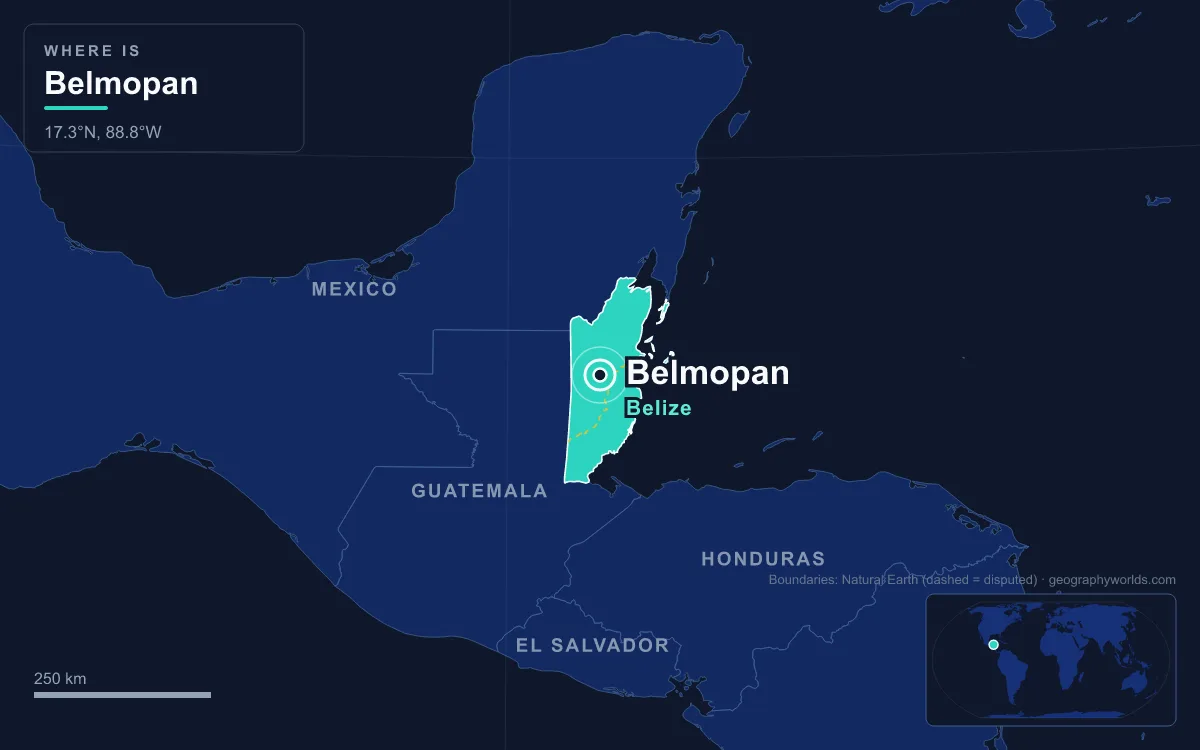
The capital of Belize is Belmopan, not Belize City. It is a planned inland city in the Cayo District, about 80 km west of the coast at 76 metres above sea level, and it had 20,754 residents in the 2022 census, making it the smallest national capital by population in the continental Americas. The government moved there in 1970 after Hurricane Hattie wrecked the old capital in 1961, and the city was designed from scratch around a ring road with a National Assembly Building shaped like a Maya temple at its centre. The easiest way to understand it is to walk it, from the highway in to the hills beyond.
Arriving on the George Price Highway
Most people reach Belmopan the way its founders did, along the road from the coast. The George Price Highway, built in the 1930s as the Western Highway and renamed in 2012 after the prime minister who led Belize to independence, runs from Belize City past Hattieville and the Belize Zoo, skirts the northern edge of the capital and continues through San Ignacio to the Guatemalan border at Benque Viejo. Hattieville is a clue to why the capital is where it is: the village began as a refugee camp for people made homeless by the storm it is named after, and never went away.
Hurricane Hattie came ashore south of Belize City on 31 October 1961 after peaking at Category 5. The governor estimated that its winds and storm surge damaged about 70 per cent of the buildings, left more than 10,000 people homeless and killed 307 people in the territory, then known as British Honduras. Belize City is low-lying and coastal, and it had already been devastated by a 1931 hurricane that killed well over 1,000 people. Hattie did heavier damage than that storm, about $60 million in losses, and only early warnings kept its death toll far lower. The colonial government concluded that the seat of government had to move to higher ground.
In 1962 a committee chose a site 82 km southwest of the old capital, on the east side of the Belize River. Premier George Price took a delegation to London in 1964 to ask for money, and to win British support he invited Anthony Greenwood, the Secretary of State for the Commonwealth and Colonies, to see the site. On 9 October 1965 Greenwood dedicated it, an event recorded on a monument at mile 49 of the highway. The name joins two rivers: the Belize, the country's longest, and the Mopan, which rises in Guatemala's Petén and meets the Macal at Branch Mouth to form the Belize River.
Inside the Ring Road
Turn off the highway and the plan becomes obvious. The city is organised around the Ring Road, a loop just under 4 km around, with most government buildings inside it or strung along it and a large share of the enclosed land left as parkland. There is no old quarter, because the city was built on a thinly populated stretch of bush.
Building it was a lesson in budgeting. The first estimate was 40 million Belize dollars, but only 20 million were available. Work began anyway in 1967, and the first phase was finished in 1970 for 24 million. For the next three decades the city had no council of its own; the Reconstruction and Development Corporation, known as Recondev, ran its services on behalf of the national government.
Up the Steps of the National Assembly Building
The Ring Road leads to the civic core, and the core leads to one building. The National Assembly Building is the focal point of the plan: grey stone, approached by broad flights of steps, deliberately modelled on a pre-Columbian Maya temple to reflect the country's Maya heritage. Both houses have sat here since 1970. The House of Representatives has 31 elected members, one for each constituency, and the Senate has 13 appointed members; the bicameral assembly dates from 31 December 1963, when it replaced the colony's single Legislative Assembly.
Around it clusters the large group of government buildings that house much of the civil service, and many of the city's residents work in them. The original buildings were designed with extensive ventilation openings to cope with the tropical heat. The result gives the walls of the original government buildings a distinctive pock-marked look.
The 2003 Market, Mot Mot Lane and the City Council
Beyond the ministries the planned city gives way to the everyday one. A bus terminal and market complex was built in 2003, giving the capital a commercial hub of its own. Belmopan now has approximately 589 business establishments, up from 373 in the 1997 census, and five international banks have branches here, but there is still very little industry: about 200 acres are zoned for it, with a 100-acre industrial park planned near the airstrip.
On Mot Mot Lane stands the Belmopan Public Library, inaugurated on 24 August 1970 with funding from the British Overseas Development Mission because the first residents asked for one. Self-government arrived later than the library. Residents voted in a 1999 referendum to elect their own council, Belmopan was incorporated as a city in 2000, and Anthony Chanona of the People's United Party became its first mayor. It is one of only two places in Belize with city status, alongside Belize City. The council promotes Belmopan as "The Garden City", and community events are often held at the George Price Centre.

Embassies, the Guatemalan Claim and the University of Belize
A walk past Belmopan's embassies shows how slowly the city was believed in. Many foreign governments hesitated to move their missions inland, unsure the new town would really function as a capital. The British High Commission opened in 1981, the year British Honduras became independent Belize on 21 September, and moved to its present site in 1984. The United States began building its chancery in February 2005 and opened it on 11 December 2006. Mexico, Brazil, Costa Rica, El Salvador and Venezuela also have embassies here, and Ecuador, Chile and the Dominican Republic have consulates. Even so, Belize City still hosts four embassies and 29 consulates, the larger share of the diplomatic community.
One neighbour's relationship with the capital is complicated by geography. Guatemala claims roughly 53 per cent of Belize's mainland, including large parts of the Cayo District in which Belmopan stands, arguing that it inherited Spain's rights and that Britain broke the 1859 Wyke-Aycinena Treaty by never building a road the treaty promised; Belize holds that the 1859 boundary is valid. Guatemala recognised Belize's independence in the early 1990s, and both countries have since voted to let the International Court of Justice decide the claim, Guatemala in a referendum on 15 April 2018 (about 95 per cent in favour) and Belize on 8 May 2019 (55.4 per cent).
The central campus of the University of Belize is also here, with colleges of education and arts, management and social sciences, science and technology, and nursing. Its Regional Language Centre teaches English to students from neighbouring Spanish-speaking countries, a reminder that Belize is the only Central American nation with English as its official language. The university's teams play as the Black Jaguars. Across the city the population mixes Kriol, Garifuna, Mestizo and Maya Belizeans with more recent arrivals from China and Taiwan.
Out to Hector Silva Airstrip and Guanacaste National Park
On the northern edge of the city, off the George Price Highway, the walk runs out at Hector Silva Airstrip, a paved runway of about 1,100 metres with no control tower or hangars. The British Army expanded it in 2002 so it could take C-130 Hercules transports, and the Belize Defence Force still uses it, but as of 2024 it had no scheduled passenger flights; travellers drive about 80 km to Belize City, home to the country's only international airport, instead.
Just outside the city the Hummingbird Highway leaves the George Price Highway and runs toward Dangriga in the Stann Creek District, partly following the bed of the old Stann Creek Railway. Near the capital, on the north side of the George Price Highway just east of the Roaring Creek bridge, the 50-acre Guanacaste National Park protects the giant guanacaste tree that loggers spared because its trunk split into three. It became a Crown Reserve in 1973 and a national park in 1990, and its trails pass mahogany, Belize's national tree.
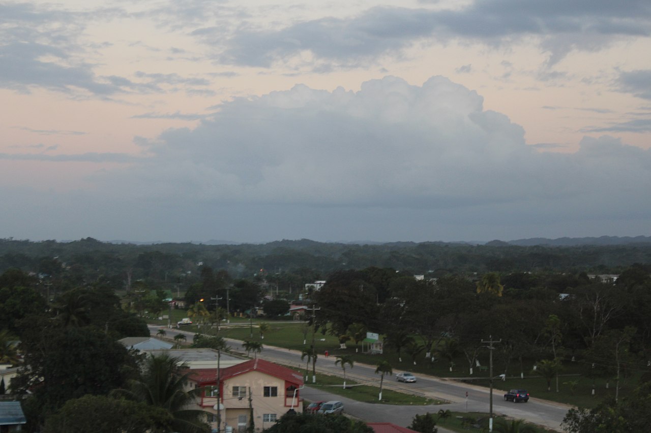
The weather follows you the whole way. Belmopan has a tropical monsoon climate with a long wet season from May to January; March and April are the driest months, each averaging around 45 mm of rain, and monthly mean temperatures stay between 23 and 28 °C. Half a century after the first ministries opened, the capital remains quieter than the port it replaced, home to about 5 per cent of a country of 397,483 people. Belmopan belongs to the same family as Brasília and Canberra, capitals built on empty land for political reasons, which our look at planned cities around the world compares; for the closest parallel in Latin America read about Brasília, and for everything beyond the ring road see our Belize country guide.
Quick Facts About Belmopan
- Country: Belize
- Continent: North America (Central America)
- Country population: approximately 429 thousand
- Capital city status: Belmopan is the capital of Belize, the seat of national government, and the location of foreign embassies, parliament, and the head of state's official residence.
Frequently Asked Questions
What is the capital of Belize?
The capital of Belize is Belmopan. Belmopan is the seat of national government, hosts most foreign embassies and consulates, and is typically where the head of state and parliament are located.
What continent is Belmopan in?
Belmopan, the capital of Belize, is located in North America, in the Central America region. As Belize's capital, Belmopan serves as the country's primary connection to the broader North American political, economic, and cultural sphere.
Why is Belmopan the capital of Belize?
Belmopan was chosen as the capital of Belize for reasons that typically combine geography, history, and politics. Capital city selections often reflect a desire for centrality (being accessible from across the country), historical importance (being a longstanding seat of government or culture), or neutrality (being acceptable to multiple regions or ethnic groups within the country). The specific reasons for Belmopan's designation are detailed in the city's history above.
What is Belmopan known for?
As the capital of Belize, Belmopan is best known for housing the country's central government institutions — parliament, presidential or royal residences, supreme court, and key ministries. It is also typically a major cultural and economic center within Belize, hosting national museums, embassies, and signature monuments. The introduction and history sections above provide detailed coverage of the city's specific notable institutions and landmarks.
Related Pages
- Belize Country Guide — full geography, climate, economy, and culture overview
- Flag of Belize — meaning, history, and design of Belize's national flag