

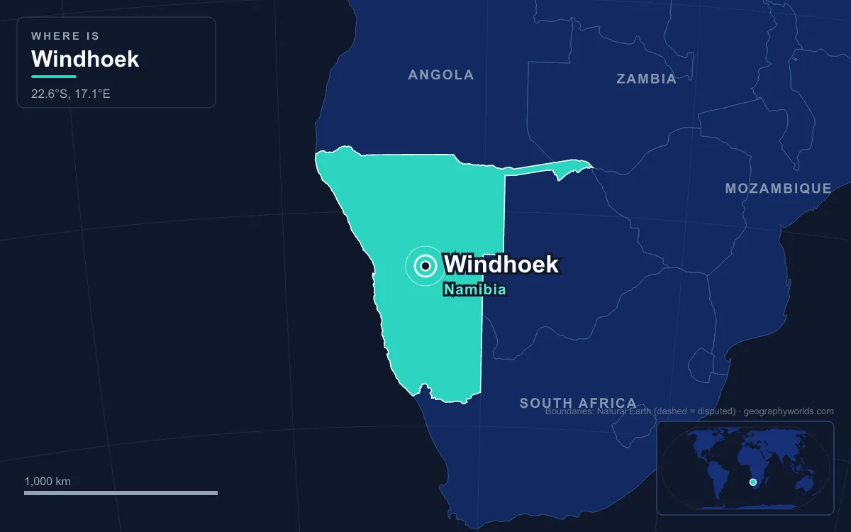
The capital of Namibia is Windhoek, the country’s largest city, which stands at about 1,700 metres on the Khomas Highland plateau close to Namibia’s geographical centre. About 486,000 people lived there in 2023, and nearly every ministry, national company, university and newspaper in the country is based in the city. Windhoek grew up around a cluster of hot springs in a dry landscape, was founded twice, in 1840 and again in 1890, and still carries both beginnings in its streets. The easiest way to read the city is to walk it, starting where the water comes out of the ground.
Klein Windhoek, Where the Springs Rise
Begin in Klein Windhoek, today a leafy suburb east of the centre and the oldest part of town. Here, beside one of the main hot springs, the Orlam leader Jonker Afrikaner settled with a following of about 800 people in 1840. He built a stone church that could hold 500 and doubled as a school. Rhenish missionaries Carl Hugo Hahn and Franz Heinrich Kleinschmidt arrived in 1842 and tried to name the place Elberfeld, but they were displaced by the Wesleyan Methodists Richard Haddy and Joseph Tindall in 1844, and Jonker’s name for the settlement won out. The earliest known written use of “Windhoek” is in a letter from Jonker to Tindall dated 12 August 1844. Most people derive it from the Afrikaans for “wind corner”; another theory links it to the Winterhoek Mountains near Tulbagh in South Africa, where Jonker’s ancestors had lived.
The first town did not last. Wars between the Nama and the Herero wrecked the settlement, and when Hahn returned in 1873 nothing of its gardens remained. A Swiss botanist passing through in June 1885 found only jackals and starving guinea fowl among overgrown fruit trees. Catholic missionaries who arrived in 1896 bought the old Rhenish land in 1899 and turned it back into an orchard and vineyard, which is why this corner of the city still feels greener than the rest.
Up to the Alte Feste on Robert Mugabe Avenue
Walk west and uphill to the ridge along Robert Mugabe Avenue, where the second Windhoek began. Germany had declared a protectorate over South West Africa in 1884, and in 1890 it sent a Schutztruppe detachment under Major Curt von François to hold it. He picked the abandoned site because it sat between Nama and Herero territory and because its twelve strong springs could water crops. On 18 October 1890 the foundation stone of his fort, the Alte Feste or Old Fortress, was laid, and that date is still treated as the city’s founding.
The whitewashed fort, with its inner courtyard and four towers, is the oldest surviving building in Windhoek, although its final layout was only completed in 1915. That same year South African troops occupied the town. The fort later became a school hostel in 1935, was declared a National Monument in 1957 and now houses part of the National Museum. Its neighbour is a sharp contrast: the Independence Memorial Museum, opened on 20 March 2014, a tall, angular building made by the North Korean firm Mansudae Overseas Projects and flanked by a statue of Sam Nujoma, Namibia’s first president, and a Genocide Memorial. The ground it stands on was known in Otjiherero as Orumbo rua Katjombondi, “a place of horror”. A German equestrian monument that had celebrated victory in the 1904–1907 war against the Herero and Nama was taken down in December 2013.
Christuskirche and the Tintenpalast Gardens
A few steps further, on a traffic island, stands the Christuskirche. Its foundation stone was laid on 11 August 1907 and it was dedicated on 16 October 1910, originally as a “Church of Peace” after the colonial wars. Architect Gottlieb Redecker used quartz sandstone quarried near the Avis Dam, with a portico of Carrara marble from Italy and a spire 24 metres high; the stained-glass windows were a gift from Emperor Wilhelm II. It still serves a German-speaking Lutheran congregation.

Across the road lies the Parliament building, known since German times as the Tintenpalast, the “Ink Palace”, a nickname for the quantity of ink its clerks were thought to use. Redecker designed this one too, and the firm Sander & Kock built it between 1912 and 1913 as the colonial administration’s headquarters, using forced labour by Herero and Nama survivors of the genocide who had been held in concentration camps. It opened on 12 April 1913. Since independence in 1990 it has housed Namibia’s parliament, now both the National Assembly and the National Council, and it has grown too small for the larger assembly created by a 2014 constitutional amendment. The Parliament Gardens in front are one of the most used green spaces in the city. Elsewhere along the ridge stand the three mock castles built by the architect Wilhelm Sander, Heinitzburg, Sanderburg and Schwerinsburg, from the years when colonial Windhoek was expanding along the ridge.
Down Independence Avenue, Once Kaiserstrasse
From the ridge, drop down to Independence Avenue, the main commercial street. Under German rule it was Kaiserstrasse, and in 1928 it became the first paved road in Windhoek. Gabled colonial buildings now stand beside glass office towers, and the Zoo Park offers shade halfway along. Off the avenue, in Post Street Mall, a fountain displays pieces of the Gibeon meteorite. Between 1911 and 1913, 33 fragments weighing between 195 and 506 kilograms were hauled to the capital from the Gibeon area in the south. The collection became a National Monument on 15 February 1950, yet thefts over the years mean only 29 remain on show today.

The avenue’s name is a political statement. When the First World War ended German rule, South Africa governed the territory, first as a League of Nations mandate from 1920 and, after the UN General Assembly declared the mandate terminated on 27 October 1966, in defiance of the United Nations until Namibia became independent in 1990. Windhoek gained formal town status on 18 October 1965, the 75th anniversary of von François’s fort, and a statue of him was unveiled outside the municipal offices the same day. It was removed on 23 November 2022 and placed in the city museum.
North to Katutura, 8 Kilometres From the Old Location
To see the other half of Windhoek’s story, head west out of the centre. The suburb of Hochland Park covers the site of the Old Location, the area to which the council moved all Black residents in 1912. Sam Nujoma was among the pupils at its St Barnabas school. In the 1950s the municipality and the South African administration decided to clear it and move its residents 8 kilometres north. Residents objected: they owned their plots in the Old Location, the new ones were smaller and rented, and they would need a bus to reach work. On 10 December 1959 police opened fire on protesters, killing 11 and wounding 44. Namibia now marks 10 December as Human Rights Day.
The new township, created in 1961, was given its name by the people forced into it: Katutura, Otjiherero for “the place where people do not want to live”. By 1962 about 7,000 people had been moved, joining some 2,000 already there. In 1971 the general strike of contract workers against the migrant labour system started from Windhoek. Katutura today holds the Sam Nujoma Stadium, built in 2005, and a state hospital, while informal settlements keep spreading on its edges. In 2020 the city counted about 41,900 informal dwellings holding close to 100,000 people.

Out to the Town Lands and Heroes’ Acre
The last leg of the walk is really a drive, because Windhoek’s boundary now runs far beyond the built-up area. In 2011 the government pushed the city limits out by at least 50 kilometres in each direction, so that the town lands cover about 5,133 square kilometres. By area that ranks Windhoek among the largest cities in the world, yet the density is only about 63 people per square kilometre. The expansion swallowed Hosea Kutako International Airport, 42 kilometres east of the centre, and outlying settlements such as Groot Aub, which was only brought under city administration in 2017. Rocky hills to the south, east and west, and aquifers under the southern side, leave the Brakwater area to the north as the main direction for growth.
Ten kilometres south, off the B1 road to Rehoboth, lies Heroes’ Acre, the national war memorial opened on 26 August 2002 and, like the independence museum, built by Mansudae. Its marble obelisk and bronze Unknown Soldier overlook 174 tombs; President Hage Geingob was buried there in 2024.
From the hills around the memorial it is easy to see why water decides everything here. Windhoek averages about 378 millimetres of rain a year, almost all of it between November and April, and the 2018/19 season brought only about 107 millimetres. The city answered scarcity early: in 1958 it opened the world’s first plant to treat sewage directly back into drinking water.
That dryness links the capital to the rest of the country, from the coastal Namib Desert in the west to the Kalahari sands in the east, a contrast set out in our Namib versus Kalahari comparison. Windhoek is where most journeys to those deserts begin, and the wider context, from Etosha to the Caprivi Strip, is in our Namibia country guide.
Quick Facts About Windhoek
- Country: Namibia
- Continent: Africa (Southern Africa)
- Country population: approximately 3.2 million
- Capital city status: Windhoek is the capital of Namibia, the seat of national government, and the location of foreign embassies, parliament, and the head of state's official residence.
Frequently Asked Questions
What is the capital of Namibia?
The capital of Namibia is Windhoek. Windhoek is the seat of national government, hosts most foreign embassies and consulates, and is typically where the head of state and parliament are located.
What continent is Windhoek in?
Windhoek, the capital of Namibia, is located in Africa, in the Southern Africa region. As Namibia's capital, Windhoek serves as the country's primary connection to the broader African political, economic, and cultural sphere.
Why is Windhoek the capital of Namibia?
Windhoek was chosen as the capital of Namibia for reasons that typically combine geography, history, and politics. Capital city selections often reflect a desire for centrality (being accessible from across the country), historical importance (being a longstanding seat of government or culture), or neutrality (being acceptable to multiple regions or ethnic groups within the country). The specific reasons for Windhoek's designation are detailed in the city's history above.
What is Windhoek known for?
As the capital of Namibia, Windhoek is best known for housing the country's central government institutions — parliament, presidential or royal residences, supreme court, and key ministries. It is also typically a major cultural and economic center within Namibia, hosting national museums, embassies, and signature monuments. The introduction and history sections above provide detailed coverage of the city's specific notable institutions and landmarks.
Related Pages
- Namibia Country Guide — full geography, climate, economy, and culture overview
- Flag of Namibia — meaning, history, and design of Namibia's national flag