

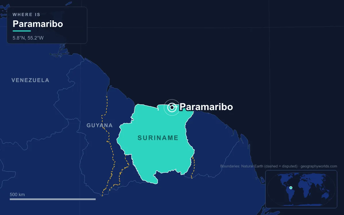
The capital of Suriname is Paramaribo, a port city on the west bank of the Suriname River about 15 kilometres inland from the Atlantic. It had an estimated 252,581 inhabitants in 2025, roughly two-fifths of Suriname’s population, and it is by far the country’s largest city. Locals call it “Foto.” Its Dutch colonial centre of white-painted timber houses has been a UNESCO World Heritage Site since 2002, and the best way to understand the city is to walk it, from the riverfront inland to the monument to emancipation.
Waterkant, Where the Fire of 1821 Started
Start on the Waterkant, the oldest street in Paramaribo. It runs along the river from Onafhankelijkheidsplein to the Central Market, and for centuries this was where ships were loaded and unloaded; the Suriname River here is more than a kilometre wide. The first Dutch trading post near the native village the early sources call Parmurbo was set up in 1613, and the name probably comes from the Paramaribo people who lived at the river mouth. Walk early: highs average about 30 °C all year, the city receives roughly 2,135 millimetres of rain annually, and the driest stretch runs from September to November, while April to July is the wettest.
What you see today is largely a rebuilding. On 21 January 1821 a fire broke out at the corner of the Waterkant and the square and destroyed about 400 houses in the centre. The city architect gave the street a new face of monumental white wooden buildings with galleries, the style that UNESCO later singled out. A second fire in September 1832 burned nearly 50 more buildings; three enslaved men, Kodjo, Mentor and Present, were convicted of arson and burned alive.
At the far end of the street stands the Central Market, finished in 1969 with room for 950 stalls. Its double-arched roof ventilates the hall, and the money changers who once crowded outside earned it the nickname “Central Bank.”
Onafhankelijkheidsplein and the Presidential Palace
Walk back along the river to Onafhankelijkheidsplein, Independence Square, the political heart of the country. Around it stand the National Assembly, the Court of Justice and the Ministry of Finance, and on one side the Presidential Palace, one of the best-kept examples of Dutch colonial architecture in Suriname.
The palace dates from 1730, when Governor-General Charel Emilius Hendrik de Cheusses enlarged the existing governor’s residence. A grand gallery and a third floor were added after 1780, and in 1911 the portico and terrace gave it its present size. The name of the square is a reminder that the governor’s house became a president’s house only on 25 November 1975, when Suriname became independent from the Netherlands. Paramaribo has been the capital throughout, from colony to republic. Since a reorganisation in 1987 the city has been divided into 12 administrative resorts, which together form the Paramaribo District.
Palmentuin, the Royal Palm Garden Behind the Palace
Behind the palace lies the Palmentuin, a grove of tall royal palms. They were planted on the orders of Cornelis van Aerssen van Sommelsdijck, governor from 1683 to 1688, who opened the garden to the public in 1685. When he took over the colony he found only 27 or 28 houses around the fort, and he began extending the settlement along the Waterkant and the Gravenstraat. In 1688 he was murdered by mutinous soldiers, and the garden stayed closed to the public until the early 20th century.
Today capuchin monkeys and tropical birds live in the palms. A statue of Henck Arron, the first prime minister of independent Suriname, was placed here in 2008, and a bust of Trefossa, who wrote the words of the national anthem, in 2013. In 2009 UNESCO provided US$147,000 to restore the garden, which was cited specifically in the 2002 World Heritage listing.
Fort Zeelandia and the December Murders of 1982
A short walk along the river brings you to Fort Zeelandia, where the city’s colonial history begins. The French built a wooden fort on the site in 1640. English settlers sent from Barbados by Francis Willoughby arrived in 1650, reinforced it in 1651 and named it Fort Willoughby, and around 1665 the village beside it outgrew the earlier English settlement of Torarica.
In 1667, during the Second Anglo-Dutch War, the Dutch admiral Abraham Crijnssen took the fort after a battle of only three hours, when the English defenders ran out of ammunition. He renamed it Fort Zeelandia after the Dutch province that had paid for his fleet, and the Treaty of Breda that year confirmed Paramaribo as the leading town of Dutch Suriname. The Dutch tried to rename the town New Middelburg, but the name never caught on.

The fort’s darkest chapter is recent. In the 1980s it was the headquarters of the military government of Dési Bouterse, and on 7, 8 and 9 December 1982 fifteen prominent young critics of the regime were taken there and killed. The December murders remain a raw subject in Suriname. The fort now houses the Surinamese Museum, with collections of archaeology, colonial furniture, textiles and historic photographs.
Keizerstraat, Where a Synagogue Stands Beside a Mosque
Head inland to the Keizerstraat. At number 82 stands the Neveh Shalom Synagogue. Sephardi Jews bought the lot in 1716 and completed a first building in 1723; the Ashkenazim took it over in 1735. The present white wooden synagogue, designed by J. F. Halfhide, was begun on 3 July 1835 in the presence of Prince Henry of the Netherlands and completed in 1842. Many of the first English settlers of the 1650s were Jews, and Suriname’s earliest synagogue stood upriver at Jodensavanne before the community moved to the capital.

Next door is the Mosque Keizerstraat, headquarters of the Lahore Ahmadiyya movement in Suriname. The city’s Muslim community was established in 1929 and completed its first wooden mosque on the site in 1932; Muhammad Ali visited it in 1979, and the present building with its minarets and dome dates from 1984. The synagogue and the mosque stand directly beside each other, a pairing that sums up the city’s mix of faiths.
Saints Peter and Paul, the Cedar Cathedral
A short walk away rises the Cathedral Basilica of Saints Peter and Paul, Paramaribo’s wooden Catholic cathedral. Catholics in Paramaribo first worshipped in a former Jewish theatre, De Verrezene Phoenix, built in 1809 and converted into a church in 1826. It later served as the city’s Catholic cathedral.
When the congregation outgrew it, the diocese built on the same site. Construction to a design by Frans Harmes began on 30 January 1883, the cathedral was consecrated in 1885, and the twin towers were finished in 1901. The interior is made of unpainted Surinamese cedar. After a poorly executed restoration in 1977 the building fell into disrepair, with tilting and termite damage, until a major restoration allowed it to reopen in 2010. Pope Francis made it a minor basilica in 2014.
Kwakoe and the Road from 1863 to Today’s Mix
Continue north to the corner of Zwartenhovenbrugstraat and Dr. Sophie Redmondstraat, near the Ondrobon bus station, where a statue of a man breaks his chains. This is Kwakoe, by the sculptor Jozef Klas, unveiled by Prime Minister Johan Adolf Pengel on 30 June 1963 on the eve of the centenary of abolition. Slavery in Suriname ended on Wednesday 1 July 1863, and “Kwakoe” means Wednesday in the Kromanti ritual language of the Maroons. The anniversary is celebrated every year as Keti Koti.
Some 300,000 enslaved Africans had been brought to Suriname. Even after 1863 the freed were required to keep working on the plantations until 1873, when many left for the city and Paramaribo’s population grew sharply. Planters then recruited indentured workers, mostly from British India and the Dutch East Indies, and their descendants gave the capital its present mix.
Creoles of African or mixed African-European descent form the largest group at 27%, followed by East Indians at 23%, people of multiple heritage at 18%, Maroons, descendants of those who escaped slavery, at 16%, and Javanese at 10%. Smaller numbers of Indigenous people, Chinese, Dutch, Portuguese, Lebanese and Jews complete the picture, and in recent decades Brazilians, Guyanese and new Chinese migrants have settled here too.
Over the Jules Wijdenbosch Bridge to Meerzorg
End the walk, or the drive, at the Jules Wijdenbosch Bridge, which carries the East-West Link 1,504 metres across the Suriname River to Meerzorg in Commewijne District. Built by the Dutch firm Ballast Nedam and opened on 20 May 2000, it gave the capital a fixed road link to the eastern side of the river.
That view explains the city’s weight. Paramaribo makes no significant goods of its own, but nearly all the revenue from Suriname’s gold, oil, bauxite, rice and timber passes through its banks and offices, and about 75% of the country’s GDP is spent here. It has the Anton de Kom University, the country’s only university, and is served by Johan Adolf Pengel International Airport. For the wider country beyond the bridge, see our Suriname country guide; for why Suriname is counted as South American despite its Caribbean ties, read whether Suriname is in South or North America; and to compare another Dutch-founded timber capital on the same coast, walk on to Georgetown in neighbouring Guyana.
Quick Facts About Paramaribo
- Country: Suriname
- Continent: South America
- Country population: approximately 645 thousand
- Capital city status: Paramaribo is the capital of Suriname, the seat of national government, and the location of foreign embassies, parliament, and the head of state's official residence.
Frequently Asked Questions
What is the capital of Suriname?
The capital of Suriname is Paramaribo. Paramaribo is the seat of national government, hosts most foreign embassies and consulates, and is typically where the head of state and parliament are located.
What continent is Paramaribo in?
Paramaribo, the capital of Suriname, is located in South America. As Suriname's capital, Paramaribo serves as the country's primary connection to the broader South American political, economic, and cultural sphere.
Why is Paramaribo the capital of Suriname?
Paramaribo was chosen as the capital of Suriname for reasons that typically combine geography, history, and politics. Capital city selections often reflect a desire for centrality (being accessible from across the country), historical importance (being a longstanding seat of government or culture), or neutrality (being acceptable to multiple regions or ethnic groups within the country). The specific reasons for Paramaribo's designation are detailed in the city's history above.
What is Paramaribo known for?
As the capital of Suriname, Paramaribo is best known for housing the country's central government institutions — parliament, presidential or royal residences, supreme court, and key ministries. It is also typically a major cultural and economic center within Suriname, hosting national museums, embassies, and signature monuments. The introduction and history sections above provide detailed coverage of the city's specific notable institutions and landmarks.
Related Pages
- Suriname Country Guide — full geography, climate, economy, and culture overview
- Flag of Suriname — meaning, history, and design of Suriname's national flag