

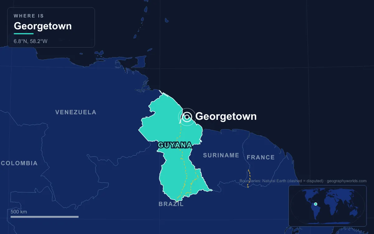
Georgetown, the capital and largest city of Guyana, sits on the Atlantic coast at the mouth of the Demerara River, on land that lies below the level of the high tide. The 2022 census recorded 125,683 people in the city. It holds the Parliament, State House, the Court of Appeal and the Secretariat of the Caribbean Community (CARICOM), and it is known for its painted timber buildings, its Dutch-built drainage canals and a seawall that keeps the ocean out. Its story runs through five eras, from a Dutch guard post to the capital of one of the fastest-growing economies in the world.
Dutch Stabroek on the Demerara, 1748–1812
The city began as a lookout. In 1748 Laurens Storm van ’s Gravesande, the Dutch governor of neighbouring Essequibo, built a guard post at the mouth of the Demerara River. Demerara had been created as a separate colony in 1745, and its sugar estates grew so quickly that by 1780 there were almost 200 plantations along the river, most of them owned by English and Scottish planters working enslaved Africans.
The colony’s administration was moved in 1755 to Borsselen Island, about 32 kilometres upriver, but planters kept building houses around the guard post at the coast. During a brief French occupation of the Dutch colony in 1782 that cluster was laid out as a town called Longchamps. It became the colony’s capital in 1782, and in 1784 it was renamed Stabroek after Nicolaas Geelvinck, Lord of Stabroek and president of the Dutch West India Company. In 1789 Stabroek had 780 inhabitants, 239 of them white. By 1807 it had grown to about 8,500, and American traders had built a wharf known as the American Stelling.
The colony’s survival depended on alliances. When enslaved people rose in neighbouring Berbice in 1763, van ’s Gravesande allied with the Lokono, Kalina, Warao and Akawaio peoples to stop the revolt spreading to Demerara and Essequibo, and sent 50 soldiers to help. Demerara’s founding documents had already declared the Amerindians free people who could not be enslaved.
Control changed hands repeatedly in these years. Britain seized Demerara, Essequibo and Berbice in 1796, handed them back to the Batavian Republic under the Treaty of Amiens in 1802, and took them again in 1803. The Netherlands formally ceded the colonies in the Anglo-Dutch Treaty of 1814.
George III’s Town and the 1823 Uprising, 1812–1838
In 1812 the British renamed the town Georgetown in honour of King George III. The old name survived in a single ward, a quarter of a mile broad and a mile long, still called Stabroek. The Dutch grid and canals were kept, and new public buildings in a British idiom went up around them: St Andrew’s Kirk in 1818 and the Parliament Building between 1829 and 1834.
Georgetown in this period was the capital of a slave colony, and the sugar estates around it were where the era’s defining event took place. On 18 August 1823 between 9,000 and 12,000 enslaved people rose in the Demerara rebellion, believing, wrongly, that Parliament in London had abolished slavery and that the colonial authorities were hiding the news. The largely nonviolent uprising lasted two days and was crushed by Governor John Murray. Between 200 and 500 people were killed in the fighting; 27 men were executed afterwards and their bodies displayed for months. John Smith, the English missionary accused of involvement, was sentenced to death and died in jail while awaiting the outcome of his appeal.
In 1831 Demerara-Essequibo and Berbice were merged into a single colony, British Guiana, with Georgetown as its capital. Britain’s Slavery Abolition Act came into force on 1 August 1834, and the apprenticeship system that tied freed people to the estates ended on 1 August 1838.
Sugar, Indenture and the Seawall, 1838–1945
With the end of slavery, planters looked for new labour, and the colony’s makeup changed with it. Portuguese workers, most of them from Madeira, arrived from 1835. In 1838 came the first indentured labourers from India: the Whitby sailed from Calcutta in January and landed its passengers in Berbice on 5 May 1838, the date Guyana now marks as Indian Arrival Day, and Indian indenture continued until 1917. Chinese workers followed from 1853; about 14,000 came between 1853 and 1879. Many of the Chinese who stayed after their indentures became successful retailers, and Arthur Chung, of Chinese descent, would later be independent Guyana’s first president.
Georgetown was granted city status on 24 August 1842. Its greatest threat was the sea. The city lies about 0.91 metres below high-tide level, and in 1855 the Kingston flood breached an earthen wall, inundated the Kingston ward and swept away Camp House, the former governor’s residence. Work on a masonry seawall began in 1858, built mainly by convicts with granite from the penal settlement at Mazaruni. The first stretch, from Fort Groyne to the Round House, was finished by 1860; in 1874 the Public Works department committed to a continuous wall from Camp Street to Kitty, and the wall was completed in 1892. Behind it, Dutch-style canals closed by sluice gates called kokers drain the city at low tide.

The late Victorian decades gave Georgetown the skyline it still has. Stabroek Market, designated by the town council in 1842, got its iron and steel hall and clock tower in 1880–81, fabricated by the Edgemoor Iron Company of Delaware to a design by the American engineer Nathaniel McKay; it covers about 7,000 square metres. The Victoria Law Courts followed in 1887 and the Gothic Revival City Hall, designed by the Reverend Ignatius Scoles, was completed in June 1889.
St George’s Anglican Cathedral, designed by Sir Arthur Blomfield, opened on 24 August 1892 and was completed in 1899. At 43.5 metres it is often listed among the tallest wooden buildings in the world. The Cenotaph at Main and Church Streets was added in 1923. The era ended in 1945, when the Great Fire caused widespread damage to the city centre.

From Crown Colony to Cooperative Republic, 1945–1992
After the Second World War, Georgetown became the stage for the colony’s politics. A new constitution in 1953 brought universal adult suffrage, and in the election of 27 April 1953 the People’s Progressive Party won 18 of the 24 seats in the House of Assembly. Fearing communist influence, Britain suspended the constitution and sent troops, occupying British Guiana on 9 October 1953 and ruling through an interim government until elections in 1957.
Guyana became independent on 26 May 1966 and a republic within the Commonwealth on 23 February 1970. The new state nationalised the sugar and bauxite industries under Forbes Burnham. Georgetown took on a regional role when CARICOM was created by the Treaty of Chaguaramas, effective 1 August 1973, with Guyana among its four founders; the Secretariat has its headquarters in the city. For the 1972 Non-Aligned Foreign Ministers Conference, Wai-Wai builders raised the Umana Yana, a conical palm-thatched benab on High Street; it burned in 2010 and was rebuilt in 2016.
These decades also brought hardship. Nationalisation, an exodus of skilled workers and ageing infrastructure weighed on the economy, and the historian Walter Rodney, born in Georgetown, was assassinated in the city in 1980. The elections of 5 October 1992, monitored by former US president Jimmy Carter, were the first since 1964 recognised internationally as free and fair.
Oil-Boom Georgetown, 2015 to Today
Through the early 2000s Georgetown was losing people. The census counted 134,497 residents in 2002, of whom 53% identified as Black or African, 24% as mixed, 20% as East Indian and smaller numbers as Amerindian, Portuguese and Chinese, a mix that reverses the national pattern, in which Indo-Guyanese are the largest group. It counted only 118,363 in 2012, a fall of 12%. Then an offshore oil field was discovered about 190 kilometres from Georgetown in 2015, and commercial production began in 2019. Guyana’s economy grew by 49% in 2020, by some accounts the fastest rate in the world, and since 2017 more than 11 billion barrels of reserves have been found off the coast. By the 2022 census the city’s population had recovered to 125,683.
The money is visible on the roads and river. The Heroes Highway, commissioned in 2022, eased traffic on the East Bank of Demerara, and on 5 October 2025 the Bharrat Jagdeo Demerara River Bridge replaced the old Demerara Harbour Bridge as the main crossing to Region 3. Eugene F. Correia International Airport at Ogle, closer to the city than Cheddi Jagan International at Timehri, handles regional flights and helicopters serving the offshore industry. Northeastern Georgetown, around the University of Guyana and the CARICOM Secretariat, is home to high-income neighbourhoods such as Bel Air Park and Lamaha Gardens, while Albouystown and Sophia in the south remain poor.
The boom has also sharpened an old question on the country’s western side. Venezuela claims the Essequibo region, some 159,500 square kilometres west of the Essequibo River and most of Guyana’s territory, and rejects the 1899 Paris Arbitral Award that set the border; Guyana, which administers the region, took the question to the International Court of Justice, which ruled in December 2020 that it had jurisdiction to hear the case. The background is laid out in our comparison of Venezuela and Guyana.
Georgetown remains a low, green, wooden city behind its wall, with most of Guyana’s population living along the same narrow coastal strip. It is also one of the few capitals in South America that belongs to the Caribbean world, a quirk explained in whether Guyana counts as South American or Caribbean, and the rest of the country is covered in our Guyana country guide.
Quick Facts About Georgetown
- Country: Guyana
- Continent: South America
- Country population: approximately 841 thousand
- Capital city status: Georgetown is the capital of Guyana, the seat of national government, and the location of foreign embassies, parliament, and the head of state's official residence.
Frequently Asked Questions
What is the capital of Guyana?
The capital of Guyana is Georgetown. Georgetown is the seat of national government, hosts most foreign embassies and consulates, and is typically where the head of state and parliament are located.
What continent is Georgetown in?
Georgetown, the capital of Guyana, is located in South America. As Guyana's capital, Georgetown serves as the country's primary connection to the broader South American political, economic, and cultural sphere.
Why is Georgetown the capital of Guyana?
Georgetown was chosen as the capital of Guyana for reasons that typically combine geography, history, and politics. Capital city selections often reflect a desire for centrality (being accessible from across the country), historical importance (being a longstanding seat of government or culture), or neutrality (being acceptable to multiple regions or ethnic groups within the country). The specific reasons for Georgetown's designation are detailed in the city's history above.
What is Georgetown known for?
As the capital of Guyana, Georgetown is best known for housing the country's central government institutions — parliament, presidential or royal residences, supreme court, and key ministries. It is also typically a major cultural and economic center within Guyana, hosting national museums, embassies, and signature monuments. The introduction and history sections above provide detailed coverage of the city's specific notable institutions and landmarks.
Related Pages
- Guyana Country Guide — full geography, climate, economy, and culture overview
- Flag of Guyana — meaning, history, and design of Guyana's national flag