

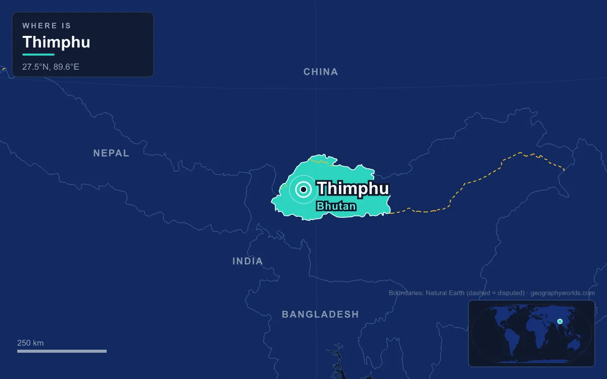
Thimphu, the capital and largest city of Bhutan, stretches north to south along the west bank of the Wang Chhu (Thimphu River) in the western Himalaya. It sits between 2,248 and 2,648 metres above sea level, which makes it the highest capital in Asia. The 2017 census counted 114,551 people. Thimphu has been the capital only since the 1950s: the decision to move from Punakha was taken in 1952, and the city was officially declared capital in 1961. Before that it was a few scattered hamlets around a fortress-monastery. Today's city was built by farmers, monks, road crews, weavers, civil servants and newcomers from every corner of the kingdom, and its story is best told through them.
Ngalop Farmers, Drukpa Monks and the Language of the Fortress
The first people of the Thimphu valley were farming families. Before 1960 the valley held a string of hamlets, among them Motithang, Changangkha, Changlimithang, Langchupakha and Taba. Several of those names survive as city districts today. The families were mostly Ngalop, people of Tibetan origin whose ancestors began arriving in Bhutan as early as the ninth century. They brought Tibetan Buddhism and a Tibetan-derived language with them, and the Ngalop remain the dominant group in western Bhutan, Thimphu included.
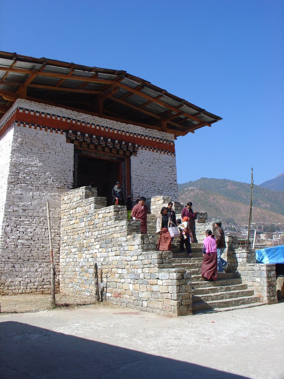
Monks and religious teachers arrived early as well. Changangkha Lhakhang, one of the oldest temples in the valley, was founded by Phajo Drugom Zhigpo, who brought the Drukpa lineage to Bhutan, and was extended by his son in the thirteenth century. Up the valley, the Tibetan lama Zhabdrung Ngawang Namgyal founded Cheri Monastery in 1620, and in 1623 he set up the first Drukpa Kagyu monastic order in Bhutan there. In 1641 he took over the valley's fortress and renamed it Tashichho Dzong, the "fortress of the glorious religion". The dzong became both a monastery and a seat of government, and it still works that way. It holds the King's throne room, the central secretariat and the ministries of Home Affairs and Finance, and every autumn its courtyards host the masked Cham dances of the Thimphu Tshechu festival.
The language of the city grew out of this fortress world. Dzongkha, Bhutan's national language, means "the language of the fortress". It is native to eight western districts, Thimphu among them, and around 2013 it had about 171,000 native speakers and some 640,000 speakers in total. In the early 1960s it replaced Chöke, the classical Tibetan used by monks, as the language of teaching in public schools. Simtokha Dzong, a fortress built in 1629 about 5 kilometres south of the centre, now houses a Dzongkha language institute.
Indian Road Crews and a Capital Built After 1961
A capital needs roads, and Bhutan had almost none. On 24 April 1961, the year Thimphu officially became capital, the third king, Jigme Dorji Wangchuck, and Indian Prime Minister Jawaharlal Nehru agreed to set up Project DANTAK. It is a unit of India's Border Roads Organisation, and its job was to build and maintain motor roads in Bhutan. DANTAK hired Bhutanese workers along with labourers from Indian border districts such as Jaigaon and Alipurduar, and DANTAK still works on the highway between Thimphu and Phuentsholing on the Indian border. In 2022 it resurfaced 4.5 kilometres of that road with shredded plastic as a trial. The DANTAK canteen at Takthi, about halfway along the route, is a regular stop for travellers.
India's role shows in the city itself. Thimphu has two Indian-run hospitals, DANTAK's at Simtokha and the IMTRAT hospital in the main town. India funded much of Bhutan's early development under successive five-year plans. Bhutan joined the Colombo Plan in 1962, the Universal Postal Union in 1969 and the United Nations in 1971, and each step brought diplomats and aid agencies to Thimphu, which helped a village turn into a small city. When Bhutan first opened to tourists in 1974, the new state Tourism Corporation was based in Thimphu. The Motithang Hotel, built for the coronation of Jigme Singye Wangchuck that same year, stood alone in the forest. The Motithang district of houses and gardens grew up around it in the 1980s.
Sharchops, Lhotshampas and the Pull of the Capital
Since the 1970s Thimphu has grown mainly through people moving in from the countryside, and that migration has brought all of Bhutan's main communities into one valley. Sharchops, the "easterners", are often counted as the country's largest single ethnic group. Most speak Tshangla, and many have taken on the Ngalop culture of the west. Lhotshampas, the "southern borderlanders", are Bhutanese of Nepali descent who began settling the southern foothills in the nineteenth century. They speak Nepali and are mostly Hindu or Buddhist. The three groups share offices, schools and apartment blocks in the capital.
That coexistence has a difficult recent past, and Thimphu was where the policy behind it was made. In the 1980s the government adopted a "One Nation, One People" policy meant to build a single national identity around Ngalop dress, language and customs. In 1989 the Driglam Namzha code became mandatory, requiring citizens to wear the gho and kira in public during business hours, and Nepali was dropped from the school curriculum. Some Lhotshampas objected to both measures. Bhutan's first full census in 1988 used 1958, the year of the Citizenship Act, as its cut-off, and residents who could not prove they had lived in the country before then were classed as illegal immigrants. Protests and violence followed. The government's position was that it was removing illegal immigrants and dealing with attacks on the state. Refugees and human rights groups reported mass loss of citizenship and forced deportation. By the 1990s more than 100,000 Lhotshampas had left or been expelled and were living in camps in eastern Nepal. Most were resettled in the United States, Canada, Australia and Europe from 2007 onward. A US State Department estimate still put Lhotshampas at around 35 percent of Bhutan's population in 2008, and the comparison of Nepal and Bhutan sets out how closely the two Himalayan kingdoms are linked.
Weavers, Painters and Traffic Police Along Norzin Lam
For a city that barely existed in 1960, Thimphu works hard at keeping crafts alive. The traditional "thirteen arts and crafts", Zorig Chusum, take in wood carving, painting, papermaking, blacksmithing, weaving, sculpture and more. They are believed to have been formally categorised under Gyalse Tenzin Rabgye, the fourth Druk Desi, who ruled from 1680 to 1694. Today they are taught at the National Institute of Zorig Chusum in Kawajangsa, the country's main centre for art education, and the Zangma Handicrafts Emporium sells what its students make. The Bhutan Textile Museum and the National Library are on Norzin Lam, the main street, and a building code requires every new building to use traditional Bhutanese design, with painted Buddhist motifs.
Traders have long met in Thimphu. For years merchants from all over Bhutan brought goods to the central square at weekends and slept in the open. Platforms were put up in 1986 and covered market halls in 1989. In 2006 the handicraft stalls moved across a new traditional-style bridge, built in 2005, to the other side of the river. The weekend market sells vegetables, yak butter, cheese, wooden bowls and fabric, and weekend shoppers, many in gho and kira, reach it over that footbridge.
Thimphu's best-known workers may be the Royal Bhutan Police officers at its main junctions. The force was formed on 1 September 1965 with 555 personnel moved over from the Royal Bhutan Army, and it grew past 1,000 by the late 1970s; its national headquarters sits in the city's Hospital Area, south of the Memorial Chorten. At Thimphu's busiest junctions, traffic has long been directed by police officers rather than signals. Local authorities once installed a set of traffic lights but removed them before they began operating, and officers in white gloves direct cars from painted pavilions instead.

Archers, Civil Servants and the Thimphu of 2027
Changlimithang is where Thimphu comes together. In 1885 a battle on this ground cleared the way for Ugyen Wangchuck to take control of the country, and he became the first king in 1907. Changlimithang Stadium was built on the site in 1974, and the 2008 coronation of Jigme Khesar Namgyel Wangchuck took place in the refurbished stadium. Its archery range hosts national competitions in the national sport. In the Bhutanese form, two targets stand more than 100 metres apart, teams shoot from one end to the other, rivals gather by the target to mock the archer, and matches come with food, singing and dancing. The same stadium hosted "The Other Final" in 2002, when Bhutan beat Montserrat 4–0 on the day of the World Cup final.
Government is Thimphu's main business. Since 2008, when Bhutan became a parliamentary democracy under a constitutional monarch, Thimphu has been the seat of the elected government. The National Assembly meets in a building across the river from the dzong, originally built for a SAARC summit, and the Royal University of Bhutan, the national university, was founded by royal decree in 2003. The Jigme Dorji Wangchuck National Referral Hospital, opened in 1972, treats patients from every district.
The next generation of residents will live in a city shaped by one plan. The Thimphu Structure Plan was drawn up by the American architect Christopher Charles Benninger, first developed in 1998 and approved in 2003. It bans building within 30 metres of a river or stream, pushes car traffic to the edge of the centre, and expects the city to reach about 162,000 people by 2027. Whether Thimphu can take that many newcomers without losing its valley forests is the question for the next decade. Bhutan's other regions, from Punakha's old capital to the eastern hills the Sharchops come from, are covered in the Bhutan country guide, and the city makes a useful contrast with the much larger Himalayan capital of Kathmandu in neighbouring Nepal.
Quick Facts About Thimphu
- Country: Bhutan
- Continent: Asia (South Asia)
- Country population: approximately 802 thousand
- Capital city status: Thimphu is the capital of Bhutan, the seat of national government, and the location of foreign embassies, parliament, and the head of state's official residence.
Frequently Asked Questions
What is the capital of Bhutan?
The capital of Bhutan is Thimphu. Thimphu is the seat of national government, hosts most foreign embassies and consulates, and is typically where the head of state and parliament are located.
What continent is Thimphu in?
Thimphu, the capital of Bhutan, is located in Asia, in the South Asia region. As Bhutan's capital, Thimphu serves as the country's primary connection to the broader Asian political, economic, and cultural sphere.
Why is Thimphu the capital of Bhutan?
Thimphu was chosen as the capital of Bhutan for reasons that typically combine geography, history, and politics. Capital city selections often reflect a desire for centrality (being accessible from across the country), historical importance (being a longstanding seat of government or culture), or neutrality (being acceptable to multiple regions or ethnic groups within the country). The specific reasons for Thimphu's designation are detailed in the city's history above.
What is Thimphu known for?
As the capital of Bhutan, Thimphu is best known for housing the country's central government institutions — parliament, presidential or royal residences, supreme court, and key ministries. It is also typically a major cultural and economic center within Bhutan, hosting national museums, embassies, and signature monuments. The introduction and history sections above provide detailed coverage of the city's specific notable institutions and landmarks.
Related Pages
- Bhutan Country Guide — full geography, climate, economy, and culture overview
- Flag of Bhutan — meaning, history, and design of Bhutan's national flag