

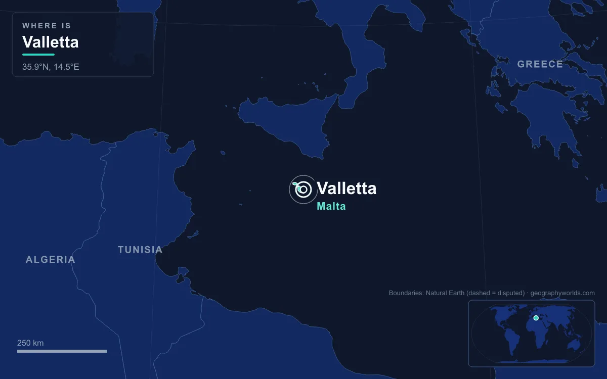
The capital of Malta is Valletta, a walled city built by the Knights of St John on the Sciberras Peninsula, a finger of limestone between the Grand Harbour to the east and Marsamxett Harbour to the west. It had 5,226 residents in July 2024 and covers just 0.61 square kilometres, making it one of the smallest capitals in the European Union. What sets it apart is that the whole city was planned at once, on a grid, after the Great Siege of 1565, and almost all of it survives: UNESCO listed the entire city as a World Heritage Site in 1980. The best way to understand it is to walk it, from the landward gate to the fort at the tip.
Why the Knights Built on Mount Sciberras
Before 1566 the peninsula held almost nothing. The Order of St John, based in Malta since 1530, had proposed a city there as early as 1524, but the only structure was a watchtower dedicated to Saint Elmo, built in 1488 and replaced by a star fort in 1552. The Great Siege, from 18 May to 8 September 1565, showed why that was dangerous: Ottoman guns placed on the bare ridge of Mount Sciberras pounded Fort St Elmo below them, and the fort fell on 23 June after holding out for nearly a month.
Grand Master Jean Parisot de Valette resolved to fortify the ridge itself. Pope Pius V lent his military engineer Francesco Laparelli, Philip II of Spain sent money, and de Valette laid the foundation stone on 28 March 1566. He died in 1568 without seeing the city that bears his name. Laparelli’s plan broke with the winding lanes of older Maltese towns: long, straight streets on a rectangular grid, running from the land gate to Fort St Elmo. After Laparelli’s death in 1570 his Maltese assistant, Girolamo Cassar, took over and designed many of the key buildings. On 18 March 1571 Grand Master Pierre de Monte moved his seat from Fort St Angelo in Birgu, and Valletta became the capital.
City Gate, Parliament House and Pjazza Teatru Rjal
The walk starts on a bridge over the deep rock-cut ditch of the Land Front, between St James’ and St John’s bastions. The gate you pass through is the fifth on the site. The first, Porta San Giorgio, went up in 1569; it was rebuilt in 1633, replaced by a larger Victorian gate in 1853, and that one was pulled down in 1964 for a Rationalist design by Alziro Bergonzo, itself demolished in 2011. Renzo Piano’s current gate, finished in 2014, is a wide, open break in the wall that marks the start of the main street.
Just inside stands Piano’s Parliament House, two stone-clad blocks of three floors joined by bridges and kept apart so they do not hide St James Cavalier from Republic Street. It was inaugurated on 4 May 2015. Its site once held the Valletta terminus of the Malta Railway, which linked the capital to Mdina from 1883 until it closed in 1931, once buses had taken its passengers. Until 2015 the House of Representatives met inside the Grandmaster’s Palace further down the street.

Next door are the ruins of the Royal Opera House, designed by Edward Middleton Barry, architect of London’s Covent Garden theatre, and opened on 9 October 1866 with 1,095 seats. A fire gutted it in 1873; it reopened with Verdi’s Aida in 1877, then took a direct hit from Luftwaffe bombers on 7 April 1942. For decades the stumps of its columns stood as a war memorial by default. Piano turned them into an open-air venue, Pjazza Teatru Rjal, which began staging performances in 2013.
Republic Street to St John’s Co-Cathedral
Republic Street, Triq ir-Repubblika, is the spine of Laparelli’s grid and the old Strada Reale. It runs dead straight for the length of the peninsula to Fort St Elmo, and because the ridge rises in the middle and falls towards both harbours, every cross street tips downhill to the water, many of them in flights of steps.

A short detour off Republic Street leads to St John’s Co-Cathedral, the Knights’ conventual church, commissioned by Grand Master Jean de la Cassière in 1572 and designed by Cassar. Its façade is plain, almost military. The interior is the opposite: in the 1660s Grand Master Raphael Cotoner had the Calabrian painter Mattia Preti redecorate it in full Baroque, with carved stone walls, a painted vault and chapels for each of the Order’s langues, where Grand Masters such as Manoel de Vilhena and Pinto da Fonseca lie under marble monuments. In the oratory hangs Caravaggio’s The Beheading of Saint John the Baptist of 1608, the largest canvas he painted and the only one he signed. De Valette himself was moved here from his first grave in Our Lady of Victories.
St George’s Square and the Grandmaster’s Palace
Back on Republic Street, the grid opens into St George’s Square, faced by the Main Guard on one side and the Grandmaster’s Palace on the other. The palace was first planned for higher ground to the south, which is why South Street was originally called Strada del Palazzo, but it ended up here, filling a whole block between Archbishop Street, Old Theatre Street and Merchants Street. Begun as a knight’s house of 1569, enlarged into a palace from 1574 and extended into the 18th century, it served in turn as the Grand Masters’ residence, the French “National Palace” after 1798 and the British Governor’s Palace from 1800. It hosted Malta’s parliament from 1921 to 2015 and today holds the Office of the President; its State Rooms and Armoury reopened to visitors after restoration in 2024.
The Knights’ administration left other marks nearby. The city had its own council, the Università, from 1577 until the British governor Thomas Maitland abolished it in 1818; local government only returned with the Local Councils Act of 1993.
Auberge de Castille and the Upper Barrakka Gardens
Doubling back along Merchants Street brings you to Castile Place, beside St James Cavalier. The Auberge de Castille was originally Cassar’s single-storey lodging for the knights of Castile, León and Portugal, built in 1573–74. Grand Master Pinto da Fonseca had it torn down and rebuilt in Spanish Baroque between 1741 and 1744 to designs by Andrea Belli. It later served as British military headquarters and now houses the Office of the Prime Minister.
A few steps away, the Upper Barrakka Gardens sit on the upper tier of St Peter and St Paul Bastion, built in the 1560s. Their arcades were added in 1661 for the knights of the Italian langue and lost their roof after the Rising of the Priests in 1775. Opened to the public in 1800, the terrace is the highest point of the city walls and looks across the Grand Harbour to the Three Cities and the dockyard. The Saluting Battery below still fires its guns at noon and 4 pm, and a lift, rebuilt in 2012, drops to Lascaris Wharf.

Old Theatre Street, Manderaggio and the Marsamxett Side
Crossing the ridge to the western, Marsamxett side of town changes the mood. On Old Theatre Street stands the Manoel Theatre, built in just ten months in 1731 at the personal expense of Grand Master António Manoel de Vilhena “for the honest recreation of the people”. Its oval auditorium has 534 seats in three tiers of gilded wooden boxes, and it is reputed to be the third-oldest working theatre in Europe.
Below it the grid frays into neighbourhoods with their own names. Manderaggio, behind the Manderaggio Curtain, was meant to become a small harbour, a mandracchio, that was never finished; a slum grew in the hollow instead and was cleared in the 1950s for housing estates. Il-Baviera takes its name from the Auberge de Bavière, the eighth auberge, added in the 18th century, and Il-Biċċerija from a slaughterhouse that once stood there.
Fort St Elmo and the Tip of the Peninsula
Republic Street ends where Valletta began, at Fort St Elmo. Laparelli rebuilt the shattered fort in 1566, and it commands the entrances to both harbours alongside Fort Tigné and Fort Ricasoli across the water. It saw action again on 26 July 1941, when its guns helped beat off an Italian seaborne attack on the Grand Harbour. The Second World War cost Valletta dearly: the Royal Navy had moved its Mediterranean Fleet headquarters away in 1939 because Malta was so close to Italy, and the harbour area was bombed relentlessly in the siege that followed. In April 1942 King George VI awarded the whole island the George Cross. The fort has housed the National War Museum since 1975, reopening with a larger collection in May 2015 after restoration.
From the tip, the Sacra Infermeria, the Knights’ hospital of 1574, now the Mediterranean Conference Centre, lies a short walk back along the Grand Harbour wall. The circuit is short, yet it takes in four and a half centuries of planning, war damage and repair. Weather rarely spoils it: the chart below shows why Valletta is often listed among Europe’s sunniest capitals.
Summer highs at Luqa reach about 32 °C in August and January highs about 16 °C, with most of the year’s roughly 580 mm of rain falling between October and February, a pattern our guide to the best time to visit Malta turns into practical advice. Valletta has served as the capital of the Knights, the French, the British and, since 1964, an independent Malta; the rest of the islands, from Mdina to Gozo, are covered in the Malta country guide, and the long-running question of which continent the archipelago belongs to is settled in is Malta in Europe or Africa.
Quick Facts About Valletta
- Country: Malta
- Continent: Europe (Southern Europe)
- Country population: approximately 549 thousand
- Capital city status: Valletta is the capital of Malta, the seat of national government, and the location of foreign embassies, parliament, and the head of state's official residence.
Frequently Asked Questions
What is the capital of Malta?
The capital of Malta is Valletta. Valletta is the seat of national government, hosts most foreign embassies and consulates, and is typically where the head of state and parliament are located.
What continent is Valletta in?
Valletta, the capital of Malta, is located in Europe, in the Southern Europe region. As Malta's capital, Valletta serves as the country's primary connection to the broader Europen political, economic, and cultural sphere.
Why is Valletta the capital of Malta?
Valletta was chosen as the capital of Malta for reasons that typically combine geography, history, and politics. Capital city selections often reflect a desire for centrality (being accessible from across the country), historical importance (being a longstanding seat of government or culture), or neutrality (being acceptable to multiple regions or ethnic groups within the country). The specific reasons for Valletta's designation are detailed in the city's history above.
What is Valletta known for?
As the capital of Malta, Valletta is best known for housing the country's central government institutions — parliament, presidential or royal residences, supreme court, and key ministries. It is also typically a major cultural and economic center within Malta, hosting national museums, embassies, and signature monuments. The introduction and history sections above provide detailed coverage of the city's specific notable institutions and landmarks.
Related Pages
- Malta Country Guide — full geography, climate, economy, and culture overview
- Flag of Malta — meaning, history, and design of Malta's national flag