

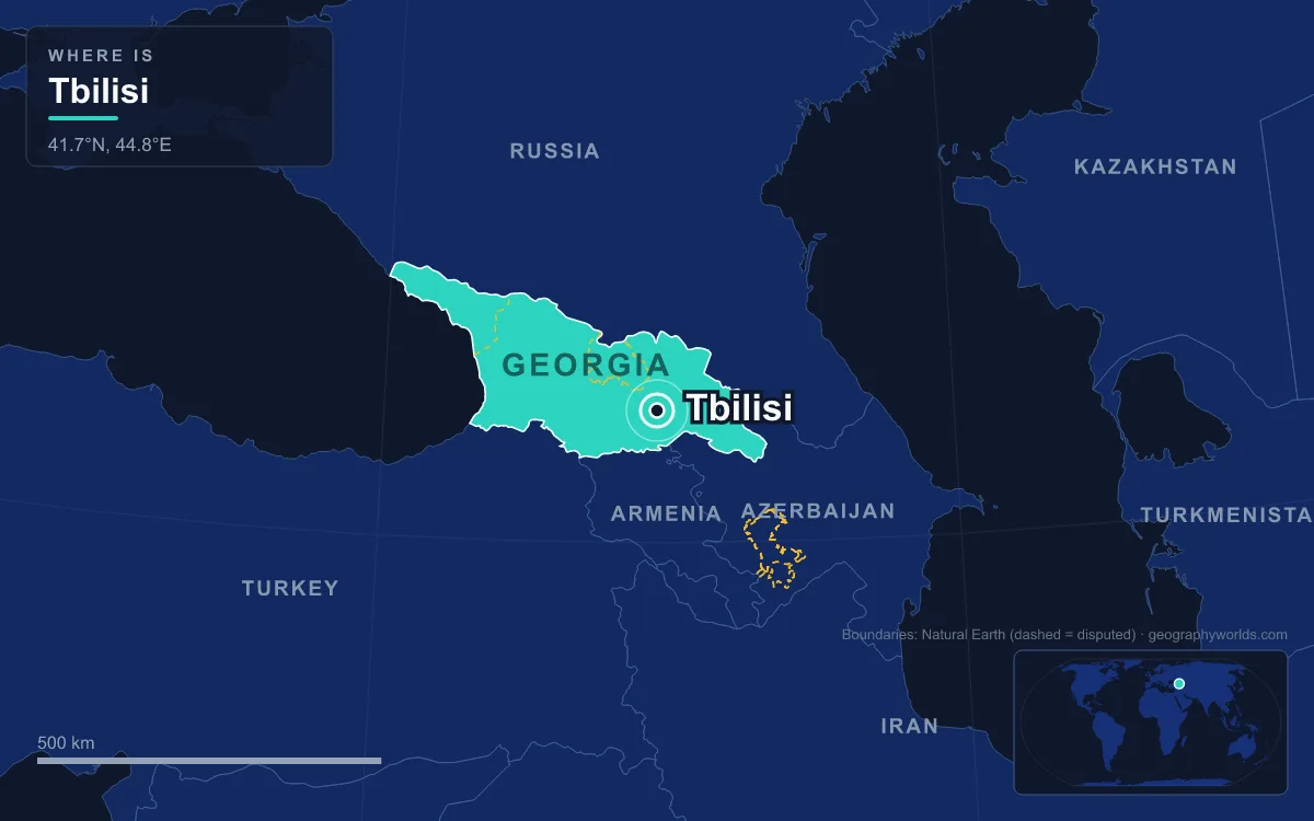
Tbilisi is the capital and largest city of Georgia, spread along both banks of the Kura River (the Georgians call it the Mtkvari) in the east of the country, in the South Caucasus. The national statistics office counted about 1,369,400 residents on 1 January 2026, roughly a third of Georgia’s 3.9 million people. What defines the city is its site: a narrow river gorge with warm sulphur springs at its foot, closed in on three sides by mountains, which is exactly why a 5th-century king chose it and why so many empires fought to hold it.
The Kura Gorge Between Metekhi and Narikala
From the Metekhi cliff the logic of Tbilisi is laid out below you. The Kura, a 1,515-kilometre river that rises in north-eastern Turkey and ends in the Caspian Sea, squeezes here between two rocky heights. On the left bank, Metekhi rises sheer from the water; on the right, the ridge crowned by Narikala fortress climbs steeply from the riverbank. A river crossing that could be watched from both sides, with a fortified hill above it, made an obvious strongpoint in a region where armies moved along the valleys.
Narikala is older than the city’s founding legend. The earliest written record of a fortress on the ridge dates to around 364, during the reign of King Varaz-Bakur. It was enlarged by the Umayyads in the 7th century and again by King David the Builder (1089–1125), and the Mongols gave it the name Narin Qala, “little fortress”. Most of the walls you see now were built in the 16th and 17th centuries, and parts were damaged in an 1827 earthquake and later pulled down. Metekhi, across the gorge, was traditionally the site of a royal residence, which is where its name, “the area around the palace”, comes from. The domed Metekhi Church of the Assumption on the clifftop was built by King Demetrius II around 1278–1284. Under Russian rule it was used as a barracks, and from 1819 the citadel beside it was replaced by a prison that did not close until 1938.

Hot Springs in Abanotubani: Why Vakhtang Built Here
The city’s name is a piece of geography. Tbilisi comes from the Old Georgian word tpili, “warm”, so the name means something like “the warm place”, after the sulphurous hot springs that surface at the foot of the Narikala ridge. The best-known version of the founding story has King Vakhtang I Gorgasali of Iberia, who ruled in the second half of the 5th century, out hunting in dense forest with a falcon. The falcon brought down a pheasant, both birds fell into a hot spring, and the king was so struck by the water that he ordered the forest cleared and a city built.
His successor, King Dachi (r. 522–534), finished what Vakhtang had started: he moved the capital of Iberia from Mtskheta, about 20 kilometres to the north at the meeting of the Kura and Aragvi rivers, to Tbilisi, and began building the defensive wall that marked out the new city. The district where the springs rise is still called Abanotubani, literally the “bath district”. By the end of the 13th century, 65 baths were recorded in Tbilisi. The bathhouses that survive are built partly underground, so from the street you see mostly a field of low brick domes.
Until 1936 most of the world knew the city by the Persian form of its name, Tiflis. On 17 August 1936 the Soviet authorities replaced the Russian form with Tbilisi, based on the modern Georgian word tbili, and most languages followed. A few languages, Turkish and German among them, still use Tiflis.
A River Crossing Coveted From Persia to St Petersburg
The same site that made Tbilisi easy to defend also placed it on the routes between the Black Sea and the Caspian, and between the Near East and the steppe north of the Caucasus, close to the Silk Road trade. That drew in almost every power in the region. Persian armies held the city from the 570s. Byzantine and Khazar forces sacked it in 627, and Arab armies under Marwan II entered in 736–738 and set up an emirate here that lasted, with interruptions, until around 1050. The Seljuk sultan Alp Arslan took the city in 1065.
Tbilisi became the capital of a united Georgia in 1122. After defeating the Seljuks at the Battle of Didgori in 1121, King David IV besieged the city, took it, and moved his court there from Kutaisi. By the end of the 12th century the population had reached about 100,000, and in Queen Tamar’s reign the poet Shota Rustaveli worked in the city while writing The Knight in the Panther’s Skin. This golden age did not last. The Khwarezmian ruler Jalal al-Din captured Tbilisi in 1226, Georgia submitted to the Mongols in 1236, and Timur sacked the city on 22 November 1386.
From the 16th to the 18th century Tbilisi changed hands between Safavid Iran and the Ottoman Empire. The Ottomans took it in August 1578 and held it for about 40 years, and from 1614 to 1747 it served, with breaks, as the seat of the Iranian-appointed vassal kings of Kartli. Looking for protection, King Heraclius II signed the Treaty of Georgievsk with Russia in 1783. It did not save the city: in 1795 the Qajar ruler Agha Mohammad Khan captured it and destroyed it. That destruction is why so few buildings in Tbilisi are older than the 19th century. In 1801 Russia annexed the kingdom of Kartli-Kakheti, and until 1917 Tiflis served as the seat of the Caucasus Viceroyalty, which governed territory on both sides of the mountains.
Climbing Out of the Valley: Sololaki, Mtatsminda and Saburtalo
Tbilisi covers about 504 square kilometres, and its terrain shapes where people live. The city lies between 380 and 770 metres above sea level and forms a rough amphitheatre. The Saguramo Range closes it off to the north, spurs of the Trialeti Range run along its south and west, and the Iori plain opens to the east and south-east. On the left bank the built-up area runs more than 30 kilometres along the river, from Avchala to the Lochini river. The right bank is a different matter: Trialeti’s slopes often come straight down to the water, so building there is squeezed into dense pockets with empty hillsides in between.
Growth has usually meant climbing. Sololaki, one of the oldest neighbourhoods, sits on the right bank below Mount Mtatsminda. Once the gardens of Georgian nobles, it was built up in the 19th century; in 1847–1851 part of the Sololaki gorge around present-day Freedom Square was developed. Russian planners laid out a European-style grid here and along Golovin Avenue, now Rustaveli Avenue, where the viceroys lived. Many Art Nouveau buildings went up in Sololaki and Chughureti between the mid-1890s and 1917.

Mtatsminda, the “Holy Mountain”, is the city’s highest point. A funicular railway first built in 1905 climbs almost 300 metres from Chonkadze Street to the park and television tower on the summit, and reopened in 2012 after years of closure. Its halfway stop serves the Mtatsminda Pantheon around St David’s Church. The first burials there were the Russian writer Alexander Griboyedov and his Georgian wife Nino Chavchavadze, and the pantheon was made official in 1929. Other Soviet-era cable cars still bridge the city’s steep ground: the Turtle Lake aerial tramway, which first opened in 1965, reopened in 2016, and since 2012 a gondola has run from Rike Park on the left bank up to Narikala.
After the Second World War a housing shortage pushed Tbilisi onto flatter ground to the north-west, where whole districts such as Saburtalo and Dighomi went up in a few decades. The Tbilisi Metro also had to work around the hills. It was the fourth metro in the Soviet Union, built between 1952 and 1966, and it now has two lines and 23 stations. On the uneven ground some track runs above the surface, and two stations are above ground. North-east of the centre, on the Iori plateau, the Tbilisi Sea is a reservoir about 9 kilometres long. It supplies drinking water and irrigation for the Samgori system.
Rain Shadow of the Trialeti Range
The mountains that protect the city also shape its weather. Tbilisi sits partly in the rain shadow of the Trialeti Range and the Likhi and Abul-Samsari ranges further west, so it gets about half the rainfall of western Georgia. The Greater Caucasus to the north keeps out much of the cold air from Russia. The 1991–2020 normals give a mean of 2.7 °C in January and about 25 °C in July and August. Rain peaks in late spring and early summer and falls away sharply in winter.
Snow falls on about 15 to 25 days a year, but the centre rarely holds more than 40 centimetres of it, while the higher suburbs can get more than 70. The narrow valley also brings risks. In June 2015 a flood killed at least twenty people and freed animals from the city zoo into the streets.
From Viceroy’s Palace to Parliament: The Capital Since 1918
Much of Georgia’s modern political history has happened on the stretch of Rustaveli Avenue that the Russians built. In the former viceroy’s palace, national councils declared the independence of Georgia, Armenia and Azerbaijan between 26 and 28 May 1918. Tbilisi then served as capital of the Democratic Republic of Georgia, and the founding of Tbilisi State University that year made it the first university city in the Caucasus. The Red Army took the city on 25 February 1921. Tbilisi was then capital of the Transcaucasian SFSR until 1936 and of the Georgian SSR until 1991. It saw the 9 March massacre of protesters in 1956 and the deaths of 9 April 1989, the civil war fighting of December 1991 to January 1992, and in November 2003 the crowds of more than 100,000 behind the Rose Revolution.
The city is still the country’s main gateway, as its position has always made it. Parliament, the government chancellery, the Supreme Court and the National Bank are all here. The city has always been mixed, too. For much of the early 19th century its largest group was Armenian, while today about 90 percent of residents are ethnic Georgians, living alongside Armenian, Russian and Azerbaijani communities and more than 100 ethnic groups in all. More than 95 percent of residents are Christian, mostly Georgian Orthodox. About 1.5 percent are Muslim, and there is also a Yazidi temple. To see how this valley fits the wider region, read our guide to the Caucasus Mountains, which wall Georgia off to the north, then look at the countries that border Georgia and at how the city’s churches and mosques reflect religion in Georgia today.
Quick Facts About Tbilisi
- Country: Georgia
- Continent: Asia (Western Asia)
- Country population: approximately 3.8 million
- Capital city status: Tbilisi is the capital of Georgia, the seat of national government, and the location of foreign embassies, parliament, and the head of state's official residence.
Frequently Asked Questions
What is the capital of Georgia?
The capital of Georgia is Tbilisi. Tbilisi is the seat of national government, hosts most foreign embassies and consulates, and is typically where the head of state and parliament are located.
What continent is Tbilisi in?
Tbilisi, the capital of Georgia, is located in Asia, in the Western Asia region. As Georgia's capital, Tbilisi serves as the country's primary connection to the broader Asian political, economic, and cultural sphere.
Why is Tbilisi the capital of Georgia?
Tbilisi was chosen as the capital of Georgia for reasons that typically combine geography, history, and politics. Capital city selections often reflect a desire for centrality (being accessible from across the country), historical importance (being a longstanding seat of government or culture), or neutrality (being acceptable to multiple regions or ethnic groups within the country). The specific reasons for Tbilisi's designation are detailed in the city's history above.
What is Tbilisi known for?
As the capital of Georgia, Tbilisi is best known for housing the country's central government institutions — parliament, presidential or royal residences, supreme court, and key ministries. It is also typically a major cultural and economic center within Georgia, hosting national museums, embassies, and signature monuments. The introduction and history sections above provide detailed coverage of the city's specific notable institutions and landmarks.
Related Pages
- Georgia Country Guide — full geography, climate, economy, and culture overview
- Flag of Georgia — meaning, history, and design of Georgia's national flag