

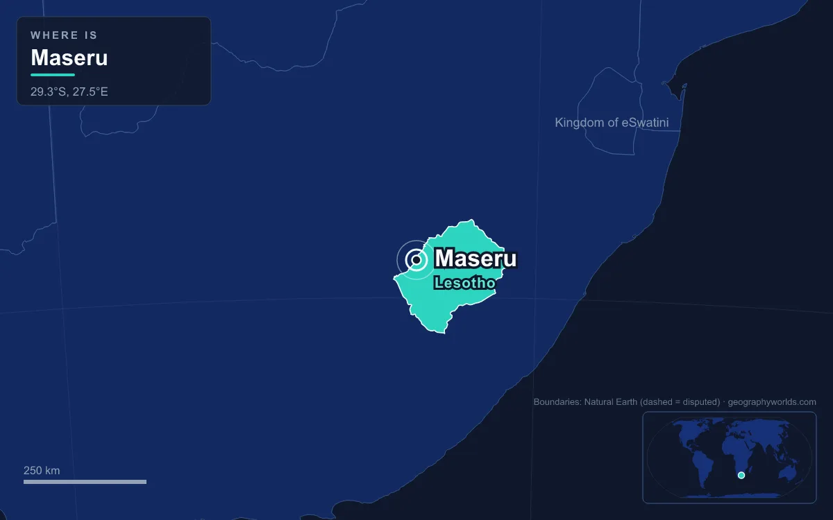
Maseru is the capital and largest city of Lesotho, the mountain kingdom entirely surrounded by South Africa. It sits in the country's north-west lowlands at about 1,600 metres above sea level, on the east bank of the Mohokare (Caledon) River, which forms the border itself: the city ends where South Africa begins. The 2016 census counted 330,760 people in Maseru, roughly one in seven of all Basotho and about half of the country's urban population. The name is Sesotho for "red sandstones", and the city began in 1869 as a small British police camp. Walking between a handful of its buildings, from the border bridge to the cathedral, gives most of Maseru's story.
Maseru Bridge on the Mohokare, Where the Camp Began in 1869
The logical place to start is the river crossing, because that is why Maseru exists. The Free State–Basotho Wars ended with Basutoland under British protection, and in 1869 Britain set up a police post on the Mohokare. The site lay at the edge of the "conquered territories", the fertile farmland west of the river that the Basotho had been forced to give up to the Orange Free State under the peace terms. The camp was 24 kilometres west of Thaba Bosiu, the mountain stronghold of King Moshoeshoe I, and a market town soon grew up around it.
Maseru's early years as capital were interrupted. From 1871 Basutoland was handed to the Cape Colony, which treated it much like annexed land. Resentment led to the Gun War of 1880–81, when many buildings in Maseru were burned. In 1884 Britain took the territory back as a Crown colony and Maseru was made capital again, a status it kept when Basutoland became the independent Kingdom of Lesotho in 1966.
Today the crossing is the Maseru Bridge border post, the main road link between the capital and South Africa. On the far bank the South African N8 road runs west to Ladybrand and on to Bloemfontein. A railway branch, built in 1905, also crosses the river to join the Bloemfontein–Bethlehem line at Marseilles, although it carries no passengers.

The river is more than a boundary. The Mohokare is Maseru's main source of water, and in dry years the city runs short; reservoirs such as the Muela and Meulspruit dams were built partly to ease that. The fertile Caledon valley was one of the reasons Basotho and Boers fought over this ground in the first place, a history covered in more depth in our guide to Lesotho.
Kingsway, Lesotho's First Paved Road
From the border, Kingsway runs east through the middle of the city. It links the old Mejametalana airfield with the Royal Palace, and for most of the colonial period it was a dirt track. It was paved in 1947 for a visit by members of the British royal family, which made it the first tarred road in Lesotho. It stayed the only paved road in the country until independence in 1966.
Maseru's two central business districts grew up along it. The western district holds the larger office blocks, department stores and banks. The eastern one is a denser mix of small shops, markets and street vendors. Both are the city's largest sources of jobs.
Kingsway also carries the scars of the worst episode in Maseru's modern history. The May 1998 election gave the Lesotho Congress for Democracy 79 of the 80 constituency seats, and opposition parties alleged fraud, although a commission led by the South African judge Pius Langa reported no evidence of electoral malpractice. Rioting spread, and the new government faced rebellion within parts of the army. At the government's request, South Africa sent troops into Lesotho on 22 September 1998 under a Southern African Development Community mandate, with Botswana also taking part. Arson and looting followed anyway, and much of Maseru's central business district was burned down. Repairs were estimated at around two billion rand, and the damage could still be seen in places until about 2008.
The rebuilt Kingsway looks different. The Pioneer Mall opened in 2009 as a South African-style shopping centre, and it was followed by Maseru Mall and City Square. The textile trade that had once made Maseru a factory town also faded. Chinese-owned clothing plants had grown fast until the Multi Fibre Arrangement expired in 2005. In 2025 the United States put a 50 percent tariff on Lesotho's goods, one of the highest in the world. Factories closed and thousands of workers were laid off before the rate was cut to 15 percent on 1 August 2025.
The Basotho Hat Building and Mount Qiloane
A short walk from Kingsway stands the building most visitors photograph first: a round, thatched structure shaped like a mokorotlo, the conical straw hat that is Lesotho's national symbol. The hat is woven from local grasses called mosea or leholi, and it appears on the national flag and on Lesotho's vehicle number plates.

The shape is usually traced to a real hill. Mount Qiloane, a conical peak close to Thaba Bosiu, is capped by a pillar of cave sandstone about 30 metres high that narrows in three great steps to a point. Its profile is believed to have inspired the hat. The origins of the mokorotlo itself are less certain. A similar hat, the toedang, was worn by the Cape Malays, and the Basotho may have adopted the style through contact with them. Chiefs seem to have taken it up in the early 20th century, and versions for women followed in the 1950s. A building in that shape puts the national symbol at the centre of a capital that began as a colonial police camp.
Our Lady of Victories Cathedral, Finished in 1955
The twin stone towers of Our Lady of Victories rise over a busy roundabout in the centre of town. The cathedral was completed in 1955 to designs by the South African architect Eduard Hebertus Antonio Payens. It is the seat of the Archdiocese of Maseru, which Pope John XXIII raised to its present rank in 1961, and Pope John Paul II visited it on his African tour of 1988.

The size of the building reflects the church's weight in national life. Lesotho is one of Africa's most Christian countries: estimates from 2011 put Christians at more than 95 percent of the population, and Catholics alone at nearly half. Nearby stands the Anglican St John's Church, another survivor of the colonial town, while the Royal Palace, the Parliament building and the State House complete the cluster of official buildings in the centre.
Parliament's roots go back further than its building. Under Moshoeshoe I, big decisions were argued out at a pitso, a public assembly called by a chief. In July 1903 the colonial authorities created the Basutoland National Council, an advisory body dominated by chiefs. Today the National Assembly has 120 members and the Senate 33, 22 of them hereditary chiefs.
Setsoto Stadium and a City That Grew Sevenfold
Setsoto Stadium, Lesotho's national ground, shows both the ambitions and the limits of the modern capital. It holds about 13,900 people, was enlarged in 2010–2011, and hosted the national football team until FIFA condemned it in 2021. Since then Lesotho has had to play its home matches abroad. Repair work stalled in 2024 for lack of money, and in 2025 the government announced a plan to raise capacity to 25,000, with completion scheduled for October 2026. Club football, meanwhile, remains a Maseru affair: most Lesotho Premier League teams are based in the capital.
The stadium sits in a city that has outgrown its colonial boundary many times over. Before 1966 the British kept Maseru small, inside an area of about 20 square kilometres. After independence the city absorbed the villages around it and now covers about 138 square kilometres. Growth ran at around 7 percent a year for decades before slowing to about 3.5 percent between 1986 and 1996.
Newer landmarks mark the edges of that expansion. Moshoeshoe I International Airport, built in 1982 to replace Mejametalana, lies about 18 kilometres south-east of the centre at Mazenod. The National University of Lesotho is further out at Roma, 32 kilometres away. Industry clusters in two zones, flour mills north of the centre along Moshoeshoe Road and textile and footwear plants in the south at Thetsane. Behind the whole city rise the Hlabeng-Sa-Likhama hills, the first foothills of the Maloti Mountains. The climate is subtropical highland: January days can reach 33°C, July nights can fall to −3°C, and nearly all of the rain comes in summer.
Thaba Bosiu, 24 Kilometres East
The last landmark is outside the city, but Maseru makes little sense without it. Thaba Bosiu is a flat-topped sandstone plateau of about 2 square kilometres, 1,804 metres above sea level, ringed by cliffs about 12 metres high. Moshoeshoe I led his followers there in July 1824 to escape the wars of the Difaqane. He named it "mountain at night" because they arrived after dark. With eight springs and room for cattle, the plateau could hold out through long sieges, and refugees who took shelter there became the core of the Basotho nation.
Thaba Bosiu was the de facto capital until the British chose a riverside camp instead, and the move says a lot about the country that followed. The mountain capital was built for defence against neighbours. The border-town capital was built for administration and trade with the territory next door. Lesotho is one of only three countries surrounded entirely by another, and the only one outside Italy; our explainer on enclaves and exclaves sets it beside Vatican City and San Marino. Maseru, pressed against the river with South Africa on the far bank, is where that geography is most obvious, and the drive from the bridge up to Thaba Bosiu climbs toward the uplands described in our guide to the Drakensberg plateau.
Quick Facts About Maseru
- Country: Lesotho
- Continent: Africa (Southern Africa)
- Country population: approximately 2.4 million
- Capital city status: Maseru is the capital of Lesotho, the seat of national government, and the location of foreign embassies, parliament, and the head of state's official residence.
Frequently Asked Questions
What is the capital of Lesotho?
The capital of Lesotho is Maseru. Maseru is the seat of national government, hosts most foreign embassies and consulates, and is typically where the head of state and parliament are located.
What continent is Maseru in?
Maseru, the capital of Lesotho, is located in Africa, in the Southern Africa region. As Lesotho's capital, Maseru serves as the country's primary connection to the broader African political, economic, and cultural sphere.
Why is Maseru the capital of Lesotho?
Maseru was chosen as the capital of Lesotho for reasons that typically combine geography, history, and politics. Capital city selections often reflect a desire for centrality (being accessible from across the country), historical importance (being a longstanding seat of government or culture), or neutrality (being acceptable to multiple regions or ethnic groups within the country). The specific reasons for Maseru's designation are detailed in the city's history above.
What is Maseru known for?
As the capital of Lesotho, Maseru is best known for housing the country's central government institutions — parliament, presidential or royal residences, supreme court, and key ministries. It is also typically a major cultural and economic center within Lesotho, hosting national museums, embassies, and signature monuments. The introduction and history sections above provide detailed coverage of the city's specific notable institutions and landmarks.
Related Pages
- Lesotho Country Guide — full geography, climate, economy, and culture overview
- Flag of Lesotho — meaning, history, and design of Lesotho's national flag