
The Saint Lawrence Seaway is one of the most remarkable waterway systems in the world, extending approximately 600 kilometers from Montreal, Quebec, to Lake Erie. Combined with the natural deep-water channels of the Great Lakes, it creates a continuous navigable route of nearly 3,700 kilometers from the Atlantic Ocean to the ports of Duluth, Minnesota, and Thunder Bay, Ontario.
Introduction
Jointly operated by Canada and the United States, the seaway was opened on June 26, 1959, fulfilling a dream that had been discussed for over a century. Its 15 locks lift ships a total of 168 meters from sea level to the elevation of Lake Erie, allowing vessels carrying up to 28,000 tonnes to reach the industrial and agricultural heartlands of both nations.
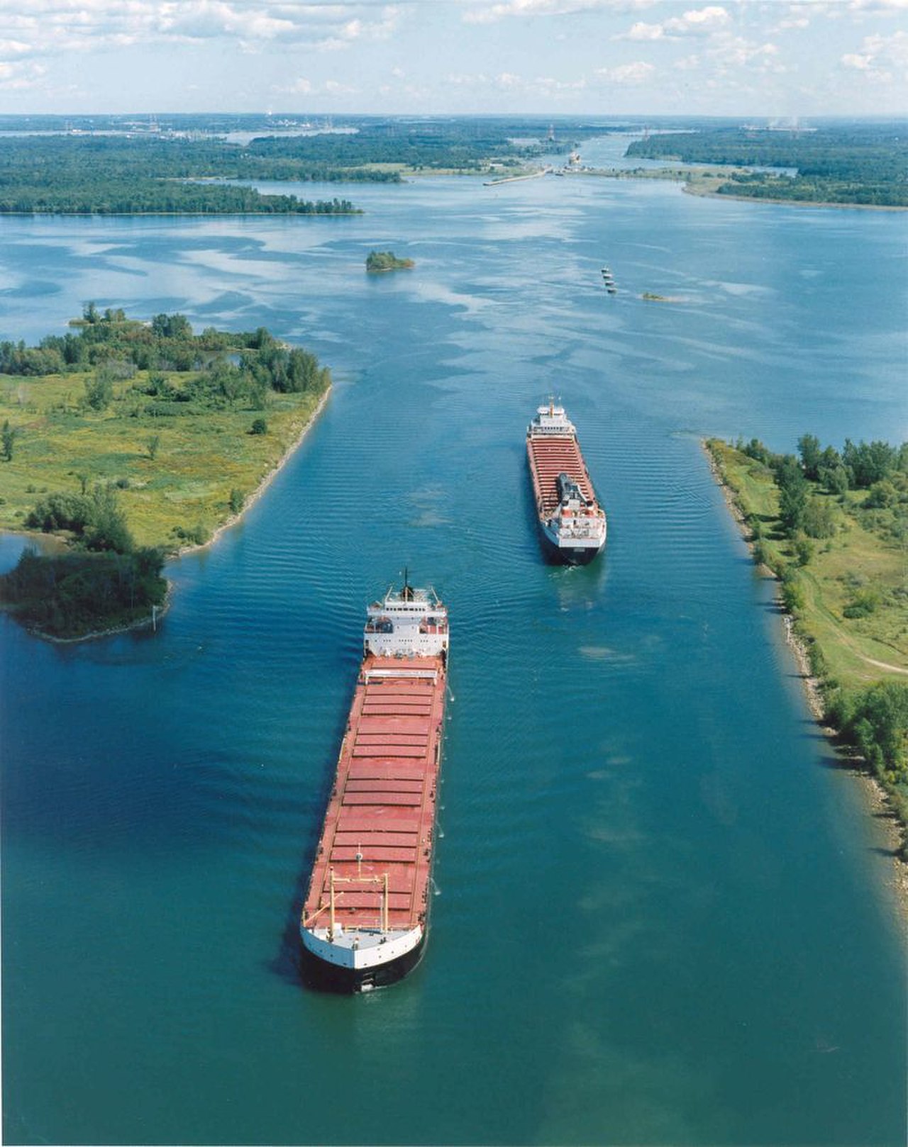
History & Construction
- Opened: June 26, 1959
- Construction Period: 1954–1959
- Cost: $470 million (US) + $330 million (Canada)
- Joint Operation: Canada and United States
Proposals for a deep-water navigation route from the Atlantic to the Great Lakes date back to the 19th century, but political disputes between Canada and the United States delayed the project for decades. Canada's threat to build the seaway unilaterally finally prompted American agreement, and construction began in 1954.
The five-year construction effort was one of the largest infrastructure projects of the 1950s. It required relocating entire towns, including the Ontario communities of Iroquois and Morrisburg, which were flooded to create Lake St. Lawrence. Over 22,000 workers participated, moving 175 million cubic meters of earth and rock.
Geographic Setting
- Length: ~600 km (Montreal to Lake Erie)
- Total Navigable Route: 3,700 km to Duluth/Thunder Bay
- Elevation Gain: 168 m from sea level to Lake Erie
- Locks: 15 locks in the seaway system
The seaway follows the St. Lawrence River from Montreal westward, passing through a series of locks that bypass rapids and dams. It crosses into Lake Ontario at Kingston, then continues through the Welland Canal — an integral component that bypasses Niagara Falls with eight locks over 43 kilometers — before reaching Lake Erie.
The route traverses a diverse landscape: from the Thousand Islands archipelago of the upper St. Lawrence, through the flat agricultural plains of southern Ontario and western New York, past the dramatic escarpment at Niagara, and into the industrial ports of Lake Erie. The seaway connects to all five Great Lakes, giving access to ports in eight US states and two Canadian provinces.
How It Works
- Lock Dimensions: 233 m long, 24.4 m wide
- Maximum Vessel Size: 225.5 m long (Seaway-max)
- Operating Season: Late March to late December
- Transit Time: ~8.5 days Montreal to Lake Superior
Ships entering the seaway from the Atlantic are limited to "Seaway-max" dimensions: 225.5 meters long, 23.8 meters wide, and 8 meters of draft. The 15 locks operate like a staircase, raising ships in steps. The largest single lift is at the Iroquois Lock, but the most dramatic section is the Welland Canal, where eight locks raise ships 99.5 meters to bypass Niagara Falls.
The seaway operates seasonally from late March to late December, closing during winter when ice makes navigation impossible. Icebreakers extend the season at both ends. During the shipping season, traffic management coordinates the movement of bulk carriers, tankers, and general cargo vessels through the narrow locks with remarkable efficiency.
Economic & Strategic Impact
- Annual Cargo: ~40 million tonnes
- Key Commodities: Iron ore, grain, coal, salt, steel
- Ports Served: Over 50 major ports on the Great Lakes
- Economic Impact: $35 billion in economic activity
The Saint Lawrence Seaway handles approximately 40 million tonnes of cargo annually, with iron ore, grain, and coal being the dominant commodities. It connects the grain elevators of the Canadian prairies and American Midwest to global export markets, and brings iron ore from the mines of Minnesota and Quebec to the steel mills of the Great Lakes.
The seaway generates an estimated $35 billion in economic activity across both countries and supports hundreds of thousands of jobs. However, it faces challenges from aging infrastructure, climate change affecting water levels, and competition from railways and trucking. Both governments have committed to long-term renewal programs to extend the seaway's operational life well into the 21st century.
Key Facts
- The Saint Lawrence Seaway extends 600 km from Montreal to Lake Erie with 15 locks.
- Ships are raised 168 meters from sea level to the elevation of Lake Erie.
- The seaway creates a 3,700 km navigable route from the Atlantic to the heart of North America.
- It handles approximately 40 million tonnes of cargo annually, primarily iron ore and grain.
- The seaway was jointly built by Canada and the United States, opening in 1959.
Fun Facts
- Queen Elizabeth II and President Dwight D. Eisenhower jointly opened the seaway on June 26, 1959, sailing aboard the royal yacht Britannia.
- Entire Canadian towns were relocated and flooded to create the seaway — the "Lost Villages" are now submerged beneath Lake St. Lawrence.
- The Welland Canal section bypasses Niagara Falls, lifting ships 99.5 meters in eight locks over just 43 kilometers.
Final Thoughts
The Saint Lawrence Seaway is a triumph of international cooperation and engineering, turning the Great Lakes into an extension of the Atlantic Ocean. It remains a vital artery for North American trade, connecting the agricultural and industrial heartlands to global markets.
Test Your Knowledge!
Think you know the world's famous canals and waterways? Try our geography quiz games!
Play Geography Games →