
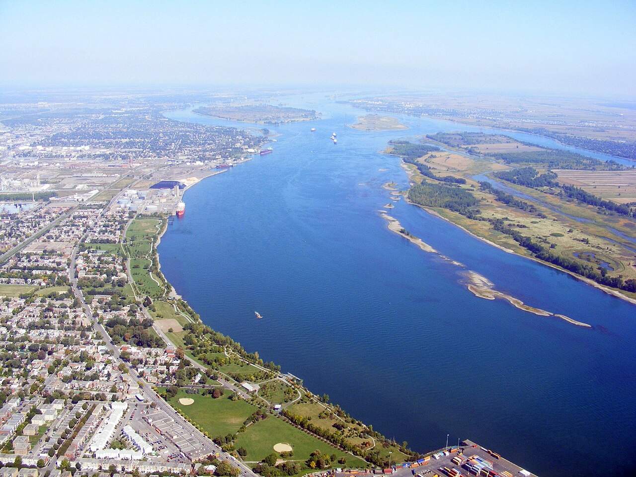
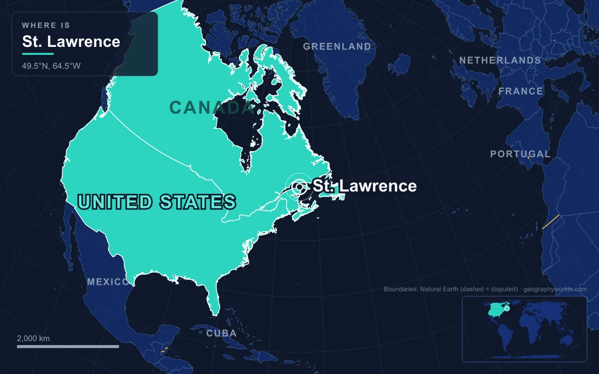
The St. Lawrence River flows northeast for 1,197 km from the outlet of Lake Ontario at Kingston to the Gulf of St. Lawrence, carrying the outflow of the Great Lakes past Montreal and Quebec City to the North Atlantic; measured from its farthest headwater in Minnesota, the system runs 3,058 km. It crosses Ontario, Quebec and New York, forms part of the Canada–United States border, has the second-highest discharge of any river in North America after the Mississippi, and ends in what scientists often call the world's largest estuary. That makes it both a shipping artery for the St. Lawrence Seaway and one of the most heavily used rivers on the continent, and the record of the last century reads as a list of pressures (hunting, dams, invasive species, industrial toxins, oil and thinning ice) answered by treaties, Ramsar listings and Canada's first marine park.
1928 to 2014: Bounties, Toxins and the St. Lawrence Belugas
The river's best-known casualty is its resident beluga population, an isolated group at the southern edge of the species' range that does not migrate to the Arctic. Early European settlers reported roughly 5,000 belugas in the estuary. Hunting from the 1600s to the 1940s cut that to about 2,500. Fishermen of the 1920s blamed the whales for eating cod and salmon, and in 1928 the Government of Quebec offered a bounty of 15 dollars for each dead beluga. A study launched by Quebec's fisheries department in 1938 eventually showed that the whales' appetite had been overestimated, and unrestricted killing continued into the 1950s; beluga hunting in the estuary was finally banned in 1979.
Pollution took over where the hunt stopped. Belugas from the estuary carry DDT, lead, mercury and cadmium, and polychlorinated biphenyl (PCB) levels of 240 to 800 parts per million have been measured in their brains, livers and muscle, far above Arctic populations. Carcasses are so contaminated that they are handled as toxic waste. Of 129 adults examined between 1983 and 1999, 27% had cancer, a rate comparable only to humans and some domestic animals and thought to be linked to contamination by polycyclic aromatic hydrocarbons.

The Committee on the Status of Endangered Wildlife in Canada (COSEWIC) listed the St. Lawrence beluga as endangered in 1983, eased that to threatened in 1997 and moved it back to endangered in 2014. The population grew by about 0.13% a year until the early 2000s and has since fallen by roughly 1% a year, with more newborn deaths and fewer young animals since the mid-2000s. It now numbers about 900.
Inundation Day, 1 July 1958: The Moses-Saunders Dam and the Seaway
The largest physical change to the river came from the joint power and navigation project of the 1950s. The Boundary Waters Treaty of 1909 had already set up the International Joint Commission to settle disputes over shared waters, but the United States stalled on development until Canada passed its own legislation in 1951. Construction of the Moses-Saunders Power Dam between Massena, New York, and Cornwall, Ontario, began in August 1954. At 8 a.m. on 1 July 1958 a cofferdam was blown, and within four days ten Ontario communities, the Lost Villages, were under the new Lake St. Lawrence. About 6,500 people were displaced and 530 buildings moved, mostly to the new towns of Long Sault and Ingleside. The St. Lawrence Seaway opened to ocean-going ships on 25 April 1959 and was formally opened by Elizabeth II and President Dwight D. Eisenhower on 26 June 1959.

The dam feeds two power stations, the 912 MW St. Lawrence–FDR project on the US side and the 1,045 MW R.H. Saunders station in Canada, and together with the Long Sault control dam it regulates the level of Lake Ontario. That regulation has its own ecological cost. Many shoreline wetland plants need periodic low water to reproduce, and with natural fluctuations damped, meadow marsh has shrunk; at Eel Bay near Alexandria Bay, large areas of wet meadow have been lost and replaced by cattails. In the late 1970s a further proposal by the United States Army Corps of Engineers prompted the "Save the River" campaign, organised in part by the activist Abbie Hoffman, which succeeded in stopping it.
Ballast-Water Stowaways: Zebra Mussels in 1988, Round Gobies in 1990
Opening the Great Lakes to ocean ships also opened them to stowaways. The Seaway's most damaging environmental side effect has been the arrival of invasive aquatic animals, most of them carried in the ballast water that freighters take on in foreign ports and discharge on arrival. Zebra mussels were first found in Canada in 1988 in Lake St. Clair and spread down the system into the St. Lawrence, where they have fouled city water facilities as well as natural habitat. The exposure has not gone away: the Seaway still handles 40 to 50 million tonnes of cargo a year, about half of it travelling to and from ports in Europe, the Middle East and Africa. The round goby, first caught in North America by an angler fishing the St. Clair River at Sarnia, Ontario, on 28 June 1990, arrived the same way and now outcompetes native bottom fish such as sculpins and logperch for food and nesting sites. Invasive species and the Seaway's artificial water-level controls have both been blamed for declines in recreational fishing.
Massena, Akwesasne and Lac Saint-Pierre: Toxins, Oil and 300,000 Shells
Industry on the upper river left a chemical legacy. Alcoa opened a plant at Massena in 1903, and Reynolds Metals and a General Motors foundry followed in the late 1950s; over decades the three released PCBs, polycyclic aromatic hydrocarbons, cyanide, fluoride and dioxins into the river and surrounding land. Beside them, straddling the border, lies the Mohawk community of Akwesasne, which in 1987 founded the Akwesasne Task Force on the Environment in response to PCB contamination. The binational response came through the Great Lakes Water Quality Agreement, signed in 1972 and amended in 1987 and 2012, and the Great Lakes Binational Toxics Strategy of 1997, aimed at persistent chemicals such as DDT, PCBs, mercury and dioxins.
Oil is the river's other recurring hazard. In 1970 the barge Irving Whale sank in the Gulf of St. Lawrence off Prince Edward Island with 4,200 tonnes of fuel oil aboard, about 1,100 tonnes of which escaped; it was raised in July 1996 in a 70-hour, 42-million-dollar operation. On 12 July 2010 the freighter Richelieu lost power and ran aground near the Côte-Sainte-Catherine lock south of Montreal, spilling an estimated 200 tonnes of diesel and closing the Seaway while the spill was contained.
The strangest pollutant lies in Lac Saint-Pierre, the river's last freshwater basin, a widening between Sorel-Tracy and Trois-Rivières. From 1952 to 2000 about 160 km² of the lake, roughly 40% of its surface, served as a Canadian military firing range. An estimated 300,000 shells rest on the bottom, around 8,000 of them unexploded, and some have drifted as far as Île d'Orléans, 150 km downstream. In 2016 the Department of National Defence began a nine-year operation to remove about 14,500 shells, including 2,700 unexploded ones, from a priority zone, working only in summer and autumn to limit damage to the lake bed. Shells used to wash up on the shore regularly, but none have been found on the banks since 2006; some that cannot be moved safely must be detonated where they lie, killing the plants and animals around them.
Ramsar Marshes and Canada's First Marine Park, 1978 to 2000
Protection came in a cluster of designations. Cap Tourmente National Wildlife Area, on the north shore 50 km from Quebec City, was established on 28 April 1978 to protect the tidal bulrush marsh where tens of thousands of greater snow geese stop each spring and autumn; in 1981 it became a Ramsar wetland of international importance, the first in North America. In 1984 the limestone monoliths of the Mingan Archipelago, on the north shore of the Gulf, became a national park reserve.
On 6 April 1990 Quebec and Canada signed an agreement to create the Saguenay–St. Lawrence Marine Park where the Saguenay fjord meets the estuary, and the park was officially created in 1998. Covering 1,245 km² and managed jointly by Parks Canada and Sépaq, it was the first park in Canada to protect a purely marine environment, and it shelters 13 species listed as at risk, including belugas, blue and fin whales and the North Atlantic right whale. The same year, Lac Saint-Pierre was listed as a Ramsar site for its seasonally flooded marshes, which hold more nesting herons than anywhere else in North America; UNESCO named it a biosphere reserve of 480 km² in 2000.
Thinning Ice from Montreal to the Gulf
Climate change is the newest pressure. In a normal winter the river starts making ice between Montreal and Quebec City in December, winds and currents push it into the estuary by the end of the month, and ice covers the whole Gulf in January and February. A study of the St. Lawrence ecosystem that monitored sea-ice conditions from 1994 to 2008 found ice cover significantly reduced compared with the 1980s and 1990s. Less ice means less habitat for ice-dependent marine mammals, more strandings and lower marine productivity, and climate change is named alongside underwater noise, chemical pollution and overfishing among the threats to the marine park whose effects are still not fully understood. Ice matters to shipping too: it damps waves and spray, which keeps ships from icing up in the Gulf in midwinter.
For how the locks and canals that carry ships past Montreal work, see our guide to the St. Lawrence Seaway, and to follow the river's water back upstream, read what the Great Lakes are and how the five lakes drain into it.