

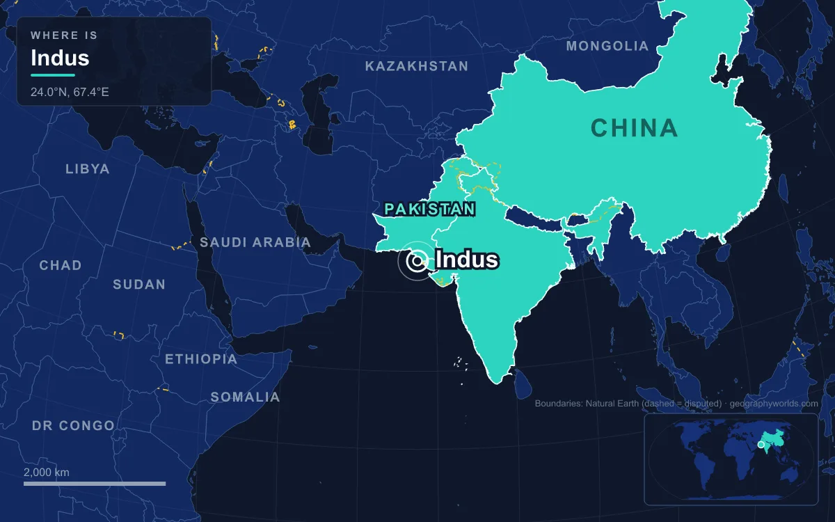
The Indus is a trans-Himalayan river of South Asia, about 3,180 km (1,980 mi) long by the Himalayan Climate and Water Atlas (2015), though a shorter figure of 2,880 km is also widely used. It rises in the Tibet Autonomous Region of China as the Sênggê Zangbo near Mount Kailash, flows north-west through the disputed Kashmir region, first Indian-administered Ladakh and then Pakistani-administered Gilgit-Baltistan, turns sharply south around the Nanga Parbat massif, and crosses the length of Pakistan to a delta on the Arabian Sea south of Thatta, near Karachi. Its basin of about 1.12 million km² reaches into Afghanistan through the Kabul River, and its average flow of about 175 km³ a year (5,500 m³/s) makes it one of the world’s 50 largest rivers by discharge. The river sustains Pakistan’s irrigated farmland, cradled the Indus Valley Civilisation, and gave its name to India. It is also far older than the mountains it cuts through, and its story is best told from the rocks up.
Fifty million years ago: the Indus–Yarlung suture and a river older than the Himalaya
The Indus headwaters follow one of the most important lines on Earth’s surface. The Indus–Yarlung suture zone, across southern Tibet and the northern edge of the Himalaya, marks where the Indian plate collided with the Eurasian plate, beginning about 52 million years ago in the Early Eocene. The rocks along it are a mélange of oceanic crust and sediment from the vanished Neotethys Ocean, volcanic rocks of an old island arc (the Dras Volcanics), and the Indus Molasse, continental gravels and sands laid down from the Eocene onwards. To the north lies the granite of the Ladakh Batholith.
The Indus runs north-west along this seam, while the Yarlung Tsangpo, later the Brahmaputra, runs east along it. Together the two rivers define the western and eastern ends of the Himalaya. Geologists classify the Indus as an antecedent river: it was already flowing before the Himalaya rose, and it kept its course by cutting down as the land rose around it, its route bent repeatedly by the growing range.
Forty-five million years ago: a proto-Indus delta in the Katawaz Basin
The clearest evidence for that great age is in the sediment. Sand and silt from western Tibet were already reaching the Arabian Sea by about 45 million years ago, which means a river was carrying material from the young collision zone to the ocean almost from the start. The delta of this proto-Indus has been identified in the Katawaz Basin on today’s Pakistan–Afghanistan border, well west of the modern river mouth. The present-day delta, the lower plains and the gorges are all much younger features grafted onto that ancient line.
From the Miocene: building the Indus Fan beneath the Arabian Sea
The greatest thing the Indus has built lies under the sea. The Indus Fan, a vast spread of sediment on the floor of the northern Arabian Sea, is the second-largest sediment body on Earth after the Bengal Fan, made of around 5 million km³ of material eroded from the mountains. Fan sedimentation is estimated to have started at the end of the Oligocene or the start of the Miocene, during a period of faster Himalayan uplift and erosion possibly linked to a strengthening monsoon, and it accelerated in the middle Miocene. More than 9 km of sediment has piled up near the top of the continental slope, threaded by some of the world’s largest channel-levee systems, buried submarine channels that interest the petroleum industry.
The sources of that sediment have been traced. Studies of sand in the modern river show the Karakoram Mountains of northern Pakistan and India to be the single largest contributor, with the Himalaya second, mostly via the Punjab rivers. Before large-scale human interference, the Indus delivered the fifth-largest sediment load of any river in the world, much of it loose glacial debris from the western Tibetan Plateau, the Karakoram and the suture zone itself.
After five million years ago: how the Indus captured the five rivers of the Punjab
The Punjab, “land of five rivers”, has not always drained to the Indus. Analysis of Arabian Sea sediments shows that about five million years ago the Jhelum, Chenab, Ravi, Beas and Sutlej were not connected to the Indus; they flowed east into the Ganges system and were captured by the Indus only after that time. Today they join successively into the Panjnad, which meets the Indus at Mithankot, and the combined river below that confluence was once called the Satnad, the “seven rivers”, for the Indus, the Kabul and the five Punjab streams together.
The capture changed the river’s geography completely. It gave the Indus its great left-bank network across the plains of Punjab and created the fan-shaped lowland that now holds most of Pakistan’s agriculture. On the right bank, the Kabul River joins near Attock, bringing water from the Hindu Kush, and the Kurram and Gomal drain the ranges of the Afghan border.
Nanga Parbat and the Indus Gorge: where the river helps lift the crust
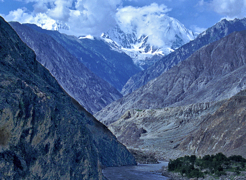
Where the Indus turns south it cuts one of the deepest gorges on Earth, 4,500–5,200 m deep beside Nanga Parbat. At 8,126 m, Nanga Parbat is the ninth-highest mountain in the world and the western anchor of the Himalaya, and in places the river flows more than 7 km below its summit. On the northern side the Rakhiot Flank climbs 7,000 m from the Indus valley to the top in just 25 km.
Here geology runs in a loop. The massive erosion caused by the Indus, after it was captured and rerouted through this area, is thought to have stripped away so much rock that rocks from the middle and lower crust have risen to the surface. The river removes weight, the crust rebounds, the mountain rises and the river cuts deeper. Upstream, the glacier-fed Shyok, Shigar and Gilgit rivers join the main stem south of the Karakoram, and in Ladakh the Zanskar carries more water than the Indus itself before their confluence at Nimmu. The flow still follows the ice: the river shrinks in winter and floods in the monsoon and melt months of July to September.
The last five thousand years: a wandering lower river, from Mohenjo-daro to the Allah Bund
On the plains the Indus is a braided, slow river, and it moves. Archaeologists link the decline of the Indus Valley Civilisation partly to shifting river courses and partly to climate: an abrupt mega-drought and cooling about 4,200 years ago, then a markedly cooler, drier climate from about 1800 BCE as the monsoon weakened. The rain-fed Ghaggar-Hakra system to the east shrank back towards the Himalayan foothills, and floods became too erratic for inundation farming.
Tectonics still steers the lower river. On 16 June 1819, an earthquake of estimated magnitude 7.7 to 8.2 struck the Rann of Kutch, killing at least 1,543 people. It raised a ridge about 80 km long, 6 km wide and 6 m high, the Allah Bund, or “Dam of God”, which dammed the Kori (Nara) river channel into the Rann, while the ground to the south sank to form Sindri Lake. There is evidence that the Indus shifted its course westward, away from the Rann, after the earthquake. The river has not forgotten the old route: in November 2011, after heavy floods, satellite images showed Indus water once again reaching the Great and Little Rann of Kutch and Nal Sarovar lake near Ahmedabad.
The delta itself is the youngest landform of all and is shrinking. It covers about 41,440 km² and meets the sea along a front about 210 km wide, with an active area of about 6,000 km². Since the 1940s irrigation has taken so much water upstream that sediment delivery to obstructed parts of the delta front has fallen by about 80 percent since 1950, and the coast has eroded by up to about 50 m in places. The delta still holds the largest arid mangrove forests in the world and is a Ramsar site.

What the geology built: Harappan cities, Tarbela and the 1960 Indus Waters Treaty
The fertile silt that the Indus spread across its plains supported one of the first urban societies. Early Harappan communities had turned into large cities such as Harappa and Mohenjo-daro by about 2600 BCE, and Mohenjo-daro, built around 2500 BCE, had an estimated population of at least 40,000 before it was abandoned by about 1700 BCE. One influential study argues that its farmers depended mainly on the summer floods rather than irrigation, though an irrigation canal network has also been found in the region. In 1980 the city became the first UNESCO World Heritage Site in South Asia. The river’s Sanskrit name, Sindhu, passed through Old Persian Hindu and Greek Indos to give the words Sindh, Hindu and India.
Modern engineering has taken over from the floods. Tarbela Dam, completed in 1976 where the Indus leaves the Himalayan foothills for the Pothohar Plateau, is the largest earth-filled dam in the world, 143 m high, with storage of 11.9 billion m³ and 4,888 MW of installed capacity. Its reservoir captures monsoon water and releases it in the low-flow winter months to the canals of Punjab and Sindh. The cost of that control was demonstrated in 2010, when monsoon floods affected about a fifth of Pakistan and killed 1,985 people, and again in 2022, when floods fed by extreme rain and glacier melt killed 1,739 people and caused about US$40 billion in damage.
The six main rivers of the system, the Indus and the five Punjab rivers it captured, were divided between two states by the Indus Waters Treaty, signed in Karachi on 19 September 1960 by Jawaharlal Nehru and Ayub Khan with World Bank mediation. It gave Pakistan the three western rivers and India the three eastern ones.
On 23 April 2025, after the attack on tourists near Pahalgam, India declared the treaty suspended, citing national security, and the World Bank has said its role is limited to that of facilitator. To follow the river through its younger chapters, read about the Mohenjo-daro archaeological site, the engineering of Tarbela Dam, and the mountain whose rise the river helped drive, Nanga Parbat.