

The Chao Phraya is the main river of Thailand. It begins at Nakhon Sawan, where the Ping and Nan rivers meet, and flows 372 km (231 mi) south across the central plain, past Ayutthaya and through Bangkok, to the Gulf of Thailand at Samut Prakan. Counted from the farthest headwater of the Nan in the Luang Prabang Range, the system is 1,112 km long, and its watershed of 157,924 km² is the largest in the country, covering about 35 percent of Thailand. Every tributary rises inside Thai territory, so the river and its plain have been the core of the Thai state since the Ayutthaya kingdom: they water the rice paddies of the central plain, carry Bangkok's river buses and frame two of its historic capitals.
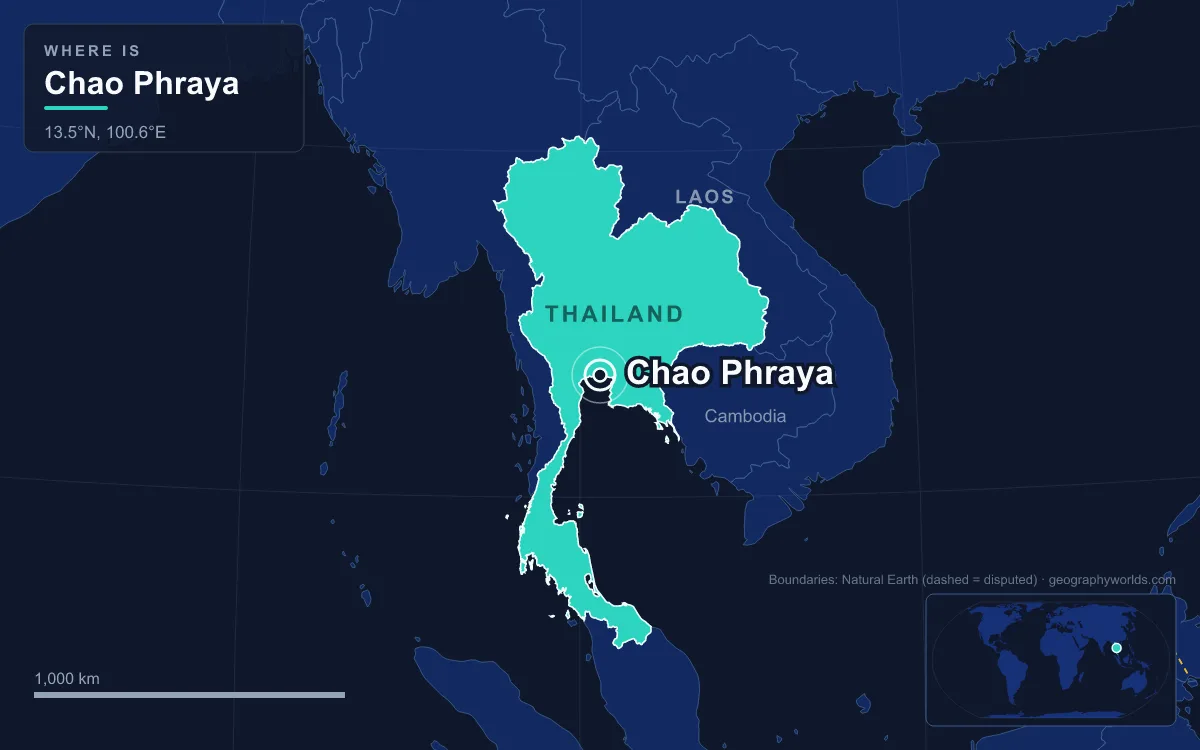
The earliest written evidence of the name Chao Phraya for the river dates from the reign of King Mongkut in the 19th century. European visitors in the Ayutthaya period simply wrote Menam, from the Thai mae nam, "river". The journey below follows the water downstream, from the confluence to the bar at the sea.
Pak Nam Pho, where the Ping and the Nan become one river
The river starts in the city of Nakhon Sawan, whose central subdistrict, Pak Nam Pho, sits on the confluence. The city lies about 238 km north of Bangkok and had 82,305 residents at the end of 2020. Upstream, the four northern rivers have already merged in pairs: the Wang joins the Ping near Sam Ngao in Tak province, and the Yom runs almost parallel to the Nan from Phitsanulok before joining it at Chumsaeng. The surrounding land is flat, broken only by a hill about 110 m high inside the city.
Just east of the confluence, south of the Nan, lies Bueng Boraphet, the largest freshwater swamp and lake in central Thailand at 224 km². The area was originally a large swamp, flooded in 1930 when a dam was built to improve fishing. It is the only known site of the white-eyed river martin; the bird wintered there but has not been seen since 1980 and may be extinct. In 1975, 106 km² of the lake were declared a non-hunting area, and in 2000 the Thai government designated it a wetland of international importance.
Chai Nat and the 1957 barrage that waters the plain
Below Nakhon Sawan the river winds south through Uthai Thani province to Chai Nat. Here it divides for the first time: the Tha Chin River splits off to the west and runs parallel to the main channel all the way to the sea, which it reaches at Samut Sakhon about 35 km west of Bangkok. The Tha Chin is the Chao Phraya's most important distributary, and the land between the two channels forms the Chao Phraya Delta.
In Sapphaya district of Chai Nat stands the Chao Phraya Dam, a barrage built between 1952 and 1957. Its sixteen 12.5-metre gates hold the river back so that canals can feed water to 11,600 km² of farmland in seventeen provinces under the Greater Chao Phraya Irrigation Project. Below the barrage begins the low alluvial plain, threaded with small canals called khlong that branch off the river to irrigate rice paddies.

Through Sing Buri and Ang Thong on a plain two metres above the sea
Between Chai Nat and Ayutthaya the river crosses Sing Buri and Ang Thong provinces, and the gradient almost disappears. The plains of the Ping and Nan stand more than 20 m above sea level, but from Ang Thong south to the delta the land averages only about 2 m. The historians Chris Baker and Pasuk Phongpaichit note that the whole plain falls only about 80 m over the 500 km from the hills to the sea. Rivers this sluggish could be poled or paddled upstream for most of the year, which made water the most convenient way to travel before the modern era.
On the slightly higher northern plains, farming intensified during the Sukhothai and Ayutthaya kingdoms in the 13th and 14th centuries, when floating rice, a fast-growing strain from Bengal, was introduced. The lowlands were once the Chao Phraya freshwater swamp forests, an ecoregion about 400 km long and 180 km wide. Almost all of that forest is gone, and with it the sarus crane, tigers, Asian elephants, Javan rhinoceros and the hunted-out Schomburgk's deer. The rice fields still hold the world's largest populations of the near-threatened Asian openbill, a stork, although farmers' pesticides aimed at the introduced golden apple snail, which damages young rice, are a threat to wildlife on the plain.
Ayutthaya's island at the Pa Sak confluence
The old capital of Ayutthaya sits on an island where the Pa Sak River joins the Chao Phraya. King Uthong proclaimed it his capital in 1351, though settlement there is older; Wat Phanan Choeng dates from 1324. With the river as its highway to the sea, the city grew to an estimated 300,000 people by 1600 and perhaps a million around 1700, one of the largest cities in the world at the time. It was destroyed by a Burmese army in 1767, and its historic core is now the Ayutthaya Historical Park, a UNESCO World Heritage Site described in our guide to Ayutthaya.
On the west bank, outside the island, stands Wat Chaiwatthanaram, built by King Prasat Thong in 1630 in a Khmer-influenced style. Flooding is the island's modern problem: in 2024 a 22 km bypass channel, Chao Phraya II, was under construction to carry floodwater around the city, joining the river north and south of Ayutthaya.

Nonthaburi, Ko Kret and the shortcut canals of 1538 to 1722
South of Ayutthaya the river passes Pathum Thani and enters Nonthaburi, and here it no longer follows its natural course. Ayutthaya's kings cut a series of straight canals across the river's widest loops to shorten the voyage between the capital and the sea, and the current gradually abandoned the old bends for the new cuts.
- 1538, Khlong Lat: a 3 km canal ordered by King Chairachathirat, Thailand's first recorded river engineering, which saved ships 13 to 14 km; it now forms part of Khlong Bangkok Noi.
- 1542, Khlong Lat Bangkok: a 2 km cut that the river adopted as its main channel, leaving the old loop as Khlong Bangkok Noi and Khlong Bangkok Yai.
- 1608, Khlong Bang Phrao: 7 km long, shortening the route by 18 km.
- 1636, Khlong Lat Mueang Nonthaburi: a further cut at Nonthaburi.
- 1722, Khlong Lat Kret Noi: 2 km long, saving 7 km.
The 1722 cut created an island. The Ayutthaya chronicles say about 10,000 men dug the canal in just over a month; erosion widened it until it became the main river, isolating the meander as Ko Kret, an island about 3 km across with an area of over 4.2 km². After Ayutthaya fell, King Taksin allowed Mon people to settle there. Ko Kret has seven main villages, the largest being Ban Mon, and is known for Mon pottery. It is still reached by ferry.
Bangkok's 21-kilometre express-boat river
Bangkok grew on the river by design. King Rama I founded Rattanakosin in 1782 on the east bank, putting the Chao Phraya between the new capital and Burmese armies approaching from the west. Opposite, in Thonburi on the west bank, Wat Arun has stood since at least the 17th century; its tall prang was added under Rama II and Rama III in the early 19th century. Our guide to Bangkok covers the city beyond its waterfront.
The river is still a working street. The Chao Phraya Express Boat, founded in 1971, runs a 21 km route between Bangkok and Nonthaburi with 65 boats and carries an average of about 40,000 passengers a day, and more than 15 boat lines operate on the river and canals. Major crossings include the Rama VI railway bridge, Phra Pin-klao bridge near the Grand Palace, the single-tower Rama VIII cable-stayed bridge, the Rama IX bridge and the Mega Bridge on the Industrial Ring Road.
The flat plain also funnels floods into the capital. In 2011, monsoon floods that began in late July with Tropical Storm Nock-ten moved down the Chao Phraya basin and reached the river mouth and parts of Bangkok in October. By January 2012, 815 people had died, 13.6 million were affected and 65 of Thailand's 76 provinces had been declared disaster zones. The World Bank estimated losses at 1.425 trillion baht (US$46.5 billion), much of it from industrial estates flooded up to 3 m deep.
Samut Prakan, the Paknam forts and the Gulf of Thailand
The last province on the river is Samut Prakan, and it may have given the river its name. A settlement here was known around 1660 as Bang Chao Phraya; historian Praphat Chuvichean links the noble title to two Khmer idols unearthed at the old river mouth in 1498. Records from King Borommakot's reign mention Pak Nam Bang Chao Phraya, "mouth of the Chao Phraya village", and the name later spread to the whole river.
The mouth has moved. Around 6550 BCE the sea stood about 4 m above today's level and covered the lower plain; the coastline retreated past the site of Bangkok between 3000 and 1000 BCE and reached roughly its present position by 500 CE. Wat Phra Samut Chedi, the "ocean stupa" begun under Rama II and finished under Rama III, was built on an island that has since become joined to the mainland.
Nearby Chulachomklao Fort guarded the bar. On 13 July 1893 the French ships Inconstant and Comète forced their way past it in the Paknam Incident; France won the exchange and blockaded Bangkok, which ended the Franco-Siamese war. Below the forts the river's water, and the silt still building the delta, pass into the northern end of the Gulf of Thailand.