

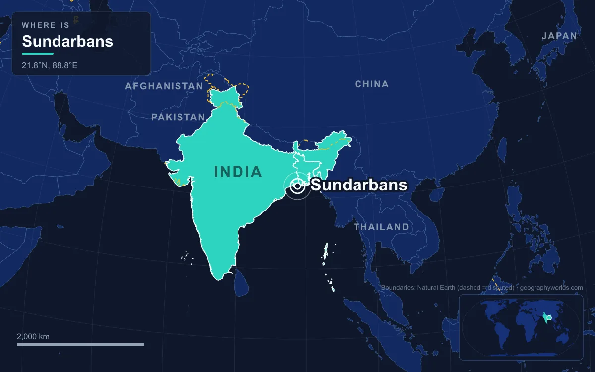
The Sundarbans is the mangrove forest at the seaward edge of the Ganges–Brahmaputra–Meghna delta on the Bay of Bengal, stretching from the Hooghly River in India's West Bengal to the Baleswar River in Bangladesh's Khulna Division. At about 10,277 km² it is the largest mangrove forest in the world, roughly 6,000 km² of it in Bangladesh and 4,260 km² in India's South and North 24 Parganas districts. It is a tidal maze of islands, mudflats and creeks dominated by the sundari tree, home to Bengal tigers and to more than four million people living around its edge. India's Sundarbans National Park was inscribed as a UNESCO World Heritage Site in 1987 and named a Ramsar site in 2019; the Bangladesh Sundarbans followed onto the World Heritage list in 1997 and is also listed under the Ramsar Convention.
The forest is often described through its tigers. But for the people of Khulna, Satkhira, Bagerhat and the 24 Parganas, it is a place of work: a source of fish, timber, thatch and honey, a storm barrier, and the backdrop to a long history of settlement, eviction and rebuilding.
Leases, Maps and the Reserved Forest of 1875
People were living at the forest's edge long before the British arrived. Settlement can be traced to the Mauryan period of the 4th to 2nd centuries BCE; ruins of an abandoned city in the Baghmara forest block are linked in Bengali folklore to the merchant Chand Sadagar, and excavations at Kapilmuni in Paikgacha, north of the forest in Bangladesh, uncovered an early medieval town. In the 15th century the Bengal Sultanate appointed Khan Jahan Ali as its governor in the Sundarbans, and the city he built at Bagerhat, on land that was once part of the mangrove forest, now holds the Sixty Dome Mosque and a cluster of Sultanate-era monuments listed by UNESCO.
Under the Mughals, local rulers leased forest tracts to anyone willing to clear them for settlement. In 1757 the British East India Company obtained proprietary rights over the Sundarbans from the Mughal emperor Alamgir II and finished mapping it in 1764. Systematic management came a century later: a forest division with jurisdiction over the Sundarbans was set up in 1869, much of the forest was declared reserved forest in 1875 under the Indian Forest Act of 1865, and a forest division headquartered in Khulna followed in 1879. The first management plan covered 1893 to 1898. As late as 1911 the tract was treated as "unexamined waste country" and left out of the census.
Gosaba and the Four Million on the Forest's Edge
The Sundarbans region has a population of over four million, almost all of it on the northern side, where the forest meets cultivated land along a sharp boundary. Natural drainage there is blocked by embankments and polders that keep the tide out of the fields. In the monsoon the low-lying land is waterlogged, so the summer kharif crop is mostly deepwater or floating rice. In the dry winter the fields usually lie fallow and are grazed by cattle, while plots near villages are watered from ponds filled during the rains and planted with vegetables. Some farms and stretches of mangrove have been cleared for shrimp and fish ponds.
Much of the Indian settlement dates from the last 120 years. In 1903 Sir Daniel Mackinnon Hamilton, a Scottish businessman who had made his fortune in Calcutta with MacKinnon & McKenzie, bought about 40 km² of tide country including the islands of Gosaba, Rangabelia and Satjelia, and brought in settlers to clear and farm them, offering rewards for killing the tigers and crocodiles that preyed on them. Rabindranath Tagore stayed at Hamilton's house in Gosaba in December 1932. Gosaba, bounded by the Matla and Zilli rivers, sits at an average of just 6 metres above sea level, and its block borders Sundarbans National Park. West Bengal's cabinet has since approved a new district, to be named Sundarban, carved from South 24 Parganas.
Fishers, Woodcutters and Honey Collectors in the Reserve
How many people work inside the forest itself is hard to pin down. On the Indian side, the number of honey collectors fell from around 1,500 to about 700 by 2007, and together they gather some 20,000 kg of honey a year; between 1985 and 2004 about 75 of them were killed by tigers. The forest's economic weight is largest in Bangladesh, where it makes up 51% of the country's reserve forest, supplies about 45% of all timber and fuelwood and brings in about 41% of forest revenue. Sundari wood is hard and is used for houses, boats and furniture, and golpata, the nipa palm, grows along the channels.

Heavy use has thinned the forest. Inventories show that the standing volume of the two main commercial trees, sundari and gewa, fell by 40% and 45% respectively between 1959 and 1983. Killing or capturing any wildlife other than fish and some invertebrates is banned, so fishing remains central to the forest economy. The waterways support at least 150 commercially important fish species on the Indian side alone, as well as the crabs and shrimp that shelter among the mangrove roots. Honey gatherers and woodcutters work on foot inside the dark forest, where tigers can stalk people absorbed in their work, though even fishermen in small boats have been attacked.
Bonbibi, Dakshin Rai and the Tigers of the Tide Country
The forest's roughly 180 tigers, counted as 106 in Bangladesh in 2015 and 74 in India in 2011 using camera traps, are among the few in the world that live in mangroves and swim between islands. They also kill people. The Sundarbans tigers once regularly killed fifty or sixty people a year; one count records around 40 deaths in 2000–2010, and by 2023 the official figure had fallen to two or three a year, though unions and NGOs put it at 10 to 25. Many attacks go unreported because victims had entered the forest without permission.
Protection from tigers is a religious matter. Fishers, woodcutters and honey collectors pray to Bonbibi, the lady of the forest, before going in; her enemy Dakshin Rai is believed to take the form of a tiger. Bonbibi is a folk Islamic figure honoured by Hindus and Muslims alike, with shared rituals on the first day of the Bengali month of Magh (January–February). In a field study in Namkhana block, 88% of respondents named her as their protector in a crisis. Villages across the forest also worship Gazi Pir, a Muslim warrior saint, alongside Bonbibi and Dakshin Rai. Practical measures have been tried too: in 1986 villagers wore face masks on the backs of their heads, because tigers usually attack from behind, but the tigers reportedly soon learned the trick.

These stories reach well beyond the delta. The Bengali epic Manasamangal sets part of Behula's journey in the Sundarbans, Manik Bandopadhyay's novel Padma Nadir Majhi follows the lives of fishermen, and Amitav Ghosh's 2004 novel The Hungry Tide, which retells the Bonbibi legend, is set almost entirely on these islands.
Marichjhapi in 1979 and the Pilgrims of Sagar Island
Settlement in the Indian Sundarbans has also been political. After Partition, waves of refugees from East Pakistan were sent to camps in Dandakaranya, in present-day Odisha, Madhya Pradesh and Chhattisgarh. When the Left Front came to power in West Bengal in 1977, many returned, and some settled on protected forest land on Marichjhapi island. In 1979 the state government blockaded and then forcibly evicted them, and the confrontation left several people dead. The episode is still remembered as the Marichjhapi massacre.
At the western end of the delta, Sagar Island shows a different kind of human use. The largest island in West Bengal, about 100 km south of Kolkata, it is counted as part of the Sundarbans but has no mangrove forest and no tigers. Every year on Makar Sankranti, in mid-January, hundreds of thousands of Hindu pilgrims bathe where the Ganges meets the Bay of Bengal and pray at the Kapil Muni Temple.
Khulna, Mongla and the Rampal Power Station
On the Bangladesh side the forest's gateway is Khulna, the country's third-largest city, on the Rupsha and Bhairab rivers. Some 48 km to the south lies the Port of Mongla, founded in 1950 as Chalna Port and moved to its present site at the confluence of the Pasur and Mongla rivers on 11 December 1954. Surrounded by the forest and about 100 km from the open bay, it is Bangladesh's second-busiest seaport, with 11 jetties; 636 ships used it in 2015–16, and tourist boats bound for the mangroves leave from there.
Industry has followed the port. The coal-fired Rampal Power Station, a 1,320 MW joint venture between India's NTPC and the Bangladesh Power Development Board, stands 14 km north of the forest in Bagerhat district. Bangladesh's own environmental guidelines call for such plants to be at least 25 km from an ecologically sensitive area, and a 2016 UNESCO report called the project's environmental impact assessment questionable and asked for it to be shelved. Its coal, about 4.72 million tonnes a year, has to be brought in by ship along the Pasur (Poshur) River.
Cyclone Sidr in 2007 and Aila in 2009
The mangroves stand between the Bay of Bengal and millions of people in Kolkata, Khulna and Mongla, and two storms showed what that means. Cyclone Sidr, whose winds peaked at 215 km/h on the India Meteorological Department's scale, struck Bangladesh on 15 November 2007, killing at least 3,447 people and damaging about 40% of the Sundarbans. Eighteen months later, in May 2009, Cyclone Aila killed at least 339 people across Bangladesh and India, left more than a million homeless and breached at least 100 river embankments in West Bengal. After Aila, many islanders thanked Bonbibi that the damage was not worse.
Rising sea levels and reduced freshwater flow are now pushing salinity higher, and the Indian Sundarbans were assessed as an endangered ecosystem in 2020 under the IUCN Red List of Ecosystems. To see how the forest fits into the wider river system that feeds it, read our guide to the Ganges–Brahmaputra Delta; for the rest of the country's rivers and lowlands, see the geography of Bangladesh, and for how the Sundarbans compares with other coastal forests, our global guide to mangrove forests.