

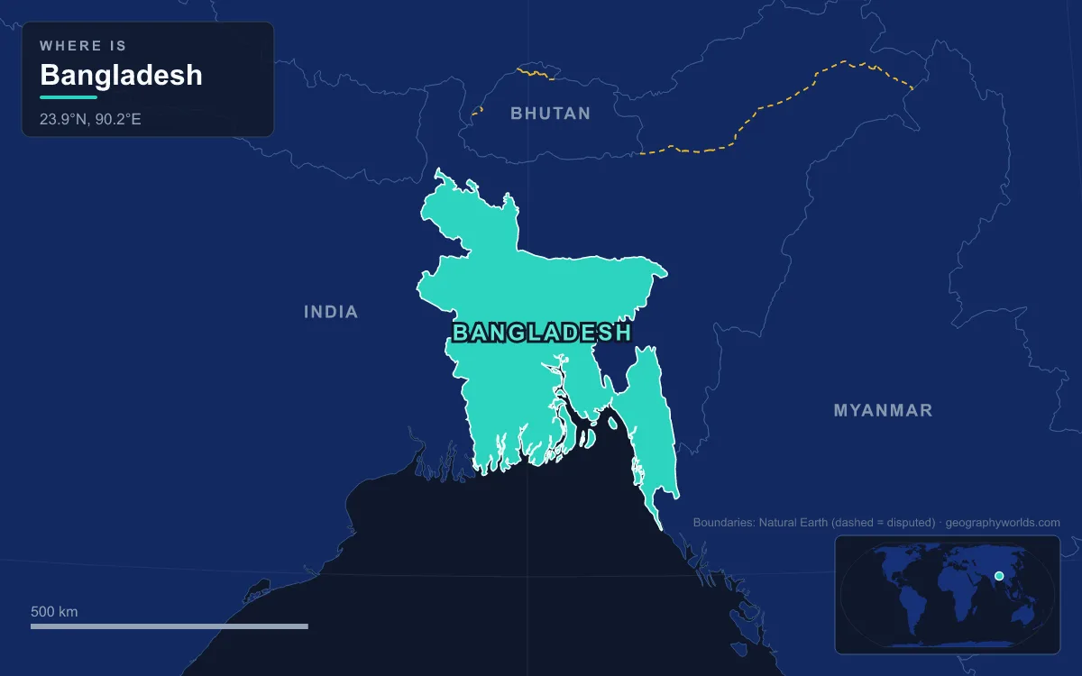
Bangladesh is a low, river-built country in South Asia at the head of the Bay of Bengal, covering about 147,570 km² by the national statistics bureau's 2020 figure (the CIA World Factbook gives 148,460 km²). About 79 percent of it is the delta plain of the Ganges (called the Padma here), the Brahmaputra (the Jamuna) and the Meghna, most of it less than 10 m above sea level. Four older, slightly raised blocks, including the Barind and Madhupur tracts, make up 9 percent, and steep hill ranges in the southeast and northeast make up the remaining 12 percent; the highest point is Saka Haphong, on the Myanmar border in the Chittagong Hill Tracts, at about 1,052 to 1,063 m depending on the survey, and the lowest is the sea-level coast. India surrounds it on the west, north and east along a 4,095 km land border, with a short 193 km frontier with Myanmar in the southeast and about 580 km of coastline in the south. The 2022 census counted 169,828,911 people, which makes it one of the most densely settled countries on Earth, and nearly every pattern in how they live, farm, trade and build can be traced back to that water and that flatness.
Padma, Jamuna and Meghna: Settling on a Moving Delta
Three of Asia's great rivers meet inside Bangladesh. The Jamuna enters from the north carrying Brahmaputra water off the Himalayas and Tibet, the Padma arrives from the west carrying the Ganges, and the Meghna gathers rain from the hills of the northeast. Together they spread the sediment that built the Bangladesh Plain, part of the wider Plain of Bengal. Elevations reach 105 m in the far north but fall to sea level along the coast, and about 10,000 km² of the country is permanently under water, with far larger areas flooding each monsoon.
That shapes where people live: the silt the floods leave behind renews the fields every year. The rivers also build and erase land. The word char, which appears in dozens of place names, means a sediment island in a river or estuary, and new chars keep forming along the coast where the Himalayan sediment load settles; Bhola, in the Meghna estuary, is the largest island in the country. Crossing so much water has always been the main obstacle to moving goods. The Padma Bridge, opened on 25 June 2022, finally put a road and a railway across the Padma between Munshiganj and Shariatpur. It is 6.15 km long, rests on piles driven as deep as 127 m into the riverbed, and ties the long-isolated southwest to Dhaka.
Rice Seasons Set by the Bay of Bengal Monsoon
Bangladesh straddles the Tropic of Cancer, and its climate is ruled by the southwest monsoon, which usually runs from June to September and brings about 80 percent of the year's rain. Most of the country receives at least 2,300 mm a year. The Rajshahi region in the west is the driest, at about 1,600 mm, while the Sylhet region in the northeast, where the monsoon meets the first slopes of the hills, is the wettest; between 1977 and 1986 its annual totals ranged from 3,280 to 4,780 mm. April is usually the hottest month, with highs of 38 to 41 °C, and January the coolest, at 16 to 20 °C by day and around 10 °C at night.
The farming calendar follows this water. Rice is the main crop and is grown in three seasons, and most of the country is intensively farmed. Fertile alluvium on the floodplains supports this density, but the same floods destroy crops and homes when they come too high. Rice is not what earns the country its foreign exchange, though: the three main sources are garment exports, shrimp exports and remittances from Bangladeshis working abroad.
Barind and Madhupur: Older Ground Above the Floods
Not all of the plain is young. The Barind Tract in the northwest, spread across parts of Rajshahi, Bogra, Dinajpur, Rangpur, Pabna and Joypurhat districts, is the largest Pleistocene landform in the Bengal Basin, covering about 10,000 km² of older alluvium. Its western side is tilted up and its eastern edge falls along a fault escarpment, with the Little Jamuna, Atrai and Lower Punarbhaba rivers flowing in the fault troughs. Its climate shows greater extremes than much of the region, with temperatures from about 45 °C down to 5 °C, and the surrounding Rajshahi area is the driest part of the country.
The Madhupur Tract, a similar raised block north of Dhaka in the Mymensingh–Tangail area, does the same job in the centre of the country. Just downslope, the old landscape returns to wetland: Chalan Beel in Rajshahi Division, a depression the Atrai River flows through, still covers about 26 km² even in the dry season.
Sylhet's Haors and Tea Estates
The northeast is where Bangladesh's wettest climate meets its first hills. The Sylhet basin is dotted with haors, bowl-shaped back-swamps that fill with river runoff in the monsoon and turn into wide inland seas, then shrink to scattered beels in winter. Tanguar Haor in Sunamganj District is the best-known example: with the 46 villages inside it, the area covers about 100 km², it supports more than 40,000 people, it holds more than 140 species of freshwater fish, and around 200 kinds of migratory birds winter there. Bangladesh declared it an Ecologically Critical Area in 1999 because its natural resources had been overexploited.
On the low hills that rise above these wetlands, the British began planting tea in the 19th century, and cultivation was introduced to greater Chittagong in 1840. Tea needs what these districts offer: high ground, high humidity and heavy rain. Bangladesh now has 166 commercial estates in districts such as Sylhet, Panchagarh and Bandarban, and in 2019 it produced 97.08 million kg, ranking ninth in the world.

Chittagong Hill Tracts, Kaptai Lake and the Port on the Karnaphuli
The Chittagong Hills in the southeast are the only significant hill system in the country, the western fringe of the north–south ranges of Myanmar and eastern India. Narrow ridges rise steeply to 600 to 900 m, with fertile valleys between them, and they culminate at Saka Haphong. This is the least densely settled part of Bangladesh and home to many of its Indigenous communities, who long farmed the valleys and slopes.
That changed when the government of East Pakistan dammed the Karnaphuli River at Kaptai between 1956 and 1961 to generate hydropower. The reservoir, Kaptai Lake, became the largest artificial lake in the country. It drowned about 220 km² of farmland in Rangamati District, an estimated 40 percent of the area's arable land, displaced about 100,000 people and submerged the palace of the Chakma king. The dam stands 54.7 m high and 670.8 m long.

Downstream, where the Karnaphuli reaches the sea, the city of Chittagong grew around the country's main seaport. Ptolemy's 2nd-century map already marked the port, Arab merchants traded there from the 9th century, and today the Port of Chittagong handles more than 70 percent of Bangladesh's foreign trade; Lloyd's ranked it the world's 58th-busiest container port in 2019. Farther south, Cox's Bazar has a 120 km beach that is the longest natural sea beach in Asia.
The Sundarbans and the Cyclone Coast of Khulna and Barisal
In the southwest the delta ends in the Sundarbans, the world's largest mangrove forest. It spans about 10,277 km² from the Hooghly River in India to the Baleswar River in Bangladesh, and some 6,017 km² of it lies in Bangladesh's Khulna Division. Tidal channels criss-cross it, sundri and gewa trees dominate, and it is the last wild home of the Bengal tiger; three protected areas on the Bangladeshi side are UNESCO World Heritage Sites. It is one of the least densely settled parts of the country. The site's Sundarbans forest guide covers its wildlife.
The forest is also a buffer against the Bay of Bengal's storms. The funnel-shaped bay drives cyclone surges onto a coast that barely rises above the tide. On 12 November 1970 the Bhola cyclone flooded the low-lying islands of the delta with its storm surge and killed at least 300,000 people, possibly 500,000, making it the deadliest tropical cyclone on record; in Tazumuddin upazila more than 45 percent of the population died. Anger at the slow relief effort by the government in West Pakistan deepened the disillusionment in East Pakistan that preceded independence in 1971. More recently Cyclone Sidr damaged around 40 percent of the Sundarbans in 2007, and Cyclone Aila hit the region in May 2009, while rising sea levels and reduced freshwater flow are making the soil and water saltier.
Dhaka's Four Rivers and the 4,095-Kilometre Border With India
The capital sits near the centre of the delta on the edge of the Madhupur terrace, bounded by the Buriganga, Turag, Dhaleshwari and Shitalakshya rivers. It grew from the 17th century as a provincial capital and trading centre of the Mughal Empire, with a busy river port, and today it is widely described as the most densely populated built-up area in the world; the areas around Dhaka and Comilla are the most crowded in the country. Its growth is covered in the site's article on Dhaka, the capital.
The border around this delta was drawn across rice fields and rivers in 1947, and for decades it was one of the most tangled on Earth. Bangladesh contained 102 Indian enclaves and India held 71 Bangladeshi ones, including Dahala Khagrabari, the world's only third-order enclave. The 1974 Land Boundary Agreement, revised and ratified on 6 June 2015, swapped them: at midnight on 31 July 2015 Bangladesh received 111 Indian enclaves and India 51 Bangladeshi ones, and their residents chose which country to belong to. Only Dahagram–Angarpota, a Bangladeshi exclave, remains. For the larger river system that built all of this land, see the site's guide to the Ganges–Brahmaputra delta.