

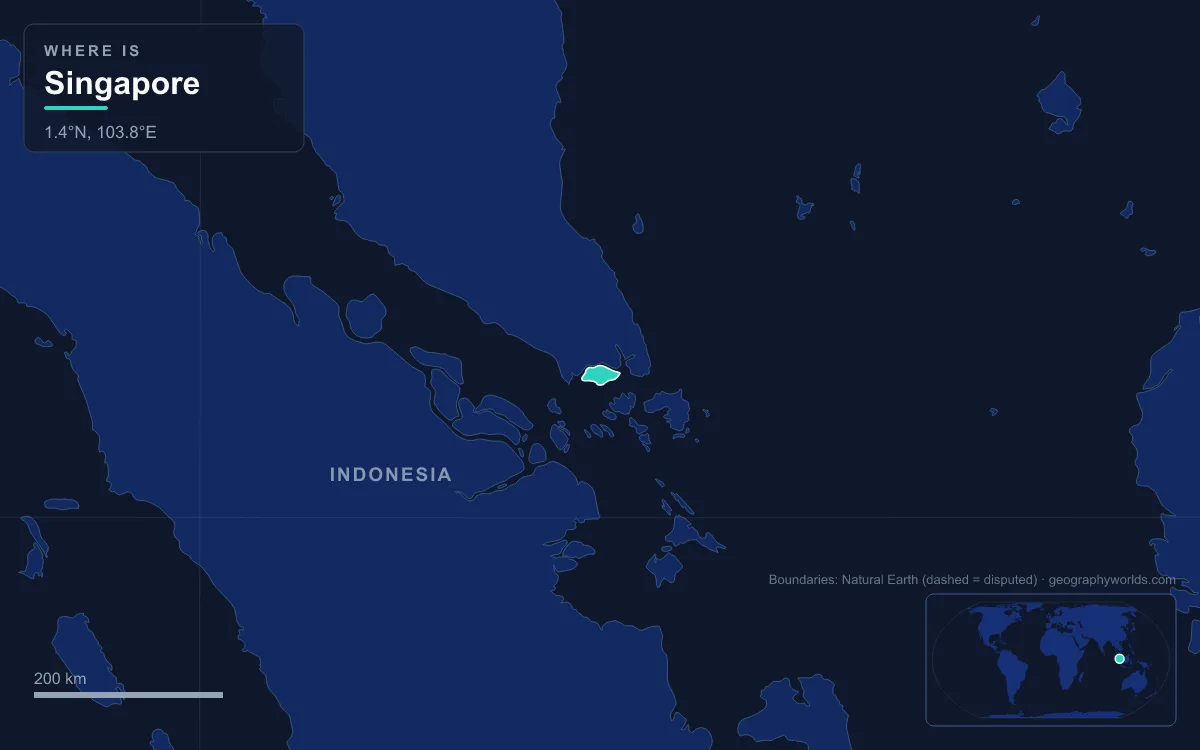
Singapore is an island city-state at the southern tip of the Malay Peninsula, about one and a half degrees north of the equator, separated from Malaysia by the narrow Straits of Johor and from Indonesia by the Singapore Strait. Its land area is roughly 744 km², up from about 582 km² in the 1960s thanks to land reclamation, and the diamond-shaped main island measures 50 km from east to west and 27 km from north to south. Physically it falls into a handful of regions: a granite core in the centre, where Bukit Timah Hill reaches the country’s highest natural point at 164 m; hills and valleys of sandstone and mudstone in the west and south-west; flatter, sandier land in the east; a reclaimed southern waterfront around Marina Bay; and a ring of offshore islands such as Pulau Ubin, Pulau Tekong, Jurong Island and Sentosa. Singapore has no natural lakes, and its rivers are short: the longest, the Kallang River, runs just 10 km. Most of the country lies no more than 15 m above sea level.
Bukit Timah and the Central Catchment: Singapore’s Granite Core
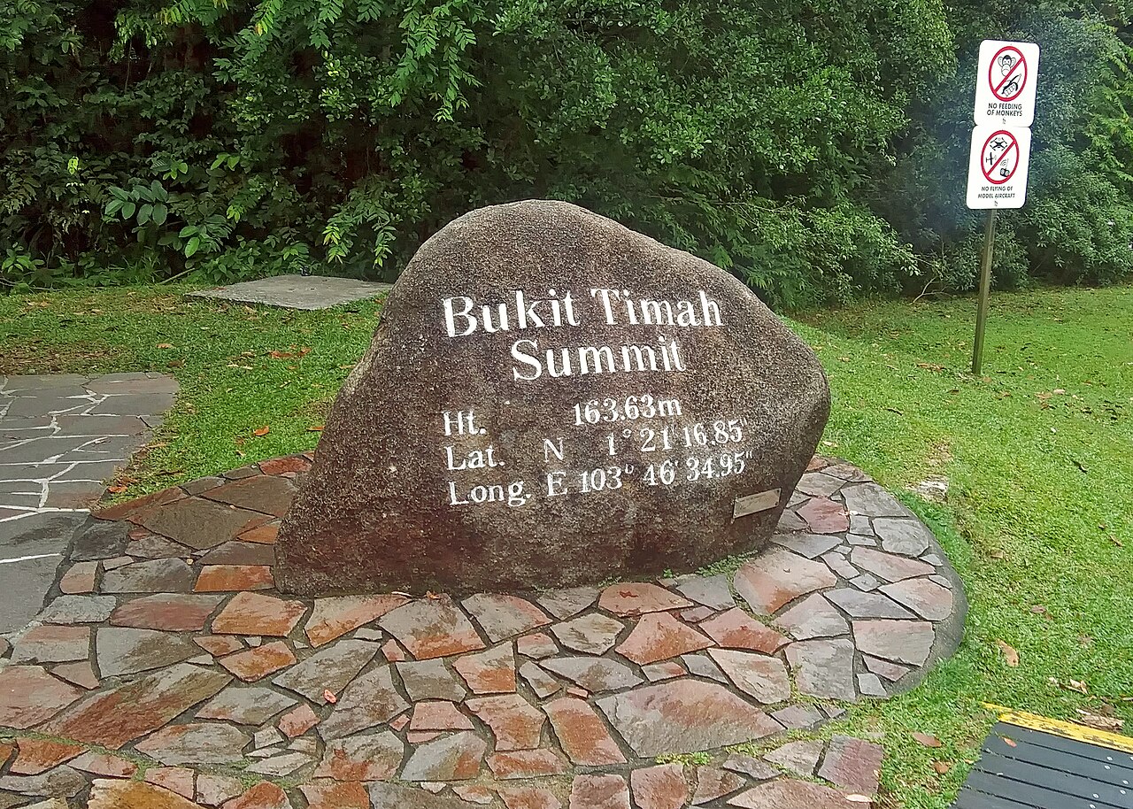
The middle of the main island is the high ground, and it is made of granite. Igneous rock surfaces at Bukit Timah, in Woodlands in the north and on Pulau Ubin, and it is the reason this part of Singapore stands above the rest. Bukit Timah Hill, whose name means “tin hill” in Malay, sits near the geographical centre of the island in the Bukit Panjang planning area rather than in the district that bears its name. Its height is usually given as 164 m (538 ft); the engraved summit stone puts it at 163.63 m. Some of its slopes reach 40 to 50 degrees, steep enough that the hill was quarried for granite for many years before quarrying stopped in the mid-twentieth century and the pits were turned over to walkers and climbers.
The hill carries one of the largest patches of primary rainforest left in Singapore. Nathaniel Cantley, superintendent of the Singapore Botanic Gardens, recommended a forest reserve here in 1882, and Bukit Timah was set aside in 1883; the Nature Reserves Ordinance of 1951 gave it formal protection. The Bukit Timah Nature Reserve covers only about 2 km², yet together with its neighbour it holds more than 840 species of flowering plants, and it was declared an ASEAN Heritage Park on 18 October 2011.
That neighbour is the Central Catchment Nature Reserve, at 2,880 hectares the largest nature reserve in the country. It wraps around the country’s main reservoirs, MacRitchie, Upper Seletar, Upper Peirce and Lower Peirce, and its forest exists to keep their water clean. Most of the catchment forest is secondary growth on land once logged or planted with rubber, but primary forest survives around the reservoir shores. It is the only place in Singapore where Raffles’ banded langur survives.
The granite core also feeds the longest river. The Kallang River starts at Lower Peirce Reservoir, originally named Kallang River Reservoir, and flows south-east for 10 km through Bishan and Toa Payoh to the Kallang Basin. A short distance west of Bukit Timah, the two hills of Bukit Gombak rise to 133 m and 113 m, the second- and third-highest natural points in the country. Their rock is different: gabbro, exposed in a flooded quarry called Little Guilin because its cliffs reminded people of Guilin in southern China.
Jurong, Kent Ridge and the Southern Ridges: The Sedimentary West
West and south-west of the granite, the island is built of sedimentary rock, mainly sandstones and mudstones, and hills and valleys of this rock dominate the north-west instead of the granite dome of Bukit Timah.
The clearest expression of this terrain is the line of hills along the south coast. Kent Ridge, formerly Pasir Panjang Ridge, was renamed in 1954 after a royal visit by the Duchess of Kent and her son two years earlier. Today Kent Ridge Park (47 ha), Telok Blangah Hill Park (34 ha) and Mount Faber are joined by the Southern Ridges, 10 km of trails and bridges proposed by the Urban Redevelopment Authority in 2002 and finished about two years later. Mount Faber, given as 94 m or 106 m depending on the source, overlooks the harbour and carries the cable car across to Sentosa.
Further north-west the sediments run down to the Straits of Johor at Kranji, where mangroves line the shore. Sungei Buloh Wetland Reserve, 130 hectares of mangrove and mudflat, became Singapore’s first gazetted wetland reserve on 1 January 2002. Migratory shorebirds, among them whimbrels, greenshanks and Pacific golden plovers, stop here on journeys between Siberia and Australia, and the site belongs to the East Asian–Australasian shorebird network. This side of the island is also wetter than the east: even a hill as small as Bukit Timah casts a rain shadow, so the west catches more of the rain than the east.
Changi and the East Coast: Sand, Flat Land and an Airport on Fill
Cross to the eastern third of the main island and the hills disappear. The east consists of sandier, flatter land, and its weather is measurably drier and slightly hotter than the west’s. That flat far-eastern ground is where Singapore built its main airport. Changi Airport began commercial flights on 1 July 1981 after about 2 km² of swamp was cleared and more than 52 million m³ of land and sea fill was brought in.
The coast here is almost entirely artificial. East Coast Park runs along reclaimed shoreline, and a 2023 proposal would add about 800 hectares more, in three tracts including an islet and a new reservoir, to protect the coast against a sea-level rise that could reach 1 m by 2100. Another 900 hectares off Changi Bay was announced for reclamation in 2022, a job expected to take ten years. For a country whose land mostly sits below 15 m, raising the coastline is as much flood defence as land-making.
Marina Bay and the Kallang Basin: The Reclaimed South
The colonial city grew around the mouth of the Singapore River on the south coast after 1819, and that area remains the Central Area today. The river itself is only about 3.2 km long. Few parts of Singapore have been reshaped as completely. The Marina Centre and Marina South reclamations, commissioned in the late 1970s and completed in 1992, added 360 hectares of waterfront, removed the old Telok Ayer Basin and rerouted the river so that it flows into Marina Bay rather than straight into the sea.
The bay was then closed off. The Marina Barrage, conceived by Lee Kuan Yew in 1987 and built from 2005, opened on 31 October 2008 across the Marina Channel. It sits at the confluence of five rivers, including the Singapore, Kallang, Geylang and Rochor, and turned Marina Bay and the Kallang Basin from salt water into a freshwater lake, the Marina Reservoir, Singapore’s fifteenth reservoir and its first in the city. When heavy rain falls at low tide, its crest gates drop to let water out; at high tide, pumps push it out to sea, protecting low-lying Chinatown, Jalan Besar and Geylang from floods.

Across Keppel Harbour lies Sentosa, a former British military island renamed in the 1970s and now run as a resort with a 2.5 km sheltered beach. Between it and the main island sits the smaller Pulau Brani. Port terminals on this stretch are being consolidated at Tuas Port in the far west, and a plan published in April 2026 would reclaim about 213 hectares at the former Keppel and Tanjong Pagar terminal sites over ten years. The waterways behind all this reclaimed land matter for shipping too; the Port of Singapore grew up on this sheltered southern shore.
Pulau Ubin, Pulau Tekong and Chek Jawa: The North-Eastern Islands
Off the north-east coast, in the eastern mouth of the Straits of Johor, the bedrock changes again. Metamorphic rocks, mainly quartzite of the Sajahat Formation, occur in the north-east of the main island and on Pulau Tekong, while Pulau Ubin returns to granite. Pulau Ubin’s name is usually explained as “granite island”, and the 1,020-hectare island was quarried for decades; its stone went into Horsburgh Lighthouse. The island rises to 75 m at Bukit Puaka.
At Ubin’s south-eastern tip, Chek Jawa is a 100-hectare wetland where sandy beach, rocky shore, seagrass lagoon, coral rubble, mangrove and coastal forest meet in one place. It was due to be reclaimed until a volunteer biodiversity survey led the government to defer the plan in December 2001.

Pulau Tekong, east of Ubin, is Singapore’s largest outlying island and a closed military training ground. It measured about 25 km² before reclamation absorbed neighbouring islets such as the 89-hectare Pulau Tekong Kechil; it is now around 40 km² after a north-western polder project, the first in Singapore, which began in 2016 and uses a Dutch-style dyke and pumps instead of sand fill. Completed works could take it to between 60 and 75 km².
Jurong Island and Pedra Branca: Singapore’s Outermost Edges
South-west of the main island, Jurong Island shows reclamation at industrial scale. Several small islands, including Pulau Ayer Chawan, Pulau Ayer Merbau, Pulau Merlimau and Pulau Seraya, had fishing villages into the 1960s. Reclamation began in 1995 to join seven islets into one block; the island opened officially on 14 October 2000, and the work finished on 25 September 2009, twenty years ahead of schedule, growing the land from 991 to more than 3,500 hectares. The island is the base of the oil refining and petrochemical industry and has been closed to the public since 2001.
At the opposite extreme lies Pedra Branca, the easternmost point of Singapore: a granite outcrop of about 8,560 m² at low tide where the Singapore Strait meets the South China Sea. Its name is Portuguese for “white rock”, after the guano left by nesting terns. The British built Horsburgh Lighthouse on it in 1850–51; Malaysia published a map placing it in Malaysian waters in 1979, and on 23 May 2008 the International Court of Justice ruled that Pedra Branca belongs to Singapore, while nearby Middle Rocks belong to Malaysia.
Back on the main island, two crossings tie Singapore to Johor: the 1.056 km Johor–Singapore Causeway at Woodlands, opened in 1923, and the Tuas Second Link bridge, opened in 1998. The weather that falls on all these regions follows two monsoons, explained month by month in our guide to the climate of Singapore, and the mainland beyond the causeway is covered in our account of Malaysia’s geography.