

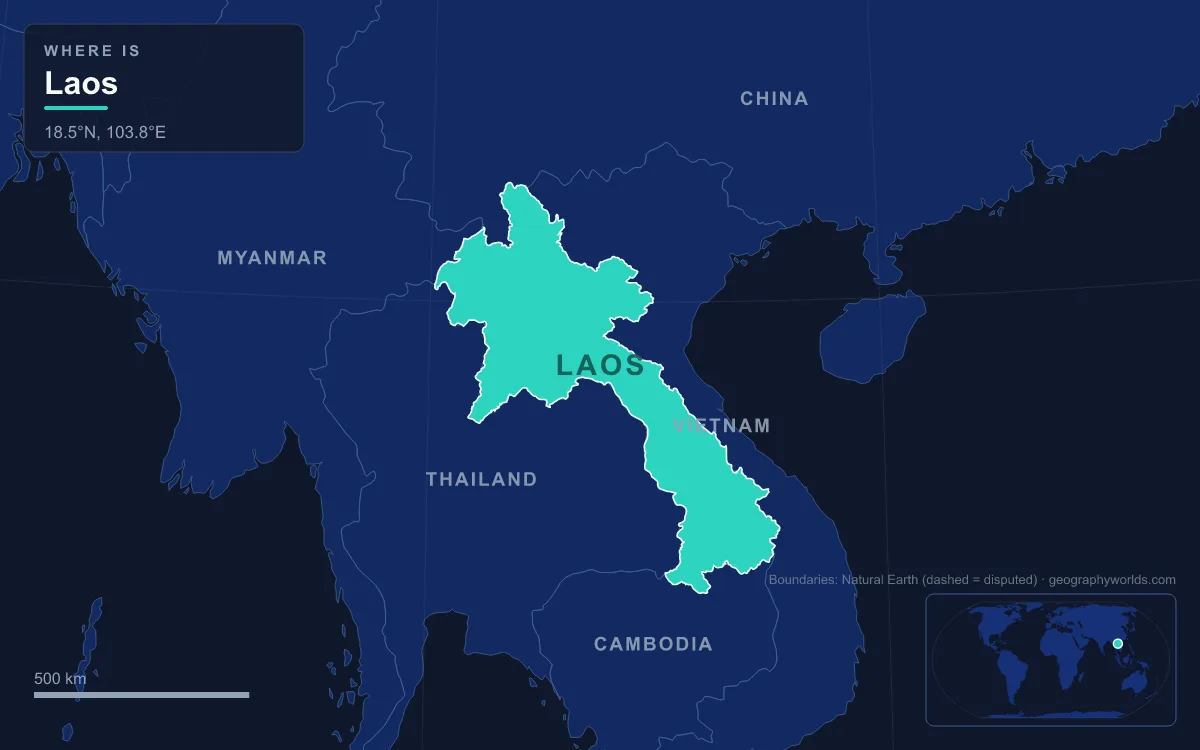
Laos is the only landlocked country in Southeast Asia, a territory of about 236,800 km² wedged between China, Myanmar, Thailand, Cambodia and Vietnam, and roughly 70% of it is mountains and plateaus. Its physical regions are the mountainous north, cut by the Luang Prabang Range and the Xiangkhoang Plateau; the Annamite Range, which runs down the eastern border with Vietnam; and a narrow belt of lowland plains along the Mekong, widest around Vientiane and in Savannakhet and Champasak provinces in the south. The highest point is Phou Bia, about 2,817 m, at the southern edge of the Xiangkhoang Plateau; the lowest is about 70 m, on the Mekong. The Mekong is the main river, forming most of the western frontier, fed by left-bank tributaries such as the Nam Ngum, Nam Theun, Se Bang Fai and Se Kong. The country has a population of more than 7.5 million. Every one of those landforms records a chapter in a long geological story, told here from oldest to youngest.
Proterozoic Rock in the Song Ma Anticlinorium
The oldest parts of Laos are also the least well known. Geologists describe the Precambrian record as poorly defined: high-grade metamorphic rocks thought to be Proterozoic, more than half a billion years old, are believed to crop out in parts of the northwest, northeast and southeast. In the northeast near the Vietnamese border, a large upfold called the Song Ma Anticlinorium exposes Proterozoic basement rock at the surface. No Cambrian rocks have been confirmed anywhere in the country, though some metamorphosed sediments lying beneath Ordovician beds may date from that period.
Northern Laos is also where two great structural belts meet. There the Luang Prabang and Truong Son structures converge, bordered by northwest-trending, fault-bounded blocks such as the Phu Hoat Massif; another prominent feature is the Yunnan-Malay fold belt, which geologists trace to the closure of two old sedimentary basins. On the surface, the north is a largely mountainous country of steep terrain, with elevations typically above 500 m cut by river valleys. The Luang Prabang Range runs along the northwest, and the only large breaks in the high ground are the plain of Vientiane and the Plain of Jars on the Xiangkhoang Plateau.
Paleozoic Seas and the Karst of Khammouane
From the Ordovician onward, much of Laos lay under water. Shale containing graptolite fossils in the northeast belongs to the Early Ordovician, and marine sediments kept accumulating through the Silurian and Devonian. In the east, deposition continued into the Carboniferous, while elsewhere the sea withdrew and the land was eroded. Then, in the Carboniferous and Permian, the sea returned, laying down sandstone, shale and, above all, limestone. There were swampy coasts too: coal from this interval is found near Vientiane and Saravane.
That Carboniferous and Permian limestone is responsible for some of the most striking scenery in Laos, because rainwater slowly dissolves it into karst: towers, sinkholes and caves. The karst is prominent in the north and east. In Khammouane Province the Phou Hin Poun National Biodiversity Conservation Area, formerly called the Khammouane Limestone NBCA, is a tower-karst landscape in which rocky outcrops are estimated to cover more than half the ground. About 130 km north of Thakhek, the Nam Hin Bun river flows into the mountain at Tham Kong Lo, a cave about 7 km long with passages up to 90 m wide and 100 m high. The first recorded rowing crossing of the cave was made in 1920 by five volunteers with torches; even after that, fear of the cave persisted for a long time, and villagers travelling between Kong Lo and the Natane valley on the other side walked a six- to seven-hour route over five mountain passes.

The same limestone hosts a major fossil site. Tam Pa Ling, the Cave of the Monkeys, sits at about 1,170 m on Pa Hang Mountain in the Annamites of northeastern Laos, formed by the dissolution of limestone laid down between the Upper Carboniferous and the Permian. A human skull found there in 2009 has a minimum age of 46,000 to 51,000 years from the surrounding sediments and a maximum of about 63,000 years from dating of the bones themselves. As of 2017 it was the earliest skeletal evidence of Homo sapiens in mainland Southeast Asia.
Permian–Triassic Volcanoes and the Rise of the Annamites
Toward the end of the Paleozoic, the region became volcanically active. Lavas erupted mainly in the Permian and continued into the Triassic in northern Laos, around Pak Lay and Luang Prabang and northwest to the border with Myanmar. Geologists correlate them with similar rocks in Thailand that are interpreted as the product of subduction, with one plate diving beneath another. Dacite and rhyolite are common around Sam Neua in Houaphanh Province, and rhyolite and tuff cover much of the Sekong valley and the country along the Cambodian border in the south. The few large bodies of intrusive rock known in Laos also date from this time, including Early Triassic granodiorite near Pak Lay and gabbro near Sayaboury.
Marine sedimentation lingered into the Triassic only in a few basins, such as the Sam Neua area. Then Triassic uplift created a mountainous terrain across the region, followed by intense erosion. Today the Annamite Range runs about 1,100 km through Laos, Vietnam and a corner of Cambodia, with most of its crests on the Laotian side. Its eastern slope drops steeply to Vietnam's coastal plain, while the western slope descends gently in a series of plateaus, from north to south the Phouane, Nakai and Bolaven plateaus, before reaching the Mekong. The border with Vietnam, about 2,130 km long, follows the crest for most of its length. Phou Bia, the country's summit, stands in this system at the southern limit of the Xiangkhoang Plateau in Xaisomboun Province; the Annamites' next-highest peaks, Phu Xai Lai Leng at 2,720 m and Ngọc Linh at 2,598 m, are far lower.
Cretaceous Salt and Dinosaurs Beneath Vientiane and Savannakhet
The mountains raised in the Triassic were worn down through the Jurassic and Cretaceous. Almost all rocks of this age in Laos are terrestrial, laid down by rivers and lakes, with the exception of Early Jurassic marine beds in the southern Sekong valley. By the Middle Cretaceous the land surface had been planed so low that shallow basins filled with silt, clay and mud interspersed with evaporites, the salts left behind when water evaporates. Those evaporites underlie the plains around Vientiane and east of Savannakhet. Laos today has extensive salt and gypsum deposits and potash near Vientiane, but very little in the way of hydrocarbons.
The Cretaceous sandstones of Savannakhet Province also hold dinosaurs. The Grès supérieurs Formation of the Savannakhet Basin produced Tangvayosaurus, a sauropod about 15 m long, described by a team led by Ronan Allain in 1999, and Ichthyovenator, a sail-backed spinosaurid found in 2010 and named in 2012. Ichthyovenator lived between about 120 and 113 million years ago and is estimated at 8.5 to 10.5 m long; its species name, laosensis, honours the country.
Pleistocene Basalt on the Bolaven Plateau
The Paleogene left no deposits in Laos at all. In the Neogene, freshwater shale, sandstone, marl and lignite settled in small valleys between mountain ranges; because these basins lack the coarse debris normally shed from steep slopes, geologists read them as down-dropped remnants of once-wider basins. Then, in the Pliocene and Pleistocene, the highlands were pushed up again and immediately attacked by erosion, sharpening the relief seen today.
The youngest volcanic landscape in the country dates from that time. During the Pleistocene, thick basalt lavas poured out over Mesozoic sandstone east of Pakse, building the Bolaven Plateau. Most of the plateau lies in Champasak Province, with its edges in Salavan, Sekong and Attapeu, at roughly 1,000 to 1,350 m above sea level. Several rivers cross it, and the plateau is known for its many waterfalls. The French planted coffee there and experimented with rubber in the early 20th century, and it has remained an important farming area for cash crops, fruit and vegetables. The Bolaven also holds the national rainfall record: about 3,700 mm a year, more than double what falls on Luang Prabang.

For more on the plateau's villages, coffee and war history, see our guide to the Bolaven Plateau.
The Mekong's Holocene Course, from the Plain of Jars to Khone Phapheng
The last chapter is written by rivers. On the Xiangkhoang Plateau, the Quaternary left extensive gravel and silt terraces, including loess and volcanic ash, and on those upland surfaces people later set out the stone jars of the Plain of Jars. More than 2,100 jars, 1 to 3 m tall, have been documented at 129 sites in Xiangkhouang Province and the surrounding area, the most visited being Site 1 near Phonsavan; luminescence dating suggests some were put in place as early as 1240 to 660 BC, and the jars at Site 1 were hauled from a quarry about 8 km away.

The Mekong itself may once have followed a different course: the sediments beneath its present channel in Laos are mostly shallow and Holocene in age, less than about 12,000 years old. For much of its length the river runs in a bedrock channel, and within Laos only a short stretch around Vientiane develops the meanders, oxbow lakes and extensive floodplains of a mature lowland river. The alluvial plains and terraces of the Mekong and its tributaries cover only about 20% of the land, and only about 4% of Laos is classed as arable; the Vientiane plain and the southern lowlands of Savannakhet and Champasak are the main areas suited to paddy rice. The river forms about 1,750 km of border with Thailand in two stretches, swinging inland for some 400 km past Luang Prabang between them, and it leaves the border again to flow through Pakse.
Near the Cambodian border, the Mekong meets resistant rock and breaks into Si Phan Don, the Four Thousand Islands. There it falls over the Khone Phapheng Falls, which at 10,783 m from edge to edge of their many channels are considered the widest waterfall in the world. The highest drop is 21 m, the rapids run for 9.7 km, and the average discharge is nearly 11,000 m³ per second, with a recorded peak above 49,000. The falls are the main reason the Mekong is not fully navigable into China; French engineers failed to force boats past them in the late 19th century and built a short railway across Don Det and Don Khon islands instead. How the falls shape the river downstream is covered in our complete guide to the Mekong River, and the five countries that share the resulting borders are traced in our look at the neighbouring countries of Laos.