
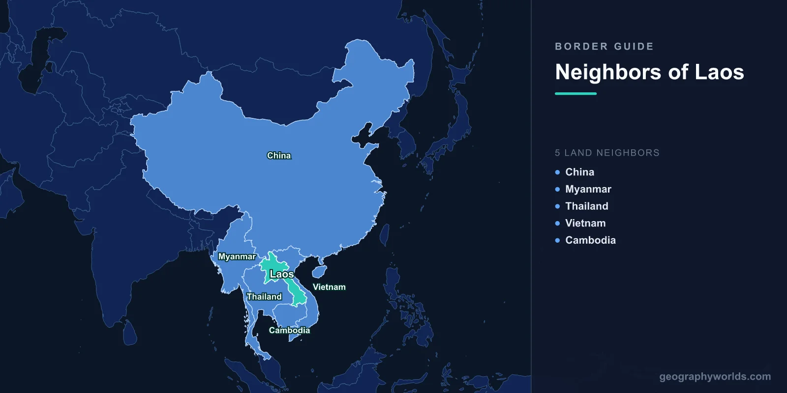
Landlocked Laos is surrounded by five countries: Vietnam to the east, Thailand to the west, Cambodia to the south, China to the north and Myanmar to the north-west. Its land borders total about 5,083 km by the CIA World Factbook figures tabulated on Wikipedia, led by Vietnam (2,130 km) and Thailand (1,754 km), with Myanmar the shortest at 235 km. As the only landlocked country in Southeast Asia, Laos has no maritime neighbours at all, so every export and import crosses one of these five lines, most often a bridge over the Mekong or a pass through the Annamite Range. Almost all of them were drawn by France between 1893 and 1907, when Laos was carved out of Siam’s sphere and attached to French Indochina. That is why this guide tells the story in order of date rather than neighbour by neighbour.
Other surveys give slightly longer figures (2,161 km for Vietnam and 1,845 km for Thailand in the individual border articles), so the chart keeps to one source.
Before 1893: the Mekong as a highway under Siamese suzerainty
For centuries the Mekong was not a frontier. Lao communities lived on both banks, and the river connected them rather than dividing them. By the mid-19th century the Lao kingdoms, along with parts of Cambodia, were tributary states of Siam, the kingdom now called Thailand, in a system of layered loyalties with no surveyed lines. To the east, the Annamite Range was the natural divide between Vietnamese kingdoms on the coast and Lao, Thai and Khmer states inland; the two sides had fought over it, most destructively when the Later Lê emperor Lê Thánh Tông invaded Laos between 1479 and 1481.
Europe arrived from the south-east. France took control of Cochinchina and Cambodia from the 1860s and grouped its possessions into French Indochina in 1887, the same year it fixed the border between Tonkin and China after the Sino-French War. French officials, the explorer and diplomat Auguste Pavie foremost among them, then set out to push Indochina’s western edge to the Mekong, which they saw as its natural boundary.
1893: French gunboats at Paknam and the Mekong line
The decisive year was 1893. After clashes in the disputed lands east of the Mekong, two French warships forced their way up the Chao Phraya River and came under fire from the fort at Paknam on 13 July. With guns trained on the Grand Palace in Bangkok, France issued an ultimatum on 20 July demanding all territory east of the Mekong and an indemnity of three million francs, then blockaded the Siamese coast. Finding no support from Britain, Siam gave way; France added, as guarantees, the occupation of Chanthaburi and a 25 km demilitarised zone along the west bank, and the Franco-Siamese Treaty was signed on 3 October 1893.
That treaty created most of modern Laos and, with it, the central fact of Lao geography: along much of its western side, the border is the Mekong itself. It also turned the line between Laos and Vietnam into an internal French boundary. A US government boundary study later concluded that its legal basis probably rests on old custom and treaties as modified by decrees of the Indochinese administration; part of it was demarcated in 1916 after a dispute, and French colonial maps became the reference for the modern border along the crest of the Annamites.
1895 and 1896: Yunnan and British Burma
With Laos in hand, France had to agree its northern edges with two other powers. China and France signed an agreement on 20 June 1895 delimiting the China–Laos boundary at its present position, and it was later marked with pillars. The line runs through remote, forested mountains between the Lao provinces of Phongsali, Luang Namtha and Oudomxai and China’s Yunnan, and both sides are home mainly to minority peoples.
Britain, meanwhile, was absorbing Burma into British India. On 15 January 1896 Britain and France agreed that their colonies would meet along the Mekong, which is why the entire 235 km Laos–Myanmar border is river. It begins at the Chinese tripoint and ends where Thailand also touches the Mekong, at the place known as the Golden Triangle.

1904–1907: Sainyabuli, Champasak and Stung Treng change hands
The Mekong did not stay the whole western border for long. In the Franco-Siamese Treaty signed in Paris on 13 February 1904, Siam ceded land west of the river, including today’s Sainyabuli Province in the north and Champasak in the south, along with parts of northern Cambodia. The Franco-Siamese treaty of 23 March 1907 followed, handing Battambang, Siem Reap and Sisophon to French Cambodia while France withdrew from Trat and Dan Sai. It was the last territorial agreement between Siam and colonial France and set out how the boundary would be demarcated.
These treaties explain the shape of the Laos–Thailand border today. From the Myanmar tripoint it follows the Mekong, leaves it to run overland south across hill ridges to the Hueang River, rejoins the Mekong for the longest stretch, and finally leaves it north-west of Pakse to follow the Dângrêk Mountains to Cambodia. A 1926 convention settled ownership of the shifting islets in the river.
The Cambodian border came from a reshuffle inside French Indochina. In 1905 the southern Lao districts of Stung Treng and Ratanakiri were moved to Cambodia because of their historic ties to the Khmer kingdom, and the old provincial boundary of Stung Treng became the line. Running through remote country, it was never surveyed in detail. It meets the Mekong at Si Phan Don, the “four thousand islands”, where the river spreads into a wide riverine lake and the border runs along its southern rim.
1941–1953: the Franco-Thai War and independence
After France fell to Germany in 1940, Thailand’s prime minister Plaek Phibunsongkhram saw a chance to recover the lands lost under King Chulalongkorn. The Franco-Thai War ran from October 1940 to a ceasefire on 28 January 1941, and a Japanese-brokered treaty signed in Tokyo on 9 May 1941 transferred the Lao territories west of the Mekong and north-western Cambodia to Thailand. After Japan invaded Burma, parts of the Shan States were also handed to Thailand, briefly erasing the Laos–Burma border.
The gains did not survive Japan’s defeat. In October 1946, after France threatened to veto Thailand’s membership of the United Nations, the two Lao enclaves on the Thai side of the Mekong and western Cambodia were returned, and Burma’s pre-war line was restored the same year. Laos became partly self-governing within the French Union in 1949 and fully independent on 22 October 1953, Cambodia on 9 November 1953, and the colonial lines became international borders.
1975–1988: the Vietnam treaty and the Ban Romklao war
Independence did not bring peace to the frontiers. From 1959 North Vietnam built the Ho Chi Minh Trail through eastern Laos, a network of roads that ran parallel to the border and was heavily bombed by American aircraft. After the communist victories of 1975, including the founding of the Lao People’s Democratic Republic on 2 December, Laos and Vietnam agreed a border treaty based on the colonial line, dated to 1976, and signed a 25-year Treaty of Friendship in July 1977. The Laos–Vietnam boundary was demarcated on the ground between 1979 and 1984, with small changes in 1986. Relations with Cambodia stayed cold, especially under the Khmer Rouge from 1975 to 1979.
The Thai border became a front line of the Cold War. Fighting broke out in 1984 over three villages on the edge of Thailand’s Uttaradit Province, and in December 1987 Thai troops occupied Ban Romklao, which Laos said belonged to Sainyabuli Province. The cause went back to 1907: the agreed rule was the watershed, but French map-makers had sometimes ignored it, and where the Hueang River splits into two tributaries each side claimed a different one. Weeks of fighting, including Thai air strikes, ended with a ceasefire on 19 February 1988, when both armies pulled back 3 km.
1992–2023: pillars, bridges and the Boten railway
Since the end of the Cold War, the borders have been surveyed again and opened up. China and Laos re-demarcated their line in April 1992, and Laos and Myanmar carried out a joint survey in June 1993. A Thai–Lao joint committee was set up in 1991 and a joint boundary commission in the mid-1990s; by 2022 about 96% of the land boundary had been demarcated, while the Mekong carries 955 km of the line and the Hueang 153 km. Cambodia and Laos began work on their line in 2000, quarrelled over the Tonle Rapov river area in 2019, and signed a demarcation treaty on 13 February 2023; there is still only one official crossing, Nong Nok Khiene.

Bridges have done the most to change daily life. The First Thai–Lao Friendship Bridge opened between Nong Khai and Vientiane on 4 April 1994, followed by bridges at Mukdahan–Savannakhet (2007), Nakhon Phanom–Thakhek (2011), Chiang Khong–Houayxay (2013) and Bueng Kan–Pakxan (2025), with a sixth under construction in Salavan. By 2019 the Thai border had 20 permanent crossings and 29 local trade checkpoints. Myanmar’s one main crossing, the Friendship Bridge over the Mekong between Xieng Kok and Kyainglap, built in 2015, opened as a border crossing on 20 November 2018. On the Vietnamese side, gates such as Dansavanh–Lao Bảo and Namphao–Cầu Treo give Laos road access to the South China Sea.
The biggest change is in the north. The Vientiane–Boten railway, part of the line to Kunming, opened on 3 December 2021; its 414 km Lao section includes 198 km of tunnels. At Boten, opposite China’s Mohan, the town keeps Beijing time and accepts the yuan. For the wider picture on either side of these lines, see the countries that border Vietnam, the countries that border China and the short Mekong frontier traced in the countries that border Myanmar.