

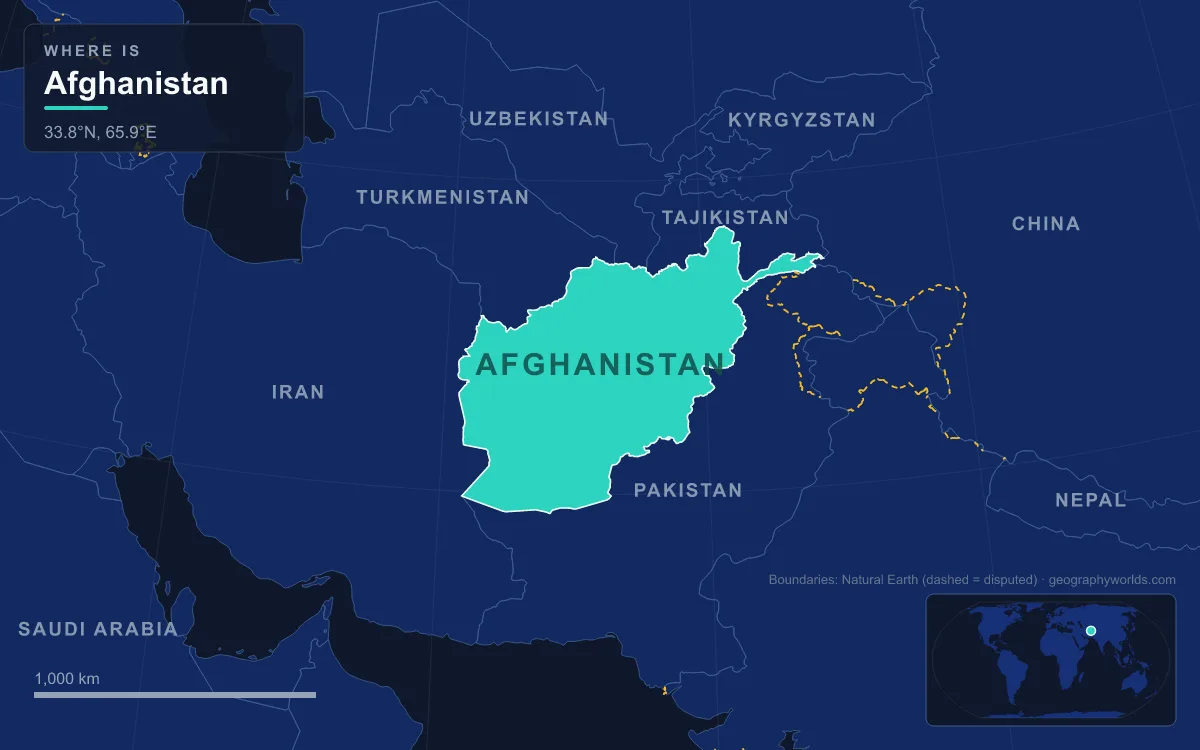
Afghanistan is a landlocked, mostly mountainous country of 652,864 km² at the crossroads of Central and South Asia, bordered by Pakistan, Iran, Turkmenistan, Uzbekistan, Tajikistan and China along 5,987 km of land frontier. The Hindu Kush crosses it from the Wakhan Corridor in the northeast toward the central highlands, splitting the country into three main regions: the northern Turkestan plains along the Amu Darya, the high valleys and plateaus of the centre and east, and the deserts of the Sistan Basin in the southwest. The highest point is Noshaq, 7,492 m, on the Pakistan border; the lowest is about 258 m, where the Amu Darya leaves the country in Jowzjan Province. The main rivers are the Amu Darya, the Helmand (at about 1,150 km the longest river in the country), the Hari and the Kabul, and most of their water ends up in neighbouring countries or in inland basins, never reaching the sea. The population is uncertain, with estimates ranging from about 35 to 50 million. Every one of those features is the product of a geological story that runs from rocks nearly a billion years old to earthquakes felt within the last decade.
Nearly a Billion Years Old: The Central Afghan Swell and Koh-i-Baba
The foundation of Afghanistan is Precambrian metamorphic rock: phyllite, greenschist, garnet-mica schist and gneiss that was partly melted deep in the crust. These old rocks form the high ground at the centre of the country. Geologists call the northernmost of these belts the Central Afghan Swell, a structural high stretching from the Sabzak Pass near Herat in the west to the Little Pamir in the far northeast. Near Kabul, schists about 938 million years old, the source of that nearly-a-billion-year figure, sit beside much younger gneisses about 644 million years old.
The swell connects to the Hindu Kush through Koh-i-Baba, the Baba range south of Bamyan. It is crowned by Shah Foladi at about 5,048 m, and it works as the country's great water tower: the Kabul, Helmand, Arghandab, Farah, Hari, Murghab, Balkh and Kunduz rivers all rise on or near it. Draining outward in every direction from this old core, those rivers explain why so many Afghan valleys radiate from the middle of the country rather than running across it. The central highlands around the range are cold and high; even the capital, Kabul, in a valley on the eastern side, stands at 1,791 m, one of the highest capital cities in the world.
Paleozoic and Mesozoic Seas: Limestone, Coal, Gas and Lapis
For hundreds of millions of years after that basement formed, much of what is now Afghanistan lay under shallow seas. In the Panjao region, 50 to 60 m of Late Cambrian limestone holds trilobite fossils. The Logar Valley south of Kabul preserves up to 1.4 km of Ordovician quartzite and shale, and eastern Afghanistan has Silurian black shale and limestone near Jalalabad. In the Permian, a marine transgression laid down about 1.5 km of limestone and dolomite, and in places north of the Hindu Kush those Permian beds rest directly on folded Precambrian rock.
The seas kept returning through the Mesozoic. Jurassic sandstones and shales up to 3 km thick accumulated in the west, and a 650 m sequence in the northwest is read as the remains of a vanished "Pamir Sea". In the Aptian stage of the Cretaceous, a major transgression from the north left up to 1.5 km of limestone, marl and claystone.
These layers hold much of the country's mineral wealth. Jurassic and Cretaceous limestones and sandstones near Shibarghan in the north contain oil and natural gas, the Cretaceous gas more than 95 percent methane. The northern Jurassic basin has about 20 known coal deposits with reserves of some 500 million tonnes, and the Hajigak Pass holds about 110 million tonnes of high-grade iron ore. A slice of ancient ocean floor, the Kabul ophiolite in the Logar Valley, contains chromite, and 40 km southeast of Kabul lies Mes Aynak, the country's largest known copper deposit. The most famous stone of all comes from the Kokcha valley of Badakhshan, where the Sar-i Sang mines have probably been worked since prehistoric times; they were the main source of lapis lazuli in the ancient world, and their stone turns up in the Royal Treasure of Ur and the tomb of Tutankhamun.
India Collides With Asia: The Hindu Kush and the Chaman Fault
The mountains themselves are young. The Indian subcontinent broke away from the Gondwana landmass around 160 million years ago and drifted northeast until it struck the Eurasian Plate about 55 million years ago. That collision raised the Himalayas and, at their western end, the Hindu Kush. At the close of the Cretaceous and start of the Cenozoic, rocks south of the Central Afghan Swell were folded and faulted. The main uplift came in the Neogene, and a further burst of intense uplift in the middle Pleistocene left older sediments tilted and buried under coarse gravels. While the ranges rose, the Amu Darya depression to the north sank and filled with up to 10 km of sediment.
The result is a range about 966 km long. Its western peaks rise above 5,100 m, the central section above 6,800 m, and the eastern "High Hindu Kush" of Badakhshan and Nuristan above 7,000 m. Noshaq, 7,492 m, sits on the border with Pakistan; it is the second-highest summit of the Hindu Kush after Tirich Mir and the westernmost 7,000 m peak on Earth. North of it the Wakhan Corridor, a high valley rising to 4,923 m, runs between the Hindu Kush and the Pamirs to China and is the source of the Panj and Pamir rivers.

The plates are still moving. The Chaman Fault, a system more than 850 km long, marks part of the boundary between the Indian and Eurasian plates; it runs from Balochistan in Pakistan north-northeast into Afghanistan, passes just west of Kabul and merges with the Pamir faults, slipping sideways by at least 10 mm a year. A strand of it ruptured in 1505, leaving a 60 km break at the surface. Under the Hindu Kush, earthquakes strike unusually deep: the magnitude 7.5 earthquake of 26 October 2015 began 231 km down, 45 km north of Kuran wa Munjan, and killed at least 399 people, mostly in Pakistan. The Salang Pass, at 3,878 m and now bypassed by the Salang Tunnel beneath it, is the main route between northern Afghanistan and Kabul. Southeast of Kabul the Safed Koh range, which includes Tora Bora, walls off the Pakistan border; the Khyber Pass, whose summit at 1,070 m lies at Landi Kotal in Pakistan, 5 km east of the border town of Torkham, is the historic way through.
Ice Ages and the Travertine Dams of Band-e Amir
During the cold stages of the Quaternary, the last 2.6 million years, glaciers spread across the high ground. Moraines are found above 3,000 m throughout the Hindu Kush, and some north-facing slopes above 5,000 m still carry ice. Those glaciers are the country's summer water supply, and they are shrinking: almost 14 percent of Afghanistan's glacier cover was lost between 1990 and 2015, raising the risk of glacial lake outburst floods.
In Bamyan Province, high in the mountains, water produced a rarer landform. At Band-e Amir, a chain of six deep-blue lakes is held back not by rock or ice but by natural walls of travertine. Water rich in dissolved minerals seeped out of faults and fractures, depositing calcium carbonate layer on layer until it built dams across the valley. The Balkh River begins here and flows north to Balkh Province. On 22 May 2009 the lakes became Afghanistan's first national park, and they now draw more than 100,000 visitors a year.

Today's Rivers: The Helmand, the Hamun and the Registan Sands
The youngest layer of the landscape is being made now, by rivers carrying mountain debris into basins that have no outlet. The Helmand rises in the Sanglakh Range about 40 km west of Kabul, separated by the Unai Pass from the headwaters of the Kabul River. It flows southwest for about 1,150 km through Daykundi and Uruzgan, past Lashkargah, across the Dasht-e Margo desert and into the Sistan marshes on the Iranian border. There it ends in the Hamun lakes, shallow seasonal lakes in a closed basin that once covered about 4,000 km² with reed beds and tamarisk. Dams and irrigation upstream have shrunk them.
East of the lower Helmand lies the Registan Desert, an arid plateau of red sand hills 15 to 30 m high, built on partly stabilised ancient dunes shaped by west-to-east winds. The sands are advancing on farmland; a severe drought in 1998 drove about 100,000 nomads out of the region, and the United Nations Environment Programme reported up to 100 villages submerged by windblown sand and dust.
The Hari takes a similar path in the west, flowing about 1,100 km past Herat, which sits some 240 m lower than Kandahar, before it vanishes into the Karakum Desert of Turkmenistan. Only the eastern rivers reach an ocean at all. The 700 km Kabul River flows east through Jalalabad to join the Indus near Attock in Pakistan, while in the north the Amu Darya, the ancient Oxus, forms the border with Tajikistan, Uzbekistan and Turkmenistan before draining toward the shrunken Aral Sea. Snow falling between November and March feeds all of them, yet Afghanistan loses about two-thirds of that water to its neighbours. For the ranges in more detail, see our guide to the Hindu Kush; for the 1893 frontier with Pakistan, internationally recognised but still contested within Afghanistan, read about the Durand Line; and for the high valley city at the centre of it all, visit Kabul, the capital.