

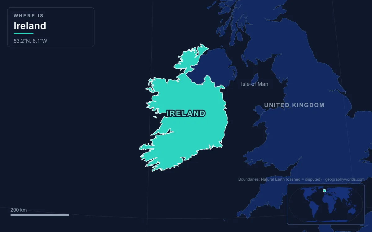
Ireland, the state, covers 70,273 km², about five-sixths of the island of Ireland in northwestern Europe, which lies west of Great Britain across the Irish Sea; its only land border is with Northern Ireland. Its geography is a saucer: a low central plain of limestone, lakes and bogs, ringed by coastal mountains such as the Wicklow Mountains in the east (Lugnaquilla, 925 m) and MacGillycuddy's Reeks in the southwest, where Carrauntoohil, 1,039 m, is the highest point in Ireland. The Atlantic west coast is the most broken, cut into peninsulas, fjord-like inlets, cliffs and islands, and no part of the island is more than about 110 km from the sea. The Shannon, about 360 km long with a 102 km estuary, is the longest river in Ireland and the British Isles; the Barrow, at 192 km, is second. The 2022 census counted 5,149,139 people. One road links many of the landforms that define the country: the Wild Atlantic Way, a 2,500 km driving route launched in 2014 that runs from Donegal's Inishowen Peninsula south to Kinsale in County Cork. Here are its stops, north to south.
Malin Head and Errigal: Donegal’s Ancient North
The route begins at Malin Head on Inishowen, the northernmost point of mainland Ireland at about 55.38°N. The headland lends its name to the Malin sea area of the BBC Shipping Forecast, and a weather station there has sent reports since 1885. Below it, Ballyhillion beach is a raised beach system of international importance: as the ice sheets melted some 15,000 years ago, the land, pressed down by their weight, stood so low that the sea reached up to 80 ft (about 24 m) above today's level, and the old shorelines are still visible as steps. Offshore, Inishtrahull holds Ireland's oldest known rock, about 1.7 billion years old.
Heading southwest past Gweedore, the road passes Errigal, 751 m, the highest peak of the Derryveagh Mountains and of County Donegal. It is the southernmost and steepest of a chain locals call the Seven Sisters, and its quartzite glows pink at sunset.
Slieve League and Benbulbin: Sea Cliffs and a Limestone Table
On Donegal's southwest coast, Slieve League rises to 601 m and drops almost straight into the Atlantic. Its seaward face is among the highest sea cliffs in Europe, second in Ireland only to Croaghaun on Achill Island, and it is usually photographed from the Bunglass viewpoint above Teelin. A knife-edge ridge along the summit, the One Man's Path, links the tops.
Across Donegal Bay in County Sligo stands Benbulbin, 526 m, a steep-sided, flat-topped mountain in the Dartry range. Its layers of Carboniferous limestone over mudstone formed in a shallow sea around 345 to 330 million years ago; the hard Dartry Limestone caps the top, fossil seashells run through every layer, and the shale near the base also holds corals. During the last Ice Age it stood as a nunatak, and glaciers flowing from northeast to southwest cut the old plateau into its present profile.
Achill Island and Croagh Patrick: Mayo’s Holy Mountain
In County Mayo the route crosses a bridge onto Achill Island, at about 148 km² the largest of the Irish isles, joined to the mainland by a bridge since 1887 and home to 2,345 people in 2022. Its western peak, Croaghaun, 688 m, has the highest sea cliffs in Ireland and the third highest in Europe, after Hornelen in Norway and Cape Enniberg in the Faroe Islands. They face north and can be seen properly only from the summit or from the sea.
Farther south, Clew Bay holds more than a hundred small islands on its landward side, Ireland's best example of sunken drumlins: low, rounded hills of glacial debris that the rising sea has partly drowned. Above the bay's southern shore rises Croagh Patrick, 764 m, a pyramid-shaped peak known locally as "the Reek". Saint Patrick is said to have fasted forty days on the summit, and thousands of pilgrims climb it every year on Reek Sunday, the last Sunday in July.
Killary Harbour and the Twelve Bens of Connemara
At the Mayo–Galway border the road reaches Killary Harbour, a flooded glacial valley 16 km long and 42 to 45 m deep in its centre, with a shallower sill at the mouth, as is typical of a fjord. It has long been called "Ireland's only fjord", though some researchers classify it as a shallower fjard. Halfway along it crooks from southeast to due east, then narrows, widens again near Leenane and ends in the valley of the River Erriff. On its northern shore Mweelrea climbs steeply to 814 m, the highest mountain in the province of Connacht. To the south lie the Maumturk Mountains and the Twelve Bens, the sharp quartzite peaks of Connemara National Park, highest at Benbaun, 729 m. Their rocks are metamorphosed marine sediments known as Connemara Dalradian, with schists in the valleys.
The Burren and the Cliffs of Moher
South of Galway Bay the scenery turns grey. The Burren in north County Clare, from the Irish Boirinn, "rocky district", is a karst landscape of about 530 km² inside a ring formed by Lisdoonvarna, Corofin, Gort and Kinvara. Rainwater has dissolved the bare limestone into pavements of blocks and cracks, with sinkholes and caves below, and the Aran Islands in Galway Bay are a geological extension of the same hills. Arctic–alpine and Mediterranean plants grow side by side in the crevices, known as grikes, and over 70 percent of Ireland's flowering species are found here; and among the stone lie monuments such as the Poulnabrone dolmen. Burren National Park, which covers only a small part of the region, is the smallest of Ireland's eight national parks.

On the Burren's southwestern edge, the Cliffs of Moher run for about 14 km. They stand 120 m high at Hag's Head in the south and reach 214 m just north of O'Brien's Tower, built in 1835. On a clear day the view takes in the Aran Islands, the Twelve Bens and Loop Head, and around 1.5 million visits a year make the cliffs one of the most visited sites in Ireland.
Loop Head and the Shannon Estuary: Where the Central Plain Drains
At Loop Head, the tip of a peninsula saved from being an island by barely a mile of land, the route turns inland along the Shannon Estuary, a broad break in the western mountain rim. This is where the interior of the country meets the sea. The Shannon rises at the Shannon Pot, a small pool on the slopes of Cuilcagh Mountain in County Cavan, and flows south through Lough Allen, Lough Ree and Lough Derg, touching 11 counties on its way to Limerick. Lough Derg, the southernmost of those three lakes, is the third-largest lake on the island after Lough Neagh and Lough Corrib. Its basin covers about 16,900 km², roughly a fifth of the island, taking in much of the low limestone plain, its raised bogs and its lakes. With an average flow of about 208 m³ a second at Limerick, it carries twice the water of any other Irish river.
The river divides the west, principally Connacht, from Leinster and most of Munster, and fewer than 35 crossing points span it between Dowra in the north and Limerick. Above the city, the Ardnacrusha power station, built in the 1920s, was producing 80 percent of Ireland's electricity by 1935. Below the city, the tidal estuary runs another 102 km out to the Atlantic between Loop Head and Kerry Head.
The Dingle Peninsula and MacGillycuddy’s Reeks
County Kerry holds the highest ground in Ireland. On the Dingle Peninsula, which ends at Dunmore Head, the westernmost point of the mainland, Mount Brandon rises to 952 m, the highest Irish peak outside MacGillycuddy's Reeks. Across Dingle Bay on the Iveragh Peninsula, the Reeks climax at Carrauntoohil, 1,038.6 m. Like Brandon, it is built of Old Red Sandstone, purple-red rock laid down in the Devonian period, roughly 410 to 350 million years ago, when Ireland lay near the equator. Ice Age glaciers then carved corries such as the Eagle's Nest into its northeastern face, along with sharp arêtes and deep gullies.

Off the Iveragh coast, 11.6 km out to sea, the twin pinnacles of Skellig Michael formed in the same mountain-building episode, about 374 to 360 million years ago, and were cut off from the mainland only when sea levels rose.
The Old Head of Kinsale: End of the Road
From Kerry the route winds around the Beara Peninsula and the coves of west Cork to finish near Kinsale, on the Celtic Sea. The Old Head of Kinsale is a narrow headland walled off by a castle rebuilt around 1223 and marked by lighthouses since a light was established in the 17th century. It is also the nearest land to where the RMS Lusitania sank in 1915, 18 km offshore.
Between Malin Head and Kinsale, the drive has taken in rock from the 1.7-billion-year-old gneiss of Inishtrahull, seen offshore, to the drumlins of the last glaciation, and every high point on it sits on the rim of the country, not its centre. To follow the great river inland, see our guide to the River Shannon; to understand the Burren's rock, read about karst landscapes; and for the city at the other end of the island, visit Dublin, the capital.