

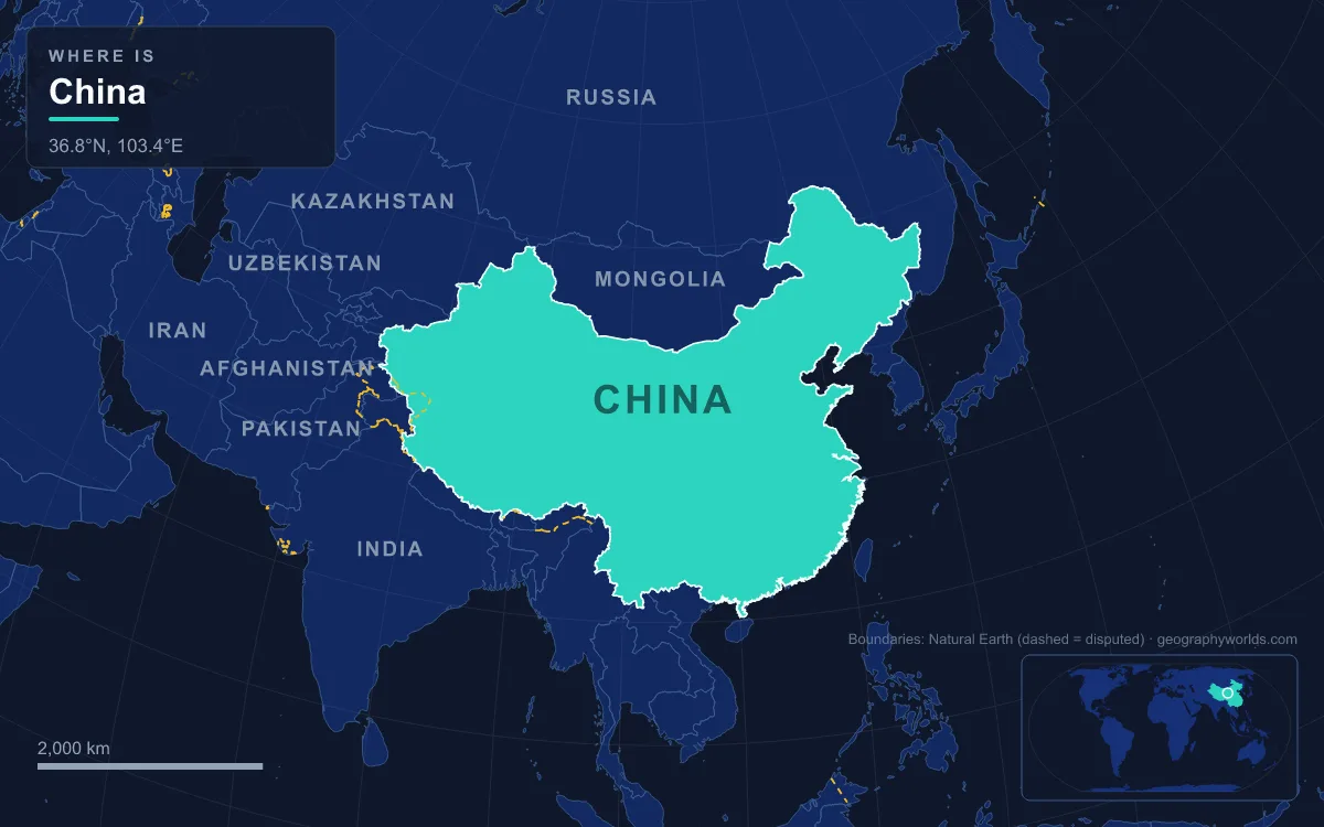
China's land falls from west to east like a staircase: from the Himalayas and the Tibetan Plateau, averaging about 4,000 m, down through the basins and plateaus of the north and centre, to the plains and hills of the Pacific coast. The People's Republic covers about 9.6 million km² in East Asia (9,596,961 km², excluding Taiwan, which it claims but does not govern), making it one of the three or four largest countries on Earth, and it had about 1.4 billion people in 2025. Its main physical regions are the Tibetan Plateau; the desert basins of Xinjiang, the Tarim and the Junggar; the Inner Mongolian Plateau and the Gobi; the Loess Plateau; the North China and Northeast plains; the Sichuan Basin and the Yunnan–Guizhou Plateau; and the hills of the southeast. The highest point is Mount Everest, 8,849 m, on the border with Nepal; the lowest is Lake Ayding in the Turpan Depression, 154 m below sea level. The main rivers are the Yangtze, at roughly 6,300 km the longest in Asia, the Yellow River (5,464 km), the Pearl and the Heilongjiang, or Amur.
The Tibetan Plateau and Everest's North Face
The top step is the largest and highest plateau in the world. The Tibetan Plateau covers about 2.5 million km², just over a quarter of China, at an average of 4,000 m above sea level. The Himalayas form its southern rim, the Karakoram and Pamirs its western corner, and the Kunlun Mountains its northern edge. Eleven of the seventeen tallest peaks on Earth stand on China's western borders, and nine of the fourteen peaks above 8,000 m are in China or on its borders. Everest, measured jointly by Chinese and Nepalese surveyors in 2020 at 8,848.86 m, sits on the China–Nepal border, and K2, 8,611 m, on the Pakistan border. The highest peak entirely inside China is Shishapangma, 8,027 m, in Nyalam County of Tibet.
Almost every great river of East and South Asia starts up here. The Yangtze rises at Jari Hill in the Tanggula Mountains and the Yellow River in the Bayan Har Mountains, while the Yarlung Tsangpo, the upper Brahmaputra, runs east along the foot of the Himalayas before turning south around Namchabarwa, the eastern anchor of the range and Earth's easternmost peak over 7,600 m. On the northeastern edge of the plateau lies Qinghai Lake, China's largest lake, an alkaline salt lake that covered 4,317 km² in 2008.
Xinjiang's Tarim Basin, the Taklamakan and the Turpan Depression
North of the Kunlun, the ground drops into the Tarim Basin of southern Xinjiang, China's largest basin, at an average of about 1,000 m. Its floor is the Taklamakan Desert, 337,000 km² of shifting sand, slightly smaller than Germany, with dunes up to about 90 m high. Mountains close it on three sides, the Kunlun to the south, the Pamirs to the west and the Tian Shan to the north, so rain-bearing air rarely reaches it. People live only in oases along its rim, fed by snowmelt rivers from the mountains, and the two branches of the Silk Road skirted its northern and southern edges rather than crossing it.
The Tian Shan, whose highest peak, Tömür, rises to 7,439 m on the Kyrgyz border, divides the Tarim from Xinjiang's second basin, the Junggar, which holds the Gurbantünggüt Desert and is closed to the north by the Altay Mountains along the borders with Russia and Mongolia. East of the Tarim, inside the Tian Shan, lies the fault-bounded Turpan Depression, about 50,000 km² and some 150 km southeast of Ürümqi. Its dried lake bed, Lake Ayding, is China's lowest point, and temperatures there have reached 49.6 °C.
The Qaidam Basin, the Hexi Corridor and the Inner Mongolian Plateau
Northeast of the Tibetan Plateau, the Qilian and Altun ranges branch off the Kunlun. Between them in northern Qinghai lies the Qaidam Basin, about 120,000 km² at 2,600 to 3,000 m, a hyperarid bowl where saline lakes and playas cover about a quarter of the floor. North of the Qilian runs the Hexi Corridor of Gansu, a narrow strip of arable plain between the Tibetan and Mongolian plateaus. It was the main route of the Northern Silk Road between China proper and Central Asia, and the modern highway and railways to Xinjiang still follow it.
Farther north, the Inner Mongolian Plateau lies between 900 and 1,500 m and arcs northeast until it becomes the Greater Hinggan Range. This is grassland and desert, including the Chinese part of the Gobi, a cold desert of rock and gravel that covers about 1.3 million km² across southern Mongolia and northern China. The line between the dry grasslands of herders and the farmland to the south follows the mountains at the plateau's southern edge, and the Ming-era Great Wall runs along that line for more than 2,000 km, from Shanhaiguan on the Bohai coast to the Hexi Corridor.
The Loess Plateau and the Yellow River's Silt
Between the Qinling Mountains and the Inner Mongolian Plateau lies the Loess Plateau, one of the largest and thickest loess plateaus in the world, covering about 635,000 km² of Shaanxi, Shanxi, Gansu, Ningxia and Qinghai at 1,000 to 1,500 m. It is built of loess, a fine, yellowish silt blown in from the deserts to the northwest by monsoon winds during the Quaternary and piled up to 200 to 300 m thick near the Liupan Mountains. It is fertile but erodes fast, leaving platforms, ridges and steep gullies.

The Yellow River takes its colour and name from that silt. After leaving the Tibetan Plateau it swings through the 1,500 km Ordos Loop, north into Inner Mongolia and then south to form the border between Shanxi and Shaanxi, picking up loess the whole way. It then turns east where it meets the Wei River, whose valley, north of the Qinling, was one of the early centres of Chinese civilisation. By the time it reaches the plain it carries so much sediment that, behind ever-higher levees, its bed has at times risen above the surrounding countryside; one estimate counts 1,593 floods between 595 BC and 1946.
The North China Plain and the Northeast Plain
The lowest step begins where the Yellow River leaves the hills. The North China Plain, China's largest alluvial plain, is a sunken rift basin filled with river sediment, bounded by the Yan Mountains to the north, the Taihang Mountains to the west, the Dabie Mountains to the south and the Bohai and Yellow seas to the east. Roughly a triangle with Beijing, Shanghai and Yichang at its corners, it is one of the most densely populated regions of China. Beijing, at its northern tip, sits where the Taihang and Yan mountains meet. Its Yellow River core, the Central Plain, was the cradle of Chinese civilisation.
Past Shanhaiguan, where the mountains meet the sea, a narrow coastal strip opens into the Northeast China Plain, about 350,000 km² and the country's largest plain. The Greater Hinggan closes it to the west, the Lesser Hinggan to the north and the Changbai Mountains to the east, whose highest summit, Paektu Mountain, 2,744 m, stands on the border with North Korea and holds the crater lake called Heaven Lake. The Heilongjiang, or Amur, forms the frontier with Russia to the north; the Amur proper is 2,824 km long. Its humus-rich chernozem, or black soil, is the third-largest such region in the world, after the East European Plain and North America's Great Plains.
The Qinling Divide, the Sichuan Basin and the Yunnan–Guizhou Karst
The Qinling Mountains of southern Shaanxi, with the Daba Mountains south of them, are the most important internal boundary in China. They separate the Yellow River and Yangtze basins, and geographers extend the line east along the Huai River as the Qinling–Huaihe Line, roughly the 33rd parallel. North of it winters bring regular snow and the climate is temperate or continental; south of it the land is subtropical, wetter and hillier.
Just south of the Qinling lies the Sichuan Basin, also called the Red Basin: about 229,500 km² of hilly lowland, ringed by mountains 1,000 to 3,000 m high, with a floor averaging about 500 m. Chengdu anchors the Chengdu Plain in the west and Chongqing the east, and the basin's fertile soils and rice fields support more than 100 million people. To its west the land climbs abruptly into the Great Snowy Mountains, where Gongga Shan reaches 7,556 m.
Southeast of the Tibetan Plateau and south of the Sichuan Basin is the Yunnan–Guizhou Plateau, at an average of about 2,000 m. In Yunnan it is a true plateau of flatter highland; in Guizhou and beyond it breaks into gorges, rolling hills and limestone karst. The karst reaches its best-known form at Guilin in northern Guangxi, where the Li River drops from 141 m at Guilin to 103 m at Yangshuo between towers of Devonian and Carboniferous limestone, 30 to 80 m high in the central basin.

The Yangtze Valley, the Nanling and the Pearl River Delta
The Yangtze collects the waters of the Sichuan Basin and leaves it through the Three Gorges. Just downstream, near Yichang in Hubei, the Three Gorges Dam, 185 m high and about 2.3 km long, was completed in 2006, and with 22,500 MW of installed capacity it is the largest power station in the world. Below the gorges the river crosses the middle and lower Yangtze plains and enters the East China Sea near Shanghai. Its basin covers about a fifth of China's land and holds nearly a third of its people, and the Yangtze Delta produces as much as 20 percent of the national economy.
South of the Yangtze the land is rugged again. Hunan and Jiangxi each centre on a river basin ringed by ranges, the Wuling, Luoxiao and Wuyi mountains among them, and the coastal provinces of Zhejiang, Fujian and Guangdong have rocky shores with pockets of lowland backed by the Southeast Hills. The Nanling range runs east to west across northern Guangdong, separating it from Hunan and Jiangxi. Beyond it the Xi, Bei and Dong rivers meet in the Pearl River Delta; measured from its farthest source, the Pearl system runs about 2,400 km, China's third longest and second by volume, draining 453,700 km² before entering the South China Sea. China's 18,000 km coastline now carries much of its export trade.
Taken together, the staircase explains the map of where people live. Mountains make up about a third of China's land and plateaus about a quarter; the plains and basins that hold most of the farmland and population are a much smaller share.
For deeper dives into single regions, see the guides to the Tibetan Plateau and the Gobi Desert, or follow China's great river from the Tanggula Mountains to Shanghai in the Yangtze River guide.