

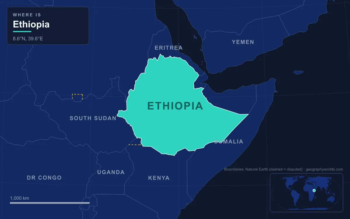
Ethiopia is a landlocked country in the Horn of Africa covering 1,104,300 km², bordered by Eritrea, Djibouti, Somalia, Kenya, South Sudan and Sudan. Its core is the Ethiopian Highlands, a dissected plateau mostly between about 1,300 and 3,000 m that the Great Rift Valley splits diagonally from the Afar lowlands in the northeast to the Kenyan border in the southwest; around it lie the Sudan lowlands to the west, the Danakil Depression and Afar to the northeast, and the Somali plains to the east. The highest point is Ras Dashen in the Simien Mountains at 4,550 m, and the lowest is the Danakil Depression at about 125 m below sea level. The main rivers are the Abay (Blue Nile), which leaves Lake Tana, the Tekezé, the Awash and the Omo. One road shows most of this in a single journey, roughly the Ethiopian line of the Cairo–Cape Town Highway (Trans-African Highway 4): it enters from Sudan at the Gallabat–Metemma crossing, climbs to Gondar, follows the A3 past Lake Tana and across the Blue Nile gorge to Addis Ababa, then runs south down the Rift to Moyale on the Kenyan border.
Metemma to Gondar: Climbing out of the Sudan Lowlands
The road begins low. Metemma, facing the Sudanese village of Gallabat across the border, stands at 685 m on the hot savanna plains that run west toward the Nile valley. From here the old caravan route from Sennar to Gondar, now a highway, heads east and climbs the plateau's northwestern edge. North of about 11° N the western wall of the highlands falls more gradually than it does further south, descending in terraces to the plains of eastern Sudan, so the climb comes as a long series of steps rather than one escarpment.
At the top is Gondar, roughly 35 km north of Lake Tana on the Lesser Angereb River, with an estimated population of 443,156 in 2021. Emperor Fasilides chose it as his royal camp in 1636 partly because caravans from Sudan and the Red Sea converged here, which is the same geography the highway follows today. His castle compound, Fasil Ghebbi, is a UNESCO World Heritage Site. Gondar is also where the A3 begins: a 762 km trunk road to Addis Ababa that runs between about 1,800 and 3,000 m for most of its length.
The Simien Massif and Ras Dashen, Northeast of Gondar
On a clear day the skyline northeast of Gondar is the Simien massif, reached by a side road through Debark, the headquarters of Simien Mountains National Park. The park, established in 1969, was one of the first sites inscribed on UNESCO's World Heritage List, in 1978; it was placed on the List of World Heritage in Danger in 1996 and removed in 2017 after populations of its rarest animals stabilised. These include the walia ibex, a wild goat found nowhere else, the Ethiopian wolf and the gelada.
Ras Dashen, called Ras Dejen by the Ethiopian Mapping Authority, rises to 4,550 m as the eastern peak on the rim of what the geographer Erik Nilsson described as an enormous old volcano, its northern half cut down about 1,000 m by ravines draining to the Tekezé. Mount Biuat (4,437 m) is its western counterpart across the Meshaha valley. A dirt road through the park crosses the Buahit Pass at about 4,430 m. These heights are typical of the northern highlands, where irregular ranges reach from 3,700 m to just under 4,600 m above a plateau of very old rock averaging 2,000 to 2,200 m. Rivers have cut that plateau into deep gorges and left flat-topped, cliff-sided hills called ambas, the signature landform of northern Ethiopia.
Lake Tana, Bahir Dar and the Blue Nile Falls
South of Gondar the double-numbered section of highway (it also carries Trans-African Highway 6 to Djibouti) runs down the eastern shore of Lake Tana to Wereta, where the two routes split. Lake Tana is the largest lake in Ethiopia: about 84 km long and 66 km wide, but only 15 m deep at most, with a surface of 3,000 to 3,500 km² depending on the rains. It sits at 1,788 m in a basin dammed by volcanic activity. Seven large permanent rivers and about 40 seasonal ones feed it, chief among them the Gilgel Abay, Megech, Gumara and Rib. Its islands hold medieval monasteries, among them Daga Estifanos, where the emperors Zara Yaqob and Fasilides are buried.
The Blue Nile leaves the lake at Bahir Dar, the capital of the Amhara Region, where the A3 crosses the young river. The first modern bridge over it here opened in 1961, and a double cable-stayed bridge followed on 12 May 2024. A control weir at the outlet now regulates the lake's level and the flow released downstream.

About 30 km downstream are the Blue Nile Falls, Tis Abay in Amharic, "great smoke". The falls are 42 m high and in the rainy season spread more than 400 m wide, though since 2003 a hydroelectric station has diverted much of the water outside the wet months. Nearby stands the first stone bridge built in Ethiopia, ordered by Emperor Susenyos in 1626. The falls mark the start of the river's canyon, and they isolate Lake Tana's wildlife from the rest of the Nile, one reason the lake has its own endemic fish.
Across Gojjam and Down into the Abay Gorge at Dejen
From Bahir Dar the A3 swings southeast across the Gojjam plateau through Debre Markos, founded in 1853 as Manqwarar, "cold place". The river it is circling has meanwhile looped east and south into a canyon about 400 km long and up to roughly 1,500 m deep, a formidable barrier to travel between northern and southern Ethiopia. Dejen, on the canyon's northern lip at about 2,421 to 2,490 m, is where the road plunges in. The A3 drops and climbs about 1,500 m in and out of the valley, and the 41 km between Dejen and Gohatsion on the far side were paved only in 2009.
The gorge explains Ethiopia's role in the Nile. Most of the highlands tilt to the northwest, so the Tekezé, the Abay and the Sobat system carry about four-fifths of the country's drainage toward Sudan, and Ethiopian water makes up the large majority of the Nile's flood. Downstream near the Sudanese border stands the Grand Ethiopian Renaissance Dam, built between 2011 and 2025 and formally inaugurated on 9 September 2025; at 5.15 GW it is the largest hydroelectric plant in Africa. Our complete guide to the Blue Nile follows the river on to Khartoum.
Addis Ababa at 2,355 Metres, Below Mount Entoto
The last stretch of the A3 crosses a pass north of the capital at about 2,800 m before descending to Addis Ababa. The city lies at 2,355 m, making it the highest capital in Africa, on former grassland at the foot of the Entoto Mountains, which rise above 3,000 m to the north. Menelik II, finding the Entoto ridge unpleasant, moved down to the valley below it in 1886, where Empress Taytu chose a site beside the hot mineral springs that gave the city its Oromo name, Finfinnee. Addis Ababa sits on the watershed of the Awash and just west of the Rift's edge; its lowest district, around Bole airport, is still at 2,326 m. Its estimated 2025 population of about 6.3 million makes it the largest city in a country of around 138 million. Our profile of Addis Ababa as Ethiopia's capital covers the city itself.
Down the Main Ethiopian Rift: Batu, Langano, Abijatta and Shalla
South of the capital the highway descends into the Main Ethiopian Rift, a valley about 80 km wide bounded by fault escarpments, which formed as the Nubian and Somali plates began to pull apart in the Miocene and is still widening by about 5 to 7 mm a year. The floor holds a chain of lakes. Lake Batu, formerly Ziway, covers 440 km² at 1,636 m and drains through the Bulbula River into Lake Abijatta. Tulu Gudo, one of its five islands, has a monastery said to have sheltered the Ark of the Covenant around the ninth century.

Lake Langano, 200 km by road from Addis Ababa at 1,585 m, is 230 km² and up to 46 m deep; its brown colour comes from dissolved minerals, and it is free of bilharzia, unlike Ethiopia's other freshwater lakes, so resorts line its shores. Just west, the alkaline lakes Abijatta and Shalla, formed by the volcanic activity of the O'a Caldera, share an 887 km² national park with hot springs and large flocks of flamingos. To the east the Rift wall rises to the Bale Mountains, where Tullu Dimtu reaches 4,377 m and the Sanetti Plateau holds the largest groups of Ethiopian wolves.
Hawassa to Moyale: Gedeo Coffee and the Borana Plateau
Past Shashamane the road reaches Hawassa, 273 km from Addis Ababa at 1,708 m. Its lake, 129 km² and only about 10 m deep, fills the Awasa Caldera; it has no surface outlet yet stays essentially fresh, which suggests water escapes underground. Beyond lies Dilla, capital of the Gedeo Zone at 1,570 m, which was the southern end of the all-weather road and the main transfer point for coffee grown farther south until tarmac reached the Kenyan border in the early 1970s. The final stretch crosses Borana to Moyale, the main border post on the Addis Ababa–Nairobi road, which lies on the southern escarpment of the Borana Plateau above the Chalbi Desert of Kenya.
Off the Highway: The Omo Valley and the Danakil Depression
Two of Ethiopia's great lowlands lie off this route, at opposite corners of the country. In the southwest the Omo, carrying about 14% of the country's drainage, flows into Lake Turkana. In the northeast the Danakil Depression, about 200 by 50 km and 125 m below sea level, is a rift basin that the sea flooded repeatedly, most recently about 130,000 years ago, leaving salt deposits more than 500 m thick; it holds Dallol, which has the highest average temperature recorded for any inhabited place, and the Erta Ale volcanic range, explored in our guide to the Danakil Desert.