
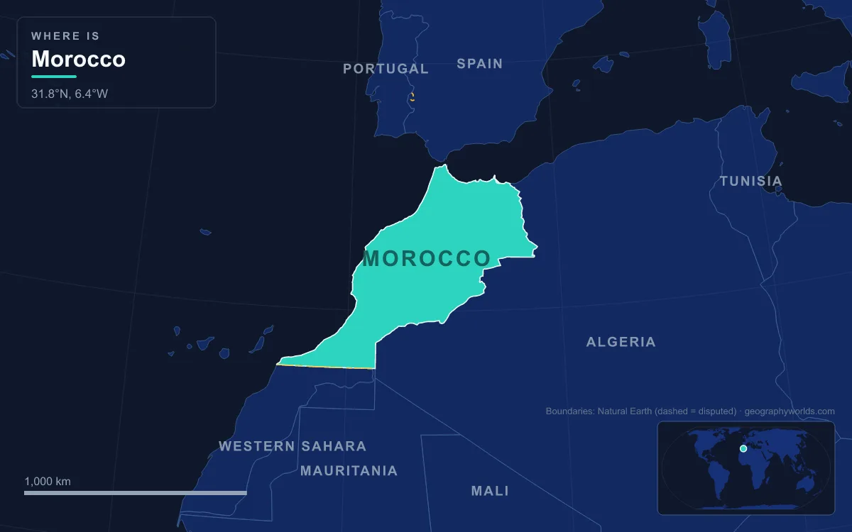
Morocco sits on the northwestern corner of Africa, facing the Atlantic Ocean to the west and the Mediterranean Sea to the north, with Spain just 13 km away across the Strait of Gibraltar. Not counting Western Sahara, a disputed territory to the south that Morocco claims and largely administers, the country covers about 446,550 km²; its 2024 census, which also covered the parts of Western Sahara that Morocco administers, counted about 36.8 million people. Its main physical regions are the Rif mountains along the Mediterranean, the Middle, High and Anti-Atlas ranges running diagonally across the interior, the Atlantic plains and plateaus around Casablanca, Rabat and Marrakesh, and the Saharan desert and oases of the southeast. The highest point is Toubkal in the High Atlas at 4,167 m; the lowest is the salt pan of Sebkha Tah near Tarfaya, 55 m below sea level. The longest river is the Draa at about 1,100 km, and the biggest by flow are the Sebou and Oum Er-Rbia, with the Moulouya draining to the Mediterranean. That map was built over more than half a billion years, and it reads best from the oldest rocks to the youngest dunes.
Precambrian Basement Under the Anti-Atlas and Jbel Saghro
The oldest part of Morocco lies in the south. The Anti-Atlas runs about 500 km from the Atlantic coast northeast towards Ouarzazate and the Tafilalt oasis, and its core exposes Precambrian basement rock of the African Plate, older than about 540 million years. Erosion has stripped this range down to summits that average 2,500 to 2,700 m, much lower than the High Atlas to the north, with a plateau at around 1,700 to 1,800 m on its northern side and Saharan uplands at roughly 700 m to the south.
At its eastern end the range continues as Jbel Saghro, the driest part of the Anti-Atlas, and in the north it joins the High Atlas through Jbel Siroua, a massif of volcanic origin that reaches 3,304 m. Rain is scarce here, typically under 200 mm a year, because the High Atlas shields the range from Mediterranean influence, although the north- and west-facing slopes are locally wetter. The Chleuh Berber villages around Tafraoute survive on terraced fields held up by dry-stone walls, and on argan, thyme and rosemary, plants that tolerate the dry slopes.

Ordovician Seafloor in the Draa Valley
After the Precambrian, much of what is now southern Morocco lay under shallow seas on the margin of the supercontinent Gondwana. The clearest record sits in the Draa valley, in the Fezouata formations. These Lower Ordovician shales, close to 480 million years old, preserve soft-bodied animals in the manner of Canada’s Burgess Shale, and they include many groups that palaeontologists had assumed died out after the middle Cambrian. The Fezouata beds fill a gap in the fossil record between the famous Cambrian sites and the Late Ordovician Soom Shale of South Africa.
The formation is more than 1,000 m thick, yet only two intervals, about 25 m and 15 m thick, preserve the soft tissue, and they crop out over some 500 km² of the valley north of Zagora. More than 1,500 such specimens from about 50 distinct taxa have been recovered. Further east, along the Algerian border, marine Palaeozoic rocks of Cambrian, Silurian and Devonian age form the floor on which later river and desert deposits were laid.
The Variscan Collision, About 300 Million Years Ago
The next great event was a collision of continents. Around 300 million years ago Gondwana, which included Africa, ground against Euramerica as the supercontinent Pangaea assembled. The impact folded the Palaeozoic rocks of the Anti-Atlas into a mountain chain that geologists link with the Appalachians of eastern North America; it may once have been higher than the Himalayas are today. Africa and North America were joined along this belt, and remnants of the same chain survive on the far side of the Atlantic, in the Appalachians and along the Fall Line of the eastern United States.
Almost nothing of that original height remains. Some 300 million years of erosion wore the chain down to the stumps that form today’s Anti-Atlas, and its debris was carried into basins that would later become the High Atlas.
Mesozoic Rifts, Kem Kem Rivers and the Khouribga Phosphate Sea
When Pangaea began to break apart in the Mesozoic, the crust under Morocco was stretched rather than squeezed. Rifts opened as the Atlantic was born, and long basins filled with sediment. Most of the rocks that form the surface of the present High Atlas were laid down in these basins under the sea, which is why limestone and marl, not granite, dominate its central valleys.
On land to the southeast, rivers built a delta. The Kem Kem beds, exposed on an escarpment along the Algerian border, are sandstones and mudstones of the Cenomanian stage of the Late Cretaceous, roughly 100 to 95 million years old. They record a tropical river system with brief monsoon rains, crowded with large predatory dinosaurs, before rising seas drowned the area and covered it with limestone.
Those seas left Morocco its most valuable rock. The Ouled Abdoun Basin around Khouribga, west of the Atlas, holds phosphate deposits that span the Late Cretaceous to the Eocene, a period of about 25 million years. It covers some 4,500 km², holds about 44% of Morocco’s phosphate reserves, at least 26.8 billion tonnes, and is the largest and northernmost of the country’s phosphate basins, ahead of Ganntour and Meskala. The same layers are packed with fossil sharks, bony fish, turtles, crocodilians and sea birds.
Africa Meets Iberia: Raising the High Atlas, Middle Atlas and Rif
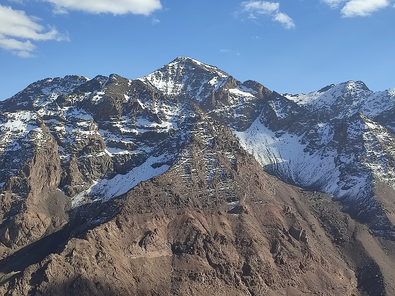
From about 66 million years ago, the direction of movement reversed. Africa pushed north into Europe at the southern tip of the Iberian Peninsula, and the old Mesozoic basins were squeezed and lifted into the High and Middle Atlas. The High Atlas rises at the Atlantic coast and runs east to the Algerian border and carries several summits above 4,000 m. Toubkal, 63 km south of Marrakesh, reaches 4,167 m and is the highest peak in North Africa and the Arab world. Unusually for the range, the Toubkal massif is made of volcanic rock weathered into sharp crests, with a 1,800 m drop to Lac d’Ifni on its southern side.
Geologists still debate how the Atlas grew so high. The crust beneath it is only slightly thickened and shortened, so recent studies suggest that hot mantle rising from below helped push up the High and Middle Atlas. The Middle Atlas, the northernmost of the three Atlas chains, is mostly limestone, climbing to 3,340 m at Jbel Bou Naceur, and is dotted with volcanic plateaus and cones such as Jbel Hebri. It catches more rain than the ranges to its south, and both the Sebou and the Oum Er-Rbia, Morocco’s two biggest rivers by flow, rise in it.
The Rif belongs to a different family. It is part of the Gibraltar Arc and an extension of the Betic mountains of southern Spain, not of the Atlas system. It runs about 250 km from Tangier towards Nador, bounded by the Ouergha River to the south and the Moulouya to the east, and it is the wettest part of Morocco, with some slopes receiving more than 2,000 mm of rain a year and forests of Atlas cedar, cork oak and Moroccan fir.
The collision has not stopped. On 8 September 2023 a magnitude 6.9 earthquake caused by shallow oblique-thrust faulting beneath the High Atlas struck Al Haouz Province, about 73 km southwest of Marrakesh. It was the strongest earthquake ever recorded by instruments in Morocco and killed at least 2,960 people, most of them in mountain villages.
The Rifian Corridor and the Mediterranean That Dried Out
Before the Strait of Gibraltar existed in its modern form, Atlantic water reached the Mediterranean through seaways across southern Spain and northern Morocco, including the Rifian corridor. As the Rif and Betic mountains rose, these corridors closed. About 5.96 million years ago the Mediterranean was cut off, and in the Messinian salinity crisis that followed it partly dried out, possibly several times, leaving salt layers tens of metres thick on its floor.
The crisis ended 5.33 million years ago with the Zanclean flood, when the Atlantic broke through at Gibraltar and refilled the basin, perhaps within a few months to two years. The strait that resulted, 13 km wide at its narrowest, is the reason Morocco faces two seas. Today the Atlantic still flows in to replace water the Mediterranean loses to evaporation.
The Draa, Erg Chebbi and the End of the Green Sahara
The youngest landforms are shaped by water and wind. The Draa forms at the confluence of the Dadès and Imini rivers, flows out of the High Atlas, cuts through the Anti-Atlas, runs southeast to Tagounite and then turns west towards the Atlantic north of Tan-Tan. At about 1,100 km it is Morocco’s longest river, yet beyond Tagounite it is dry for most of the year, and the Mansour Eddahabi dam, built in 1971, now regulates its upper flow. Stone tools found near Tamegroute show people lived along the valley in the Lower Palaeolithic, and Neolithic rock art there depicts hunting scenes and domesticated cattle in a landscape that is now desert.
The dating of that art is uncertain; the earliest panels may go back to the 3rd millennium BCE, soon after the close of the African humid period. That wet phase began roughly 14,600 years ago, when a stronger monsoon spread grassland and lakes across the Sahara, and it ended between about 6,000 and 5,000 years ago. Today the southeast is true desert, and Erg Chebbi, near Merzouga on the Algerian border, shows it at its most dramatic: a sea of wind-blown sand about 28 km long and 5 to 7 km wide, whose dunes rise up to 150 m above the surrounding rocky hamada.

On the Atlantic side, the coast near Tarfaya holds Sebkha Tah, a salt flat 55 m below sea level and the lowest point in the country. Between these extremes, about 95% of Moroccans live in the milder northwest, where a Mediterranean climate takes on oceanic influence along the Atlantic coast. For a closer look at the ranges that make up the country’s spine, read our guide to the Atlas Mountains; for the waterway born in the Zanclean flood, see the Strait of Gibraltar guide; and for how rain and heat change between the Rif and the Sahara, continue to the climate of Morocco.