

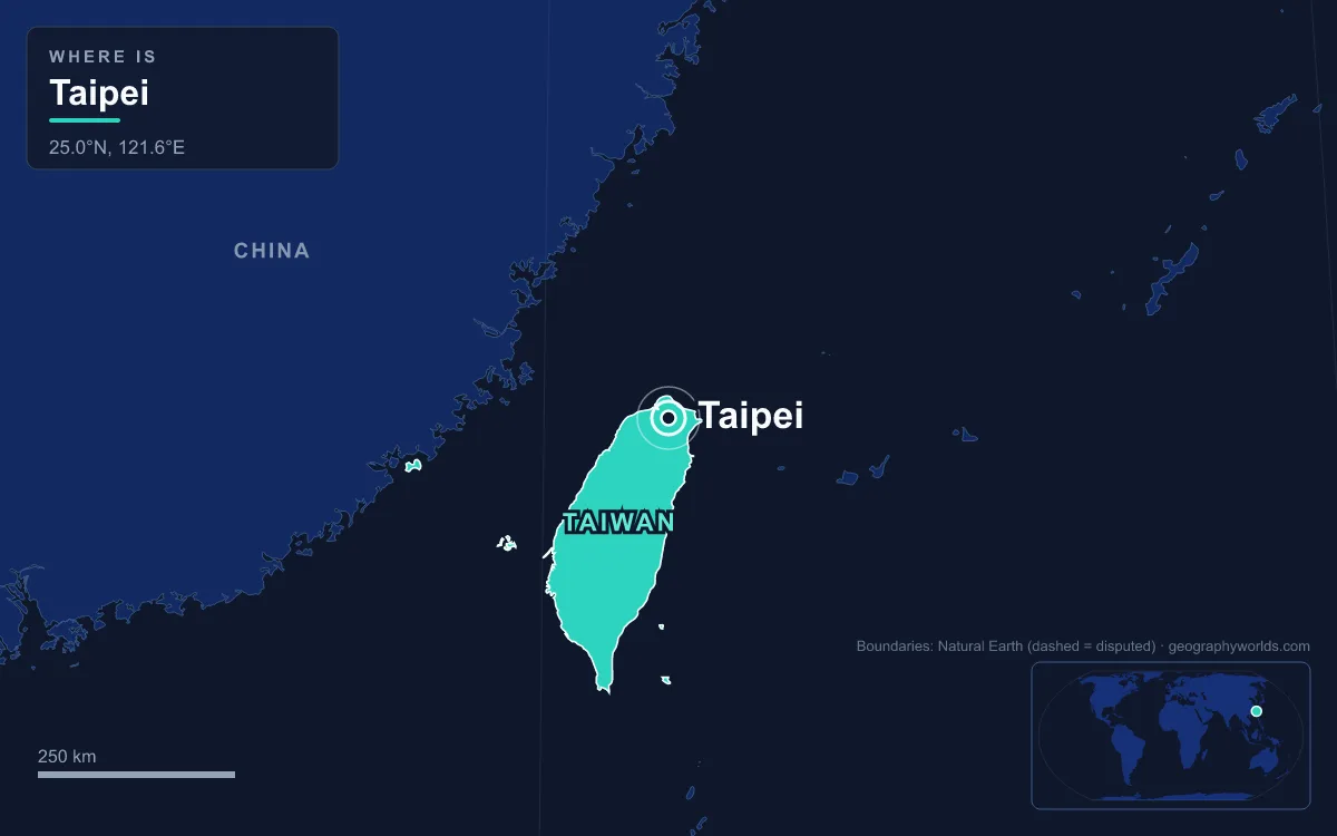
The capital of Taiwan is Taipei, a city of about 2.49 million people (March 2023) in the Taipei Basin, an ancient lakebed at the northern end of the island where the Keelung and Xindian rivers join to form the Tamsui. Taipei has been the seat of the Republic of China government, Taiwan’s official name, since December 1949, when the Kuomintang declared it the provisional capital after losing the civil war on the mainland, and it has functioned as the capital ever since. The People’s Republic of China, governing from Beijing, claims Taiwan as part of its territory and does not recognise that government, and that ambiguous international status is why Taiwan’s athletes compete at the Olympics as “Chinese Taipei”. The city proper covers 271.8 square kilometres and is entirely surrounded by New Taipei City; together with Keelung the metropolitan area holds about 7.05 million people. Taipei is best understood on foot, because its history is laid out in order from the river bank eastward: an 18th-century temple town, a 19th-century tea port, a walled Qing capital, a Japanese administrative quarter and a 21st-century skyline.
Wanhua: Lungshan Temple and the Settlers of Bangka
Start where the city started, on the east bank of the Tamsui River in Wanhua District. Before the 18th century the Taipei Basin belonged to the Ketagalan, a Plains Indigenous people. Han Chinese settlers from southern Fujian began arriving in 1709, and the riverside village of Bangka (also spelled Manka) grew into the basin’s chief trading town. In 1738 settlers from the counties of Jinjiang, Nan’an and Hui’an built a temple here to Guanyin, naming it after the Lungshan Temple in their home county.

None of the 1738 structure survives. Earthquakes and fires damaged the temple repeatedly, it was rebuilt between 1919 and 1924, and on 31 May 1945 American bombers hit it during the Taihoku Air Raid, the largest Allied attack on the city, because the Japanese were reportedly storing weapons there. The main hall and the left corridor were damaged, many artworks were lost, and the temple was rebuilt after the war. Today the temple mixes Buddhist worship of Guanyin with halls to folk deities such as Mazu, the sea goddess, and Guan Yu, a blend described in the guide to religion in Taiwan.
A short walk north brings you to Ximending, also in Wanhua. Its name comes from Seimon-chō, a Japanese-era ward meaning the area outside the city’s west gate. It became Taipei’s theatre street in the 1930s, and at one point one section of Wuchang Street alone had more than ten cinemas. As the city’s centre of gravity moved east in the 1990s, business fell away, until in 1999 the city closed the streets to cars on weekends and holidays. Ximending became Taipei’s first pedestrian zone and is still the largest in Taiwan.
Dadaocheng: Dihua Street and the 1850s Tea Trade
Walk north along the river into Datong District and you reach Dadaocheng, known in Taiwanese Hokkien as Twatutia. Its rise came from a quarrel: in 1853, after a feud in Bangka known as the Ding-Xia Jiao conflict, many of its residents moved downriver here. At the same time tea exports from northern Taiwan were booming: the first shop opened in 1851, foreign traders arrived in 1867, and five British firms had offices in Twatutia by 1872.
The spine of the district is Dihua Street, laid out in the 1850s as Centre Street by merchants whose families came from Quanzhou. For the rest of the century it was the island’s main market for Chinese medicinal herbs, fabrics, incense materials and tea processing, and it is often called Taipei’s oldest street. The present name dates only from 1947, when the Republic of China government renamed it after the city of Dihua, now Ürümqi, in Xinjiang. Before Lunar New Year the street hosts a market that draws crowds from across the city.

Dadaocheng was also the first place in Taipei with a railway station, opened in October 1891 when the line to Keelung began service. It was also the centre of the 28 February Incident of 1947, which began in Taipei and grew into an island-wide crackdown by forces loyal to Chiang Kai-shek; Taiwan’s martial law period ran from 1949 to 1987.
Chengnei: The 1884 Walls and the North Gate
Turn southeast and the street grid tightens into what was once Chengnei, “the inner city”. When the Qing dynasty created Taipeh Prefecture in 1875, it placed the new prefectural seat beside the thriving townships of Bangka, Dalongdong and Twatutia. Work on walls began in 1879 but stalled because the soil was too soft; the finished circuit, nearly 5 kilometres long with five gates, was completed only in 1884. In 1886 Taipeh was designated the capital of the new Taiwan Province, and it was formally confirmed in that role in 1894.
The walls did not last. After Japan took Taiwan in 1895 under the Treaty of Shimonoseki, the colonial government demolished them, along with the West Gate, as part of its restructuring of the city. After 1945 the East, South and Little South gates were rebuilt in altered form. Only the North Gate still looks as it did in 1884: a solidly built two-storey closed blockhouse in the traditional style.
Zhongzheng District: The Presidential Office and Liberty Square
Inside the old walls stands the clearest symbol of Taipei’s role as a capital. The Presidential Office Building was designed by Uheiji Nagano, whose plan won a two-stage competition held in 1906 and 1910, and it was built between 1 June 1912 and 31 March 1919 as the Office of the Governor-General of Taiwan. Tokyo raised the central tower from six storeys to eleven, and the building faces east. On 31 May 1945 the same air raid that struck Lungshan Temple set it burning for three days. Around 81,000 workers restored it in 1947 and 1948, and in 1950 it became the Office of the President.
A few blocks southeast lies Liberty Square, a 240,000-square-metre plaza flanked by the National Theater and National Concert Hall. At its east end is the National Chiang Kai-shek Memorial Hall, begun on 31 October 1976, the 90th anniversary of Chiang’s birth, and opened on 5 April 1980, five years after his death. Two flights of 89 steps, one for each year of his life, lead to the hall. The square carries a different memory too: in 1990 the Wild Lily student rallies here helped move Taiwan from one-party rule to multi-party democracy by 1996.
Xinyi: Taipei 101 and the 1937 Tobacco Factory
From here the metro is the easiest way east. The Taipei Metro opened on 28 March 1996 as the island’s first rapid transit system and has grown to 131 stations carrying more than two million trips a day. Get off in Xinyi District, the financial centre where banks such as Cathay Life Insurance, Shin Kong and Hua Nan have built towers. Also in Xinyi, the Songshan Cultural and Creative Park occupies a tobacco factory the Japanese monopoly bureau built in 1937; cigarette production stopped in 1998, and the buildings reopened as a creative park in 2011.
Above everything rises Taipei 101, 508 metres tall with 101 floors. It was officially the world’s tallest building from its opening on 31 December 2004 until the Burj Khalifa in Dubai took the title at the end of the decade, and its lifts, built by Toshiba, were the world’s fastest at completion, climbing from the 5th to the 89th floor in 37 seconds. The design includes features to withstand the earthquakes and typhoons of the region; the typhoon season here runs from June to October. How it compares with the rest of the skyline is set out in the list of the tallest buildings in Taipei.
Shilin and Beitou: The Palace Museum and Yangmingshan’s Volcanoes
The walk ends in the north, in districts that were not part of Taipei at all until 1968. After Taipei became a special municipality on 1 July 1967, it annexed Shilin, Beitou, Neihu, Nangang, Jingmei and Muzha the following year, quadrupling its area and lifting its population to 1.56 million. The city’s 16 districts were merged into the current 12 in 1990.
In Shilin, the National Palace Museum holds nearly 700,000 objects spanning 8,000 years of Chinese history, most of them from the imperial collections of the Ming and Qing dynasties. The museum was founded in Beijing’s Forbidden City in 1925, and its treasures were moved to Taiwan during the government’s retreat before it reopened here in 1965. Further north, Beitou takes its name from Kipatauw, a Ketagalan word meaning witch, and its valley is known for the steam that rises from geothermally warmed rivers. A German sulphur merchant opened the first hot-spring club shortly before Japanese rule, and the Japanese developed the springs into a resort.
Behind Beitou rise the peaks of Yangmingshan National Park, including Qixing Mountain, at 1,120 metres the highest dormant volcano in Taiwan and the tallest point on the rim of the basin. Snow has been recorded within the city limits only on mountains such as these, and the city’s recorded temperatures have ranged from −0.2°C in February 1901 to 39.7°C on 24 July 2020. From the slopes you can look back across the whole route, from the Tamsui River where Bangka began to the tower in Xinyi, and on a clear day towards the coast facing the Taiwan Strait, the water that separates the island from mainland China.
Quick Facts About Taipei
- Country: Taiwan
- Continent: Asia (East Asia)
- Country population: approximately 23.0 million
- Capital city status: Taipei is the capital of Taiwan, the seat of national government, and the location of foreign embassies, parliament, and the head of state's official residence.
Frequently Asked Questions
What is the capital of Taiwan?
The capital of Taiwan is Taipei. Taipei is the seat of national government, hosts most foreign embassies and consulates, and is typically where the head of state and parliament are located.
What continent is Taipei in?
Taipei, the capital of Taiwan, is located in Asia, in the East Asia region. As Taiwan's capital, Taipei serves as the country's primary connection to the broader Asian political, economic, and cultural sphere.
Why is Taipei the capital of Taiwan?
Taipei was chosen as the capital of Taiwan for reasons that typically combine geography, history, and politics. Capital city selections often reflect a desire for centrality (being accessible from across the country), historical importance (being a longstanding seat of government or culture), or neutrality (being acceptable to multiple regions or ethnic groups within the country). The specific reasons for Taipei's designation are detailed in the city's history above.
What is Taipei known for?
As the capital of Taiwan, Taipei is best known for housing the country's central government institutions — parliament, presidential or royal residences, supreme court, and key ministries. It is also typically a major cultural and economic center within Taiwan, hosting national museums, embassies, and signature monuments. The introduction and history sections above provide detailed coverage of the city's specific notable institutions and landmarks.
Related Pages
- Taiwan Country Guide — full geography, climate, economy, and culture overview
- Flag of Taiwan — meaning, history, and design of Taiwan's national flag