
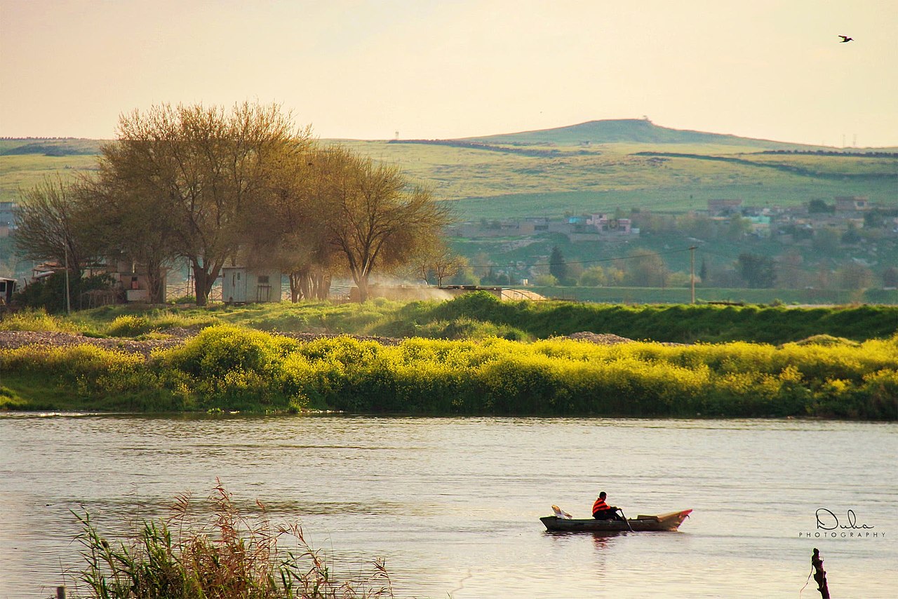
The Tigris River is one of the two great rivers of Mesopotamia, flowing approximately 1,900 kilometers from its source in the Taurus Mountains of eastern Turkey through Iraq to the Shatt al-Arab waterway and the Persian Gulf. Together with the Euphrates, it defined Mesopotamia — the "land between the rivers" — where some of the earliest civilizations in human history arose.
Introduction
The Tigris is the faster-flowing and more unpredictable of the twin rivers, historically prone to sudden, violent floods. Ancient Mesopotamian cities like Nineveh, Ashur, and Ctesiphon were built on its banks. Today, the river faces severe challenges from upstream dam construction, pollution, and climate change-driven water scarcity.

Source to Sea
- Length: ~1,900 km
- Source: Hazar Lake, Taurus Mountains, eastern Turkey (~1,150 m elevation)
- Mouth: Shatt al-Arab waterway, then Persian Gulf
The Tigris rises from Hazar Lake in the Taurus Mountains of southeastern Turkey, flowing southeast through Turkish Kurdistan before crossing into Iraq near the town of Cizre. In Iraq, the river passes through Mosul, Tikrit, Samarra, and Baghdad before merging with the Euphrates at Al-Qurna to form the Shatt al-Arab, which flows 190 kilometers to the Persian Gulf.
Between Baghdad and the Shatt al-Arab, the Tigris passes through the Mesopotamian marshlands, once the largest wetland ecosystem in the Middle East. These marshes were deliberately drained by Saddam Hussein in the 1990s to punish the Marsh Arabs but have been partially restored since 2003.
Geography & Course
- Basin Area: ~375,000 km²
- Countries: Turkey, Iraq, Syria, Iran
- Major Tributaries: Greater Zab, Lesser Zab, Diyala, Adhaim
The Tigris Basin is shared primarily between Turkey and Iraq, with smaller portions in Syria and Iran. Unlike the Euphrates, which receives no significant tributaries in Iraq, the Tigris is fed by several major tributaries flowing from the Zagros Mountains of Iran and Iraqi Kurdistan, giving it a higher and more variable flow.
The Greater Zab and Lesser Zab rivers, both originating in the Zagros Mountains, contribute significantly to the Tigris's flow. The Diyala River, entering near Baghdad, is the last major tributary. These tributaries make the Tigris more powerful than the Euphrates but also more flood-prone.
Climate & Hydrology
- Average Discharge: ~1,500 m³/s (historically; declining)
- Peak Flow: Spring snowmelt from Taurus and Zagros Mountains
- Flow Decline: River flow has decreased ~40% since the 1970s
The Tigris's flow is driven primarily by spring snowmelt from the mountains of Turkey and Iran, with peak flows typically occurring in April and May. Historically, these spring floods could be devastating — ancient Mesopotamians believed the Great Flood of their mythology was inspired by Tigris floods.
Turkish dam construction, particularly the GAP (Southeastern Anatolia Project) with its Ilisu Dam completed in 2018, has significantly reduced the Tigris's flow to Iraq. Iraq has seen roughly a 40 percent decline in Tigris water since the 1970s. Combined with declining rainfall due to climate change, this threatens Iraq's water security.
Ecology & Wildlife
- Mesopotamian Marshlands: Once 20,000 km²; drained 1990s, partially restored since 2003
- Fish Species: ~60 species in the Iraqi portion
- Marsh Arabs: Indigenous culture dependent on the marshlands for millennia
The Mesopotamian marshlands at the Tigris-Euphrates confluence were once the largest wetland in the Middle East, covering up to 20,000 square kilometers. In 1991–2000, Saddam Hussein's regime drained over 90 percent of the marshes, devastating the ecosystem and displacing the Marsh Arabs (Ma'dan), who had lived there for at least 5,000 years.
After 2003, local communities breached the dams and dikes, and water has returned to roughly 50–75 percent of the former marsh area. The restored marshlands were inscribed as a UNESCO World Heritage Site in 2016. However, reduced upstream flows threaten the restoration, and water reaching the marshes has declined significantly in recent years.
Human Geography & History
- Ancient Civilizations: Sumerian, Assyrian, Babylonian, Abbasid
- Population in Basin: ~45 million people
- Modern Cities: Mosul, Baghdad, Basra (on Shatt al-Arab)
The Tigris was the cradle of some of humanity's greatest civilizations. Nineveh, capital of the Assyrian Empire and once the largest city in the world, stood on the Tigris at modern Mosul. Ctesiphon, capital of the Parthian and Sassanid Empires, was located south of Baghdad. Baghdad itself, founded in 762 CE by the Abbasid Caliphs, became the world's largest and most cultured city for centuries.
Today, Baghdad straddles the Tigris, which divides the city into Rusafa (east bank) and Karkh (west bank). The river is central to Iraqi identity and daily life, though pollution, reduced flow, and conflict have degraded its condition severely. International water disputes with Turkey remain a critical geopolitical issue for Iraq's survival.
Key Facts
- The Tigris is approximately 1,900 km long, flowing from Turkey through Iraq to the Persian Gulf.
- The Tigris and Euphrates together defined Mesopotamia, where civilization first arose ~5,500 years ago.
- The Mesopotamian marshlands, drained in the 1990s, are partially restored and a UNESCO World Heritage Site.
- Turkish dams have reduced Tigris flow to Iraq by approximately 40% since the 1970s.
- Baghdad, founded in 762 CE on the Tigris, was once the world's largest city.
Fun Facts
- Ancient Nineveh on the Tigris was the largest city in the world around 700 BCE, with an estimated 100,000 residents.
- The Arch of Ctesiphon on the Tigris is the largest single-span brick arch in the world, built ~1,600 years ago.
- Marsh Arabs used reed houses and boats virtually unchanged for 5,000 years until the marshes were drained.
- The Tigris flows significantly faster than the Euphrates, which is why "Tigris" may derive from an Old Persian word meaning "fast like an arrow."
Final Thoughts
The Tigris River is where human civilization began, and its future is now uncertain. Upstream dams, climate change, and political instability threaten the river that sustained Mesopotamia for over 5,000 years. Ensuring adequate water flows in the Tigris is not only an environmental imperative but a matter of survival for millions of Iraqis and a cultural heritage of universal value.
Test Your Knowledge!
Think you know the world's rivers? Test your knowledge!
Play Geography Games →