
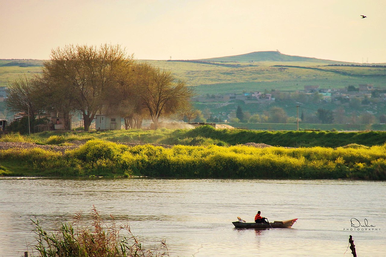
The Tigris runs about 1,850 km from the mountains of eastern Turkey through Iraq to meet the Euphrates near al-Qurnah, where the combined river becomes the Shatt al-Arab and flows into the Persian Gulf. It is the eastern of the two rivers whose name Mesopotamia describes — Greek for "between the rivers" — and it is the shorter, steeper and considerably faster of the pair.
Two rivers, and why they are not interchangeable
The Tigris and the Euphrates rise within a couple of hundred kilometres of each other in eastern Anatolia and end in the same estuary, and they are almost always discussed as a pair. They behave quite differently.
- Length: the Euphrates is the longer at roughly 2,800 km; the Tigris runs about 1,850 km.
- Gradient and speed: the Tigris drops more sharply and runs faster. It was historically difficult to navigate upstream and dangerous in flood; the Euphrates is gentler and was the more usable waterway.
- Volume: despite being shorter, the Tigris typically carries the greater volume, because it collects substantial tributaries from the Zagros mountains along its eastern side — the Greater and Lesser Zab, the Diyala. The Euphrates receives almost nothing after it leaves the highlands.
- Flood timing: both flood with Anatolian snowmelt in spring, but the Tigris rises faster and more violently, which historically made it the more destructive and the harder to irrigate from safely.
That last difference shaped settlement. Early large-scale irrigation in southern Mesopotamia relied more on the Euphrates, whose gentler gradient and higher bed relative to the plain made gravity-fed canals practical. The Tigris ran lower and faster, harder to divert without engineering.
The cities that stood on it
The Tigris carried a remarkable succession of capitals. Nineveh, across the river from modern Mosul, was the capital of the Neo-Assyrian Empire at its height in the seventh century BCE and among the largest cities in the world at the time, with the library of Ashurbanipal that preserved the Epic of Gilgamesh on clay tablets. Ashur and Nimrud, earlier Assyrian centres, also sat on or near the river.
Further south, Ctesiphon was the capital of the Parthian and then Sasanian empires for centuries. Its great arched hall, the Taq Kasra, still stands and holds one of the largest single-span brick vaults ever built.
And in 762 CE the Abbasid caliph al-Mansur founded Baghdad on the Tigris, a few dozen kilometres upstream of Ctesiphon. The choice was deliberate and geographical: at that point the Tigris and Euphrates run close together, so a city there could tap the canal network between them, control river traffic on both, and sit at the junction of routes running to Iran, Syria and the Gulf. Baghdad became for several centuries the largest city in the world.
A river that has moved
One reason ancient Mesopotamian sites are so often found stranded in dry land, well away from any water, is that both rivers wander. On a flat alluvial plain a sediment-laden river builds its own bed up above the surrounding land, and eventually breaks out and takes a new course — a process called avulsion.
Over five thousand years the channels have shifted repeatedly, and cities that were founded on a riverbank have been left kilometres from one. The southern plain is also subsiding and accumulating sediment, so the coastline itself has moved: the head of the Persian Gulf was once considerably further inland, and several ancient ports now sit well away from the sea. Any map of ancient Mesopotamia drawn on modern hydrography is misleading.
Upstream dams, downstream anxiety
The modern politics of the Tigris follow the standard upstream–downstream pattern, sharpened by the fact that the headwaters of both rivers lie in a single country.
Turkey's Southeastern Anatolia Project, generally known by its Turkish acronym GAP, is a multi-decade programme of dams and irrigation works on both rivers. On the Tigris, the Ilısu Dam — completed in the late 2010s — is the most contested: it flooded the town of Hasankeyf, continuously inhabited for thousands of years and holding significant medieval Artuqid architecture, some of which was relocated before the reservoir filled.
Iraq's position is that of the downstream state on both rivers, and it has been squeezed from two directions: Turkish storage and abstraction upstream, and reduced flows on Tigris tributaries that rise in Iran. There is no comprehensive treaty allocating the basin between Turkey, Syria, Iraq and Iran, and each has approached the question bilaterally and inconsistently. The result is a river system where the downstream user's supply depends on other governments' reservoir decisions in a region where rainfall is declining.
The most dangerous dam in the world
The Mosul Dam, on the Tigris upstream of the city, has an engineering problem that has never been solved. It was built in the early 1980s on a foundation of gypsum — a soluble rock that dissolves in flowing water. From the moment the reservoir filled, water began working its way into voids beneath the structure.
The response has been continuous grouting: crews inject cement into the foundation more or less permanently, replacing what dissolves. Interrupt it and the voids grow. When the dam fell briefly under the control of Islamic State in 2014, the grouting stopped and staff dispersed, and subsequent assessments described the risk in stark terms — a failure would send a flood wave down the Tigris valley toward Mosul and eventually Baghdad, endangering a very large number of people. A US Army Corps of Engineers assessment at the time called it one of the most dangerous dams in the world.
Remedial grouting resumed under contract afterwards and the immediate crisis passed, but the underlying geology has not changed. It is an unusual case of a major piece of national infrastructure that requires permanent maintenance simply to avoid failing, and it sits above two of Iraq's largest cities.
A river that resisted boats
The Tigris was never the highway the Euphrates was, and the traditional craft reflect it. The quffa — a round coracle of woven reeds waterproofed with bitumen, described by Herodotus in the fifth century BCE and still in use into the twentieth — was designed for a fast river where a boat's job is to survive going downstream rather than to make progress up it. The kelek, a raft floated on inflated animal skins, worked the same way: it carried cargo down from the northern highlands and was then dismantled, the timber sold and the skins deflated and carried back overland by donkey.
Both are answers to the same problem — a steep river with a strong current and shallow, shifting reaches. Bitumen, incidentally, was available in Mesopotamia from natural seeps, and its use for waterproofing boats is among the earliest recorded applications of petroleum anywhere.
The marshes at the bottom
Where the Tigris and Euphrates approach each other in southern Iraq, they historically fed the Mesopotamian Marshes — a wetland of reed beds and shallow lakes covering thousands of square kilometres, home to the Marsh Arabs, or Maʻdān, who lived in reed houses on artificial islands and moved by canoe.
In the early 1990s the Iraqi government drained the marshes almost completely, through a system of canals and embankments, following uprisings in the south. The wetland shrank to a small fraction of its former extent, the population was displaced, and the ecosystem — a major stopover on the migratory flyway between Siberia and Africa — largely collapsed.
After 2003, local communities breached embankments and substantial areas reflooded. Recovery has been genuine but partial and precarious: the marshes now compete for water with upstream irrigation and dams, and dry years shrink them again. The Ahwar of southern Iraq were inscribed as a UNESCO World Heritage site in 2016, in recognition both of the biodiversity and of the ancient cities on their edge.
The name itself
The English name comes via Greek Tigris from Old Persian Tigrā, and ultimately from a root meaning fast or arrow-like — an accurate description, and the clearest evidence that its speed relative to the Euphrates was the feature ancient observers noticed first. In Arabic it is Dijlah, in Kurdish Dîcle, and in Sumerian it was Idigna, from which the Persian form descends.
What the two rivers built, and what remains
Southern Mesopotamia is where the earliest cities we know of appeared — Uruk, Ur, Eridu — along with writing, monumental architecture and administrative bureaucracy, all of them arguably downstream consequences of irrigated agriculture producing a surplus large enough to support people who were not farmers. Our Mesopotamia guide covers that history in more depth.
The irrigation that made it possible also carried a long-term cost. Watering a flat plain in a hot, dry climate with no natural drainage concentrates salt in the soil as the water evaporates, and salinisation is visible in the ancient record as a shift from wheat to more salt-tolerant barley in the southern fields, and eventually in the abandonment of land. The same problem affects Iraqi agriculture today, compounded by reduced flows that leave less water available to flush the salt away.
The Tigris, then, remains what it has been for five millennia: the faster, more difficult, more generous of the two rivers, running past the ruins of everything it previously supported.
