
Scattered across the central Pacific like a handful of pearls flung onto blue glass, the Marshall Islands is a nation built almost entirely of coral, water, and sky. With barely any land rising more than a couple of metres above the waves, this tiny republic has produced some of history's greatest navigators, hosted some of the twentieth century's most consequential events, and now stands on the front line of a changing climate. Here are ten facts that reveal why this remote archipelago matters far more than its size suggests.
1. A Nation of Coral Rings, Not Mountains
The Marshall Islands is made up of around 29 atolls and five isolated coral islands, totalling more than 1,200 individual islets but only about 181 square kilometres of dry land spread across an ocean territory larger than Mexico. There are no mountains, no rivers, and almost no soil to speak of. Most of the country sits less than two metres above sea level, which is why land here is precious and tightly held by family lineages. The atolls are ring-shaped coral formations enclosing turquoise lagoons, the remnants of ancient volcanoes that long ago sank beneath the surface. To explore the geography in more depth, see our country guide.
2. Majuro Is the Crowded, Lively Capital
The capital, Majuro, is itself an atoll, and the urban heart of the country stretches along a thin ribbon of connected islets called Delap-Uliga-Djarrit. In places the road has the ocean on one side and the lagoon on the other, just metres apart. Roughly half of the country's population lives in or around Majuro, making it surprisingly busy for such a remote place, with shops, government offices, a port, and the main international airport. Life unfolds along the single main road, and the contrast between modern commerce and traditional island living is everywhere you look.
3. A Small Population With a Big Diaspora
With roughly 40,000 people living in the islands, the Marshall Islands has one of the smallest populations in the world. Yet tens of thousands more Marshallese live abroad, particularly in the United States, with sizeable communities in Arkansas, Hawaii, and Washington State. A unique migration agreement allows Marshallese citizens to live and work in the US without a visa, so families are often spread across thousands of kilometres of ocean. This makes the Marshallese a genuinely transnational people, with relatives just as likely to be in Springdale, Arkansas as in Majuro.
4. They Invented Maps Made of Sticks
Long before satellites and GPS, Marshallese navigators crossed open ocean using stick charts, or rebbelib, lattices of palm ribs and shells that recorded the way swells bend and refract around islands. These were not maps in the Western sense; they were memory aids, studied on land and then left behind before a voyage. A skilled navigator could feel the interaction of ocean swells through the hull of a canoe and locate an island over the horizon by reading the water. This sophisticated wave-piloting knowledge is one of the great intellectual achievements of human seafaring, unique to the Marshall Islands.
5. Bikini Atoll and the Atomic Age
Between 1946 and 1958, the United States conducted 67 nuclear tests in the Marshall Islands, mostly at Bikini and Enewetak atolls. The largest, the 1954 Castle Bravo hydrogen bomb, was roughly a thousand times more powerful than the Hiroshima bomb and remains the biggest device the US ever detonated. The fallout displaced entire communities, contaminated islands, and caused lasting health and environmental harm that the country is still reckoning with today. Bikini Atoll is now a UNESCO World Heritage Site, recognised as a stark symbol of the nuclear age and its human cost.
6. Two Official Languages and a Rich Oral Culture
Marshallese, a Micronesian language, is spoken by virtually everyone, alongside English, which is widely used in government and education. Marshallese is notable for its complex vowel system and for the way it has absorbed loanwords through a turbulent colonial history. Culture remains deeply communal and matrilineal: land rights and clan identity typically pass through the mother's line, giving women significant traditional authority. Storytelling, chant, and genealogy carry the history of each lineage, and respect for elders and family obligation, known as the spirit of sharing, still governs much of daily social life.
7. Coconut, Fish, and the Earth Oven
With so little land for farming, Marshallese cuisine leans heavily on the sea and the coconut palm. Fresh reef fish and tuna, breadfruit, pandanus, taro, and arrowroot form the backbone of traditional meals, often cooked in an earth oven called an um. Coconut appears in countless forms, from fresh milk to grated flesh, and copra, dried coconut meat, has long been an important export. Imported rice and tinned foods are now staples too, but festive occasions still showcase the old island foods prepared the traditional way.
8. An Economy Floating on Aid, Fish, and Flags
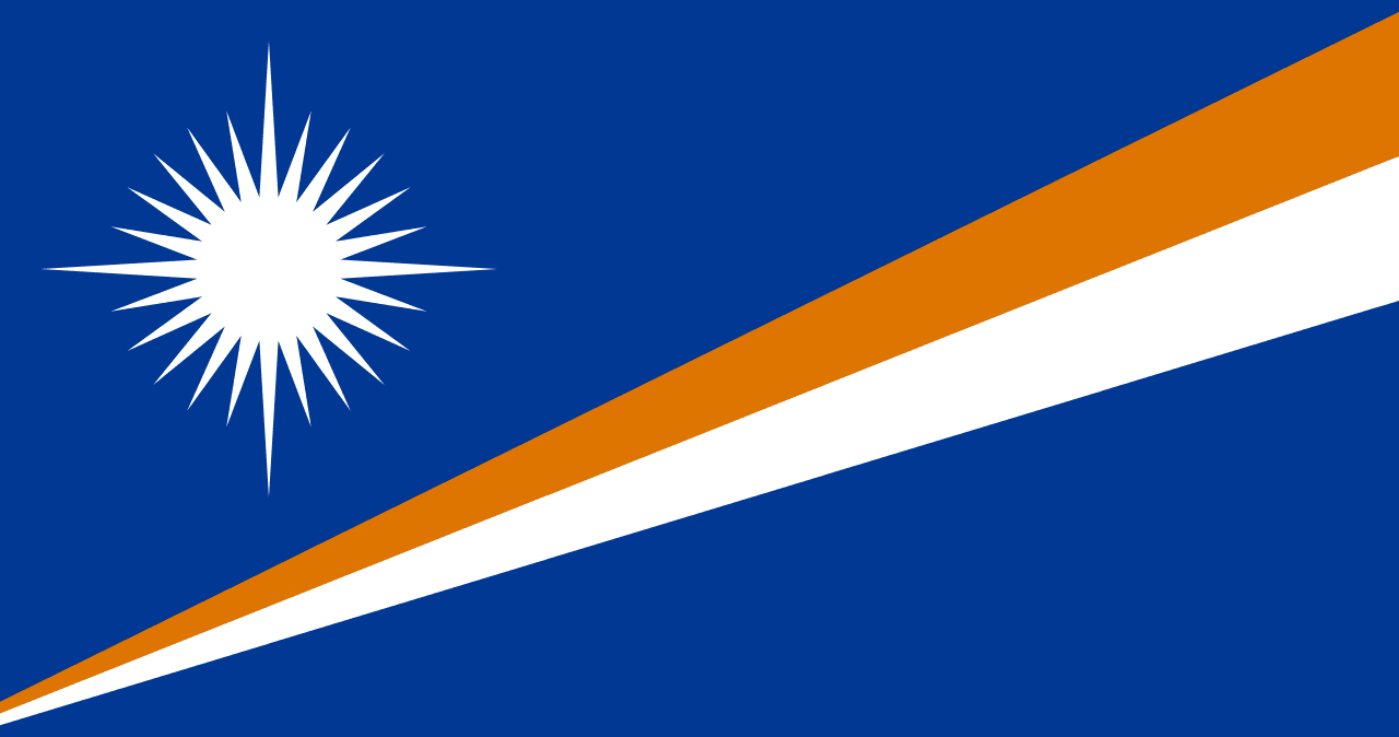
The Marshallese economy is heavily supported by financial assistance from the United States under the Compact of Free Association, in return for which the US retains defence responsibilities and a major missile-testing range at Kwajalein Atoll. Beyond aid, the country earns revenue by licensing foreign fleets to fish its enormous tuna-rich waters and by operating one of the world's largest open ship registries, meaning a remarkable number of the world's merchant vessels fly the Marshall Islands flag. You can learn more about that ensign in our flag article.
9. Kwajalein: The World's Largest Lagoon
Kwajalein Atoll encircles the largest lagoon on Earth, a vast expanse of sheltered water more than 1,800 square kilometres in area. The United States operates the Ronald Reagan Ballistic Missile Defense Test Site there, and intercontinental missiles fired from California splash down in its waters as part of testing programmes. The lagoon is also a diver's dream, dotted with WWII shipwrecks and aircraft from fierce fighting in the Pacific theatre. Few places on the planet combine such natural grandeur with such concentrated military and historical significance in a single ring of coral.
10. On the Front Line of Climate Change
Because almost the entire country sits barely above sea level, the Marshall Islands is one of the nations most threatened by rising seas. King tides already flood roads and homes in Majuro, and saltwater intrusion endangers freshwater and crops. Marshallese leaders and poets, most famously Kathy Jetnil-Kijiner, have become powerful voices at global climate summits, refusing to accept that their homeland is doomed. The country's motto, Jepilpilin ke ejukaan, "Accomplishment through joint effort," captures the resolve with which Marshallese face an uncertain future.
Frequently Asked Questions
What is the capital of the Marshall Islands?
The capital is Majuro, itself a coral atoll. About half the country's people live in the urban strip of Delap-Uliga-Djarrit, where the ocean and the lagoon sit just metres apart on either side of the main road.
What are the Marshall Islands famous for?
They are best known for Bikini Atoll and the Cold War nuclear tests conducted there, for the traditional stick-chart navigation of their seafaring ancestors, and for being one of the world's lowest-lying countries on the front line of climate change.
Why do so many ships fly the Marshall Islands flag?
The country runs one of the largest open ship registries in the world. Foreign shipowners register vessels there for its straightforward regulations and tax advantages, so a huge share of global merchant tonnage technically sails under the Marshallese flag.
Conclusion
The Marshall Islands is proof that geography is about influence, not acreage. From ingenious wave-reading navigators to atomic history, from the world's largest lagoon to a leading voice in the climate fight, this scattering of coral rings carries a weight on the world stage that dwarfs its tiny landmass. It is a country whose past and future both speak directly to humanity's relationship with the ocean.