

The War of 1812 (1812-1815) was America's most geographically sprawling conflict before the Civil War. Fought between the United States and Great Britain (including British Canada), the war played out across an enormous theater stretching from the Great Lakes to the Gulf of Mexico, from the Atlantic seaboard to the Mississippi River.
Introduction
Geography shaped every aspect of this war. The Great Lakes became the northern theater's decisive feature. The Canadian border — the world's longest undefended frontier today — was then a contested military boundary. The Chesapeake Bay provided the British with an invasion route to Washington, D.C. And the Mississippi River's strategic importance led to the war's most famous battle at New Orleans, fought two weeks after the peace treaty was signed.
The Great Lakes Theater
- Key Feature: Control of Lakes Erie and Ontario determined the northern war
- Battle of Lake Erie: September 10, 1813 — Oliver Hazard Perry's decisive victory
- Border: The Great Lakes formed the US-Canadian frontier
- Naval Construction: Both sides raced to build warships on the lakeshores
The Great Lakes were the War of 1812's most important geographic feature. Without roads or railroads connecting the northern frontier, the lakes were the only practical way to move troops and supplies across the vast distances. Whoever controlled the lakes controlled the ability to invade or defend the border.
Both sides engaged in frantic shipbuilding on the lakeshores. Oliver Hazard Perry built an entire fleet at Presque Isle (now Erie), Pennsylvania, cutting timber from the surrounding forests. His decisive victory at the Battle of Lake Erie on September 10, 1813 gave the United States control of the lake and forced the British to abandon Detroit and retreat into Ontario. Perry's famous message — "We have met the enemy and they are ours" — reflected a geographic triumph as much as a naval one.
The Canadian Border Campaigns
- American Goal: Invade and conquer British Canada
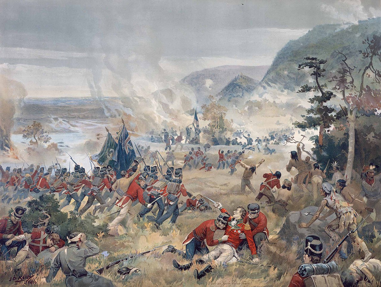
- Key Battles: Queenston Heights, York (Toronto), Thames, Lundy's Lane
- Niagara Frontier: The narrow Niagara River between Lakes Ontario and Erie
- Detroit: Surrendered to British-Canadian forces in August 1812
The US-Canadian border was the war's primary geographic battlefield. American leaders believed conquering Canada would be, as Thomas Jefferson predicted, "a mere matter of marching." The geography proved otherwise. The border ran through dense wilderness, crossed by few roads and defended by British forts, Canadian militia, and Native American allies.
The Niagara frontier — the 36-mile stretch of the Niagara River between Lakes Ontario and Erie — saw the war's heaviest fighting. The Battle of Queenston Heights (October 1812), fought on the steep escarpment above the river, was a British-Canadian victory that killed the brilliant British commander Isaac Brock. The Battle of Lundy's Lane (July 1814), fought within earshot of Niagara Falls, was one of the bloodiest engagements of the war.
The Chesapeake Bay & Washington
- British Strategy: Use naval superiority to raid the Chesapeake coast
- Burning of Washington: August 24, 1814 — British burned the Capitol and White House
- Fort McHenry: September 13-14, 1814 — defense inspired "The Star-Spangled Banner"
- Geographic Vulnerability: The Chesapeake's deep navigable waters allowed British warships to penetrate inland
The Chesapeake Bay's geography made it a perfect invasion corridor for the British. Its deep, navigable waters extended over 200 miles inland, and the Patuxent River provided a water route to within marching distance of Washington, D.C. In August 1814, a British force sailed up the Patuxent, disembarked, and marched overland to the capital, which they burned on August 24.
The British then turned to Baltimore, a larger and more important city. But Baltimore was prepared. Fort McHenry, a star-shaped fortress guarding the harbor entrance, withstood a 25-hour naval bombardment on September 13-14, 1814. Francis Scott Key, watching the bombardment from a ship in the harbor, wrote "The Star-Spangled Banner" after seeing the fort's flag still flying at dawn. Baltimore's defenders had used the geography of the harbor — its narrow entrance channel commanded by the fort — to turn back the invasion.
The Battle of New Orleans
- Date: January 8, 1815 — fought after the Treaty of Ghent was signed
- Location: Chalmette, Louisiana — below New Orleans on the Mississippi
- Andrew Jackson: Used the terrain — a canal, earthworks, and the river — to create a killing ground
- British Casualties: ~2,000 vs. ~70 American casualties
- Geographic Significance: Control of the Mississippi River mouth
The Battle of New Orleans, fought on January 8, 1815, was the war's most lopsided victory and its most geographically significant engagement. New Orleans controlled the mouth of the Mississippi River — the economic lifeline of the entire American interior. Whoever held New Orleans held the key to the continent's heartland.
Andrew Jackson chose his defensive position with geographic brilliance. He placed his army behind a canal (the Rodriguez Canal) that ran between the Mississippi River and a cypress swamp, creating a narrow front that the British could not outflank. Behind the canal, he built earthworks studded with artillery. When 8,000 veteran British troops attacked across the open sugarcane fields, they were funneled into a killing ground barely 600 yards wide. The result was catastrophic: approximately 2,000 British casualties against fewer than 70 American losses.
Legacy & Geographic Outcomes
- Treaty of Ghent: December 24, 1814 — restored pre-war boundaries
- Rush-Bagot Agreement: 1817 — demilitarized the Great Lakes
- Convention of 1818: Established the 49th parallel as the US-Canada border west of the Great Lakes
- Long-term Impact: Permanently stabilized the US-Canadian border
The War of 1812 ended with the Treaty of Ghent, which restored all conquered territory to pre-war boundaries — a geographic stalemate. But the war's most important geographic consequence was the permanent stabilization of the US-Canadian border. The Rush-Bagot Agreement of 1817 demilitarized the Great Lakes, and the Convention of 1818 established the 49th parallel as the border from the Lake of the Woods to the Rocky Mountains.
These agreements created the foundation for what would become the world's longest undefended border — 3,987 miles from the Atlantic to the Pacific (5,525 miles including the Alaska-Canada border). The War of 1812's geographic legacy is thus paradoxical: a war fought to conquer territory ended up stabilizing the border that neither side could change, creating one of the most peaceful international boundaries in history.
Key Facts
- The Great Lakes were the war's most strategically important geographic feature.
- Perry's victory at the Battle of Lake Erie (1813) gave the US control of the northern frontier.
- The British burned Washington, D.C. in August 1814 after sailing up the Chesapeake Bay.
- The Battle of New Orleans was the war's most decisive engagement, with 2,000 British vs. 70 American casualties.
- The war permanently stabilized the US-Canadian border along the 49th parallel.
Fun Facts
- The Battle of New Orleans was fought two weeks after the peace treaty was signed in Belgium — news traveled too slowly to reach Louisiana.
- Fort McHenry's giant flag, which inspired the national anthem, measured 30 by 42 feet — deliberately oversized so the British could see it from their ships.
- Tecumseh, the Shawnee leader and British ally, was killed at the Battle of the Thames in Ontario — his death shattered the last major Native American military alliance east of the Mississippi.
- The White House got its name because it was painted white to cover the burn marks left by the British in 1814.
Final Thoughts
The War of 1812 was shaped at every turn by geography — the Great Lakes determined the northern campaign, the Chesapeake Bay enabled the British attack on Washington, and the Mississippi River made New Orleans the war's most critical geographic prize. Its most lasting legacy was geographic: the permanent stabilization of the world's longest peaceful border.
Test Your Knowledge!
Think you know your US historical geography? Try our interactive quiz!
Play Geography Games →