
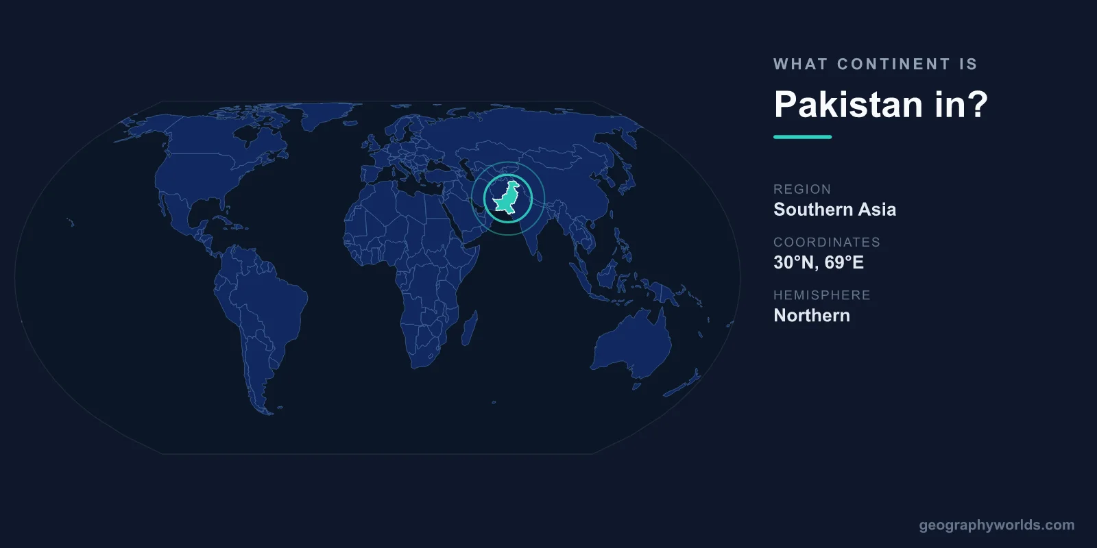
Pakistan is located in Asia, specifically in the South Asia region of the continent. It sits at a remarkable crossroads where South Asia, Central Asia, and the Middle East meet, sharing land borders with India, China, Afghanistan, and Iran, and opening onto the Arabian Sea to the south. Every one of its neighbors is an Asian nation, placing Pakistan firmly on the Asian continent with no ambiguity.
Why Pakistan Is Classified as Part of Asia
Continents are defined by large, continuous landmasses, and Pakistan lies entirely on the Asian mainland. With a land area of roughly 881,913 km², it occupies a substantial stretch of southern Asia between the Iranian Plateau in the west and the Indian subcontinent in the east. Its capital, Islamabad, sits in the north near the foothills of the Himalayas, while its largest city, Karachi, anchors the southern coast.
Geographers place Pakistan in South Asia, a sub-region of Asia that also includes India, Bangladesh, Nepal, Bhutan, Sri Lanka, and the Maldives. The country is the fifth-most populous in the world, home to well over 240 million people, which makes it one of Asia's demographic heavyweights. There is no overlap with Europe, Africa, or any other continent — Pakistan is Asian by geography, geology, and culture alike.
A Country at the Crossroads of Three Regions
What makes Pakistan's location distinctive is that it straddles the meeting point of three major Asian zones. To the south and east it belongs to South Asia; through its northwestern frontier and the Khyber Pass it connects to Central Asia; and its western borderlands with Iran link it to the Middle East. This junction has shaped Pakistan's history for thousands of years.
The region was a vital artery of the ancient Silk Road, a corridor for traders, armies, pilgrims, and migrants moving between the Mediterranean world and the East. The Indus Valley Civilization, one of the world's earliest urban societies, flourished here more than 4,000 years ago at sites like Mohenjo-daro and Harappa. That deep history is a direct consequence of Pakistan's position on the Asian landmass.
The Dramatic Geography of Pakistan
Pakistan's terrain ranges from sea level to the highest reaches of the planet. Its landscape includes some of the most extreme topography anywhere on Earth:
- Highest point: K2 (8,611 m), the world's second-tallest mountain, in the Karakoram range
- Major river: the Indus, which flows the entire length of the country from north to south
- Coastline: about 1,046 km along the Arabian Sea
- Climate: arid deserts in the south, fertile river plains in the center, and alpine glaciers in the north
The northern mountains, where the Karakoram, Himalayas, and Hindu Kush converge, contain more peaks above 7,000 meters than any other country. Pakistan also holds more glacial ice than anywhere outside the polar regions. Moving south, the land flattens into the agricultural heartland of Punjab and Sindh, watered by the Indus, before reaching the Thar Desert and the coast. This vertical sweep from glaciers to seashore all sits within Asia.
Pakistan's Neighbors and Borders
Pakistan shares its land borders with four countries, each a fellow Asian state:
- India to the east — its longest and most historically significant border
- China to the northeast — connected by the Karakoram Highway, the highest paved international road in the world
- Afghanistan to the west — across the famous Khyber Pass
- Iran to the southwest — linking Pakistan to the Middle East
To the south, the Arabian Sea forms a natural maritime boundary and gives Pakistan access to vital shipping lanes connecting the Persian Gulf to the Indian Ocean. The deep-water port of Gwadar, near the Iranian border, has become a strategic hub for regional trade. For a fuller overview of the nation's geography, history, and culture, see our pakistan country guide.
How Pakistan Compares Within Asia
Although Pakistan is not among Asia's largest nations by area — it ranks roughly 33rd globally in size — its population places it in the continent's top tier. It is far smaller than neighbors like China or India in land area, yet its population rivals that of much larger countries. The name "Pakistan" itself reflects its Asian regions, drawn from Punjab, Afghania, Kashmir, Sindh, and Balochistan. This blend of peoples and provinces underscores how the country knits together distinct corners of Asia into a single state.
Frequently Asked Questions
Is Pakistan in Asia or the Middle East?
Pakistan is in Asia, in the South Asia region. While it borders Iran and is sometimes grouped culturally with the broader Middle East, geographers classify it as a South Asian country on the Asian continent.
What region of Asia is Pakistan in?
Pakistan is in South Asia, alongside India, Bangladesh, Nepal, Bhutan, Sri Lanka, and the Maldives. It also sits at the edge of Central Asia and the Middle East, making it a true crossroads nation.
What continent is Pakistan's capital, Islamabad, in?
Islamabad, like the rest of Pakistan, is in Asia. The city lies in the country's north, near the Margalla Hills at the foothills of the Himalayas.
Does Pakistan share a border with any non-Asian country?
No. All four of Pakistan's land neighbors — India, China, Afghanistan, and Iran — are located in Asia, and its only sea boundary is the Arabian Sea.
