

A gorge is a narrow valley with steep, rocky walls, cut downward by a river through rock hard enough to hold those walls up. The defining feature is the ratio: a gorge is much deeper than it is wide, because vertical erosion by the river has far outpaced the widening of the slopes above it.
Gorge, canyon, ravine: a distinction nobody fully agrees on
Most references will tell you a canyon is larger than a gorge. That is roughly true in practice and almost impossible to defend as a rule, because no threshold exists — there is no depth at which a gorge is reclassified.
What actually separates the words is usage, and usage splits along three lines:
- Region. Canyon entered English from Spanish cañón and dominates in the Americas. Gorge came via French and dominates in Europe. The Verdon in Provence and the Grand Canyon in Arizona are the same class of landform named by different colonial vocabularies.
- Width relative to depth. Where both words are available, gorge tends to mean the narrower, more slot-like form, and canyon the broader one with terraced or stepped walls.
- Scale of the whole system. A canyon often refers to a long regional feature; a gorge is frequently one dramatic stretch within a longer valley.
A ravine is the genuinely different term of the three: smaller, usually cut into soil and loose material rather than bedrock, and often carrying water only intermittently. A gully is smaller still. Those two describe a different erosional world, not a smaller version of the same one.
Three ways a gorge gets cut
Gorges are not all made the same way, and the differences show in their shape.
Uplift outpacing the river. The commonest mechanism. A river with an established course crosses land that begins rising. If the river can cut downward at least as fast as the rock rises, it keeps its course and saws a gorge through the emerging obstacle. Rivers that do this are called antecedent, and they produce the counter-intuitive result of a river running straight through a mountain range rather than around it. The Indus and Brahmaputra both cut through the Himalaya this way, having predated the range.
Waterfall retreat. Where a river crosses a hard layer sitting on softer rock, the softer rock is undercut, the hard cap collapses, and the waterfall steps upstream — leaving a gorge as the record of its passage. Niagara has retreated roughly 11 km since the last glaciation and left the Niagara Gorge behind it, and it is still moving at around 0.3 m a year after diversion for hydroelectricity slowed it from about 1 m.
Meltwater and collapse. Glacial meltwater under pressure can cut deeply in a short time, and some gorges are the drained remains of cave systems whose roofs fell in. Cheddar Gorge in Somerset is generally read as a mix of both: periglacial meltwater cutting through limestone during cold phases, when frozen ground stopped the water from sinking underground as it does today.
Why limestone does this so well
A disproportionate number of celebrated gorges are cut in limestone, and the reason is chemical as much as mechanical.
Limestone is soluble in weakly acidic water, so rain and river water dissolve it along joints and bedding planes. But it is also mechanically strong and holds a vertical face once cut. That combination — dissolves readily along fractures, stands up firmly in between — produces exactly the deep, sheer-sided profile a gorge requires. A rock that resisted dissolution would erode too slowly; a weak one would slump into a V-shaped valley.
The Verdon shows the result. Its river has cut about 700 m into Jurassic limestone over roughly 21 km, in places leaving a channel as little as 6 m wide at the bottom between walls hundreds of metres high. The Tarn in the Cévennes and the Samariá in Crete — some 16 km long and narrowing to about 4 m at the Gates — are the same rock behaving the same way.
Slot gorges and the flash-flood problem
At the narrow extreme sits the slot: a gorge metres wide and tens of metres deep, usually cut into sandstone by water carrying abrasive sand. Antelope Canyon in Arizona is the photographed example, its walls sculpted into smooth flutes by sediment-laden flood water rather than by the trickle normally present.
That is precisely what makes them dangerous. A slot gorge drains a catchment far larger than anything visible from inside it, and its cross-section cannot accommodate a surge, so water rises vertically instead of spreading. A storm 15 km away over ground a visitor never sees can fill a slot within minutes under a clear sky overhead. Eleven people died in Lower Antelope Canyon in August 1997 in a flood from a thunderstorm miles upstream.
The lesson generalises to gorges of any size: the relevant weather is never the weather at the gorge, but the weather across everything that drains into it.
When the river did not do all the work
Not every gorge is purely erosional. Some follow structural weaknesses that were already there, and the river merely exploited a line the rock had handed it.
Fault-guided gorges form where a river finds a fracture zone and cuts along it, producing unusually straight reaches and sharp right-angled turns that pure headward erosion would not generate. Others are tectonic in a more direct sense: parts of the Jordan Valley's steep-sided sections owe their form to the Dead Sea Transform pulling the crust apart, with water shaping a trench that faulting opened.
Distinguishing the two matters for reading a landscape. An erosional gorge narrows steadily upstream towards its headwaters, because that is the direction the cutting worked. A structurally controlled one can stay abruptly parallel-sided for kilometres, ignoring the gradient, because its width was set by the fault rather than by the river's discharge.
The deepest-gorge argument
Superlatives here are unusually contested, because the answer depends entirely on how you measure.
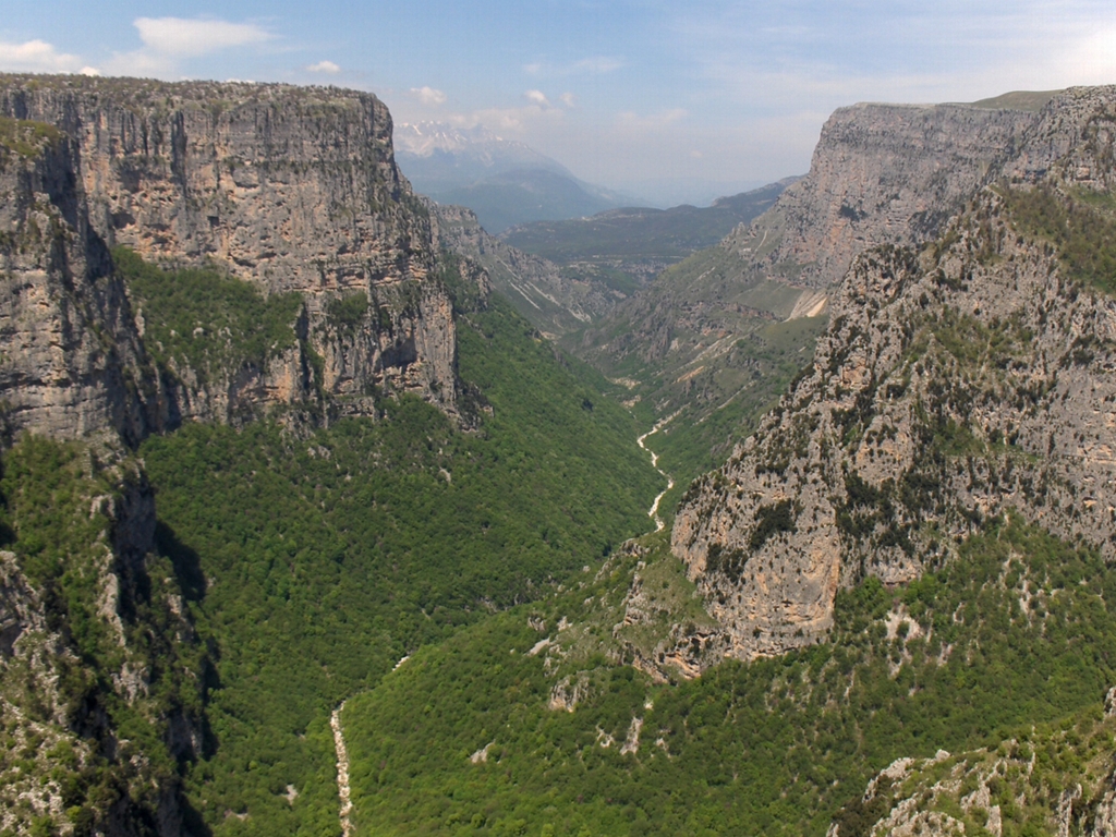
Vikos, in the Pindus mountains of northern Greece, is often cited as the deepest in the world — and the claim rests on a ratio rather than a depth. Vikos is about 900 m deep, which is not exceptional, but at its narrowest the floor is only around 100 m across. On depth-to-width it beats almost everything; on raw depth it is not close.
By raw depth, the Yarlung Tsangpo Grand Canyon in Tibet takes it. The river drops through a gorge reaching about 5,382 m measured to the peaks flanking it — Namcha Barwa at 7,782 m on one side, Gyala Peri at 7,294 m on the other — while the river itself sits near 2,400 m. Kali Gandaki in Nepal is argued for on the same basis, running between Dhaulagiri and Annapurna I, both over 8,000 m.
The disagreement is a measurement problem, not a geographical one. Depth from what — the rim, the highest nearby summit, the average of both walls? Each convention produces a different champion, which is worth remembering whenever a single figure is quoted without one.
A gorge is a cross-section through time
Because a gorge exposes a continuous vertical face, it lays bare a sequence of rock that would otherwise stay buried, and geologists read them as sections rather than scenery.
The principle is simple: in undisturbed sedimentary rock, lower layers are older. A gorge cutting 500 m down exposes however many million years those 500 m represent, in order, at a single accessible spot. Mapping the same sequence across a plateau would take hundreds of boreholes.
The walls also record the river's own history. Terraces perched partway up mark former floodplain levels, each one a period when downcutting paused and the river widened instead. A staircase of terraces is a staircase of climate or uplift episodes, and dating them gives the rate at which the gorge was cut — which is how figures like Niagara's retreat are derived rather than guessed.
Barriers, corridors and chokepoints
A gorge is simultaneously the easiest way through a mountain range and one of the hardest places to build, and human geography follows from that tension.
Rivers cutting through uplands provide the only near-level route across, so roads and railways are pushed into gorges despite the cost. The Rhine Gorge between Bingen and Koblenz carried the traffic that funded the castles now lining it. The Columbia River Gorge is the single sea-level breach through the Cascade Range, and the Oregon Trail, the highway and the railway all use it for that reason.
The same narrowness makes gorges the preferred sites for dams — a short wall holds back a long reservoir. The Three Gorges Dam on the Yangtze takes its name from the feature it closed, and displaced roughly 1.3 million people in doing so. That is the recurring bargain: the geometry that makes a gorge cheap to dam is exactly the geometry that makes the valley behind it worth flooding.
They are also ecological refuges. Steep, inaccessible walls with their own microclimate shelter species that have vanished from the plateau above, which is why gorges so often turn up as the last habitat of something — and why the Vikos-Aoös and Samariá gorges are national parks rather than merely scenic. If you want to see how the same forces look at continental scale and in far softer rock, the Grand Canyon is the obvious next stop.
