
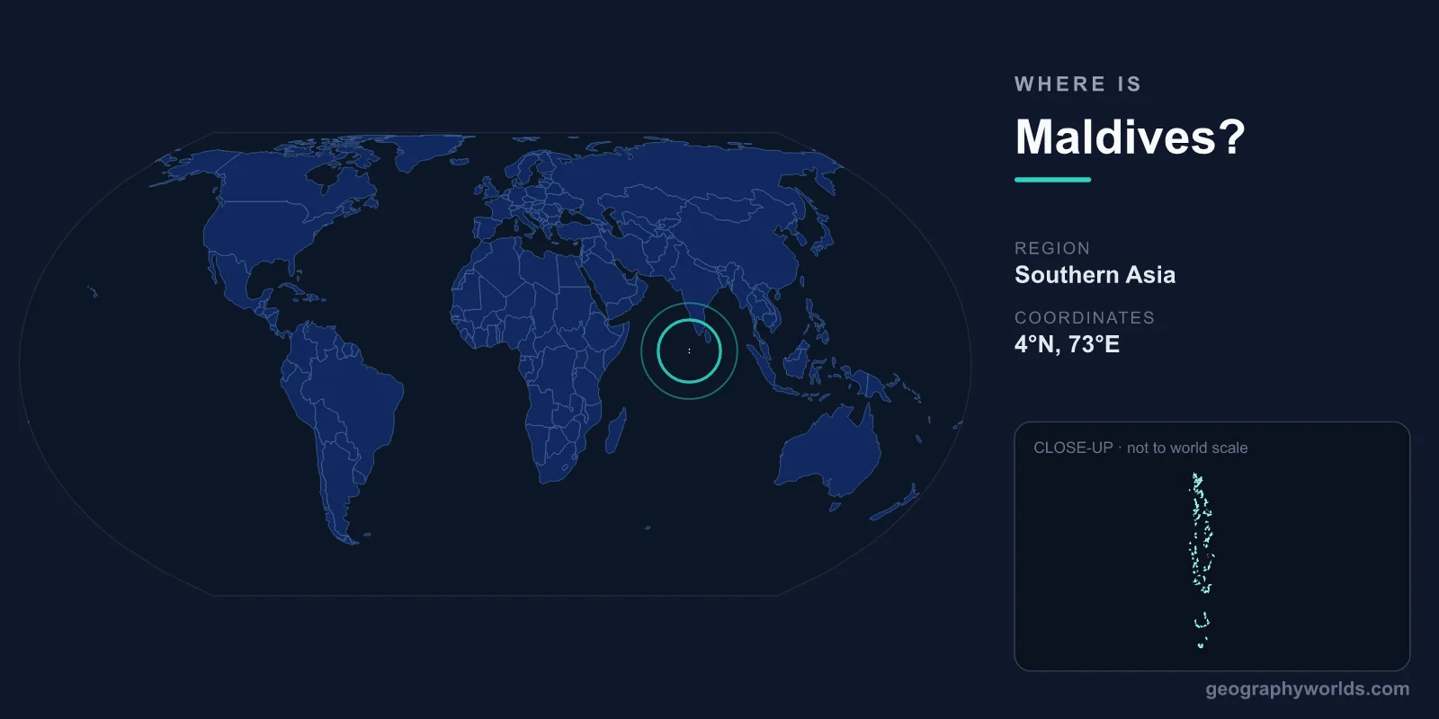
The Maldives is located in the Indian Ocean just southwest of India and Sri Lanka, lying along the equator at approximately 3.2°N latitude and 73.2°E longitude. This island nation is made up of 1,190 coral islands grouped into 26 natural atolls, scattered across roughly 90,000 square kilometers of ocean. Despite its enormous oceanic footprint, the country has only about 298 square kilometers of actual land — making the Maldives both one of the smallest and one of the most geographically dispersed nations on Earth. Its capital is Malé.
Where Exactly Is the Maldives?
The Maldives sits in both the Northern and Southern Hemispheres, because the long chain of atolls straddles the equator. The northernmost atoll, Haa Alif, lies near 7°N, while the southernmost, Addu (Seenu), extends slightly south of the equator at about 0.5°S. This gives the country a north-to-south span of roughly 871 kilometers, even though it is only around 130 kilometers across at its widest point. Because of this, the Maldives is one of the few countries on the planet that can claim to lie on both sides of the equator.
Geologically, the islands rise from the Chagos-Laccadive Ridge, a submerged volcanic mountain range running down the floor of the Indian Ocean. The coral reefs that form the visible islands sit atop the peaks of these long-extinct volcanoes, which is why the Maldives appears as a delicate, broken thread of green and white in an otherwise empty blue ocean. For more travel and geography context, see our maldives country guide.
Neighboring Countries and the Indian Ocean
As an archipelago surrounded entirely by sea, the Maldives shares no land borders with any nation. Its nearest neighbors are all reached across open water:
- Sri Lanka — about 700 km to the northeast
- India (Lakshadweep Islands) — about 430 km to the north-northeast
- Chagos Archipelago — roughly 1,200 km to the south
This position places the Maldives directly along one of the busiest maritime corridors in the world, the shipping route linking the Persian Gulf and the Strait of Hormuz with the Strait of Malacca and the ports of Southeast Asia. For a country with so little land, the Maldives holds outsized strategic importance simply because of where it sits on the map.
A Nation Built of Atolls
The defining feature of Maldivian geography is the atoll. Each atoll is a roughly ring-shaped coral reef enclosing a shallow, calm lagoon, with low sandy islands forming along the reef rim. The 26 natural atolls are arranged in a double chain running north to south, with deep channels between them allowing ocean currents to pass through. The English word "atoll" itself derives from the Dhivehi word atholhu, a small linguistic reminder of how central these formations are to the country.
Of the 1,190 islands, only around 200 are inhabited by local communities, while another 160 or so have been developed as private tourist resorts — typically one resort per island. The remaining islands are uninhabited sandbanks, fishing stops, or simply too small and fragile to support settlement. This scattered pattern means that travel within the Maldives is almost entirely by boat or air rather than by road.
The Lowest and Flattest Country on Earth
The Maldives holds a remarkable geographic distinction: it is the lowest-lying country in the world. Average ground level sits at only about 1.5 meters above sea level, and the highest natural point in the entire nation rises just 5.1 meters, on Addu Atoll. There are no hills, mountains, or rivers anywhere in the country — only flat coral islands ringed by turquoise lagoons.
This extreme flatness makes the Maldives one of the most climate-vulnerable nations on the planet. Even a modest rise in global sea levels threatens to submerge large portions of the archipelago, which is why the Maldives has become a prominent voice in international climate negotiations. In 2009 its government famously held an underwater cabinet meeting, with ministers in scuba gear signing documents on the seabed to dramatize the stakes for the world.
Climate and Getting There
The Maldives has a tropical monsoon climate, warm and humid all year, with temperatures generally ranging from 26°C to 31°C and very little seasonal variation. The dry northeast monsoon (December to April) brings clear skies and calmer seas, making it the peak tourist season, while the wet southwest monsoon (May to November) brings more rain and rougher water.
Most visitors arrive at Velana International Airport on Hulhulé Island, next to Malé, which receives direct flights from hubs such as Dubai, Colombo, Singapore, Istanbul, and London. From there, onward travel to the resorts and inhabited islands is by speedboat, domestic flight, or seaplane — the Maldives operates one of the largest seaplane fleets in the world, offering spectacular aerial views of the atolls below.
Frequently Asked Questions
Is the Maldives part of India or Sri Lanka?
No. The Maldives is an independent sovereign nation. It lies southwest of both India and Sri Lanka but is a separate country with its own government, currency (the rufiyaa), and language (Dhivehi).
What continent is the Maldives in?
The Maldives is generally classified as part of Asia, specifically the South Asia region, even though it lies in the middle of the Indian Ocean well offshore from the Asian mainland.
Does the Maldives lie on the equator?
Yes. The chain of atolls straddles the equator, with the southern Addu Atoll sitting just below it. This makes the Maldives one of the few countries to span both the Northern and Southern Hemispheres.
How far is the Maldives from India?
The nearest Indian territory, the Lakshadweep Islands, is about 430 km to the north-northeast, while mainland India is considerably farther. Sri Lanka lies roughly 700 km to the northeast.
